News   Apr 26, 2024
 2.4K     4 
News   Apr 26, 2024
 608     0 
News   Apr 26, 2024
 1.2K     1 

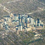
Google Maps: Toronto in 3D!

Meanwhile, Apple Maps has every building and vegetation over a metre tall in Toronto in 3D before Google Maps had that for Toronto.

Problem is, I can't view Apple Maps on my laptop since I don't have the latest OS. It only works on iPad and iPhone.
 
Googles satellite imagery is normally updated around every 4 years, so it should have been done in 2013. They probably just decided to delay it as they will probably be doing the 3D stuff soon. Toronto is the last large Canadian city without the new form of 3D. (even Sudbury has it)

So, Google decides to make Toronto the last city where they do 3D imagery, when logically it should have been one of the first. And when they do decide to do Toronto, of all places they pick Scarborough.
 
So, Google decides to make Toronto the last city where they do 3D imagery, when logically it should have been one of the first. And when they do decide to do Toronto, of all places they pick Scarborough.
I think they already have 3D imagery of downtown Toronto already, but the density probably causes a lot of defects requiring manual cleanup of the 3D data (e.g. the gaps between buildings are not always accurately scanned, due to parallax/obliqueness of satellite passes). Everywhere outside Toronto downtown-to-Bloor is much easier to 3D-ize.

Toronto downtown is probably forthcoming shortly, once the army of Google Mappingineers finishes that downtown dataset...
 
So, Google decides to make Toronto the last city where they do 3D imagery, when logically it should have been one of the first. And when they do decide to do Toronto, of all places they pick Scarborough.

Google used to make a big deal out of their 3D maps, posting updates on their blog. While they have since stopped with the announcements, one thing I noticed was a lot of cities to get the 3D treatment were smaller ones and suburban districts.

The CBD is coming soon...
 

Back
Top