News   Apr 23, 2024
 269     0 
News   Apr 23, 2024
 471     0 
News   Apr 22, 2024
 1.3K     0 

Google Maps: Toronto in 3D!

It's cool. I mean, Apple maps had the same thing, but Google has newer data (and can be used on non-Apple computers).

It'll be great a decade or two from now if they scan every few years and you can go back & forth in time. I mean, you can do that now with street view, but if you could do that with the 3D renders it would be cool to watch Toronto grow over time.

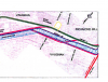
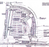
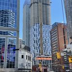
They covered quite a lot of the GTA too, although, not everything, but you can see places like Mississauga City Centre, Brampton, Markham. Yeah the Spadina subway station construction is cool. You can also see the Eglinton Black Creek launch shaft.
 
I noticed that if you rotate to a different angle you can move back & forth in time. I guess certain angles have newer data/photos.

For example, if you look at the Strachan grade separation, rotating shows it in various phases of construction.
 
Interesting.. You don't get that in Google Earth. Seriously, if you want the best way to use this, use Google earth. Its not limited to the 4 angles given to you in Maps.

Is the data in the City 3D Mapping available in a KMZ format?
 
It fronts onto a golf course, and Street View shows one of the most perfectly manicured lawns in existence. Could be a country club
 
The 3D views are really amazing.

I know it's impolite to snoop, but I wonder who owns this palace?
https://www.google.ca/maps/@43.8243064,-79.4380165,250a,20y,273h,55.35t/data=!3m1!1e3!5m1!1e1

Looks bigger than most Bridle Path homes and I wonder why there are so many empty lots on that street??

I actually worked on that house back in 2005-06. The Brattys live there. It's about 40+ thousand sq ft. Underground swimming pool with retractable glass roof above. Seperate guest house with car wash, etc, etc, etc
Cost around 30 million to build.

As for the empty lots on that street: It was (still is?) marketed as an exclusive gated community for custom homes to be built and nobody was willing to pay what they were looking for to live in that middle-of-nowhere suburban hellhole of a neighbourhood.
 
Last edited:
It fronts onto a golf course, and Street View shows one of the most perfectly manicured lawns in existence. Could be a country club

Sadly, there is no access to yon golf course as it is accessed from Yonge Street on the other side of the valley. I mean, I guess you could hop the fence but I don't see the occupants of this palace doing that. That golf course has a wee ski hill as well which is weird....because for me, even Blue Mountain ain't worth skiing on.
 
I actually worked on that house back in 2005-06. The Brattys live there. It's about 40+ thousand sq ft. Underground swimming pool with retractable glass roof above. Seperate guest house with car wash, etc, etc, etc
Cost around 30 million to build.

As for the empty lots on that street: It was (still is?) marketed as an exclusive gated community for custom homes to be built and nobody was willing to pay what they were looking for to live in that middle-of-nowhere suburban hellhole of a neighbourhood.

A greedy real estate developer huh? That figures.

Actually I stumbled upon this area by looking at the planned routes for the Hwy 7 busway and Yonge subway extension. So even though it's in a middle of nowhere hellhole it will still be decently close to transit in the future!!
 
No it won't be, unless you count the highway 7 BRT. its way too far walking wise from the yonge subway.
Looking at that pathway on Glenforest up to the hydro easement, it looks like there's a long-term plan for a pathway along the hydro easement. As Langstaff subway station is to be at the easement and Yonge (conveniently located for both the hydro easement and the cemetery), it's only about a 15-minute walk from that mega-mansion to the proposed subway station. Not great, but quite doable - and only a few minutes on a bike, without any road crossings - even I might bike that.

Might not be much good for the Lord of the Manor - but surely there's more staff there than residents!

I'm also curious where the 407 Transitway station at Bathurst would be. I can't (quickly) find the plans anywhere.

I don't really think the "407 Transitway" has been given much thought. York Region has instead been focusing on the "Highway 7" transitway. If they were to make both they would be pretty redundant.

The latest Highway 7 West plan can be found here: http://www.vivanext.com/files/PublicPresentations/Vaughan_PKI_2014_05_12_FINAL.pdf

In short, by 2019 this lucky SOB will be able to hop on the bus right to the Vaughan Subway station and Yonge Subway station when it is extended!
 
I don't really think the "407 Transitway" has been given much thought. York Region has instead been focusing on the "Highway 7" transitway. If they were to make both they would be pretty redundant.
The Ministry of Transportation completed the 407 Transitway Project Report back in late 2010 with revision in 2011. It appears to have been scrubbed from the Net - but the links to it can be found at https://web.archive.org/web/2011062...407Transitway/environmentalProjectReport.html - I thought we'd discussed that here in Urban Toronto back in 2010/2011.

There are however some low-resolution glimpses of the alignment at Bathurst in the Town of Richmond Hill report: http://www.richmondhill.ca/documents/meetings/cow/2_7_2011_16_30/Item 12.pdf

It looks like although they did consider some alignments (pink lines) along the south side of the transmission lines, which would have put Bathurst station a couple of minute walk from this mega mansions, the final alignment (green line) puts the transitway north of Highway 407, close to Highway 7:
407 Transitway Alighments.png


The final Bathurst station location itself is due north of Glenforest Drive - but on the wrong side of the 407. I doubt they'd bother with a pedestrian crossing of the 407. So a long walk.

407 Bathurst Station.png
 

Attachments

  • 407 Transitway Alighments.png
    407 Transitway Alighments.png
    396.1 KB · Views: 804
  • 407 Bathurst Station.png
    407 Bathurst Station.png
    815.7 KB · Views: 823

Back
Top