News   Nov 22, 2024
 648     1 
News   Nov 22, 2024
 1.1K     5 
News   Nov 22, 2024
 3K     8 

Evocative Images of Lost Toronto

This is not a Toronto story, but still, an interesting history lesson.
Does anyone have a source for a higher-resolution map similar to this (attached)?
I'm curious about the date - North America appears to be under the jurisdiction of Britain, America, Mexico and Russia.

Goldie,
Yes these are interesting history lessons.
Wikipedia or google the Luisiana purchase or the Alaska purchase.
It does get very interesting! Your map must be between 1803 and 1867.

Edit:
Found a bit more which I could not think of off the top of my head. Mexican American war 1846, so your map is between 1803 and 1845.
 
Last edited:
Goldie,
Yes these are interesting history lessons.
Wikipedia or google the Luisiana purchase or the Alaska purchase.
It does get very interesting! Your map must be between 1803 and 1867.

Edit:
Found a bit more which I could not think of off the top of my head. Mexican American war 1846, so your map is between 1803 and 1845.

I found another copy of the map - dated 1826.
Also surprised to learn that the Alaska Purchase amounted to 2 cents per acre ($7.2 million)- now that's an "Honest Ed's" bargain!
I wonder if Britain offered any competing bid for that territory which obviously (by geography alone) should belong to Canada.
At the time Russia was not on good terms with England (the Crimean War was only just over) and I doubt that they would have wanted to give them/sell them more land. They wanted $$ and wanted to contain England and not see more British expansion in the Pacific so selling to US (who were also not very friendly with England) was by far the best idea. See more info on Library of Congress site at: http://frontiers.loc.gov/intldl/mtfhtml/mfak/mfaksale.html
 
Last edited:
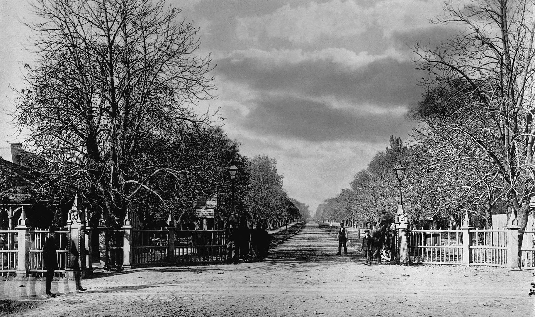
2001-77-6MS_zps441f8eb9.jpg

University Gate at Queen Street, ca. 1868.
 
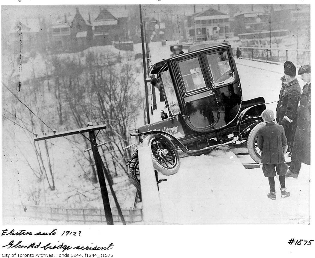
electric car accident - Glen Road Bridge - Toronto 1912 (Caption in "Ontario, 200 Years in Pictures" & City of Toronto Archives)

****** FUTURE INVESTIGATIONS REVEAL THIS TO BE THE HUNTLEY ST. BRIDGE

electriccar-GlenRoadBridge-Toronto1912.jpg
 
Last edited:
Streetcar strike 1910

Streetcarstrike1910.jpg


Union Stock Yards 1920

sheepatUnionStockYards1920.jpg


S.S.Noronic fire 1949

SSNoronicfire1949.jpg


Interns - Toronto General Hospital 1900

Interns-TorontoGeneralHospitalc1900.jpg


Board of Trade building - Yonge/Front 1892

BoardofTradeBuilding-streetcars-FrontYonge1892.jpg
 
picture is 1912, so perhaps a 1910 goad's map might help --

hmmm, i can't match those houses either

The image is facing south - the houses that are shown were demolished. Over the years they were replaced by bungalows, a low-rise apartment building and a contemporary residence.
 
Note the Judas Goat at the head of sheep.

Thanks, Earlscourt Lad for pointing that out to us.
I never noticed the goat and never before have heard of that slaughter-house practice - looked it up after seeing your note.
It's never too late for an education!

sheepatUnionStockYards1920.jpg
 
Last edited:
The image is facing south - the houses that are shown were demolished. Over the years they were replaced by bungalows, a low-rise apartment building and a contemporary residence.

f1244_it1575.jpg


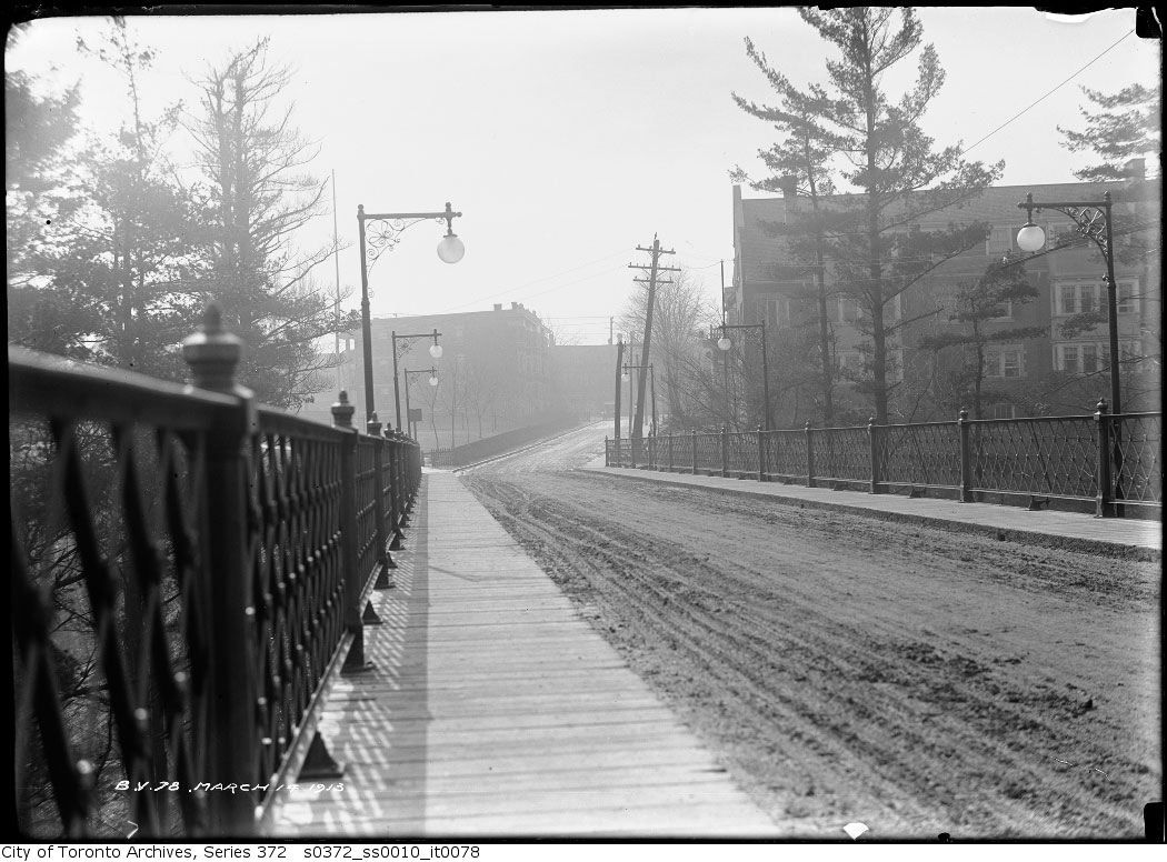
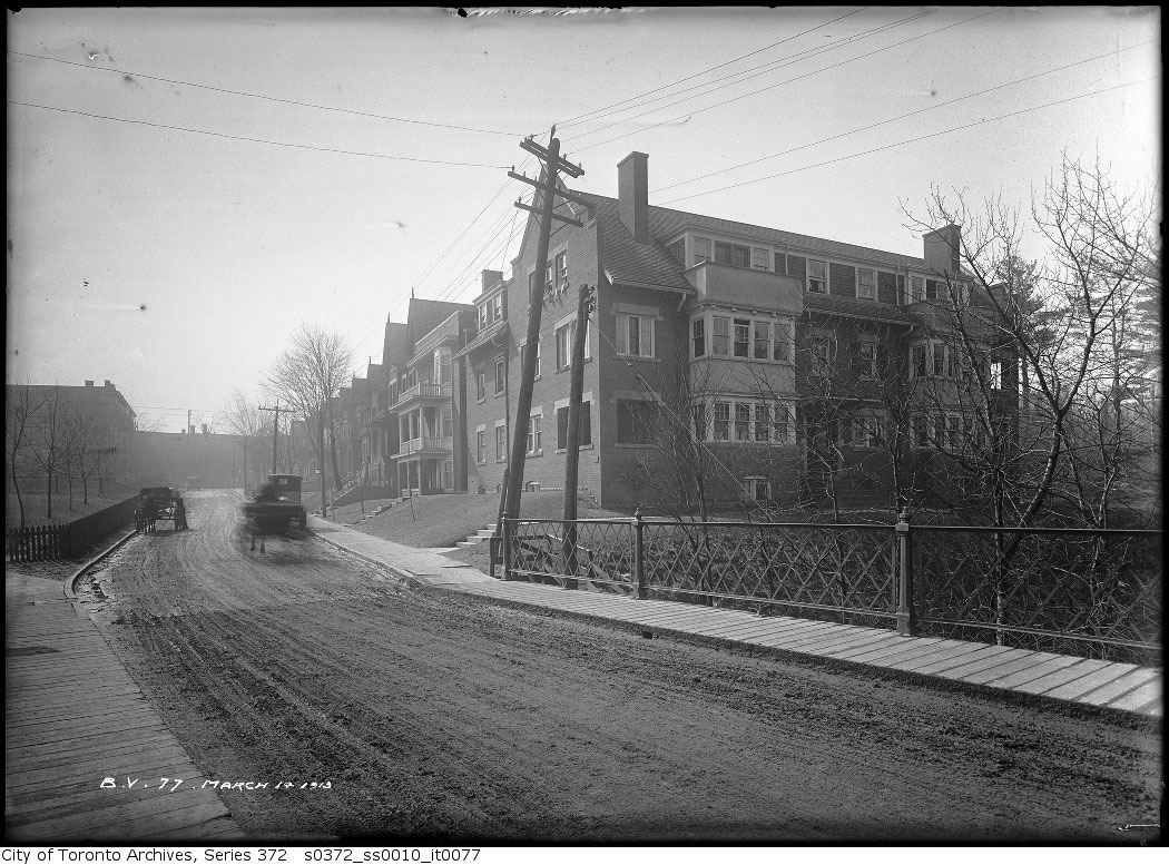
Doesn't quite match the south view in these pics:


s0372_ss0010_it0078.jpg


s0372_ss0010_it0077.jpg
 
Last edited:

Back
Top