News   Jun 17, 2024
 246     0 
News   Jun 14, 2024
 2.6K     1 
News   Jun 14, 2024
 1.8K     1 

TTC: St. Clair Streetcar Right Of Way

Is it 200m? you sure? the station is right under the Loblaws isnt it?

Yes, that's 200 metres or so. But you don't step through a door on St. Clair directly into the streetcar either. It's another 200 metres to the stop in the station which is on the far end of the platform. It's probably under St. Mike's football field. You can walk from the entrance of the station to the Tweedsmuir or Bathurst stop more quickly that down to the stop in the station, especially when it's crowded.

For people new to St. Clair, here's a great reminder of what was accomplished with the transformation. These two pre-ROW photos are from this thread.

StClair12.jpg


StClair40.jpg
 
Last edited:
Mihevc calls for third-party review of St. Clair right-of-way

http://www.torontosun.com/2012/03/30/mihevc-calls-for-third-party-review-of-st-clair-right-of-way


TORONTO - Councillor Joe Mihevc wants some St. Clair disaster relief.

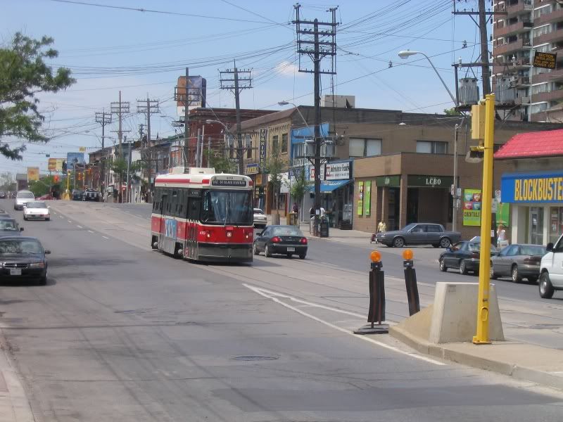
The Ward 21, St. Paul’s councillor is asking councillors on the Toronto Transit Commission to order a third-party review of the St. Clair streetcar right-of-way project.

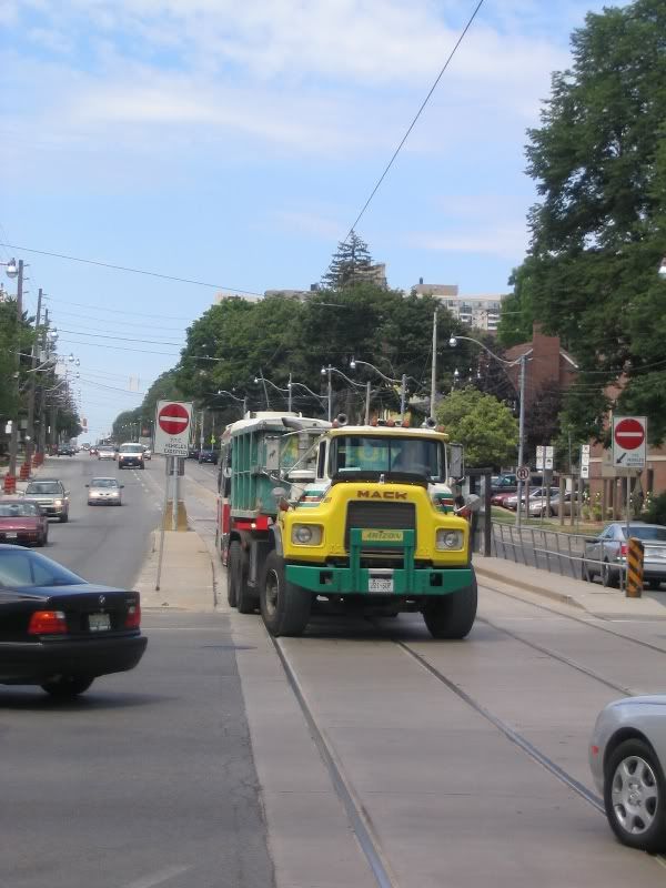
While Mihevc is a major proponent of the project, Mayor Rob Ford along with several councillors have continually hammered the costly dedicated streetcar line down the middle of St. Clair Ave. W. as a “disaster” and “fiasco” that cost the city millions over budget, brought a plague of lengthy construction and continues to tie up car traffic.

“There is so much misinformation out there on whether St. Clair was a success or not, people are speaking to it with great passion and sometimes very little information,” Mihevc told reporters Friday.

“What we really need, given that the future of the city seems to be in the suburbs going in the direction of light rail, we need an objective evaluation, done by a third party, to look at standards and measurements.

“Did it increase TTC ridership? Did it increase development potential on a particular street? Did it bring down the accident rate? What happened to the automobiles? What happened to pedestrians?”

“Let’s study it from an objective, third-party point of view, determine its success and that will then impact perhaps how we do light rail in other parts of the city and whether it is worth the money for other projects.”

The 2009 project was supposed to cost $65 million and ended up costing $106 million.

Mihevc stressed the St. Clair project was a victim of scope creep — with hydro and water work being added — and the actual right-of-way part of the project was only over budget by $3 million.

“There is a difference between scope creep and cost overruns,” Mihevc said.

The TTC is expected to consider Mihevc’s request Friday.

Penny-pinching councillors were baffled by Mihevc’s push to spend more money studying a project that went over budget.

Councillor Doug Ford called the St. Clair project “one massive screw-up”.

“And we’re going to pour more money into it just to justify Joe Mihevc’s request? That’s why Joe Mihevc is a councillor and not a business person,” Ford told the Sun.

Deputy Mayor Doug Holyday said it seems Mihevc has been “stung by the criticism” of the project.

“We don’t hire a firm to try to absolve ourselves of (criticism),” Holyday said, noting the city likely has all the numbers needed to determine the value of the St. Clair right-of-way

“I don’t think it takes any great report to find out this information,” he said.

Mayor Ford invoked the “nightmare” on St. Clair just last week when he tried unsuccessfully to urge councillors to reject the Sheppard LRT in favour of extending the Sheppard subway.

“People hate this St. Clair, they hate these streetcars, you can call them what they want, people want subways folks, subways, subways,” Ford shouted during a speech to city council. “They don’t want these damn streetcars clogging up our city!”
 
Thanks for resurrecting the pre-ROW pics I posted a while back. I wish I could find the original digital files, but alas. I really should follow up on the nows for some of the shots.
 
They should hire KPMG for it - they are so good, the city sole-sourced them for the services review.

AoD

I was just going to say that! Doug Ford has no problem spending tax dollars on a 3rd party review of what services to cut, but when it's spending money on a 3rd party review to tell him that he's full of shit, it's an egregious use of tax dollars! (Although Douggie wouldn't use egregious, it's too big of a word for him)
 
...I nearly choked on my drink reading the above post. Bravo, gweed, one of the better Ford burns I've heard in a while.

As for St. Clair, it's always been faster than before the ROW was put in when I've ridden on it, so I have no idea what Robbie's smoking. It's bad for your health, Rob!
 
Deerrun, Vaughan and one of the stops between Oakwood and Dufferin need to be remove, otherwise, the stops are right.

TTC wanted to do this from day one, but got shot down by ward councilors.
Its amazing councillors get involved in this but not about how St. Clair and the Stockyards is being redeveloped and those big box stores - home depot and rona
 
When I was living up there, I thought they should just keep the two stops that lie between Vaughan and Bathurst, and just name both Bathurst/Vaughan. (It's crazy because the eastbound Vaughan stop is practically across from the westbound Bathurst stop.)

I don't understand how some of these streets got developed. Why does Vaughan merge into Bathurst and why does it run diagonally before Bathurst (other than allowing it to merge with Bathurst). But then again why does Vaughan Road even exist as it is so close to Bathurst
 
I don't understand how some of these streets got developed. Why does Vaughan merge into Bathurst and why does it run diagonally before Bathurst (other than allowing it to merge with Bathurst). But then again why does Vaughan Road even exist as it is so close to Bathurst

Generally speaking, if it doesn't follow the grid then it follows a pioneer trail which generally followed a native trail which generally followed terrain. In this case, the terrain it's following is the Cedarvale ravine. If you continue to draw the line, then you start to follow Black Creek and then the Humber River towards Vaughan and Albion Township (Bolton).
 
Generally speaking, if it doesn't follow the grid then it follows a pioneer trail which generally followed a native trail which generally followed terrain. In this case, the terrain it's following is the Cedarvale ravine. If you continue to draw the line, then you start to follow Black Creek and then the Humber River towards Vaughan and Albion Township (Bolton).

Dufferin Street going north of Eglinton Avenue is a continuation of Vaughan Road, that's why there's a little jog in the Dufferin roadway today. Vaughan Road was cut off from Dufferin Street after Dufferin Street was widened south of Eglinton Avenue. Buses would have run to the more important corners at St. Clair and Vaughan where passengers would be able to transfer to the St. Clair streetcar and the Bay and Bathurst streetcars to downtown.

This photo was from 1924, when the Oakwood streetcar trackbed were being laid on Eglinton Avenue.

s0071_it3453.jpg
 
Last edited:
Dufferin Street going north of Eglinton Avenue is a continuation of Vaughan Road, that's why there's a little jog in the Dufferin roadway today. Vaughan Road was cut off from Dufferin Street after Dufferin Street was widened south of Eglinton Avenue. Buses would have run to the more important corners at St. Clair and Vaughan where passengers would be able to transfer to the St. Clair streetcar and the Bay and Bathurst streetcars to downtown.

This photo was from 1924, when the Oakwood streetcar trackbed were being laid on Eglinton Avenue.


How do you access all these old pictures.
 
Last edited by a moderator:
How do you access all these old pictures.

Got to this link at the Cty of Toronto Archives. Press the Search the Archives' database link, press the Advanced Search to bring up the Advanced Search box, fill the the keywords box (IE. Gilbert loop), click the Scanned photographs only check-box, and then press the SEARCH button.

Click one of the item selected, (IE. Item 3456 - Township of York, Eglinton and Gilbert Loop, looking east - October 17, 1924), and click on the thumbnail.
thumbnailImage


and you'll get the large photo.
(IE.
s0071_it3456.jpg

)

In this case, its a photo of the Gilbert Loop, 1 block west of Caledonia on Eglinton, in October 27, 1924.


Below is St. Clair Avenue West, looking east into the ravine from Bathurst Street, in 1910.

f1244_it1552.jpg


And where St. Clair West subway station is today.

f1244_it1097.jpg
 
Last edited:
Generally speaking, if it doesn't follow the grid then it follows a pioneer trail which generally followed a native trail which generally followed terrain. In this case, the terrain it's following is the Cedarvale ravine. If you continue to draw the line, then you start to follow Black Creek and then the Humber River towards Vaughan and Albion Township (Bolton).

Wow, that is quite interesting
 
Dufferin Street going north of Eglinton Avenue is a continuation of Vaughan Road, that's why there's a little jog in the Dufferin roadway today. Vaughan Road was cut off from Dufferin Street after Dufferin Street was widened south of Eglinton Avenue. Buses would have run to the more important corners at St. Clair and Vaughan where passengers would be able to transfer to the St. Clair streetcar and the Bay and Bathurst streetcars to downtown.

This photo was from 1924, when the Oakwood streetcar trackbed were being laid on Eglinton Avenue.

s0071_it3453.jpg
But how can Dufferin be a continuation n of Vaughan when its quite a bit east.(well not that far). The keele jog at Eglinton takes only a few minutes to walk east on Eglinton to get to keele St running north but the walk from Vaughan at Eglinton to Dufferin is more than a few minutes I think.

Ok I read the Wikipedia articles on Vaughan Road so it makes sense especially with that esso station not there. i keep forgetting that before all these structures on roads there use to be nothing but dirt roads and trails
 
Last edited:

Back
Top