News   Jul 09, 2024
 279     1 
News   Jul 09, 2024
 1.1K     2 
News   Jul 09, 2024
 468     0 

Transit Fantasy Maps

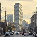
I dunno, I think your DRL alignment downtown just seems to be connecting dots on a map. A subway like that would never be built today. It's just too all over the place. The curves have to be a lot gentler than that. I think we should choose a road that it'll travel under mostly and stick with it. Or the rail alignment. Or even a big swooping arc up to Pape. e.g. your Queen West and Entertainment stations are at right angles from each other, even though they're one stop apart.

Okay, I'll give this another shot then. I tried to smooth out the curves while not loosing the connectivity of the service. NB- deeper tunnels as I'd use minimize the issue of vibrations affecting residences above a prescribed alignment. It's not only the destinations that I'm focused on but also how the inner-city alignment can intercept several surface transit routes in one sweep. Now instead of Wellington, I chose Front for the brief E-W section through the CBD, such that Queen West and Entertainment Stns can both exist along John proper and afterward the line makes a turning radius down to Union Stn that's appropriate for today's standards (twice the distance of St Andrew-Union). So no loud, screechy turns.

RapidTransitSolutionsPartII-theWest.jpg


The star attraction of this map however is the Highway 27 BRT, with a special short turn branch during rush hour directly serving Etobicoke North GO Stn and Rexdale Mall via the F.H.C. This in many ways is comparable to a subway (though at a fraction of the expense) due to the ability to sustain an exclusive ROW for most of its length including a long stretch uninterrupted from stop lights between the Queensway and Rexdale Blvd. As the black arrowheads indicate branch services west along Rexdale and Goreway into Westwood Mall; and northbound along Islington into 'downtown' Woodbridge would be possible should demand for direct BRT into these places grows. Lakeshore-Islington-Queensway loop at the southern end would bring mass transit to New Toronto which is gradually experiencing infill development in places the WWLRT or 508 fails to target, particularly along the Queensway.

This combined with BRT through the east-west portion of the F.H.C. does away with the need for a Finch West LRT.

Other fantasy proposal elements include:

  • I put both a rail corridor alignment and inner-city alignment for the DRL into the map to allow for a visual compare/contrast; with intercepting surface transit highlighted in red to see which offers the best alleviation. You may argue that the more curvy inner-city route will elongate travel times to the CBD but at least it'll minimize the time wasted on streetcars afterward to backtrack to the downtown's major commercial/job centres outside of the Financial District including Queen West, Cabbagetown, Little Italy, etc.

  • I extended the Bloor-Danforth five stops west to terminate in the bustling downtown of Cooksville via East Mall, West Mall, Dixie GO and the Mississauga Chinese Centre (midway in-between Tomken and Cawthra- easy walking distance to either). This is met by a Hurontario LRT "subway" which eventually runs at-grade north of Eglinton.

  • New GO stations for the Junction, Kingsway Mills, and of course Mt Dennis. GO service along the Midtown corridor.

  • How I'd direct the Eglinton subway into Pearson Int'l airport is very simple. By Martin Grove the subway would either be in a trench or elevated above the streetscape a la Yorkdale Stn. As a hydro corridor conveniently routes perpendicularly up to Hwy 27/Dixon from this point, have the line bridge over Richgrove, Longbourne and Hwy 401; then curve back into the F.H.C. to allow for a east-west station at Hwy 27 (walking distance of Skyway, the Congress Ctr and Doubletree Int'l). Then another stop at Carlingview for all the area hotels which will prove to be a well frequented stop by airport patrons. Alternately Mississauga buses could feed into this stop same as they would @Renforth/Eglinton (# 7, 17, 18, 50). The PIA stop would be at Terminal 1 opposite the people-mover tram, allowing for easy accessibility to points all over the airport. I would even recommend extending the people mover to further stops at Orlando and at Malton GO Stn/International Ctr.

  • Oh and kept Jane in, as BRT, but now only from Eglinton northbound via Mt Dennis Stn (no sense placing a subway stop in the middle of Eglinton Flats park for a transfer point, you know).
Feedback's always welcome. :)
 
As for Scarberian, the offer stands. He can help out or sit on the sidelines and coach from an armchair. I am no expert at this but I'd rather do my best to help my community that cast rocks against those that are doing their best.

You could try putting common sense first instead of not first, unless yet another fantasy map is the goal. Hasn't anybody bothered to even pull out a Ride Guide and a list of service figures like actual riderships and actual numbers of vehicles used per route?

DRL supporters and the Weston folk, among others, haven't tied the lines they're pushing to, say, monorails to Orangeville or BRT lines to nowhere along corridors like Progress that seem so very important [to people that live there] but probably don't even crack the list of top 50 busiest bus routes. Are there 50 BRT/LRT/subway lines on the map? Progress doesn't deserve a cent of funding more than these other 50 corridors, most of which put up with worse traffic, too.

We need to be concise and utilitarian in our planning here. Scarborough has a declining population, meanwhile Etobicoke and North York are booming.

In the time it took you to type this, you could have googled the fact that you're wrong about which areas are growing and which aren't. The correct statement of the three is that North York is booming, but even that growth is confined to a few areas, while other parts of North York are hemorrhaging people.
 
The concern with Progress was over serving Centennial. We've dropped that idea. We've decided to use Neilson instead to tie our Finch and Ellesmere BRTs together while servicing Malvern. I've asked gweed to put the map up so we can discuss it. Everyone seems to be stuck on our early proposals. Like I said earlier, the process is iterative. In the beginning we were concerned about canning the SRT extension, that's why we were focusing on Progress; mimicking the SRT in a way. But as the plan developed we decided to use Ellesmere and Neilson to serve Malvern. I think it's rather unfair of some here to be monday morning quarterbacks when you haven't understood the thought process or been part of the discussion. If you want your input to count, join the group and pitch in where it matters: in the SOS group forum.
 
Do you want input that counts? Iterate on back to a few simple subway extensions, which has been said before. Everything else is as silly as Transit City...why would the powers that be drop an entire plan of random lines only to adopt another plan of assorted lines that's just as arbitrary? Where will your BRT lines run tomorrow?

Anyone who's ever taken the Neilson bus knows that that's not the way to serve Malvern. A glance at a map would suggest the same thing.
 
Then how do you serve Malvern? Also, I keep asking what approach to take. Early on when I suggested subway only that was critiqued as too much subway fanboyism. We can't seem to win either way here. Either we have a complicated proposal with subways and BRTs or we're too simple with just a subway network fantasy map. Whose criticsm should I take to heart?
 
Last edited:
Started this a long time ago. The LRT lines would be like the Calgary LRT but with more frequent stops - and never stopping at red lights. GO lines electrified and upgraded to high frequencies with local and express trains. Basically the subway and LRT would provide rapid transit where there are no rail corridors, and the regional rail lines would provide it where there are rail corridors.

http://i517.photobucket.com/albums/u335/mister-f/Maps/transit2-1.png


What about sending the Queen Line to Kennedy and taking over for the SRT, bypassing the B/D to not bother having to take it downtown for some and eliminating the need for the transfer even though the transfer is still there.

And have the B/D split off at both ends. To continue east and service Kingston Road, and on the western end split off to parallel the 427 to go to the airport and scoop up many Mississauga transit routes.
 
Started this a long time ago. The LRT lines would be like the Calgary LRT but with more frequent stops - and never stopping at red lights. GO lines electrified and upgraded to high frequencies with local and express trains. Basically the subway and LRT would provide rapid transit where there are no rail corridors, and the regional rail lines would provide it where there are rail corridors.

transit2-1.png

I like this. The network is similar to mine, except my map doesn't show limited service regional rail lines. After all, rapid transit lines should have frequent service, right? And not all rail corridors can support that kind of service, and I excluded such corridors from my map. So our maps show different things, but the network is very similar though there are some differences.
 
Nitpick: It should be possible to transfer from the Richmond Hill GO line to the Richmond Hill Centre station on the Yonge subway line, as the two lines are right beside each other at this point.
 
I like that plan, it links so much together through public transit. Shouldn't the Lakeshore to Hamilton line be rapid rail though? There has to be at least a million people in this corridor already and it is an area targeted for increased density to curb urban sprawl by drawing development down closer to the Lakeshore/QEW area and away from the farmland/hinterland north of hwy 5.
 
^^ "Rapid Rail"?

I think that the entire Lakeshore corridor should be improved to HSR standards. This means that trains could be run very quickly along it, improving travel times greatly. Depending on what kind of trains they buy, they could run a very, very fast regional rail service. I'm not sure how fast traditional Regional Rail EMUs can run, but I'm sure there are some that can run regional rail at 200 km/h top speeds. It would also make it a lot easier for a connection with the US New York HSR, which would end up creating a Toronto-New York HSR route that could connect elsewhere. Putting Lakeshore East up to HSR standards would be paving on road to a complete Toronto-Montreal HSR corridor.

This should include one or two tracks for VIA and Amtrak trains, and two tracks for Go trains. I don't actually see any reason for the Hamilton-Pickering Section to have any freight capacity, since it gets basically no freight traffic right now. Where there is freight traffic, the rail should be improved to increase freight capacity, while also separating it from passenger rail. I think that with all the government's investment in roads and highways, it's only fair to have big rail corridors too.
 
Could anyone guess what the cost/km of something GO-ALRT -ish would be today? Something which would use fairly small EMU's, run at high speeds on it's own ROW and operate at high intervals. In 1980 the system was supposed to cost 2.8b, or 14m/km. Inflation adjusted that is about 40m/km. Obviously it would be more, but how much? 80m/km? 150m/km? 200m/km?

Next, what would the costs be of upgrading to something which could be called REX? So, electrify the rails, over/under-passing all the level crossings, building better stations, updating signaling and so forth.

The costs for HSR are about 80-100m/km, depending. Maybe it would be a good idea to replace the GO-Lakeshore entirely with high speed rail. Any high speed rail worth going for would need it's own ROW to start with, so moving commuters onto it could be worthwhile given that it would be much more capable than existing tracks. I doubt HSR frequencies would be above 1 per hour, which should leave plenty of track space for some kind of high speed commuter service. Assuming the HSR would enter the GTA around Pickering, we could then just put up stations along the ROW every 3km or so until Hamilton. Marginal stations could have bypass tracks.
 
^^ I think that the HSR should be relatively separate from GO. HSR should have minimal stops, and that leaves plenty of room for Go to operate a regional rail service.

I'd see an express Toronto-New York HSR stopping only at Toronto, maybe Hamilton, Buffalo, Rochester, Albany and New York. With Toronto-Montreal, there'd be one express route that stops at Toronto, Ottawa and Montreal. There'd also be a more regional service that stops at Toronto, Oshawa, Belleville, Kingston, Ottawa, Laval, and Montreal. Then there might be an even more local service that serves Cobourg, Brighton, Trenton, etc.

But Go should be providing a regional rail service throughout the GTA/GGH, bringing Metro-style service. The thing is that if all the tracks are upgraded to HSR levels, Go can operate trains very, very quickly provided they have trains that have high top speed but also high acceleration and braking. Imagine hopping on a Go train in Toronto and arriving in Ajax in 15 or 20 minutes? If the trains even had a top speed of 200 km/h, that's quite possible.
 
My thinking was that if you were going to build a railway capable of high speeds (150+kph) that would intersect all of GO's major passenger sources, Hamilton, Burlington, Oakville, Mississauga, (potentially) YYZ, Union, Scarborough and Pickering, you might as well spend a bit more on it and give up on trying to REX-ify the Lakeshore Corridor. I doubt HSR could even be built to run at 300kph through the GTA. Those speeds require turns with radii measured in km, a high degree of separation from freight and noise abatement. Downgrading to 200kph through urban areas seems somewhat inevitable.

For the Olympics in London they are going to use Javelin trainsets, a derivative of a Shinkansen, to shuttle people from St. Pancras to Stratford. It can travel at a top speed of 225kph. If we were to build a HSR using typical TGV style trains, it should be possible to slow them down through the GTA (which would likely happen anyways) to about 180kph and use something like the Javelin for commuter services. Even assuming we could run a train at 300kph right into Union, we would only be adding about 6 minutes to a train coming from the East if we slowed it down to 180 kph around Pickering. Smaller stations, like Guildwood, could have bypass tracks to prevent any gratuitous speed loss.

This would kill multiple birds with one stone. We would get HSR, which I think most people consider good. We would get a kick ass Union-YYZ link (~10m), blisteringly fast commuter rail service and we could stop using trainsets that operate to North American mixed rail standards.
 
My thinking was that if you were going to build a railway capable of high speeds (150+kph) that would intersect all of GO's major passenger sources, Hamilton, Burlington, Oakville, Mississauga, (potentially) YYZ, Union, Scarborough and Pickering, you might as well spend a bit more on it and give up on trying to REX-ify the Lakeshore Corridor. I doubt HSR could even be built to run at 300kph through the GTA. Those speeds require turns with radii measured in km, a high degree of separation from freight and noise abatement. Downgrading to 200kph through urban areas seems somewhat inevitable.
I think that that service in between Hamilton, Burilington, Oakville and Mississauga is important, and sacrificing 10 minutes from the total route time doesn't quite justify taking service off those routes. Not to mention that HSR will already be improving the route speeds a lot.

I think that 200 km/h should be the bare minimum for a HSR route. I'd think that something like Lakeshore West past Mimico is straight enough for close to 300 km/h. Noise precautions should be pretty easy to take, and it'd probably be an improvement over the noise that normally comes from trains running at 80 km/h without any barriers. HSR will also be a lot smoother, so meaning the trains won't make such a racket when going over the rails.

As for YYZ, I'm hoping that HSR through that corridor would result in rerouting it under Pearson, diverting just west of Etobicoke North. It might be expensive, but I think it's worth it, especially since tracks would need to be upgraded anyways.
 
Isn't HSR for connect distant cities, like Windsor-Toronto-Montreal-Quebec corridor? I am not sure if HSR has any place in this discussion.
 

Back
Top