News   Apr 19, 2024
 2.5K     1 
News   Apr 19, 2024
 963     3 
News   Apr 19, 2024
 1.6K     3 

Transit Fantasy Maps

I could maybe see the justification for tunnelling the section from Laird to the Science Centre later on, while keeping the same technology, if the above-ground section on Leslie actually becomes a bottleneck. I'm not sure that will actually happen, though.
 
At this point, can it converted into Subway in the future?

I mean, why? Other than this cities fetishization for the subway rolling stock.

The crosstown stations can be converted into having 4-car long LRTs.

Each LRT has a crush load of 200 people. Thats 800 people per 4 car trains. Thats plenty for this area of Toronto for a very long time.

Even then, you could do things like convert to 3, 7 module LRTs, which would have more space (less empty space between cars) with no driver compartment in the middle train. Etc.

There are a ton of engineering things you could do with LRT rollingstock that would offer the same ridership of the Toronto subway cars, and cost a fraction less to implement.

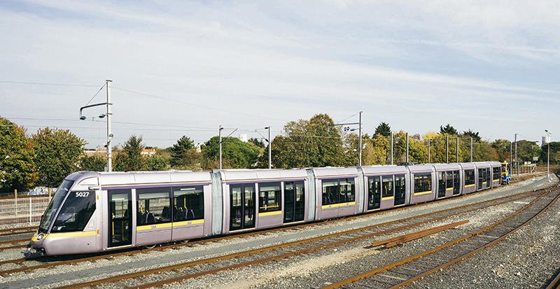
Like the 55 meter Alstom Citadis

DPEay07W4AAvgEP
 
At this point, can it converted into Subway in the future?
It can (the station boxes are long enough to fit existing 6-car subway rolling stock), but it'd be expensive and cumbersome.
It can be converted, but I believe the platforms are 95m long and not 150, so they can only hold 4-car trains. But I think as everyone says, it's not whether it's TTC subway or not, as long as it's grade-separated.
 
I mean, why? Other than this cities fetishization for the subway rolling stock.

The crosstown stations can be converted into having 4-car long LRTs.

Each LRT has a crush load of 200 people. Thats 800 people per 4 car trains. Thats plenty for this area of Toronto for a very long time.

Even then, you could do things like convert to 3, 7 module LRTs, which would have more space (less empty space between cars) with no driver compartment in the middle train. Etc.

There are a ton of engineering things you could do with LRT rollingstock that would offer the same ridership of the Toronto subway cars, and cost a fraction less to implement.

Like the 55 meter Alstom Citadis

DPEay07W4AAvgEP
It's not a fetishization for subway rolling stock, it's for improvements in passenger movement, the increase in the number of doors, and an increase in overall capacity. If a subway can carry 1000 people reliably and crush load 1500 passengers while a 5 car LRV train can reliably carry 675 passengers and crush load 1,100 passengers, there are genuine improvements that can be made.
It can be converted, but I believe the platforms are 95m long and not 150, so they can only hold 4-car trains. But I think as everyone says, it's not whether it's TTC subway or not, as long as it's grade-separated.
You can tap into the full station box, moving ventilation equipment and whatnot and fit 2 more LRVs, but again, it would require a full shutdown of the station, so at that point, a conversion would probably be the best way to go.

Even then, if you were to do a conversion to subway without tapping into the full station box, a 4-car subway would still be significantly better operationally than a 3 car LRT.
A 3-LRV train can carry 450 passengers reliably, 600 crush loaded
A 4-car subway can carry 800 passengers reliably and 1000 crush-loaded.

We wouldn't be needing this type of capacity for at least 30 years though, so conversion can obviously still happen, but it'd likely be at a point in which the line needs an overhaul anyways.
 
Last edited:
Toronto Core Line.png


What if the relief line was designed as Toronto's core subway line?

I have absolutely no clue where the line should go between St Clair West and Dufferin, but everywhere else are the stops I would have if this line was to be elevated north of the DVP east of Yonge. It hits nearly every major east-west corridor through Toronto, which would be able to relieve every subway by giving faster access to the core than through Lines 1 or 2. Ideally, the loop could be closed by a westwards extension of Line 4.

Also, the technology used would of course be subways SUBWAYS SUBWAYS because we don't want to have to talk about replacing it 30 years after it's built.
 
Also, the technology used would of course be subways SUBWAYS SUBWAYS because we don't want to have to talk about replacing it 30 years after it's built.
Hey look, a subways Subways SUBWAYS we can actually get excited about.

And running the relief line along the Weston corridor isn't even a bad idea, it could easily replace the UPX and add more stations. They do it in Tokyo, New York City, London, among a bunch of other cities, there's no reason it couldn't be done here.
 
It's not a fetishization for subway rolling stock, it's for improvements in passenger movement, the increase in the number of doors, and an increase in overall capacity. If a subway can carry 1000 people reliably and crush load 1500 passengers while a 5 car LRV train can reliably carry 675 passengers and crush load 1,100 passengers, there are genuine improvements that can be made.

You can tap into the full station box, moving ventilation equipment and whatnot and fit 2 more LRVs, but again, it would require a full shutdown of the station, so at that point, a conversion would probably be the best way to go.

Even then, if you were to do a conversion to subway without tapping into the full station box, a 4-car subway would still be significantly better operationally than a 3 car LRT.
A 3-LRV train can carry 450 passengers reliably, 600 crush loaded
A 4-car subway can carry 800 passengers reliably and 1000 crush-loaded.

We wouldn't be needing this type of capacity for at least 30 years though, so conversion can obviously still happen, but it'd likely be at a point in which the line needs an overhaul anyways.

Im sorry but the capital costs to do such a thing for a slight improvement in capacity I just cant see being justified.

Plus you then create a transfer at Laird.

The improvements with maxing out the LRT system both in train length and frequency would near match the advantages of switching to subway rolling stock.
We're likely going to spend 4-5 billion dollars improving capacity on the Yonge line (1B for the Second Union Station platform, 1-2B for Bloor-Yonge station improvements, 1-2B for signal modernization, and some amount for Rolling Stock improvements). Spending 3-5 billion (adjusted for inflation) to increase capacity by up to 78% is completely reasonable if crowding ever gets to a level that justifies it.

You'd move the terminus to Science Center, which has access to the Relief line.

Again, this scenario assumes you max out LRV train length and frequency. A scenario like this would likely exist beyond the 30-year service life, and necessary overhauls would be taking place anyways.
 
So I wrote this post in the Ontario Line thread:

TBH there are feasible options for building a second Yonge Line that I have seen speculated upon in the Transit Fantasy Maps thread.

The one option that intrigues me most is a configuration that has a new express-like subway built under Bay Street and eventually connecting to Yonge at Davisville, and taking over the Line 1 track north to Richmond Hill. The original Line 1 terminates at Davisville Station (or if it can be figured out how, extended one more stop to Eglinton). In terms of disruption, Davisville station would probably have to be shut down for a while but that is hardly a system-ending inconvenience.

And got inspired to see what a rebuild of Davisville station area could look like. But first, I mapped out the Bay-Yonge Subway configuration:

1577035901258.png


Essentially the Bay Subway is an express line downtown, that takes over the Yonge Corridor north of Eglinton. It extends all the way to Queens Quay, thus finally resolving the whole Waterfront transit & Union Station issue. I chose an alignment that detours onto Avenue and St. Clair to expand transit coverage, and because you can mostly follow public ROW and seemed like less eventual issues with grade as you approach Davisville. Though, since the Yonge Line is actually not under Yonge Street between Wellesley and St. Clair, you could also run it up Yonge Street as some other people have suggested previously.

I've left stations out of the map as that is up for discussion between balancing coverage and the express-like aspect of the Bay Line. (Though, I would have beginning from the south: Queens Quay, Wellington (Fin. District/Union connection), Nathan Phillips Square, Gerrard, Bay (south of Bloor), Davenport, St. Clair & Avenue, Davisville)

I still haven't figured out how the section between Davisville and Eglinton looks like. It feels unsatisfactory for Line 1 to terminate at Davisville just before Eglinton, so on my sketch below I send it through a new tunnel under Duplex to Eglinton (barely shown at the top of the image), where the line terminates (not sure how the train will be able to turn around at Eglinton yet). The Bay subway emerges onto the old Line 1 tracks just after Chaplin Crescent and continues to Eglinton and beyond.

1577036517918.png


Yellow are the subway lines, Orange are the station platforms, and the dark red are the reduced Davisville Yard functions. The new Davisville Yard is decked over and probably would largely just serve as storage for a few trains to assist with operations. I tried to make station platforms 150m in length, wasn't sure that was enough.

Now, the inspiration that led to all these holiday morning sketches, Davisville Station is decked over and redeveloped:

1577043335006.png


So, unlike with the Crosstown, we have learned our lesson and decided to use subway investment as an opportunity to do some development and community-building, and hopefully recoup some of the cost of construction. Davisville Station has been decked over as previously mentioned, with necessary support structures for the development above incorporated in the design. Going to be a very tricky construction, especially for the buildings above the existing Yonge Subway fronting on Yonge Street. Don't ask me if it's feasible, I'm not engineer, just posting a map in a transit fantasy thread.

I suspect none of those buildings in the middle block can have underground parking, so that is interesting from a planning perspective I suppose.

Existing street network in cyan. Extension of Duplex shown in teal to meet with Merton Street at Yonge.
Pink describes mixed-use residential buildings. Purple describes primarily office towers with residential on-top, this includes a rebuilt of the Davisville TTC HQ.

Oriole Park is extended, Frobisher Ave is converted into a trail as access to the Davisville Yard can be had from the extended Duplex Ave. The green in the middle of the Davisville Station block is an open-space public plaza that enables European-style public-square and programmable space.

edit: updated the map to trace the subway lines underneath the Davisville Station redevelopment.

....

I'm sure there are plenty of flaws, but this is intended as a conversation starter.
 

Attachments

  • 1577037129238.png
    1577037129238.png
    2.2 MB · Views: 355
Last edited:
I'm not sure that breaking the direct connection between Union station and waterfront transit is necessary or desirable.
Is it not?

Having Waterfront Transit jog up to Union Station seems like such a drag. If your intentions are to travel along the waterfront, you are subjected to a lengthy detour to Union Station.

Presently, that is fine of course because the predominant travel pattern is from Union Station to somewhere on Queens Quay West. In the future, as the eastern waterfront is developed and gradually inhabited (to say nothing of the Portlands), that may no longer be the case, and the jog up to Union Station may inconvenience many people looking for a direct east-west route.

If a Bay Subway existed, there would simply be a transfer point at Bay and Queens Quay West. If your travel pattern has you connecting to a GO train, people can board the subway for one stop to Union Station. If you are a traveler from further north looking to transfer onto Waterfront Transit, you would simply opt to take the Bay Subway rather than the Yonge Subway as the Bay subway becomes your more direct route. If you are coming from somewhere on the Spadina Line (York University let's say), then yes, you will have a little extra annoying transfer, but there are always winners/losers with any configuration.
 
Is it not?

Having Waterfront Transit jog up to Union Station seems like such a drag. If your intentions are to travel along the waterfront, you are subjected to a lengthy detour to Union Station.

Presently, that is fine of course because the predominant travel pattern is from Union Station to somewhere on Queens Quay West. In the future, as the eastern waterfront is developed and gradually inhabited (to say nothing of the Portlands), that may no longer be the case, and the jog up to Union Station may inconvenience many people looking for a direct east-west route.

Putting aside the cost of the proposal and the significant investment that was made for the existing streetcar tunnel (and its planned expansion) that would presumably be scraped...

For this to make sense, two things would have to be true:
1) Evidence that a continuous route along the waterfront is significantly more valuable and useful for our overall transportation network, than maintaining the direct connection to Union station (which includes the entire Go train & bus system, intercity rail, two branches of Line 1, and our central business district).

2) Assuming such a shift in our travel patterns actually takes place... the cost/benefit ratio of your subway would have to be superior to other alternatives. For example, the creation of a new numbered streetcar line (or a branch of an existing one) that bypasses Union station would achieve your same objectives, with minimal infrastructure investment other than a wye junction at Queens Quay & Bay.
 
I like the Bay Express subway concept in general, but not sure it can go that far south. The problems are the conflict with PATH, and the water table issues when the line gets close to the lake.

Building the whole network from scratch, I would actually send the Bay line all the way south, connect to the Waterfront streetcar at Queens Quay, and maybe even reach one of the islands with the subway.

But having to fit into the existing environment, I would accept the Bay line only reaching south as far as Queen or King. The waterfront streetcars would still connect to Union using the existing streetcar tunnel, and use the expanded loop. They wouldn't have any direct connection to the Bay line, and that will be a gap on the map and a shortcoming for the actual riders, but avoids a big bundle of problems during the construction.
 
Last edited:
And with all the extra GO platforms added south of the station Union rail station practically reaches the waterfront anyway. Unless Union station could get an elevated looped people mover.
 

Back
Top