Mississauga Pearson Transit Hub | ?m | ?s | GTAA

For the former, it's obvious.

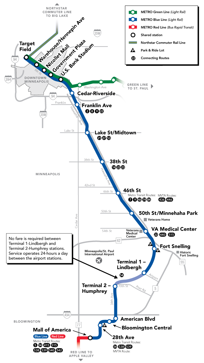
Let's look at the starter station. (The shoestring go RER station I'm talking about). We don't currently (For the purposes of this paragraph) care yet about what it will become. Just that it'll be a station closer to the airport than Weston, that serves all rail transit users coming from either direction (Kitchener, Toronto). Let's call this "GO Woodbine" or "GO Pearson". For the moment, we're temporarily ignoring HSR, we're temporarily ignoring development (existing or future), for the purposes of just getting a RER infill station that services Pearson.

Brand new GO stations are typically in the the neighborhood of very roughly $50 million (Examples: $44M for James North). Sometimes it's lower like the $35M station portion of the $150M Stoney Creek rail extension (extra parallel track, etc). Numerous budgets show GO stations typically cost well under $50M each, with only a few larger complex station projects breaking through, or massive addons like Oakville's beached cruseship for cars (aka parking garage) but the government won't be providing free parking for airport travellers. Even the Weston unmanned UPX platform, smaller than a GO platform, is just a line-item in a ~$50M station budget including the slightly fancier Weston UPX waiting room.

Any basic starter GO station that gains the standard station name "GO Pearson" would obviously need to have a way to service Pearson quickly, and the best candidate would be the Woodbine racetrack simply because UPX spurs off to Pearson right after Woodbine.

Let's, for the moment, focus on where a GO (RER) station that contains "Pearson" in its name, and costs only $50M to build, will not be able to afford the cost of relocation of the UPX. No spur at Malton, no Pearson terminal relocation.

I now turn the tables -- how do you propose to install an equally inexpensive starter Pearson station that's not located near Woodbine racetrack?

This question is relevant because once "GO Pearson" station exists between "GO Weston" and "GO Malton", is relevant because, once this happens, it becomes one of the many possible candidates to be upgraded to a HSR station. They need the RER station much sooner than HSR, possibly two decades sooner. Many considerations occur, and by the time HSR arrives, it becomes more attractive (space for adjacent station without shutting down existing 15-min-RER service, some kind of developments already occurring, etc) it is likely whatever is named "GO Pearson" becomes the primary candidate if no UPX/LINK replacement occurs in a sequence before HSR (that connects to Malton, etc).

Metrolinx has a habit of replacing placeholder names. GO Woodbine is probably likely to be renamed GO Pearson if it interchanges with the UPX spur. See GO James North renamed to GO West Harbour (a geographical feature located further away). Metrolinx, also, happens to own and run the corridor and the UPX. So they call the shots on what cheap GO station receives the name "GO Pearson" -- that name becomes a neodynium magnet for future station expansions.

Sure, the Pearson Hub could relocate to Malton but before the HSR Pearson Hub, there may be 5 years, 10 years, 20 years of some kind of a Pearson-servicing GO station before HSR finally arrives to it. By then, it'll be a much stronger candidate than today, especially if the HSR station can be built adjacent to it without shutting down the existing station. I'm not betting HSR will be on time, so I feel there's quite a time window between GO Pearson and the HSR Pearson Hub.

Another scenario is if everyone can suddenly afford to build a $1bn station all at once, then yes, bulldoze Malton for I care and also build the new spur for whatever (UPX or LINK II or another link). But if we do that now, it will be empty, with so much redundant infrastructure. Best to start small, start a GO RER station, and go from there. While GTAA and Metrolinx (who brings the rail services) is hashing out details for any future megastation master plan, a RER infill is far more likely to occur many, many years before HSR service.

The starter station may be a completely independent location of what becomes the big HSR Pearson Hub (separate locations) but once a starter station exists, becomes named "GO Pearson", and starts being a magnet, it is already a much stronger candidate to be selected as the HSR station. And when we've gone that far, it might as well be the Pearson Hub.

But the question here, is specifically addressed to "which station becomes the starter Pearson station of some sort" (Tiny GO station? HSR station? Big Pearson Hub?), and I think the answer is obvious -- both from a financial and infrastructural sense from the Pearson perspective.

For this latter part, a correction:
"in 30 years, we'll have perhaps already redeveloped half of Woodbine"

Which of course, implies it could be a little, could be a lot. Similiar statements I've said in that post here (if I didn't word them correctly), should be interpreted as such. It's meant to help you understand. A progression, an incremental station expansion, since there's a gap between RER and HSR. If you built Pearson Hub all at once, sure, raze Malton -- as part of a megaproject to do RER+HSR+new spur. But if you're doing it incrementally, in the most inexpensive progression possible at first, that pretty much strongly limits station location choices.

Everything you speak of seems to be able to be accommodated at Malton saving the $50 million cost of a new proto-pearson station at Woodbine.

You assume that UPX would take passengers from Woodbine the rest of the way to the terminal (otherwise how will they get from pearson station to the airport). That would degrade the UPX service as it would have to stop at yet another station, part of their marketing is the speed between pearson and union. A station at Malton would require some way to move passengers to/from the airport, would building a second airport mover (or replacing the current link train) cost more than a new GO station?

not to mention, in 2020 it will have another station added where it crosses the Crosstown. I seriously doubt, there is interest in adding another one so close to the airport....particularly as it, unlike the others, would add no revenue.
 
Everything you speak of seems to be able to be accommodated at Malton saving the $50 million cost of a new proto-pearson station at Woodbine.

You assume that UPX would take passengers from Woodbine the rest of the way to the terminal (otherwise how will they get from pearson station to the airport). That would degrade the UPX service as it would have to stop at yet another station, part of their marketing is the speed between pearson and union. A station at Malton would require some way to move passengers to/from the airport, would building a second airport mover (or replacing the current link train) cost more than a new GO station?

That's a very good consideration, and you may very well be right, especially if UPX voter support increases significantly over time.

But this is complicated by:

- Controversy of spending more funds on anything UPX related. Voter support for that is currently very low.
- Controversy of spending taxpayer funds on a LINK II today (after HSR yes, but today no).
- New SmartTrack GO RER route may go south along 427, with a Pearson stop and an Airport Corporate Centre stop.

smarttrack.jpg

(screenshot taken by Steve Munro from updated City/Metrolinx PDFs)

This is possibly one the station locations GTAA may be evaluating. Although not directly on Pearson property, it connects to HSR without an expensive rail corridor diversion, is compatible with current GO RER proposals, is compatible with SmartTrack proposals, and is politically/economically compatible with whether we keep UPX or not (maximum number of possible face-saving moves over UPX).

There is a new infill station at the location of where I think Pearson Hub will be. That's still Woodbine. This new SmartTrack plan keeps the door open to keeping or killing UPX, anytime soon or anytime later. There is currently strong public support for a SmartTrack (GO RER) station at Pearson which can interchange with both a premium UPX and a cheap bus shuttle. And the map shows the stop near Woodbine Racetrack, just before the UPX spur. That station probably will ultimately contain "Pearson" in its name.

Even if the spur to Airport Corporate Centre does not get built, any modified SmartTrack / modified GO RER plan, is almost certainly going to include at least a basic Woodbine station as it is currently seen in many GO proposals, including any infill station talk (like SmartTrack-style enhancements), if GO RER proceeds with infill stations.

Fed, provincial, and city are currently eager to fund this. Fed just announced SmartTrack funding while fully knowing the Pearson spur alternative that came up a few weeks ago in SmartTrack planning. And there's little political appetite to either expand or cancel UPX (hot potato issue in both directions). The Woodbine location allows all govts to save face in either direction.

There are possible unexpected curveballs that can occur -- e.g. GTAA permits SmartTrack onto airport property in exchange for a future rough-in of Pearson Hub that's off the main Metrolinx corridor (a real zinger of a curveball). However, that loses out on a lot of other transit services that would likely down the Kitchener corridor (GO Transit, VIA, HSR). Or the Pearson SmartTrack spur might actually also be the route of a new rail shuttle (whether it is a subset of UPX, LINK II, or an entirely new one) to connect the HSR/GO/VIA to the Pearson Hub that's off the Kitchener corridor. And yes, Malton may enter the discussion.... But so far, it hasn't, and it's too far off all current possible plannings (UPX-related and SmartTrack-related, etc).

This does not detract from the need to put a greatly enhanced public transit perimeter completely around Pearson someday, including Malton and Airport Corporate, so Pearson Hub could be a place to star-out all the transit route options all over the place (via RER infills to Bramalea, via added ECLRT stations, and via SmartTrack spur built on Pearson property to the west of the 427, and possible extra new rail routes in the future).

This does not preclude further transit improvements along the transit-starved areas (e.g. north-south of Malton, the Dixie corridor, etc) as that will still be sorely needed to pull more people out of cars in that region someday. But, realistically, that's a transit-poor area for Pearson Hub compared to a Woodbine station on the GO RER route that overlaps current SmartTrack and UPX routings, and GTAA/Metrolinx/city desire.

If not at Woodbine, then a hub on actual Pearson land (between Woodbine and Airport Corporate) is more likely to happen near the 427 (SmartTrack routing) than Malton. If that happens, HSR would probably be Woodbine, for a short people-mover of some kind to Pearson Hub along the SmartTrack 427 corridor. Pearson owns the land just west of 427, and

For example, GTAA may shell out for a station on their land, and then extend the existing LINK train to reach this Hub -- the current LINK terminus is at Terminal 3 with the railroad stub pointing towards the proposed new SmartTrack Pearson spur. Simply extend the LINK (Without disrupting existing LINK service) so the new LINK terminus touches the SmartTrack spur. Where this intersects, is a possible Pearson Hub location, but this time on actual Pearson property. One of the many, many possible scenarios that may happen. But all of them are pretty close to Woodbine, which would probably get the connecting HSR service. The UPX spur may or may not be involved (e.g. using a portion of it to help SmartTrack trains get south of the freeways, before wye-ing off).

One Pearson Hub can't possibly serve the whole area, but the combination of RER Bramalea + SmartTrack Pearson spur + ECLRT extension (all 15min or better), will, as a total, greatly enhance surrounding transit surrounding Pearson Hub. Near Pearson Hub (if located east-ish) will be directly on the much-vaunted rapid rail rapid transit loop (future ECLRT extension, Pearson SmartTrack spur, and the Georgetown corridor, creates a circle). Serving a massive large number business parks with between half a dozen to a full dozen of stations nearby (spurring out to Malton via GO RER, spurring out to Dixie/Tomden via ECLRT, etc). If you locate Pearson Hub at Malton, you have fewer "starring-out" options -- e.g. rapid transit rail public transit connections within a 5-10 minute transit ride. Any east-located Pearson Hub (either at Woodbine or along SmartTrack Pearson spur idea) would be more central to all of this mass of rapid transit expansion, than Malton, being closer hop to all the variety of transit options. Pearson Hub on a vaunted rapid transit transit loop (we need MANY more rapid transit loops other than TTC subway downtown "U"), and locating Pearson Hub this would attract far more people. Being a Hub, staring out to a maximum number of transit services that already funded/proposed/studied/planned...

From that point of view, Woodbine is a compromise that satisfies the most checkboxes that's currently in our elected government minds today.

Anything can happen, or evaporate, though (see: Rob Ford).
 

Attachments

  • smarttrack.jpg
    smarttrack.jpg
    82.9 KB · Views: 1,062
Last edited:
Everything you speak of seems to be able to be accommodated at Malton saving the $50 million cost of a new proto-pearson station at Woodbine.

You assume that UPX would take passengers from Woodbine the rest of the way to the terminal (otherwise how will they get from pearson station to the airport). That would degrade the UPX service as it would have to stop at yet another station, part of their marketing is the speed between pearson and union. A station at Malton would require some way to move passengers to/from the airport, would building a second airport mover (or replacing the current link train) cost more than a new GO station?
A new PeopleMover would cost significantly more than $50m. For reference, the AirTrain at SFO (Bombardier Innovia APM100, 10km @ $430m USD in 2003$), SkyTrain at Phoenix Airport (Bombardier Innovia APM200, 3.5km, $1b US in 2005$) and SkyLink at Dallas-Fort Worth Airport (Bombardier Innovia APM200 7.7km @ $867m USD in 2006$).

However, he is assuming that with Woodbine that he can save costs by using the UPX spur as his PeopleMover, which is not a guarantee at all.

For reference, the UPX spur + Terminal station cost $128m. West Harbour GO station is to cost $44m for a two-side platform station.
 
A new PeopleMover would cost significantly more than $50m.
Exactly, that's why I said any starter GO RER station (or SmartTrack infill, if you prefer to call it) will not likely include a new people mover or a new spur, at first.

However, he is assuming that with Woodbine that he can save costs by using the UPX spur as his PeopleMover, which is not a guarantee at all.
Don't forget SmartTrack's alternate 427 routing too.

For reference, the UPX spur + Terminal station cost $128m. West Harbour GO station is to cost $44m for a two-side platform station.
Exactly, the 3-kilometer spur is a major line item in this cost. A Woodbine station would not have this lineitem, and it's a desired GO RER station location anyway for many reasons even if not just Pearson. A Malton station would raise a discussion of building a new spur, and the political talk of UPX waste, a hot potato that nobody wants to touch. Woodbine would permit keeping UPX flexible (use it, don't use it) and we've also seen the new SmartTrack routing too, which can either connect to Pearson or Woodbine becomes the HSR connector to the new SmartTrack Pearson-lands station (if GTAA pays for that on the new SmartTrack routing). Metrolinx, GTAA, *and* City consequently, would be more amenable to an eastwards primary Pearson Hub rather than a westwards primary Pearson Hub.

It sounds very unrealistic they will decide to make Malton the primary Pearson Hub in either realistic scenario, barring a sudden plan trajectory change.
 
Hello everyone, I live in Malton so I would like to add my two cents to this discussion.
Let me begin by saying that I prefer the expanded GO Malton as the Pearson hub, I think the reason is obvious.

How to link Malton to the terminals? I would add a LRT along Airport road which would enter Pearson property at Silver Dart Rd and through the terminals south along the Silver Dart line to the Renforth Hub (future). If this LRT is build to standard gauge then the FWLRT and the ECLRT could use it to loop to each other.

What about the space at Malton, could we expand the station? Yes, the parking lot is big enough for expansion and if more land is needed then part of the International Centre parking lot could be expropriated and then there is the old Orenda Engine buildings just east of the tracks. I'm sure that the owners of the International Centre wouldn't mind losing some parking for a major transportation hub at their door step. As for the old Orenda buildings, one is empty and the other has a flooring retail business which could be relocated anywhere.

Why not Woodbine?
I've never understood this proposition. Re-development at Woodbine has been discussed since I left high school in the late '80s, while it may happen still I wouldn't even bet on it. As for the employment area south of Woodbine, remember that the Metro-West Detention Centre is just south of the tracks on Disco Road, not really a draw for office development. Even more so is the waste transfer station, stand downwind of that place on any day and then tell me that you'll like your office nearby. The rest of the employment lands in that area is warehousing, some manufacturing and unoccupied buildings, not a whole lot of commuters for a new station, imo.

But Woodbine is closer to the terminals?
Yes it is, even by my biased measurements. But this is straight line measurements. Take a look at the 409 corridor into Pearson, west of 427, not much space is there? When building the UPX, Metrolinx had to buy a couple building at the ends of Northwest Dr and Dorman Rd to fit the spur. Is there space for an LRT link to the airport there? Also once you get your track to Airport Road what then? Does everything go underground? When looking at the details of routing access to Pearson then the lines aren't so straight then. As for the UPX spur, sure the train could make an extra stop but now you're adding another 5-10 min to the time travelled. How does the extra time fit into the current schedule? How about the future schedule with expanded GO service, would a UPX train per hour have to be dropped? Could the spur be used with a truncated GO train or a Smart Track train?

Some minor points.
Expanding the link train: The link trains service the parking garages on Viscount Rd, any extension will have to include this service as well.

Bicycle access to Pearson terminals: Someone asked about this a while back, and eventually the notion was tossed as impractical. As someone who has ridden my bike to Pearson and other airports, I can say that access to the terminals is quite easy. The north end of terminal 3 is about 100m from the Airport Rd/American Dr intersection, you can easily walk from Airport rd to T3 from there, many people do, and mind the bicycle rack as you walk around the bend. Terminal 1 is a little more difficult, but the western end of Jetliner Rd is near the south end of T1. There is and old road to the terminal that has a fence that blocks access to the terminal. Remove a section of this fence and you have an easy bike route to the terminal. I've brought these two routes to the attention of Jacquelyn Hayward Gulati, the cycling manager for Toronto when she was the cycling manager of Mississauga.
Why do we need bicycle access? I'll use it, some employees use it, some bicycle tourists would use it. Someone should ask the manager of Lyon Airport why they have bicycle routes to their airport, and that airport is in the middle of nowhere. Or ask the manager of Munich's airport they have them too.
 
Last edited:
Technically, that *could* be what happens. I like your post. GO RER Pearson could still happen on the UPX/SmartTrack routings as the obvious starter, but then when HSR comes, it gets redone at Malton instead including a spur for some kind of transit southwards.

Though, SmartTrack routing is a fly in the ointment for Malton. And jails are relocatable, especially on a 30 to 40 year timescale.
 
Last edited:
Technically, that could be what happens. GO RER Pearson could still happen on the UPX/SmartTrack routings as the obvious starter, but then when HSR comes, it gets redone at Malton instead including a spur for some kind of transit southwards.

Jails are relocatable, especially on a 30 to 40 year timescale.

Not shifting my support to Woodbine .....but I thought that was one of the correctional facilities that was merged into the new Toronto South facility that we spent, what, $600 million....is metro west still operational?
 
Not shifting my support to Woodbine .....but I thought that was one of the correctional facilities that was merged into the new Toronto South facility that we spent, what, $600 million....is metro west still operational?
Good question. It is still listed on the Ministry of Community Safety & Correctional Services webpage ...

Here is a Global News article from December 2014;
The $600 million facility started accepting inmates last January; more than a year after construction was completed. By mid-December it was still operating at less than half capacity, housing approximately 720 inmates, even though it was built to contain 1650.
He said the rollout of the South Detention Centre is on schedule, but would not speculate as to when it would be operating at full capacity.
 
Good point about the jail, it is a brand new one. I looked at the photos jusr now -- it looks more like a university or city hall building facade than a classic ugly American style jail facade with razor wire fences. It will soften impact on any adjacent development, to an extent.

I used to live near Riverdale Jail, in Riverdale/Broadview, and it had not affected Cabbagetown/Riverdale residential noticeably.
 
The Toronto West Detention Centre was built in the brutalist style typical of public buildings in the late '60s to mid 70s. While many don't like the imposing look of this style, I do. The jail could be easily repurposed as a tech campus or office and with the property being on the edge of the Mimico Creek ravine it would be a desirable location as such.
The bigger problem is the Disco Road Waste Transfer station. With a life span 40-50 years (or more) this place isn't going any where soon. This transfer station was recently expanded by adding what I think are two large bio-digester silos to decompose green-bin waste, so this place isn't going anywhere for at least the next 30 years. If you're inclined to think long term, try to think of where you would move the transfer station to?
I would hate to be waiting on the Woodbine station platform on those days that the station would be downwind of the transfer station.
I worked for 6.5 years at the corner, sharing a fence with the jail and on bad summer days, plugging my nose walking to the car. My company owned (business has since changed hands) the lot across the street, but would never be able to build anything more than a 1 story structure on it because apparently some of the surrounding land was once landfill, or at least so I was told.

Thinking about it more closely, pushing the Finch LRT over the river to Malton may make more sense than down 27. And it does make sense that you could terminate Eglinton and Finch at either an upper or lower level to the UPX station, with a loop around the parking garage allowing the trains to return on their respective routes. I like it.

I imagine you might be able to convert the LINK train to LRT by modifying the stations and re-using the piers for an LRT deck, which I've shown below.
Pearson LRT.jpg

Both LRTs will be Metrolinx owned, so less of an issue that they cross municipal borders.
 

Attachments

  • Pearson LRT.jpg
    Pearson LRT.jpg
    302.9 KB · Views: 796
Last edited:
Thinking about it more closely, pushing the Finch LRT over the river to Malton may make more sense than down 27. And it does make sense that you could terminate Eglinton and Finch at either an upper or lower level to the UPX station, with a loop around the parking garage allowing the trains to return on their respective routes. I like it.

I imagine you might be able to convert the LINK train to LRT by modifying the stations and re-using the piers for an LRT deck, which I've shown below.

Hey, that's a clever alignment. It enables Malton as the hub, gives people coming off GO/RER/VIA to/from the west a way to get across the top of the city without going all the way downtown first.

I would not do the blue/yellow thing, just run the LRT through the two terminals and onwards to Renforth.....one LRT station giving two routings out of the terminal. No fancy tunnelling. And doubles as a link for people coming on/off at Malton down to Eglinton as well. Even if you left LINK and built a new set of piers into the terminals it would work fine.

- Paul
 
Hey, that's a clever alignment. It enables Malton as the hub, gives people coming off GO/RER/VIA
And a much easier "Pearson Station" for high speed rail (if it happens).

It can be a Free-Fare Zone.

There is precedent in using an LRT as the shuttle between terminals, too. Some cities do that with their LRT systems that also double as an inter-concourse shuttle. Minneapolis is one:

metro_blueline_map_031716_large_web.png


Originally, I was thinking LINK would simply be upgraded to a mini-Pearson-specific LRT, that also connects to one of the GO stations (either Malton or Woodbine), which would be very flexible in having frequent service (4 minutes) without worrying about how the rest of the LRT network is running (like an accident at a surface intersection).

That said, the issues aren't insurmountable, and multiple Pearson-specific LRVs can keep looping in between the Crosstown LRVs using the loop -- to add timetable frequency -- while becoming immune to accidents elsewhere (e.g. accidents on Finch or Eglinton).
 
Last edited:

Back
Top