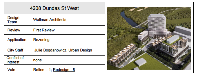
There was a public consultation for this last night at Etobicoke Collegiate. This was not the statutory meeting, which is still to come, but a volunteered meeting in advance of that. Not sure why though: other than one hour of questions about traffic and 5 minutes of talk on shadows, there's very little to work out about the project at this stage before a final submission.
That said, it has changed quite a bit again since its Design Review Panel appearance in July, and mostly in response to the DRP member who said it should be taller and with a smaller floor plate to be more elegant. Toronto Planning seems to have come around on that, now favouring a 21 storey tower at the east end of the site, just back from the rim of the Humber valley. So, on with the show:
First off, two slides showing the original application, when there was a 24 storey tower in the north middle, a 10-storey slab by the Humber, and an 8 storey commercial and residential building on Dundas.
That met with resistance from the Planning Department and locals, so the team revised the plans and showed up with those at the DRP in July (as per post 17 above). That changed the tower to 19 storeys and, but as I said, got the DRP calling for taller and more elegant.
Now, here's the more elegant version, with the 21 storey tower, and the 8 storey mixed commercial/residential on Dundas, plus townhouses.
The internal street plan now has a looping configuration, and there's now parkland off to the west to better connect into the hydro corridor. It will become greenspace; it's currently the lumber yard for the Rona on the site. (That land is owned publicly.)
The new proposal, as you can see below, is significantly less dense than the original. (The DRP version is omitted from the stats.)
While a couple of residents are decrying 21 storeys here as being out of keeping with the neighbourhood (Councillor DiCiano from the south side of Dundas agrees that's an issue), the 45° angular plane diagrams rising from the closest single family home lot lines to the north and to the south in the following pics, show that there's nothing lose to what could be described as skyline crowding in this proposal. Councillor Campbell, whose ward this is in, agrees.
One hour's worth of discussion was spent by the residents grilling the Transportation Planner from the BA Group, essentially not believing these stats.
So, what will it look like now? Here's an aerial view looking eat, with the tower in the rear middle ground, left.
It's a mini version of Tableau, all in white.
Here's the mixed-use building facing Dundas. Cleaner and less G+C-ish than the previous version.
Here's the look on the internal street.
42


