urbannorth
New Member
There is a major hydro corridor parallel to highway 400.Honestly id be happy with a provincial highway style road along the gta west corridor ( a la hwy 9 or 115/35) rather than a full 400 series highway. East west travel across the central/north part of york region is a hige pain.
An alternative 400 series rouring id suggest is from just north of barrie (around the 400/11 split, and running roughly south west through orangeville and the kitchener/waterloo/guelph triangle. I can see this routing being beneficial to trucking companies bringing goods to/from central/northern ontario and south western Ontario while bypassing the gta
Considering that both 403 and 407 follow hydro for quite a while, I would say this might be a good bet for an alignment.
This would basically be a hwy 427 extension.
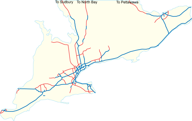
Adding in a few other proposals (purple) such as; Bradford Bypass, GTA West highway (413), hwy 404 extension, hwy 7 new between Guelph and KW, Morriston By-pass - we can see what missing is (blue) a freeway from Brampton to Guelph, and a connection of hwy 11 to hwy 400 (@ Gravenhurst).
The final thing missing (not shown at all) is an extension of hwy 413 to connect with hwy 404, 48 and maybe hwy 12.
Putting some numbers to it. What's a freeway cost nowadays - about $10M per lane km?
Highway 427 extension = 75 km = $3.0B.
Highway 413 = 50 km = $4.5B.
Highway 7 New = 20 km = $0.75B
Bradford Bypass = 25km = $1.0B
hwy 404 ext. = 35 km = $1.5B
Hwy 412 ext. = 8 km = $0.4B
Morriston bypass = 4 km = $0.25B.
Brampton-Guelph hwy = 40km = $2.0B
Gravenhurst Connector = 40 km = $2.0B
Total = 3000 km = $16.0B
Last edited: