News   Dec 20, 2024
 1K     5 
News   Dec 20, 2024
 778     2 
News   Dec 20, 2024
 1.4K     0 

Ontario Line Extension West of Ontario Place (Speculation)

For the Dufferin option, they can probably do something similar to the Lakeshore East corridor.

Starting from Exhibition:
Dufferin/Queen
Brockton (Dufferin/Dundas)
Dundas West (<> line 2)
"Junction" (Dundas/Dupont)
Stockyard (replaces planned station on Kitchener line)
Mount Dennis (<> line 5)
Jane/Lawrence
Jane/Wilson
Jane/Sheppard
Jane/Finch (<> line 6)

and then might as well, Jane/Steeles, Highway 407 (<> line 1)

Line should be entirely elavated on Jane.
 
Up Dufferin in downtown is one of the options (not my favorite, but one that makes sense if there is room for the curve from west to north).

Up Dufferin near Finch, probably not. That segment would compete for the riders with the western leg of Line 1, that isn't very busy up north. If OL West follows Dufferin and crosses Bloor and Eglinton, then after Eglinton it needs to either swing way west, or just connect to one of Line 1's Allen Road stations and terminate there.

Another subway running east and then up Kingston Road to Yorkmills .. maybe, but there will be competing proposals to turn it north way sooner and go up Victoria Park.
I was about the say that. Any portion of OL on Dufferin north of Eglinton will parallel Line 1. That portion, if built, will be a bigger waste of money than tunneling for Line 2 extension in Scarborough. We could spend that money on extending Sheppard.

Ending it at Eglinton won't be a bad option either. It's passing through a lot of dense areas and intersecting Lines 2 and 5. There are GO lines to serve areas further west and then we have Finch LRT.
 
For the Dufferin option, they can probably do something similar to the Lakeshore East corridor.

Starting from Exhibition:
Dufferin/Queen
Brockton (Dufferin/Dundas)
Dundas West (<> line 2)
"Junction" (Dundas/Dupont)
Stockyard (replaces planned station on Kitchener line)
Mount Dennis (<> line 5)
Jane/Lawrence
Jane/Wilson
Jane/Sheppard
Jane/Finch (<> line 6)

and then might as well, Jane/Steeles, Highway 407 (<> line 1)

Line should be entirely elavated on Jane.
It looks like though that the ultimate destination is Pearson. By doing what you'd suggest, you'd duplicate the Finch West LRT. I'd hit Dufferin station, turn west, somewhere (with a couple of stations) and hit Jane/St. Clair (extending the 512 to Jane), and then follow Dundas West to Kipling.

At which point, the Jane LRT probably doesn't need to go south of St. Clair - making it a lot cheaper and feasible, mostly above-ground.
 
Option 1: north on Dufferin to Eglinton (Fairbank)
Option 2: north on Roncesvalles to Dundas West; + north via rail corridor to Jane
Option 3A: north on Parkside to Keele; + north on Keele to Keelesdale
Option 3B: north on Parkside to Keele; + north on Keele via rail corridor to Jane
Option 4: north on South Kingsway/Windermere to Jane then north on Jane
Option 5A: west via the rail corridor to Humber Bay; + west via Queensway/Gardiner to Sherway
Option 5B: west via the rail corridor to Humber Bay; + west via Queensway/Gardiner then north to YYZ
Option 6:
west via the rail corridor to Humber Bay; + west to Long Branch and beyond

they all seem relatively viable, but north on Jane makes the most sense to me. whether it uses Roncesvalles, Parkside, Keele, South Kingsway or whatever route to get there probably isn't that important.

and like others have said I agree with the need for a second OL on Dufferin in the future.
I like option 2 best

Mount Dennis
Rogers Road
St. Clair/Keele
Keele/Dundas
Dundas West
High Park Blvd
Roncesvalles/Queensway
Jameson Ave
Dufferin/Queen
Dufferin/ King
Exhibtion

If you want to go north
Jane/Weston
Jane/Lawrence
Jane/Church
Jane/Wilson
Chalkfarm
Jane/Sheppard
Jane/Finch (intersects with the LRT)
Driftwood
Pioneer Village
 
My idea for an entirely elevated / at grade OL extension all the way to Bramalea City Centre in Brampton.

Basic idea would be that it runs along the LSW corridor to Humber Bay, along the Gardiner to Canpa, up Canpa to Kipling, up the Etobicoke Hydro Corridor to Dixon, across Airport Rd / Dixon by the airport, up the Kitchener corridor to Bramalea, then circle through existing natural connections to Bramalea CC (that last part may be politically challenging).

Yellow = Elevated
Orange = at-grade

View attachment 448467

This could be built in 3 phases, Exhibition - Kipling, Kipling - Airport, and Airport - Bramalea.
We share the belief that the western extension should utilize the Gardiner to avoid tunneling west of humber bay, however I have a few questions.

I don't understand the Kipling hydro corridor routing through Etobicoke at all. You have somehow managed to miss the entirety of the limited density that currently exists in western Etobicoke along the east/west mall (along 427), while also routing the line entirely away from the rapidly expanding Sherway gardens. Sherway gardens and the currently industrial land between the 427 and Kipling along the Queensway are set to see development at a similar level to the Golden mile and this routing ignores that for the suburban neighborhoods along the hydro corridor.

The north turn prior to Sherway also means that the almost certain future line 2 extension to Sherway would now not form a highly convenient subway transfer between line 2/Ontario line and the developing hub in Sherway.

Besides the problematic routing through Etobicoke to the airport, the final extension to Brampton is almost inconceivable and I would be highly interested in hearing your thought process behind that.
 
Ontario Line West Extension

This is my proposal for a western extension of the Ontario Line, including exact routing, rough station locations and explanations for each section of the line. To preface and prevent any confusion, this is set roughly 15+ years in the future and assumes that the Gardiner east of Park Lawn has been capped and eliminated as a highway, with the entire structure east of Exhibition being destroyed. However, west of Exhibition the former Gardiner R.O.W is preserved and used to create a widened GO/OL corridor. Additional tracks are added to allow for future express/branch lines or interlining with any future TTC/GO project.

These three images are a relatively low detail rendition of the full map I created on a separate platform. The link to the full map is below and on it each portion of the line and each station have in depth explanations given for them.

I hope you find my proposal interesting and I welcome feedback and advice.

The colour key is as follows:

Blue = Expanded GO Lakeshore West Corridor
Green = Highway Median
Pink = Elevated Track


Section 1:

Starting from the current OL terminus at Exhibition, the line runs along the repurposed Gardiner R.O.W until Park Lawn road. The OL will have a connection with the currently under construction Park Lawn GO Station. From here it enters the median of the Gardiner Expressway and runs at grade so as to not conflict with the low bridges over the Gardiner along Royal York and Grand Avenue. There is already a substantial median on this portion of the Gardiner so no major lane reductions (if any at all) would be needed. Arriving at Islington, the line raises off the Gardiner and runs elevated over what is currently the Cineplex parking lot on the south west corner of Islington/Queensway. It then runs elevated down the center of the Queensway. An elevated trackage further east of Islington on the Queensway would not be possible due to the narrowness of the road and existing suburban homes.

1674892679746.png


Section 2:

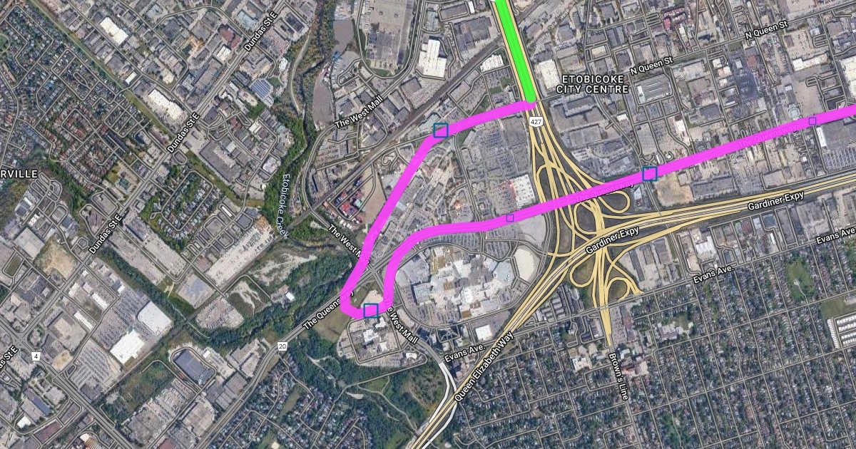
Continuing elevated along the Queensway, the line has a flyover over the 427/Gardiner interchange. From here it continues elevated along the Queensway until the West mall where it turns south to a station on the north side of the existing medical facility. Thereafter looping north-east, there is an additional station as close to the rail corridor as possible to allow for an easy transfer from the future Line 2 extension to Sherway from Kipling along the rail corridor. Briefly after this the line runs elevated along North Queen Street, then enters the median of highway 427.
1674893560009.png


Section 3:

The final and likely least controversial portion of track continues along the median of the 427, then runs elevated over the interchange of highway 427, 27 and the 401. There is a westwards run towards the eastern terminus of the Mississauga Transitway and future Renforth station of the Eglinton Crosstown Western Extension. Turning north again the route runs elevated again for a short time before entering the median of the 427 before making a western turn onto the ground of Pearson Airport. Here it once again runs elevated to avoid the complex road network below, before finally ending north of the terminal where a new station will be constructed adjacent to the existing building.

1674894200168.png

 
Ontario Line West Extension

This is my proposal for a western extension of the Ontario Line, including exact routing, rough station locations and explanations for each section of the line. To preface and prevent any confusion, this is set roughly 15+ years in the future and assumes that the Gardiner east of Park Lawn has been capped and eliminated as a highway, with the entire structure east of Exhibition being destroyed. However, west of Exhibition the former Gardiner R.O.W is preserved and used to create a widened GO/OL corridor. Additional tracks are added to allow for future express/branch lines or interlining with any future TTC/GO project.

These three images are a relatively low detail rendition of the full map I created on a separate platform. The link to the full map is below and on it each portion of the line and each station have in depth explanations given for them.

I hope you find my proposal interesting and I welcome feedback and advice.

The colour key is as follows:

Blue = Expanded GO Lakeshore West Corridor
Green = Highway Median
Pink = Elevated Track


Section 1:

Starting from the current OL terminus at Exhibition, the line runs along the repurposed Gardiner R.O.W until Park Lawn road. The OL will have a connection with the currently under construction Park Lawn GO Station. From here it enters the median of the Gardiner Expressway and runs at grade so as to not conflict with the low bridges over the Gardiner along Royal York and Grand Avenue. There is already a substantial median on this portion of the Gardiner so no major lane reductions (if any at all) would be needed. Arriving at Islington, the line raises off the Gardiner and runs elevated over what is currently the Cineplex parking lot on the south west corner of Islington/Queensway. It then runs elevated down the center of the Queensway. An elevated trackage further east of Islington on the Queensway would not be possible due to the narrowness of the road and existing suburban homes.

View attachment 452952


Section 2:

Continuing elevated along the Queensway, the line has a flyover over the 427/Gardiner interchange. From here it continues elevated along the Queensway until the West mall where it turns south to a station on the north side of the existing medical facility. Thereafter looping north-east, there is an additional station as close to the rail corridor as possible to allow for an easy transfer from the future Line 2 extension to Sherway from Kipling along the rail corridor. Briefly after this the line runs elevated along North Queen Street, then enters the median of highway 427.
View attachment 452953


Section 3:

The final and likely least controversial portion of track continues along the median of the 427, then runs elevated over the interchange of highway 427, 27 and the 401. There is a westwards run towards the eastern terminus of the Mississauga Transitway and future Renforth station of the Eglinton Crosstown Western Extension. Turning north again the route runs elevated again for a short time before entering the median of the 427 before making a western turn onto the ground of Pearson Airport. Here it once again runs elevated to avoid the complex road network below, before finally ending north of the terminal where a new station will be constructed adjacent to the existing building.

View attachment 452954
I do think it follows the the 427 too closely, and also that diversion to Sherway Gardens is a bit match. A better choice might be to make it a general Kipling RT line.
 
Ontario Line West Extension

This is my proposal for a western extension of the Ontario Line, including exact routing, rough station locations and explanations for each section of the line. To preface and prevent any confusion, this is set roughly 15+ years in the future and assumes that the Gardiner east of Park Lawn has been capped and eliminated as a highway, with the entire structure east of Exhibition being destroyed. However, west of Exhibition the former Gardiner R.O.W is preserved and used to create a widened GO/OL corridor. Additional tracks are added to allow for future express/branch lines or interlining with any future TTC/GO project.

These three images are a relatively low detail rendition of the full map I created on a separate platform. The link to the full map is below and on it each portion of the line and each station have in depth explanations given for them.

I hope you find my proposal interesting and I welcome feedback and advice.

The colour key is as follows:

Blue = Expanded GO Lakeshore West Corridor
Green = Highway Median
Pink = Elevated Track


Section 1:

Starting from the current OL terminus at Exhibition, the line runs along the repurposed Gardiner R.O.W until Park Lawn road. The OL will have a connection with the currently under construction Park Lawn GO Station. From here it enters the median of the Gardiner Expressway and runs at grade so as to not conflict with the low bridges over the Gardiner along Royal York and Grand Avenue. There is already a substantial median on this portion of the Gardiner so no major lane reductions (if any at all) would be needed. Arriving at Islington, the line raises off the Gardiner and runs elevated over what is currently the Cineplex parking lot on the south west corner of Islington/Queensway. It then runs elevated down the center of the Queensway. An elevated trackage further east of Islington on the Queensway would not be possible due to the narrowness of the road and existing suburban homes.

View attachment 452952


Section 2:

Continuing elevated along the Queensway, the line has a flyover over the 427/Gardiner interchange. From here it continues elevated along the Queensway until the West mall where it turns south to a station on the north side of the existing medical facility. Thereafter looping north-east, there is an additional station as close to the rail corridor as possible to allow for an easy transfer from the future Line 2 extension to Sherway from Kipling along the rail corridor. Briefly after this the line runs elevated along North Queen Street, then enters the median of highway 427.
View attachment 452953


Section 3:

The final and likely least controversial portion of track continues along the median of the 427, then runs elevated over the interchange of highway 427, 27 and the 401. There is a westwards run towards the eastern terminus of the Mississauga Transitway and future Renforth station of the Eglinton Crosstown Western Extension. Turning north again the route runs elevated again for a short time before entering the median of the 427 before making a western turn onto the ground of Pearson Airport. Here it once again runs elevated to avoid the complex road network below, before finally ending north of the terminal where a new station will be constructed adjacent to the existing building.

View attachment 452954
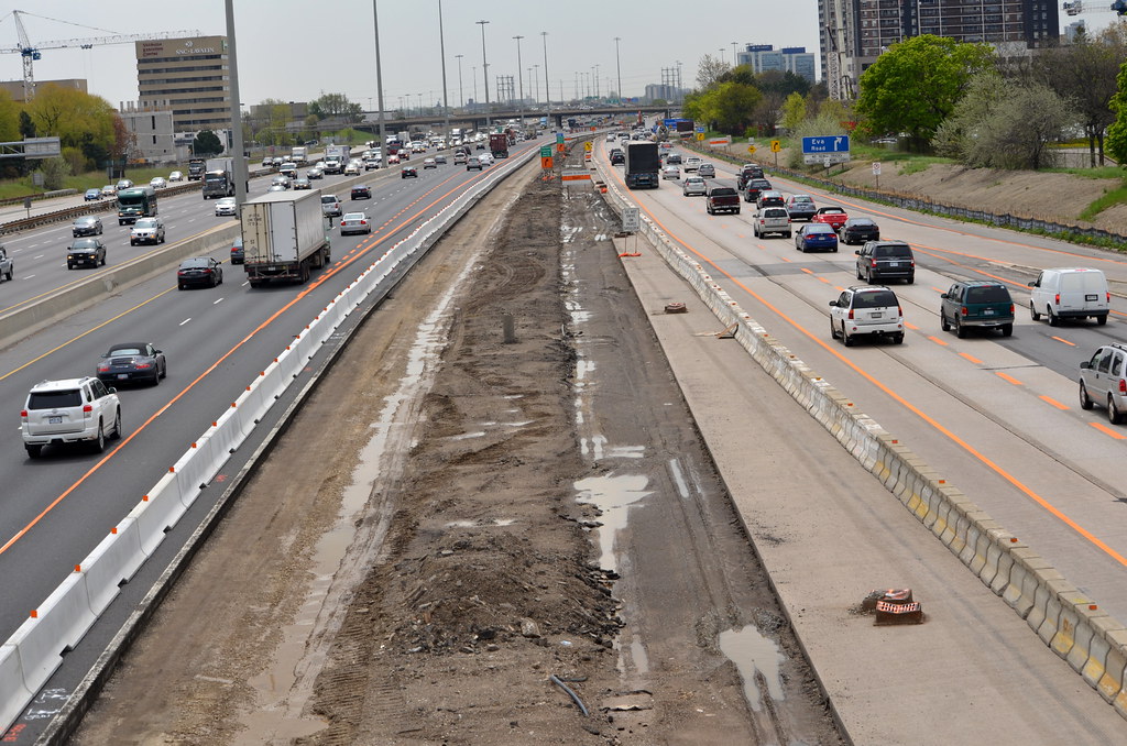
The question I am asking is no different than what I have stated in the past for maps, ""HAVE YOU LOOK AT THE AREAS FIRST HAND"" to see what there today????

Do you Think MTO Will allow 2 lanes of traffic for 13+ Months to be remove to allowing for building of the Guideway on 427??

The Same Question for the Gardiner under City of Toronto control Question??

Where on 427 do you think the guideway will be built??

Where do You Think it Will Happen on the Gardiner??

Where In The Rail Corridor do you think you can place the guideway???

What impact will the building of the guideway have on GO Service??

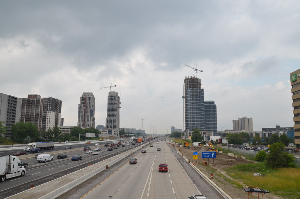
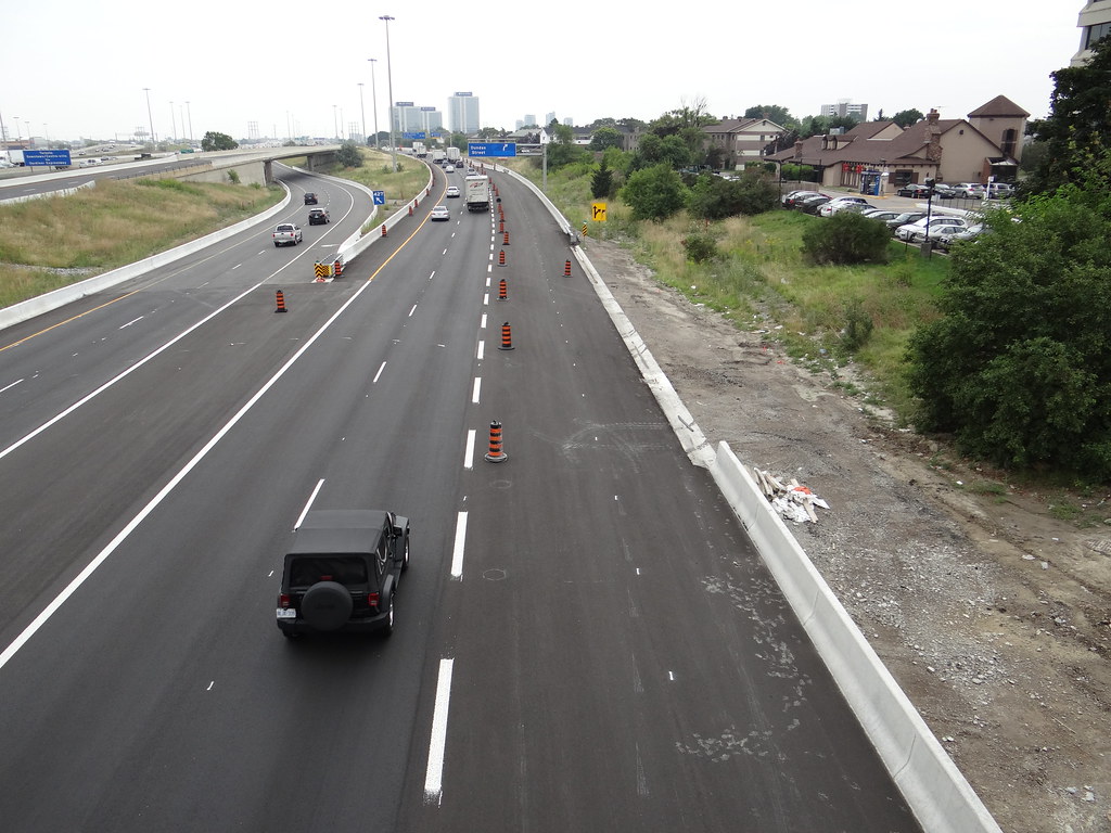
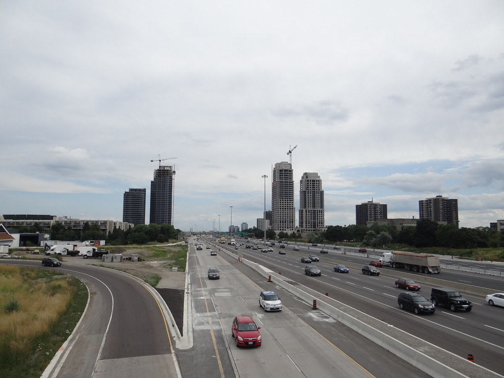
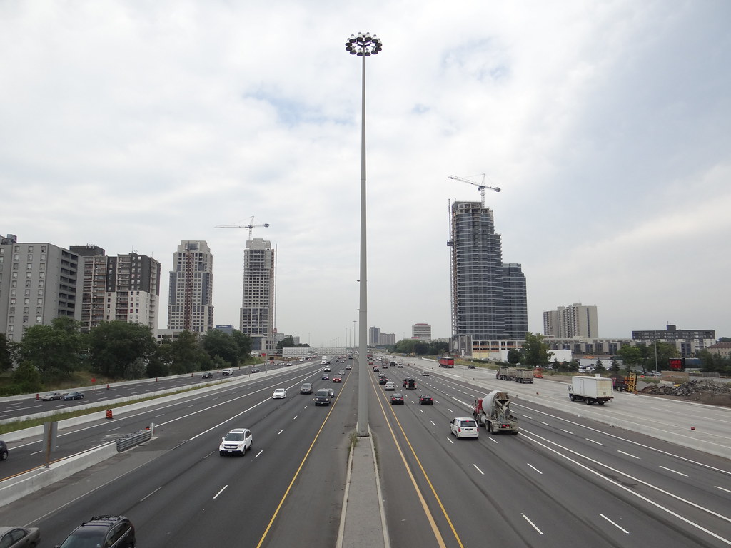
Its so happen I was fixing some of my Flickr tags that I came upond these photos shot in 2012 off Bloor St overpass for 2 developments taking place with one on each side of 427 to help you. Have some shots somewhere for Burnhamthrope, but not going looking for them.
6997465600_4b912c87e7_b.jpg

9221011566_449c7b2256_b.jpg

9609594751_a78747aa86_b.jpg

9403489829_4221a2aa83_b.jpg

9612826452_4720b89ca7_b.jpg
 
Though this thread is entitled "Ontario Line Extension West of Ontario Place (Speculation)" I am really not sure if it is even worth speculating. Any extension will be built (can only be built) once the line planned (and unbuilt!) now is finished. By the time that happens much will have changed!
 
Though this thread is entitled "Ontario Line Extension West of Ontario Place (Speculation)" I am really not sure if it is even worth speculating. Any extension will be built (can only be built) once the line planned (and unbuilt!) now is finished. By the time that happens much will have changed!
Not as much will have changed by then to build the Ontario Line in the median of the 427! 🤣😂
 
The question I am asking is no different than what I have stated in the past for maps, ""HAVE YOU LOOK AT THE AREAS FIRST HAND"" to see what there today????

Do you Think MTO Will allow 2 lanes of traffic for 13+ Months to be remove to allowing for building of the Guideway on 427??

The Same Question for the Gardiner under City of Toronto control Question??

Where on 427 do you think the guideway will be built??

Where do You Think it Will Happen on the Gardiner??

Where In The Rail Corridor do you think you can place the guideway???

What impact will the building of the guideway have on GO Service??

Its so happen I was fixing some of my Flickr tags that I came upond these photos shot in 2012 off Bloor St overpass for 2 developments taking place with one on each side of 427 to help you. Have some shots somewhere for Burnhamthrope, but not going looking for them.
6997465600_4b912c87e7_b.jpg

9221011566_449c7b2256_b.jpg

9609594751_a78747aa86_b.jpg

9403489829_4221a2aa83_b.jpg

9612826452_4720b89ca7_b.jpg
The pedantic engineering and service delay issues you feel obligated to comment on every post in existence is mind numbing. Half of your questions, including but not limited to

"Where on 427 do you think the guideway will be built??"

"Where do You Think it Will Happen on the Gardiner??"

"Where In The Rail Corridor do you think you can place the guideway???"

Have been answered in the forum post or within the route map itself, I encourage you to read what you are attempting to critique before commenting.

Your more political questions also ignore answers provided within the document or route map itself. This proposal PRESUMES that through whatever political machinations you can imagine, the Gardiner east of Park Lawn has been eliminated as a highway. In terms of Highway 427 service disruptions what answer are you honestly expecting? Would you like if I called up the head of the MTO and asked if their ministry would allow for lane reductions for my speculative proposal set decades in the future? Please be serious and on topic in your comments as what you have produced so far is of essentially no value.

You also expressed concern that I am unfamiliar with the area and am simply crayoning on a map. I have spent my entire life living within the areas discussed in this proposal and have been on each of the roads and highways quite literally hundreds of times. I travelled up and down them where sidewalks exist to see if what if I am proposing fits the geography and if space would be available.

Finally, as for GO service disruptions, there has continuously been weekends without GO service on the Lakeshore West corridor to facilitate construction of the Hurontatrio Line. So yes, GO disruptions may be needed for construction, but there is immense precedent for that in the case of expanding rapid transit.
 
Though this thread is entitled "Ontario Line Extension West of Ontario Place (Speculation)" I am really not sure if it is even worth speculating. Any extension will be built (can only be built) once the line planned (and unbuilt!) now is finished. By the time that happens much will have changed!
ya your right, its almost depressing to think about how far out something like this would be occurring. 2035 at best
 
I do think it follows the the 427 too closely, and also that diversion to Sherway Gardens is a bit match. A better choice might be to make it a general Kipling RT line.
I looked closely into the following the old Kipling RT plan, but apparently the hydro corridors are no longer available for transit? Something to do with the provincial ministry. The other issue with that route is it misses all the existing and future density in Sherway gardens and along the 427 (west/east mall). I don't think building a whole light metro through deeply suburban central etobicoke is worth the cost.
 
Not as much will have changed by then to build the Ontario Line in the median of the 427! 🤣😂
True BUT the source/destination of the passengers may have changed and building transit is more than simply putting rails on an available space. The customers need to be able to reach them quickly and easily!
 
True BUT the source/destination of the passengers may have changed and building transit is more than simply putting rails on an available space. The customers need to be able to reach them quickly and easily!
Absolutely!
 

Back
Top