

maestro
Senior Member
How are streetcar supposed to make right turns from the right turn lanes? I thought the whole point of them being in the middle of the road is to allow greater capacity, longer vehicles with larger turning radiuses.
|
|
|
I don't like that idea as much. My idea is implementable right now and doesn't require any moving of streetcar tracks.
If you want to make it pedestrian friendly why not do it this way:
<<<<<STREETCAR<<<<<<<
<<<<<<CARS<<<<<<<<<<
>>>>>>CARS>>>>>>>>>>
>>>>>>STREETCAR>>>>>>
Voila pedestrians are protected from splashing cars by streetcars.
<<<<<STREETCAR<<<<<<<
<<<<<<CARS<<<<<<<<<<
>>>>>>CARS>>>>>>>>>>
>>>>>>STREETCAR>>>>>>
.
According to Rob Ford, streetcars are the cause of congestion on King and Queen. So let's take cars off King and streetcars off Queen and see which street goes faster.
On a more serious note, maybe we could reduce traffic congestion on King by banning automobiles on the portion between Yonge and University. That way King ceases to be an east-west thoroughfare, but continues to serve all the businesses that front onto it (between Yonge and University it's just office towers). Traffic might be reduced because when the streetcar has an advantage over the automobile, more people will end up taking the streetcar.
Unfortunately, there will still be those who would insist that those rules would not apply to them:
Sadly I know that's true. On Dufferin Street/Allen Road there are often people driving in the bus lanes, and in the HOV lanes north of Steeles, half the cars only have a single occupant.
However, I didn't mean that we should put "no car" and "no right turn" signs, I meant going full out and widening sidewalks and putting in bike lanes. Basically the King street transit mall proposal, but with bike lanes.
It was an innovative idea when first envisioned. The TTC was not the first to have a trip planner so their innovation in creating one where solutions already existed only makes sense if they somehow delivered it cheaper. Considering both Google and their in-house version were implemented I fail to see the benefit of their innovation.
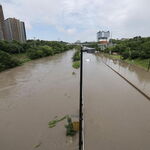
Not just here in Toronto, but even in the rest of world there are idiots who can't read but drive. This idiot driver drove into the underground subway section as well.
[video=youtube;un5UbyGRf-o]http://www.youtube.com/watch?v=un5UbyGRf-o[/video]
Also fun fact: the "Next Train" information in the subway system has a perception control system. Even though the Transit Control has accurate information on the location of the train, the TTC has a policy of setting minimum next train times, that never revise their figures upward. So even if Transit Control's computers show the train will likely not reach a particular station for 10 minutes, the public monitor will just slow down time and still show "5 minutes" -- counting down 1 minute for every 2 minutes. Awesome!
Correct me if you know otherwise, but I thought the 'next train' times were based on location, ie when a train passes a certain physical location, it should be X minutes from the next station. Of course that assumes that the train is traveling at the scheduled speed and doesn't experience any intervening delays.
It is based on current GPS coordinates + magic sauce by NextBus (typical vehicle speed at that time/route/weather). The TTC has had (sometimes unreliably) real-time monitoring of vehicle locations since the 70's.
I thought he was referring to the subway 'next train' times, or does Next Bus deal with those in addition to the surface routes?