NoahB
Active Member
No idea how they're planning to get by with 40m trains, unless the frequency approaches that of the Canada Line. I very much doubt the REM de l'Est will have that kind of frequency, though it's theoretically possible.
The technical brief already said that the trains will come every 2 min in the central section and 4 min in the branches. That is Canada Line frequencies. Elevated and ground-based stations can be expanded relatively easily if it comes to that. So At least one of the branches can be expanded without heavy costs. (Look at the London DLR) But I am hoping that the underground stations will be built with longer trains in mind.
The connection from Central to the terminus should be pretty simple. Hopefully the final station is underground, but I"m sure they could have some long escalators from elevated as well, if they are willing to sacrifice road lanes.
A bigger issue is the connection to the Metro at the terminus. Their figure makes it look like Central and Bonaventure are a single station. In reality, parts of Central are as close to Square-Victoria, and honestly, the slighter walk from McGill to Central seems simpler, as it's so much shallower than Bonaventure. I find the excellent STM downtown map (see below) very good at showing the relative locations of things.
What's missing here, unlike the REM which links to the Green Line well (and I hope there's some improved connections from the Central platforms into Place Bonaventure), is as good connection to the existing Metro lines downtown - though tough, given where Réné-Levesque runs.. However, isn't the Orange Line quite shallow (and straight) underneath Réné-Levesque? I wonder if there's any feasibility in adding a station there - that area has certainly developed since the Metro was first built, and if the northern entrance was at Réné-Levesque, then it's no closer than Place-des-Arts and Saint-Laurent.
But hang-on ... if you look at the map closely, they do mention and show an intermodal connection with the Orange Line! Is that really a new Metro station?
View attachment 289257
The northern terminus of the Montreal North branch is unclear. They say at Cegep Marie-Victorin, but the figure makes it look like just west of the Anjou Exo station. But they don't show an intermodal connection.
The driving route from Cegep Marie-Victorin to Central Station is interesting. Does anyone really drive that way (south on the 25, west on the Metropolitan, and then down Decarie and the Ville Marie) ? I suppose it's the only expressway route - but I take the 25, Souligny, Dickson and Notre Dame - or possibly St. Laurent and Park from the Met. I don't think whoever did graphic has driven down Decarie and between the 15s very often!
View attachment 289256
I would not bet on them adding anew station to the Metro. The images in the technical brief clearly shows the whole downtown segment is elevated. Berri-UQAM's closest entrance on Berri is a good 200m away from Rene Levesque/Labelle. It probably will be an elevated pathway of some sort. Or maybe a pathway to the closest underground path. (The university?) It is still possible to create an underground passage under the road. I have seen it done for Riyadh Metro. But Is very disruptive can add costs that the elevated alignment was meant to avoid. So I wonder what they will choose.
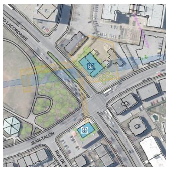
Given the station name, Labelle Station will probably is about here:
Last edited:


