


Mustapha
Senior Member
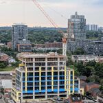
For your weekend Delight:
Today.
And Tonight.
Today.
And Tonight.
|
|
|
For your weekend Delight:
Today.
<snip>
And Tonight.
<snip>


I recently received this 1977 photo (by Charles Cooper) of the CNoR (Canadian Northern Railway) abandoned right-of-way.
It's an older version of the one I posted recently.
This is what could be seen looking S. from Ellesmere in Scarborough.
These homes (1721-1727 Ellesmere) were completed in 2010 on the same site.
Example of another type of "infill" building.
Goldie,
Do you (or anyone reading this thread) know the routing of this abandoned right of way? I find these things fascinating as I am sure many others of us do,..
In the rare maps thread, the routing is clearly shown on an excelent map. Be sure to download the original map and zoom in for greater detail.
I have that map on all my computer desktops. It makes a great way to pass time just surfing around it.
Thanks mattelderca. I see on Google satellite maps that this is just east of Stoneton and Ellesmere.. and that the route can still be traced via property lines and to the northeast as far as Progress Avenue.

I think you can find it even further northeast
http://maps.google.ca/maps?q=Bon+Ec...=G7FxuGAEFxIYsy7IShRsHw&cbp=11,223.43,,0,3.21
And to the south it's the route of the subway between Victoria Park and Kennedy stations.
")
I believe the CNoR line existed from about 1909 to 1926.
It began in the Don Valley, near the Leaside Bridge and continued through Scarborough, Whitby, Oshawa, Port Hope on the way to Ottawa.
The abandoned right-of-way is still evident in many places along the route, especially thru built-up areas of Scarborough.
I'm indebted to a fine railroad buff, Charles Cooper, for much of this information.
This pair of photos show the abandoned CNoR bridge over Morningside and the recent alteration to the roadway. When taken in 2002, I didn't know it was part of the CNoR line.
The attached map shows the spot where the new homes are located on Ellesmere (It's a detail from the larger map).
Thanks Anna. Fascinating stuff. I thought knowing about the Belt Line put me in an exclusive group.
Well, I just found out that the northern part of the right of way may have been retained for a possible extension to the Scarborough RT.