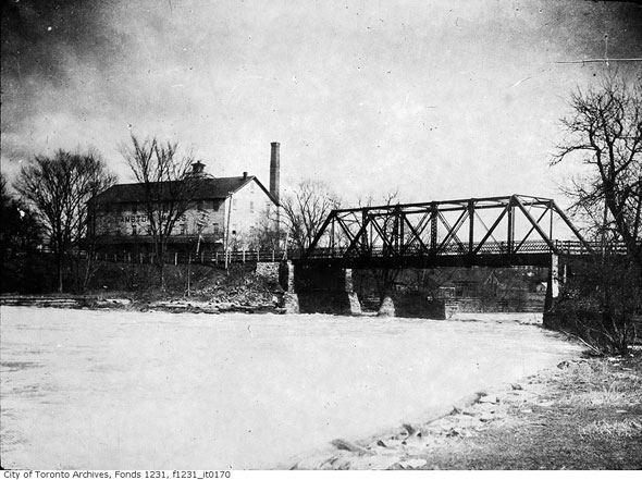
There's probably other refs (and are there date markers on the bridge rail abutments?), but I picked this out of the blue...
Incredible stuff! I'm still digging on the (newer) Dundas Bridge, it seems part of the divergent history may be due to a *number* of replacement 'concrete bridges', more on that later.
On the reference mentioned a few posts back, the book "Rails from the Junction", by James V Salmon, 1958...I was at Annette Public Library today, just cycling past, and thought I'd drop in to see if they had the book stored in stacks down the basement or some central storage vault somewhere...and lo and behold, it was in a featured local history section on the main floor. Reference only, fair enough.
https://www.google.ca/search?client...-8&oe=utf-8&gfe_rd=cr&ei=OU0yWbGDJeSfXvDEl-AL
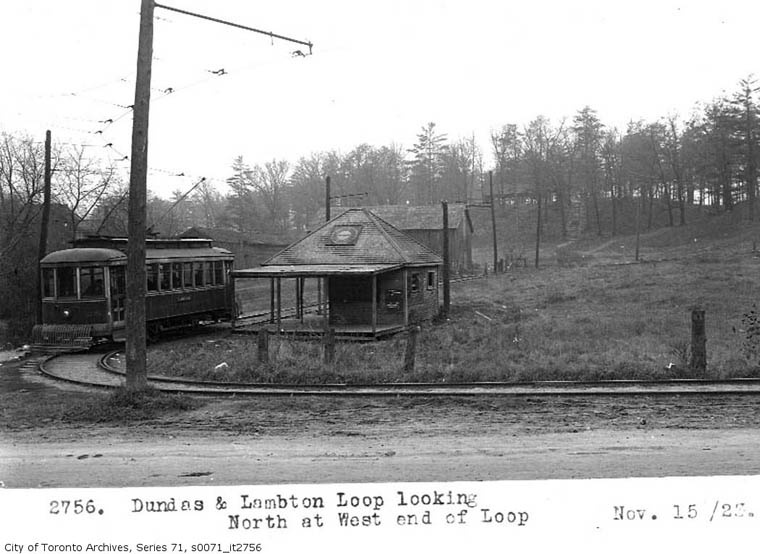
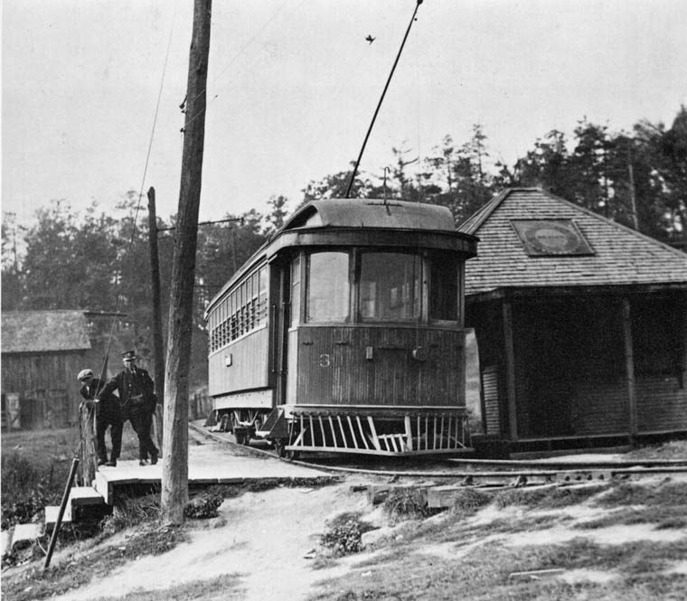
It's an absolute treasure trove of information, and the Old Time Trains page copied-in above is from it. It's not that many pages, perhaps 50 or 60, but some fascinating stuff in there, and lots of detailed stunning photos. Just glossing through it I learned many things about the pics above.
I'm going to attempt to take digital photos of some of the pages, and post some of the pics and text in this forum string. I haven't done any serious photography for close to half a century. I was good, worked mostly in 2 1/4 format (mostly 120 film, B&W, the slowest I could find for razor sharp detail) but being young, other interests (mostly electronic engineering....and girls...and things...lol) got me off course. But it's time to get back to it. And slow shutter static shots. High detail and contrast.
Looked into renting gear today at Sutherlands on Carlaw. I know Joe from back in the Village days, he wasn't in, I'll catch him next week, all that his staff knew was digital, and I want to do film....but I might do well to get my 'feel' back starting with digital. lol...it'll be a hell of a lot cheaper as well as simpler! Joe might know exactly the best way to approach this, and have it to rent.
So I'm loving this forum string! It's not only great viewing, it's like being back in college again. Except older and a hell of lot wiser....one hopes.
RE: Camp Naivelt ("Eldorado Park")
There was a very similar one
https://en.wikipedia.org/wiki/Idylwild_Park just south of Hespeler on the (later) Grand River Railway, an interurban, now a rail trail I've cycled many times (right down to Port Dover and Hamilton via various branches of other old tracks) and Idylwild has been taken back by riverside swamp, but I have visited the site many times, now virtually inaccessible save for the trail.
I'll continue digging on the Dundas Street Bridge, and hopefully have some pics of my own to post in the next few weeks.


")