News   Dec 20, 2024
 1K     5 
News   Dec 20, 2024
 783     2 
News   Dec 20, 2024
 1.4K     0 

Miscellany Toronto Photographs: Then and Now

A Walk on the Old Side

I took a walk along Adelaide West via Google Earth Street View the other day and found the construction site of the Shangri La hotel. Although I can't provide a visual picture of what the block looked like 150 years ago I thought you might like to see who was living there way back then.
http://toronto1861.blogspot.com/2011/12/one-block-in-st-andrews-ward.html
 
Last edited:
I've been touring some other pages on this site for the first time - I'm amazed at the amount of material I've missed by concentrating on "Then & Now".
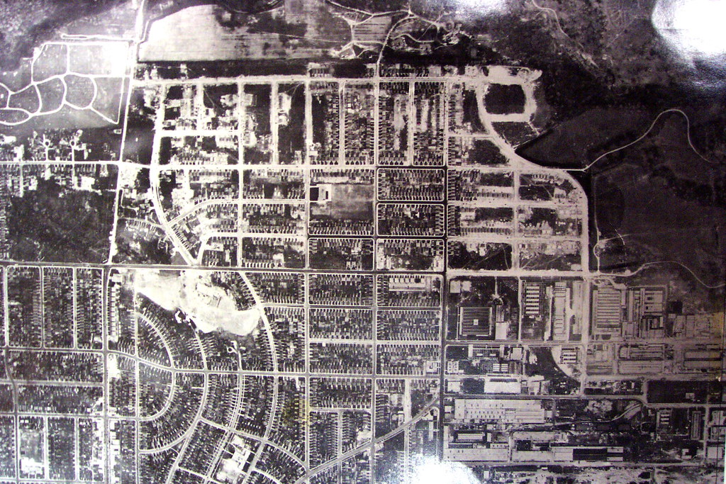
For example, I found this rare aerial of Leaside that was posted by Lone Primate under his investigation of the Eglinton Ave. E. extension [http://urbantoronto.ca/forum/showthread.php/4835-Eglinton-Avenue-Extension?highlight=eglinton}.
It's renewed my interest in the Leaside Aerodrome that was in this neighbourhood, c. 1915.
Does anyone have an aerial-photol showing evidence of the aerodrome hangars, planes or runway? - I've never seen one!
The site must have been in the area between Laird/Wicksteed and Brentcliffe.

1315403492_9244e8451c_b.jpg


Lone Primate: "This is the west end of Eglinton in 1947... it's one of the plates you can't freely access anymore, so I'm glad I took this when I did. Eglinton is dead centre on the horizontal, and ended, at the time, at Laird, though you can see it's been roughed in Brentcliffe in conjunction with the expansion of the subdivision. To the east is the Don River. Leslie Street didn't come down to Eglinton at the time as, of course, there wasn't an Eglinton to get to yet."

See attached photos and question.
 

Attachments

  • TN Leaside airfield 1929-30.jpg
    TN Leaside airfield 1929-30.jpg
    66.9 KB · Views: 339
Last edited:
I took a walk along Adelaide West via Google Earth Street View the other day and found the construction site of the Shangri La hotel. Although I can't provide a visual picture of what the block looked like 150 years ago I thought you might like to see who was living there way back then.
http://toronto1861.blogspot.com/2011/12/one-block-in-st-andrews-ward.html

I'll have to check your link when I'm not in the office (it's blocked here) but part of that site was occupied by the very old Bishop's Block, which was built in the 1830-ish timeframe and survived (in part) all the way up until it was taken down for the Shangri-La; parts have been incorporated in the new building. There are loads of images out there of the Bishop's Block, both back in the day and more recently.
 
I've been touring some other pages on this site for the first time - I'm amazed at the amount of material I've missed by concentrating on "Then & Now".
For example, I found this rare aerial of Leaside that was posted by Lone Primate under his investigation of the Eglinton Ave. E. extension [http://urbantoronto.ca/forum/showthread.php/4835-Eglinton-Avenue-Extension?highlight=eglinton}.
It's renewed my interest in the Leaside Aerodrome that was in this neighbourhood, c. 1915.
Does anyone have an aerial-photol showing evidence of the aerodrome hangars, planes or runway? - I've never seen one!
The site must have been in the area between Laird/Wicksteed and Brentcliffe.

1315403492_9244e8451c_b.jpg


Lone Primate: "This is the west end of Eglinton in 1947... it's one of the plates you can't freely access anymore, so I'm glad I took this when I did. Eglinton is dead centre on the horizontal, and ended, at the time, at Laird, though you can see it's been roughed in Brentcliffe in conjunction with the expansion of the subdivision. To the east is the Don River. Leslie Street didn't come down to Eglinton at the time as, of course, there wasn't an Eglinton to get to yet."

See attached photos and question.

Goldie, back on page 463 of this thread, we talked here a bit about Leaside airport, the closest 'aerial' we came up with is:

http://www.angelfire.com/ca/TORONTO/history/leaside28.html

which isn't an exact perspective duplicate of Lone Primate's aerial but the link refers to a 'grass field' [no runways]. Many aircraft landing gear of the era were built to withstand the jolting of grass field operations.
 
Last edited:
I took a walk along Adelaide West via Google Earth Street View the other day and found the construction site of the Shangri La hotel. Although I can't provide a visual picture of what the block looked like 150 years ago I thought you might like to see who was living there way back then.
http://toronto1861.blogspot.com/2011/12/one-block-in-st-andrews-ward.html

What a labour of love, thank you NomoreaTorontonian. I had to look up the occupation 'wharfinger'. [608 Adelaide, Mr. Upton].
 
Goldie, back on page 463 of this thread, we talked here a bit about Leaside airport, the closest 'aerial' we came up with is:

http://www.angelfire.com/ca/TORONTO/history/leaside28.html

which isn't an exact perspective duplicate of Lone Primate's aerial but the link refers to a 'grass field' [no runways]. Many aircraft landing gear of the era were built to withstand the jolting of grass field operations.

Thanks, Mustapha.
I think I've seen that photo before but there's nothing visual to identify an airfield.
Although, I'm sure that big snow-covered area is probably the site.
I went to page 463 and could find no info.
Is that the correct page #?
 
Then and Now for Dec 19.


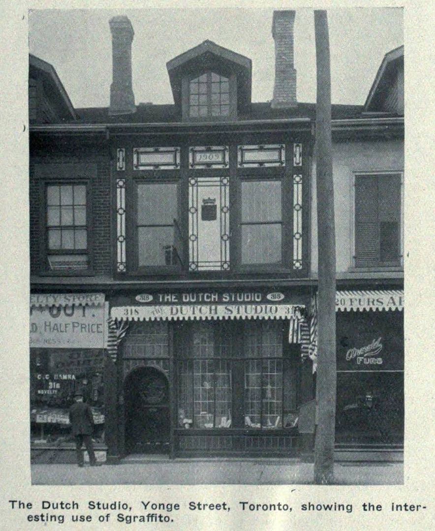
Then. 318 Yonge circa 1910. A wwwebster sourced picture. Our downtown Yonge street buildings/shops... if you go far back enough, before age and the turnover of repetitive makeovers and demolitions took their toll, our 'main drag' was pretty, handsome, dignified even.

318Yongec1910.jpg


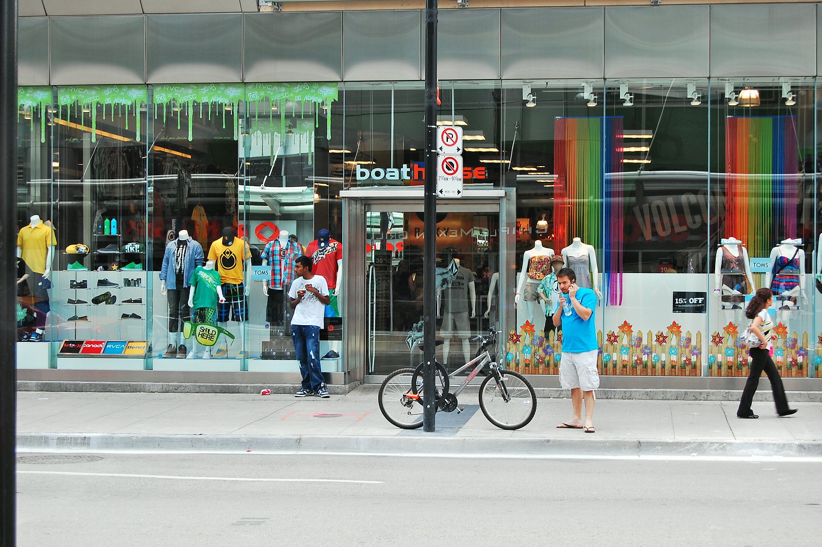
Now. July 2011.

CSC_0041.jpg

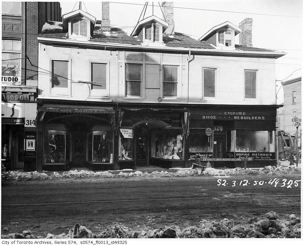
1950:

s0574_fl0013_id49325.jpg
 
Here is one of the hangers Goldie.


Thanks for that photo, brewster. I'll add it to my collection.
I photographed the same building from the north side in 2010.
I wonder if it's the last remaining evidence of the airport.
I've searched for more, but found none.

lastAerodromebuilding.jpg
 
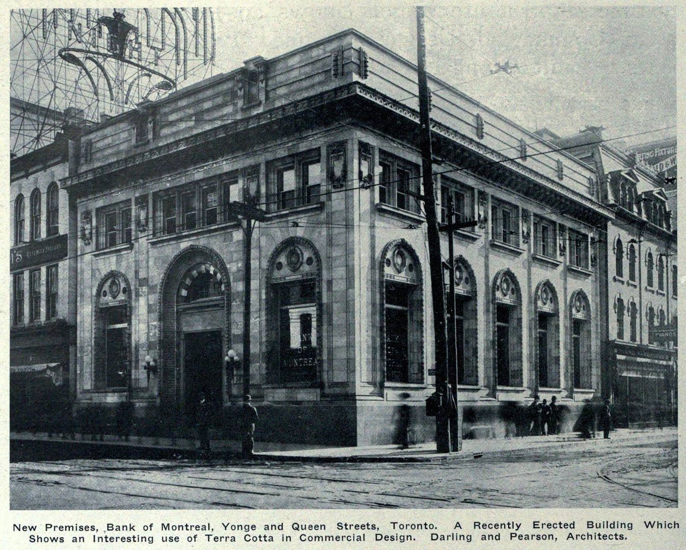
Then and Now for Dec 21.


Then. Queen and Yonge, NE corner. c1910.

'New Premises, Bank of Montreal, Yonge and Queen Streets, Toronto. A Recently Erected Building Which Shows an Interesting use of Terra Cotta in Commercial Design. Darling and Pearson Architects.'

QueenYongeNEc1910.jpg


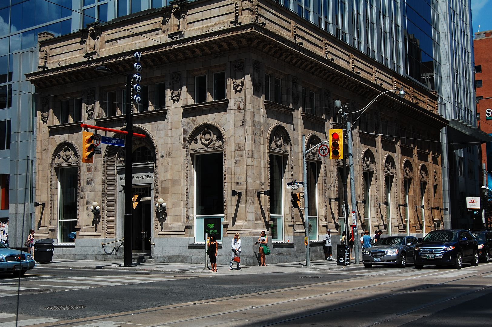
Now. July 2011. Note the addition..

DSC_0045.jpg


Only the facade here now but at least it hasn't been modified into a homage or, like the University Theatre, a faux, recreated facade.
 
Last edited:
I wonder if it's the last remaining evidence of the airport.
no, but you may be excused for thinking so, because you got the location right

jane pitfield's book leaside says that the last of the airfield hangars was removed in 1971

the airfield was built in 1917 with 45 miles of field tiles to drain the area, which extended north from wicksteed across eglinton to broadway, and west from the don valley across laird to sutherland

see http://books.google.ca/books?id=zli...&pg=PT44#v=onepage&q=leaside airfield&f=false
 
Thanks for that photo, brewster. I'll add it to my collection.
I photographed the same building from the north side in 2010.
I wonder if it's the last remaining evidence of the airport.
I've searched for more, but found none.

lastAerodromebuilding.jpg
If the Aerodrome closed in 1931, those buildings were not part of it. Those are not old enough to have been abandoned in 1931. If it had been an airfield in WWII, then they might have been.

EDIT: I did not read down far enough before replying.
 

Back
Top