News   Jan 06, 2025
 719     0 
News   Jan 06, 2025
 440     0 
News   Jan 06, 2025
 435     1 

Miscellany Toronto Photographs: Then and Now

January 1 2011 addition.


Then. "July 4, 1913. St. Patrick and William Street." William street is now Dundas street. Streetcar track being installed. The church tower is still there - St. Patrick's Church.


s0372_ss0058_it0196.jpg


Now. December 2010.


DSC_0811.jpg
 
It looks like they still needed to remove some of the southwest sidewalk after they put the tracks in? There appears to be a bit of a causeway in between where they've laid the tracks in the foreground and the background. Along with a couple of hydro/telephone poles: the one next to the horses looks about 6 inches from the outer rail and the one just behind and left of it looks like right where the inner rail needs to go.
 
The building to the extreme right is the Toronto Brewing and Malting Company, corner of then Anderson Street later Dundas,

with the frontage on Simcoe Street. ( 272-284 ) This later became part of the O'Keefe's Ale Brewery Limited, which was

included within the Canadian Breweries Limited, a conglomerate put together by E P Taylor.

Regards,
J T

JT, do you recall the big copper brewing vats that could be seen from Simcoe street? I suppose they were a point of pride of the company. They were behind large windows and lit at night so passersby could walk by and admire.
 
The SW corner of the then pic has gone through many buildings..


TKWizard, I recall a gas station in the 60s, that lasted up until 1990 or so I think.

It looks like they still needed to remove some of the southwest sidewalk after they put the tracks in? There appears to be a bit of a causeway in between where they've laid the tracks in the foreground and the background. Along with a couple of hydro/telephone poles: the one next to the horses looks about 6 inches from the outer rail and the one just behind and left of it looks like right where the inner rail needs to go.

Browning Avenue, a search of the online Toronto Archives under "St Patrick" will show some of the road widening and building demolition scenes related to the track installation.
 
Yes, and by the tyme that you mention, korect me if I am rong,

DOW was the brewer's name on the building.

Regards,
J T

"The year 1961 also initiated some traumatic problems for the Local. Carling O'Keefe opened its new plant in Etobicoke and began to consolidate all its operations under one roof. The O'Keefe plants on Simcoe and Victoria Streets were beginning to be phased out and Local 327, Dow Breweries in Kitchener was merged with Local 304 when Dow Breweries moved to Simcoe Street in Toronto."

http://www.breweryworkerslocal1.ca/pensioners.php


JT, your recall is correct. I had to look it up. I was but a stripling in the 1960s and remember the building but not the signage.


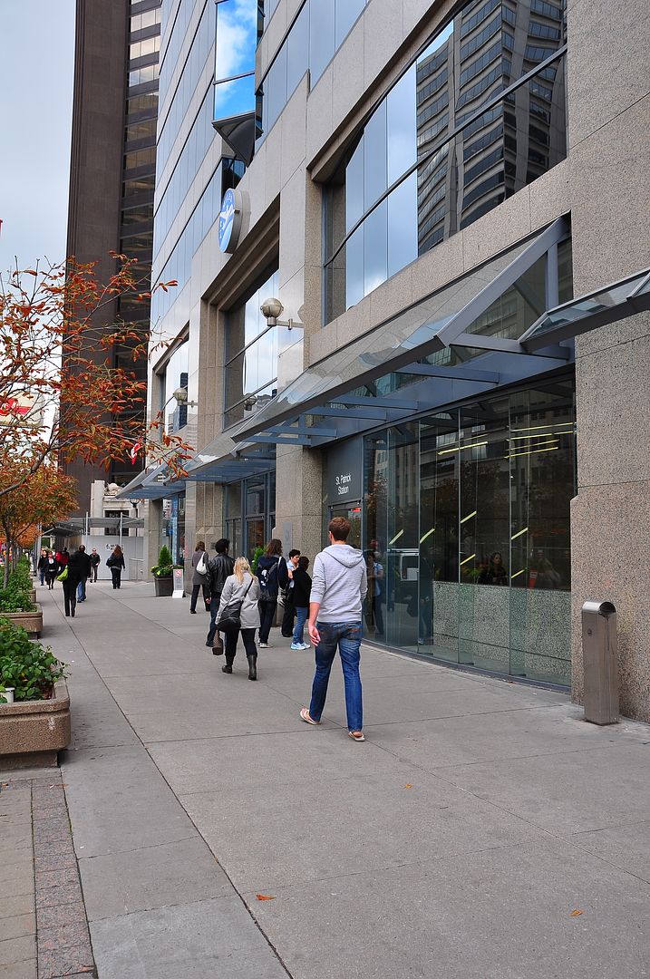
January 2 addition.


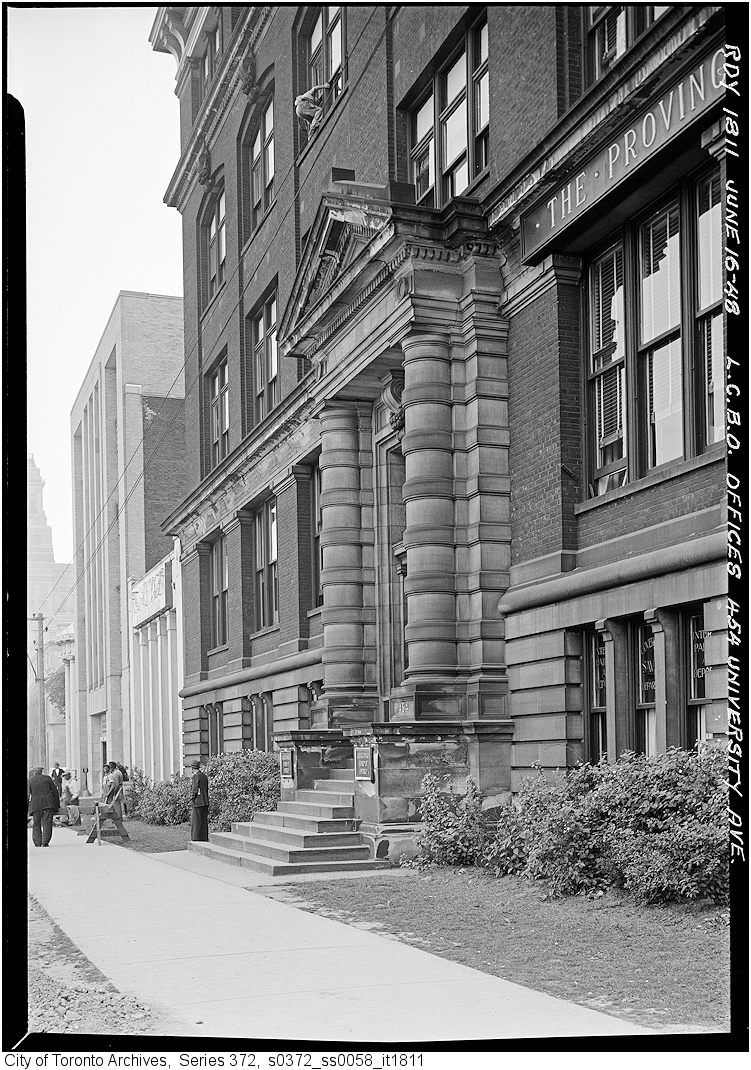
Then. "June 16, 1948. LCBO Offices. 454 University Avenue"


s0372_ss0058_it1811-Copy.jpg


Now. Novemner 2010.


DSC_0810-Copy.jpg
 
Your link to the union above makes me laugh.

I am sure that the NOBLE AND HOLY ORDER OF THE KNIGHTS OF LABO(U)R, as well as the IRON MOULDERS' INTERNATIONAL UNION,

both from the 1880's, and the inclusion of others, will also be of mirth, if only they were now alive.

Regards,
J T
 
January 1 2011 addition.
Then. "July 4, 1913. St. Patrick and William Street." William street is now Dundas street. Streetcar track being installed.

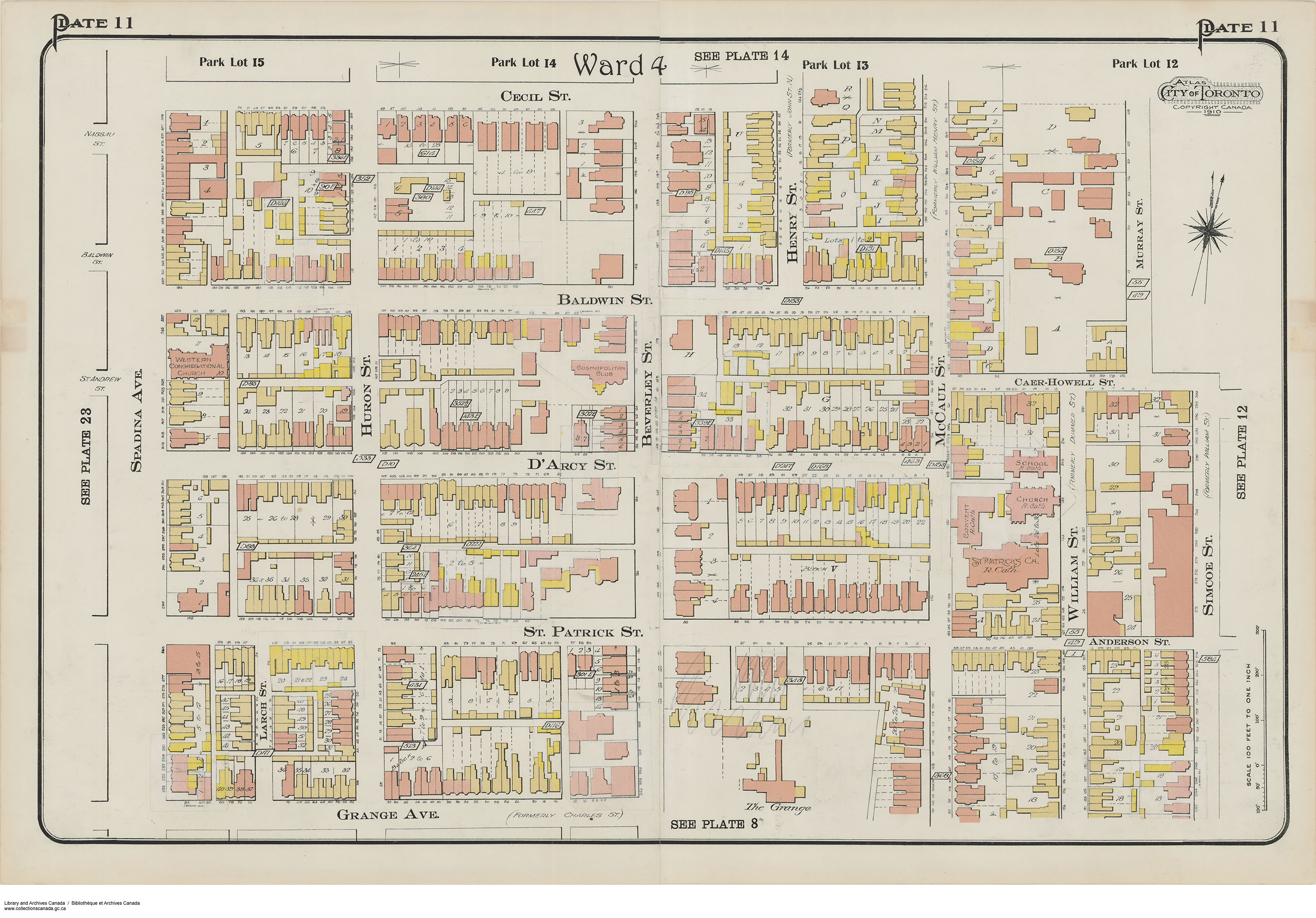
Actually, I think St. Patrick St. is now Dundas Street - and William Street is now St. Patrick.

William St was originally the first street west of University, north of Queen.
Dummer St. was the second street west of University.
Both names came from William Dummer Powell, who owned park lot #12 and had a house called Caer Howell. His heirs subdivided his park lot after he died in 1834.

At some point William St. was renamed Simcoe.
So Dummer St. was renamed William.
Caer-Howell St was renamed Elm.
and Henry St. was renamed McCaul
and John St. north was renamed Henry
- and at one point Simcoe St south of Queen was called Graves St.
Then maybe when St. Patrick (and Anderson) were renamed Dundas, William was renamed St. Patrick?
Must have driven the postman mad.


e010757085-v8.jpg
 
So therefore it went from

Houses > Office Building > Gas station > Current Condo?

I only remember the last two incarnations. :)

Although going by the pictures at the Toronto archives I would say it went from

Houses removed for a widened Dundas street > Gas station > current condo
 
Last edited:
Actually, I think St. Patrick St. is now Dundas Street - and William Street is now St. Patrick.

William St was originally the first street west of University, north of Queen.
Dummer St. was the second street west of University.
Both names came from William Dummer Powell, who owned park lot #12 and had a house called Caer Howell. His heirs subdivided his park lot after he died in 1834.

At some point William St. was renamed Simcoe.
So Dummer St. was renamed William.
Caer-Howell St was renamed Elm.
and Henry St. was renamed McCaul
and John St. north was renamed Henry
- and at one point Simcoe St south of Queen was called Graves St.
Then maybe when St. Patrick (and Anderson) were renamed Dundas, William was renamed St. Patrick?
Must have driven the postman mad.


e010757085-v8.jpg

And, one more, according to your map: Grange avenue was once Charles street.

A teacher messaged me awhile ago. Some classroom somewhere uses this thread as a teaching aid. I can imagine your schedule of street changes as the basis for an exam question. :)


January 3 addition.


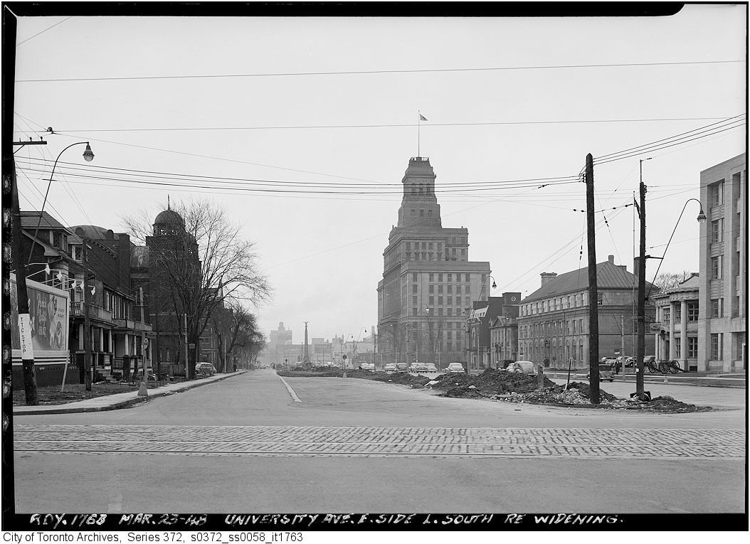
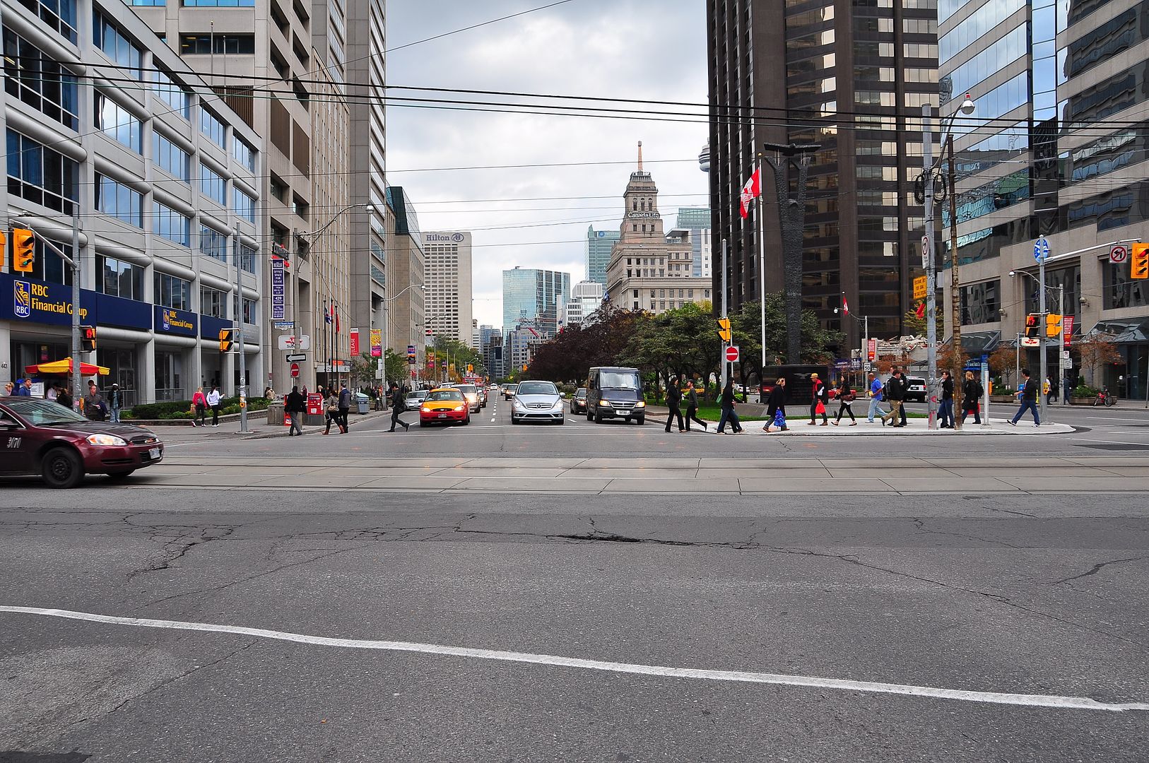
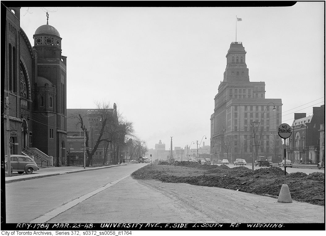
Then. "March 23, 1948. University Ave E side looking S re widening."


s0372_ss0058_it1763.jpg


Now. November 2010.


DSC_0808.jpg


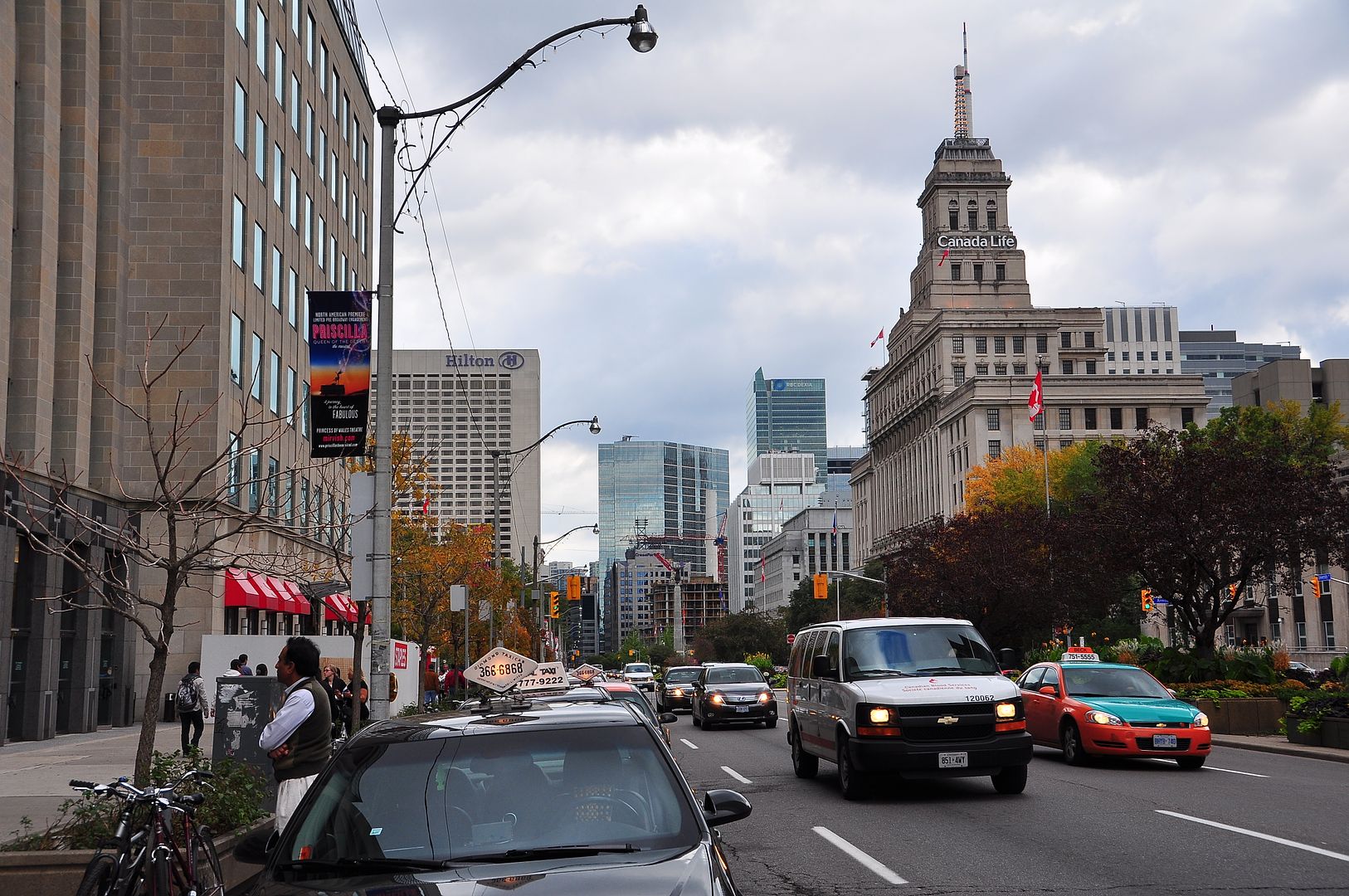
Then. Same as our 1st picture except that the photographer has walked S half a block.


s0372_ss0058_it1764.jpg


Now.


DSC_0807.jpg


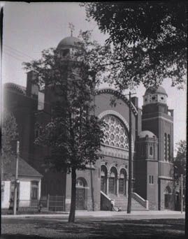
That Synagogue on the left - Goel Tzedec, has been covered off here before - please read thecharioteer's excellent writeup on its subsequent history back on page 174 of this thread.


GoelTzedec1924.jpg
 
I understand where you are comming from but, what BOTHERS me is the pronunciation of three (maybe more?) major Toronto streets.

EG:

YONGE Street.
Rhymes with sponge.
Not "yung".
Geo Yonge was minister of War, + friend of John Graves Simcoe.


SPADINA Avenue/Road/etc.
Not, "spa dine a".
Subsequent street are named after SPADINA HOUSE.

STRACHAN Avenue.
Not "straun".
DR STRACHAN changed the pronunciation of his name;
he felt that it sounded "too hard". (stra chan)

TOO BAD FOR YOU DR STRACHIN ! TO THE VICTOR GOES THE SPOILS.


Regards,
J T

(What do you mean "I lost"? Yes I know, it's not 1850 but . . . )

And my husband (an Englishman) insists that ST CLAIR is SINCLAIR--to which I answer that we didn't name major streets after news readers!
 
And my husband (an Englishman) insists that ST CLAIR is SINCLAIR--to which I answer that we didn't name major streets after news readers!

Though they *could* have renamed it, symbolically speaking, given that Mr. The Americans was HQ'd at Yonge + St Clair...
 
I only remember the last two incarnations. :)

Although going by the pictures at the Toronto archives I would say it went from

Houses removed for a widened Dundas street > Gas station > current condo

I'm pretty sure of the Office Building, as theres a pic of it in one of those books that I read about the TTC. It was being built when the TRC was still in place.

- edit2- I did some searching up and it seems that the building that I was talking about WAS ON UNIVERSITY >_>.
 
Last edited:

Back
Top