News   Mar 28, 2024
 928     2 
News   Mar 28, 2024
 531     2 
News   Mar 28, 2024
 830     0 

Metrolinx: Other Items (catch all)

Some have, many have not.


Very much so, this ROW is almost entirely in tact. The only built-over part I'm aware of is the Casino.

That's not to say I'm sold on that as a priority investment. There are countless other choices/priorities many of which have higher ridership potential and few obstacles.

In the case of Niagara, the ROW from the west still has tracks to within a very close distance of the casino.

The greater challenge would lie to the east where the track literally weaves between homes and such; certainly, I can imagine many an objection to relaying the tracks across trail, or through someone's backyard.

On that side of the Falls, the case for an LRT running from the VIA station is probably better, on a different alignment.

But again, there are many investments that would be preferable before getting there.

Edit to add: This is the ROW leading into downtown Niagara from the Welland side:

View attachment 385056

The last white dot at the bottom of the picture is where the tracks stop. The ROW runs ~600M in tact before hitting the Fallsview Casino.

Subsequently, it continues intact for 1.6km where it crosses Victoria Avenue in the heart of Niagara's tourist district.
What industries did that track serve? Why was it abandoned?
 
What industries did that track serve? Why was it abandoned?

In terms of railways former customers, @crs1026 could likely speak to that better than I.

Though, if memory serves, I think Nabisco was one of the last customers.

Some video of CP running through NF:


As noted below, by @OntarioOnTheMove the rail corridor was purchased expressly for Fallsview Casino, by Niagara Falls, with the balance to become a trail (which is partially the case today)
 
Last edited:
What industries did that track serve? Why was it abandoned?
This was originally the CASO and later CP Hamilton Sub mainline crossing into Niagara Falls NY at the now-unused Michigan Central Bridge. The land was purchased by Niagara Falls and OLG in 2001 for redevelopment and to remove slow-moving trains from the tourist area. CP diverted US interchange traffic to Buffalo, passing through Fort Erie over the CN Stamford Sub.
 
Last edited:
Gosh, I never knew about that Humber loop. Walking around the Lessard Park neighbourhood, particularly to the north, I always thought there was something very odd about the street/lane layout - but I hadn't put 2+2 together.
There used to be a train on the South Kingsway and Humbercrest??
 
221c53c3899319e3febf3481a363f203.jpg

Toronto Beltline Railway looking south from Bloor at what is now South Kingsway.
From link.

967a967ccff5fd9cbc377f112f7db7e1.jpg

654c0894a9a56f1e706016175ae7e781.jpg

Beltline tracks behind what is now Halford Avenue

3db476e8be65cb626c4d41af239e0e66.jpg

46 Halford Ave. is visible in top right corner of photo. Beltline trackbed is now their lower terrace.
 

Based on the description above, this is the same location currently:

1647290276535.png

3db476e8be65cb626c4d41af239e0e66.jpg

46 Halford Ave. is visible in top right corner of photo. Beltline trackbed is now their lower terrace.

46 Halford today, from the other side:

1647290722420.png


Hard to find an identical shot w/streetview to the archival one above w/Streetview.

I've tried to come close, but instead of being south of the heritage bridge, we're looking up to Halford from said bridge:

1647291174100.png
 
Last edited:
Well, I mean it only lasted for 2 years. So it was barely an anything really.
The area where the commuter line (Belt Line) went through was undeveloped at the time. Very little in the number of houses or businesses. It would take decades before homes would start to be developed in large enough numbers to support it.
 
There's certainly something still visible in the topography in the park, and even to the north.
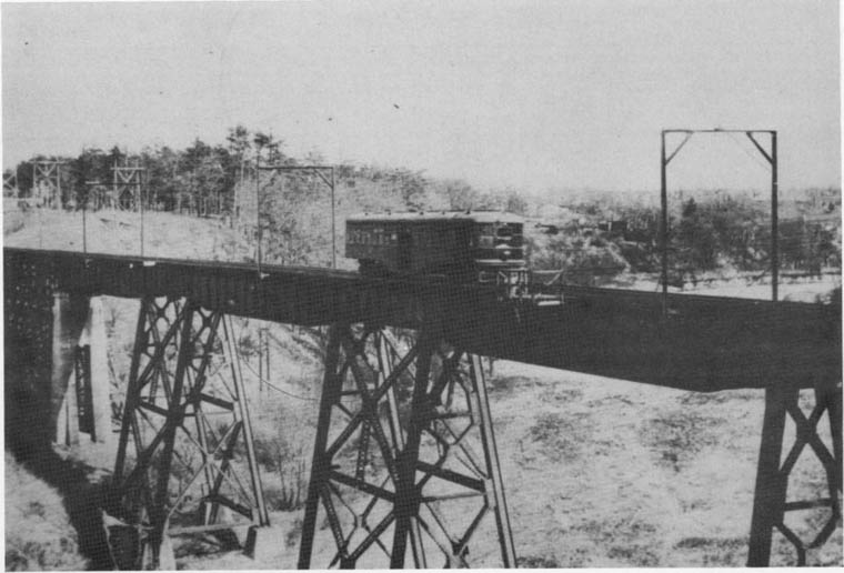
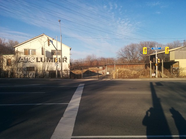
The hydro corridor north of St. Clair Avenue West and along Dundas Street West, from Weston Road and west, used to be the Guelph Radial Line.

See link.


humber-bridge_radial-car.jpg

Radial car westbound on the Humber River bridge. 1920

48387513_2047818028613145_1826490565529698304_n.jpg


49701233708_0b55f86594_z.jpg
From link.
Substation (powerhouse) for the Weston Road streetcars. The bridge was finally demolished in the 1980s but the old T.Sub.R. powerhouse still stands today. (Until Gunns Road is extended to Keele Street under the railway berm in the background).
 
Last edited:
That's exactly where I was, when I thought something was odd - I remember standing there and looking around, thinking WTF! Never crossed my mind that it had been an old commuter service.

Yea I did not know about this Humber Loop part of the Beltline. Been through Swansea so many times and wasn't aware. Pretty neat to learn about.
 
Yea I did not know about this Humber Loop part of the Beltline. Been through Swansea so many times and wasn't aware. Pretty neat to learn about.
Click on this link for more information about Swansea.

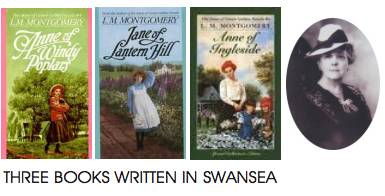
From 1935 until her death in 1942, Lucy Maud Montgomery (author of "Anne of Green Gables") lived at “Journey’s End”, located at 210 Riverside Drive. When Montgomery moved here, the ravine was oak forest. On June 5, 1935, she wrote in her diary, “The ravine is lovely, so green and ferny. There are darling wild columbines in it.” A small parkette at the intersection of Riverside Dr. and Riverside Crescent is named in her honour.
lucy-Maud-Montgomery-books.jpg


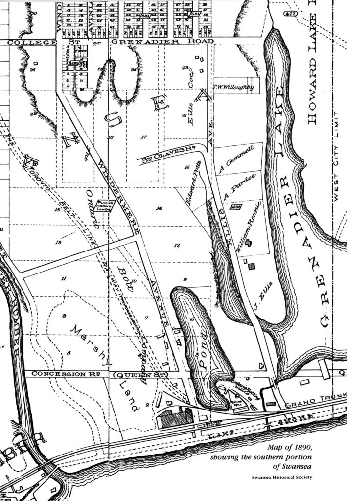
maps-swansea-1890-709x1024.jpg

Map of 1890 Swansea, showing the southern portion of Swansea. Swansea Historical Society Archives.

Notice the name "College Street", that is currently "Morningside Avenue". The thinking of the time was that College Street would have been extended west into Swansea, but High Park was in the way.
 
Last edited:

Back
Top