News   Nov 01, 2024
 2K     14 
News   Nov 01, 2024
 2.4K     3 
News   Nov 01, 2024
 740     0 

Lost Road and Bridge: Lawrence Avenue

I have not had a chance to look yet, sorry! There was probably not much traffic going over this bridge because...there was no where to go east of the Don in this area. There was just not much there.

Yeah, I don't imagine it was anything like it is today. Still, the idea of, what, 10, 15 thousand people living just west of this spot, where a four-lane road drops down to this single lane in the space of a half hour walk from Don Mills Road, fascinates me. I can only imagine what that must have been like. It must have been very weird. Then bang, here's the DVP, here's your six-lane capacity Larry bridge, all in the space of a year or two. Kind of thing you just don't see anymore. Well, not around here, anyway. Finch and Morningside notwithstanding. :)
 
Real estate ads of the day seemed to direct potential buyers up Victoria Park in the case of 'O'Connor Hills' in November 1958
- note the detour due to the railway bridge under construction on Victoria Park

OConnorHills.jpg


and across York Mills to 'Parkway Woods' in January 1960

ParkwayWoods.jpg
 
Real estate ads of the day seemed to direct potential buyers up Victoria Park in the case of 'O'Connor Hills' in November 1958
- note the detour due to the railway bridge under construction on Victoria Park

and across York Mills to 'Parkway Woods' in January 1960

I've got pictures of that bridge, before and after. It was a little two-lane job made of wood, if you can believe it. Lawrence Avenue used to run right alongside the railroad tracks on the north side back then, and T-junctioned with Victoria Park Avenue immediately north of the bridge on the west side. There's not a hint of that now. The stretch down by the pioneer cemetery didn't exist yet at the time, at least on the west side.

Roanoke Road, which runs a straight shot just north of Lawrence Avenue today, is actually Old Lawrence Avenue. It's kind of strange to drive along it and come to a dead end between two huge slab apartment buildings and realize that 50 or 60 years ago, it was a country road coming up the side of the hill out of the valley into farmland.

Your clips bring up another interesting old bit... Woodbine Avenue. Hard to imagine saying "Woodbine and York Mills" and "Woodbine and Sheppard" and "Woodbine and Finch" now, but it's really only been since the 60s for the first two and the late 70s for Finch. Every time I drive along Underpass Gate it dawns on me that not too long ago, it was a just a field with a two-lane road there... not the never-empty DVP roaring by overhead just yards from one of the busiest interchanges in the world. I really wish I could have driven, seen, Woodbine down to its end in the trees above where it would have intersected with Lawrence if the terrain hadn't been prohibitively complex, but that was before my time. I haven't even found photos of that, except Woodbine and York Mills being erased to build the DVP bridge over York Mills there. I keep meaning to get down to the city archives and see if any of the negatives of DVP construction show things like the state of affairs down on Lawrence, or the dogleg for York Mills and Woodbine before it was torn up.

I found out that the very last house on Woodbine is actually still standing. It's this one. That place once stood alone at the dead end of Woodbine Avenue, south of York Mills. Now its front yard is its back yard, and its driveway doesn't feed from Woodbine anymore (obviously), but the residential street it now finds itself on, surrounded by other homes. What a story that place could tell.
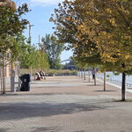
 
I've got pictures of that bridge, before and after. It was a little two-lane job made of wood, if you can believe it...
Photo of old bridges(?) from the Archives. Odd that it wasn't a level crossing, like over at Pharmacy. Must have had something to do with the terrain.

s0065_fl0044_id0006.jpg


Roanoke Road, which runs a straight shot just north of Lawrence Avenue today, is actually Old Lawrence Avenue.

Never knew that, until I found out from you. You also solved the mystery of why 'Old Lawrence' runs south from 'new Lawrence'. I had also always wondered why the houses in the Underhill area were newer than those to the north and east in 'O'Connor Hills' and 'Parkway Woods' - but I guess it was all tied into the construction of the DVP, and 'new Lawrence'. I remember being driven up the Parkway as a kid one night - it stopped at Lawrence but construction north of there was pretty much complete - the lights were on and it looked like all they had to do was take down the barriers. I think it had those orangey-tinted lights at that time.

'New Lawrence' under construction
f0217_s0249_fl0106_it0001.jpg


Your clips bring up another interesting old bit... Woodbine Avenue. Hard to imagine saying "Woodbine and York Mills" and "Woodbine and Sheppard" and "Woodbine and Finch" now, but it's really only been since the 60s for the first two and the late 70s for Finch...

Yes, I remember this
f0217_s0249_fl0070_it0001.jpg


and this (and 42 cent a gallon gas) - but not much south of there.
f0217_s0249_fl0164_it0001.jpg


I found out that the very last house on Woodbine is actually still standing. It's this one. That place once stood alone at the dead end of Woodbine Avenue, south of York Mills. Now its front yard is its back yard, and its driveway doesn't feed from Woodbine anymore (obviously), but the residential street it now finds itself on, surrounded by other homes. What a story that place could tell.
You used to be able to see that house from the DVP, which makes sense since it originally faced it.

There are a couple of photos of the Woodbine/401 interchange on http://www.thekingshighway.ca - a great website.
http://www.thekingshighway.ca/PHOTOS/hwy401-79_lg.jpg
http://www.thekingshighway.ca/PHOTOS/hwy401-44_lg.jpg
 
Yes, I remember this
f0217_s0249_fl0070_it0001.jpg

For me, that's the precursor of the view I had every weekday morning for 10 years hopping onto the 404. It looked at a little different by then. :)
 
Great picture. I remember the post-stop sign era when there were traffic lights at Finch & Woodbine. On Sunday evenings in the summer, I distinctly remember the crush of cars on Woodbine coming home from cottage country. Always made for a long wait turning left from northbound Woodbine to Finch.
 
Great picture. I remember the post-stop sign era when there were traffic lights at Finch & Woodbine. On Sunday evenings in the summer, I distinctly remember the crush of cars on Woodbine coming home from cottage country. Always made for a long wait turning left from northbound Woodbine to Finch.

Yeah, the whole DVP thing is such a phenomenon of the 60s it's often hard for me to remember it ended at Sheppard and that the Woodbine and Finch intersection existed well into the 70s. I never knew there were lights there. When I imagine the traffic coming off the DVP and squeezing down into one northbound lane, though, I always wonder about the Monday morning madness THAT must have entailed. Standing up on Sheppard and watching the stunts right below you must have been better than going to the Olympics.

Now, of course, we have umpteen lovely lanes on the ghost of Woodbine so that traffic never needs to slow down and bunch up. :)
 
DVP & Lawrence, before and 'after' - 1949 and 1969(?) - looking southeast

DVPLawrencebefore.jpg


DVPLawrenceafter.jpg
 
From the TPL digital collection - James Salmon photos from 1955.
Not sure if they are the same ones that were posted in May 2012

pictures-r-6341.jpg

pictures-r-6340.jpg

pictures-r-6342.jpg
 
Last edited:
From the TPL digital collection - James Salmon photos from 1955.

pictures-r-6342.jpg

Has anything more happened to the Milne House since I saw this in 2011?

Milne House 2.jpg
 

Attachments

  • Milne House 2.jpg
    Milne House 2.jpg
    99.6 KB · Views: 841
From the TPL digital collection - James Salmon photos from 1955.
Not sure if they are the same ones that were posted in May 2012

pictures-r-6341.jpg

The bridge shots are the same. This one is backward, though; flipped in the vertical axis, making right, left. In the original view, Salmon was facing northwest from the southeast corner of the bridge. The light comes from the south, and the road curves off to the north, which is consistent with maps and aerial photos. The view here seems to reverse that. It's on the west side that the road curves suddenly away from the moorings of the bridge; on the east side, the approach was more direct.

I don't remember seeing that photo of the Milne House before, though. Man, it was hurtin' almost as bad in 1955 as it is today. I guess it's had and lost its renaissance in the meantime.
 

Back
Top