Lone Primate
Active Member
Jerrek suggested this one, and I happen to have a lot of shots of this place because I always found it interesting. It's 4th Line in Halton where it crosses Sixteen Mile Creek. I used to live in Mississauga so I and my buddies would occasionally use this road when we were just tearing around Halton. At the time, the road was open for use in the summer, but it was considered too treacherous for use in the winter and would be closed annually. A few years ago, it was closed to automobile traffic for good. It's one of the few places I can think of where I have photos that predate the closure... and here are some of them, before, and after.
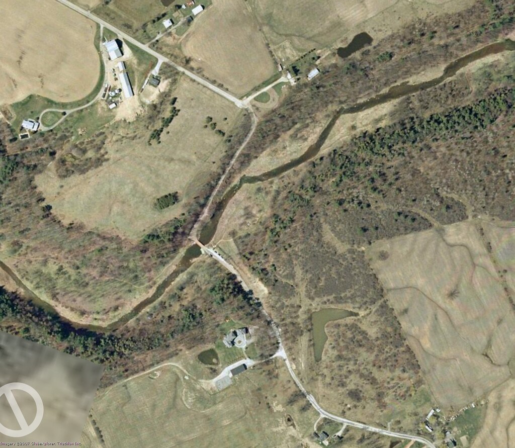
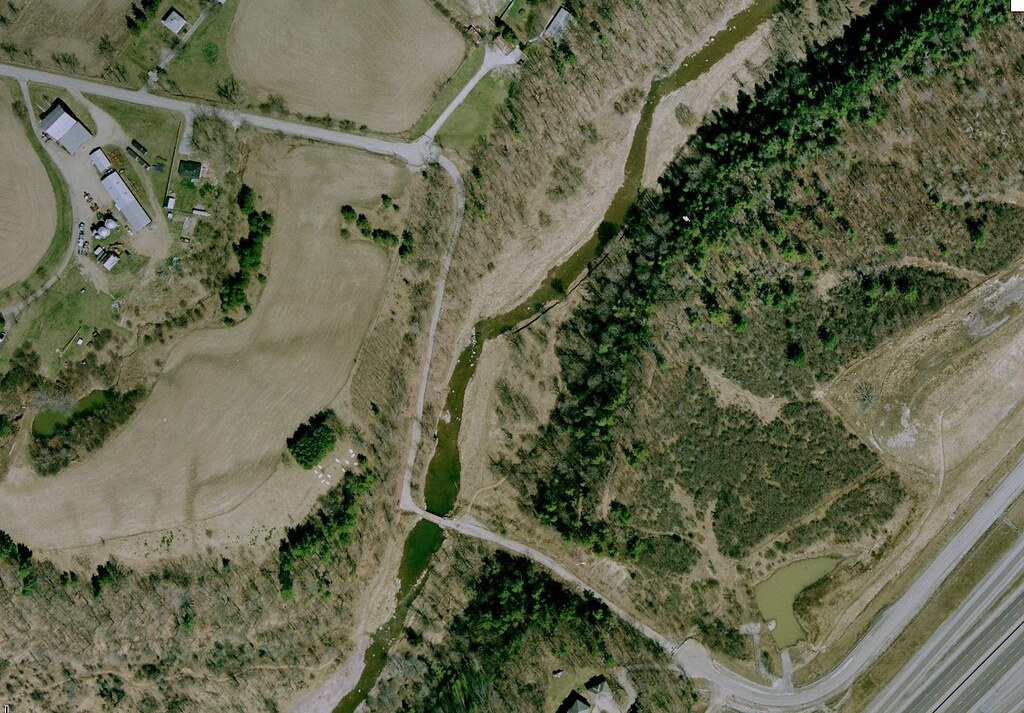
Here's the area from the air, thanks to Google. The shots I took from the 90s approach from the upper left. The shots from 2006 I was parted at the lower right.
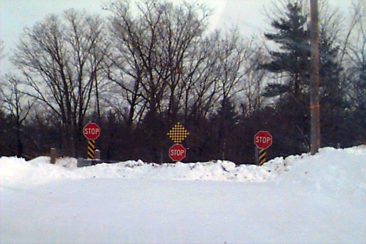
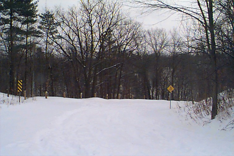
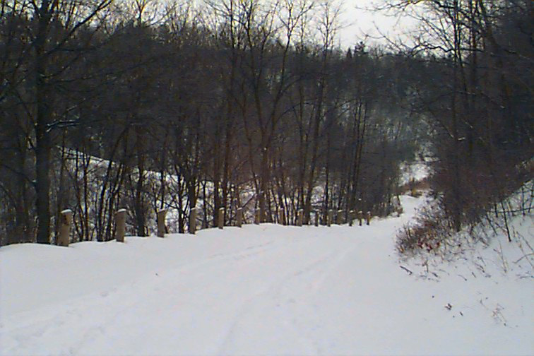
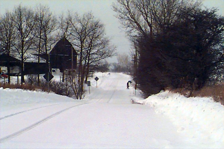
Below, winter of 1999. February, I think. At the time, the road was still open to you in warm weather. But of course, in cold, it was closed. This is what it looked like then.
The shot below is taken from the same position as that of the shot above, but around seven years later. If you look closely, you'll recognize some of the trees as identical.
Notice the signs are gone, however.
...And back to 1999.
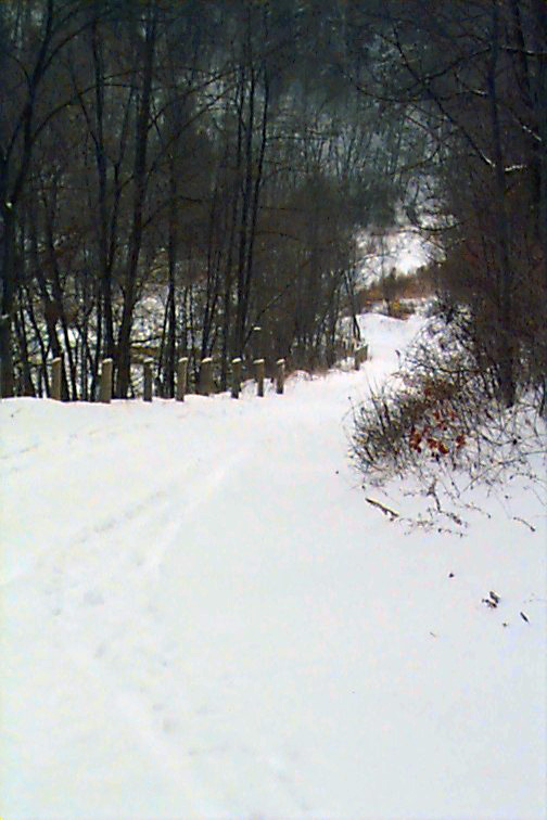
The bridge is at the bottom, right behind the trees. This is a longer shot than it looks; I went nowhere near the bottom. Not with all that snow. It was getting into my sneakers.
So, I wrote my name, headed back up to where my buddy was waiting beside his car, and off we went, back up the north end of 4th Line.
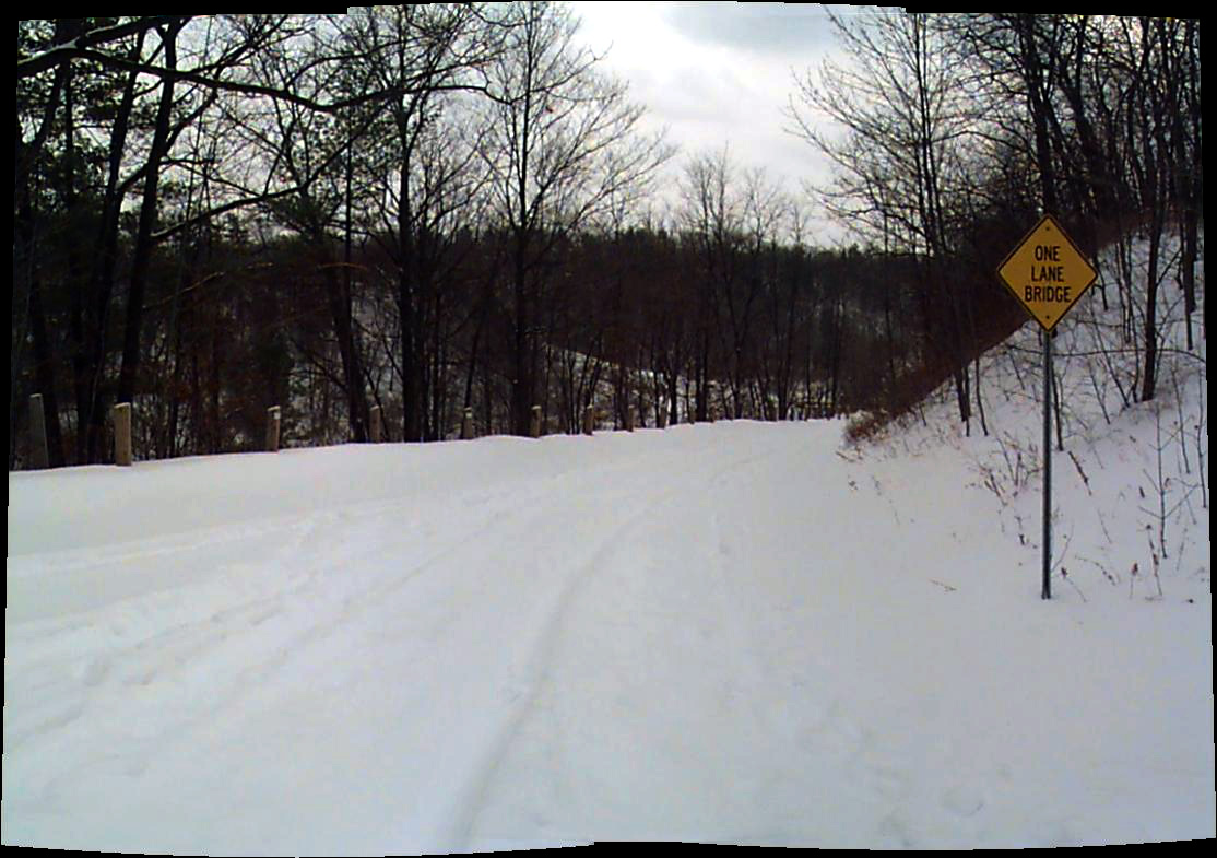
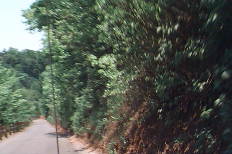
Different car, different buddy; this is May, 1999. Obviously, the road is now open to vehicle traffic, and I'm riding shotgun, manning my camera as we head down towards the bridge from the north.
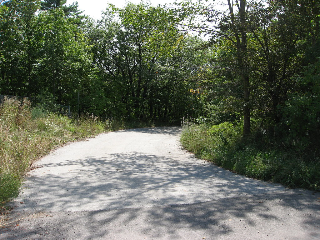
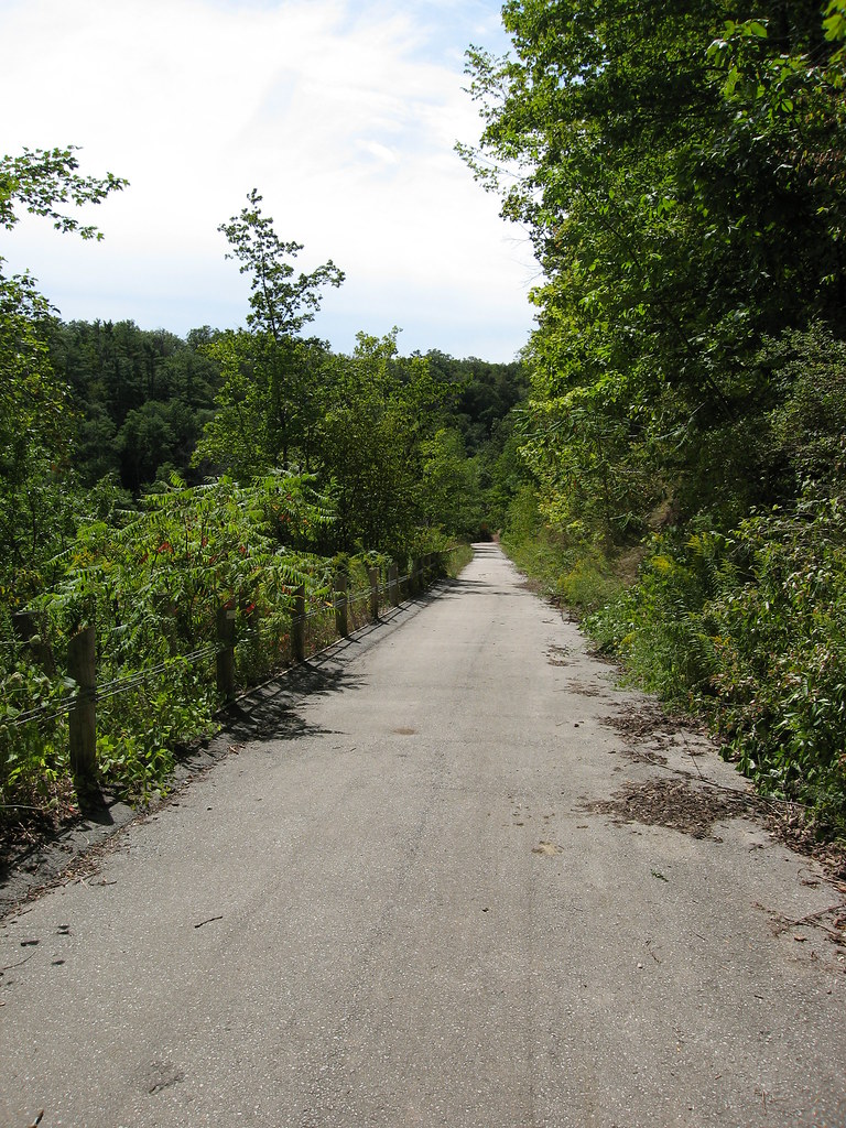
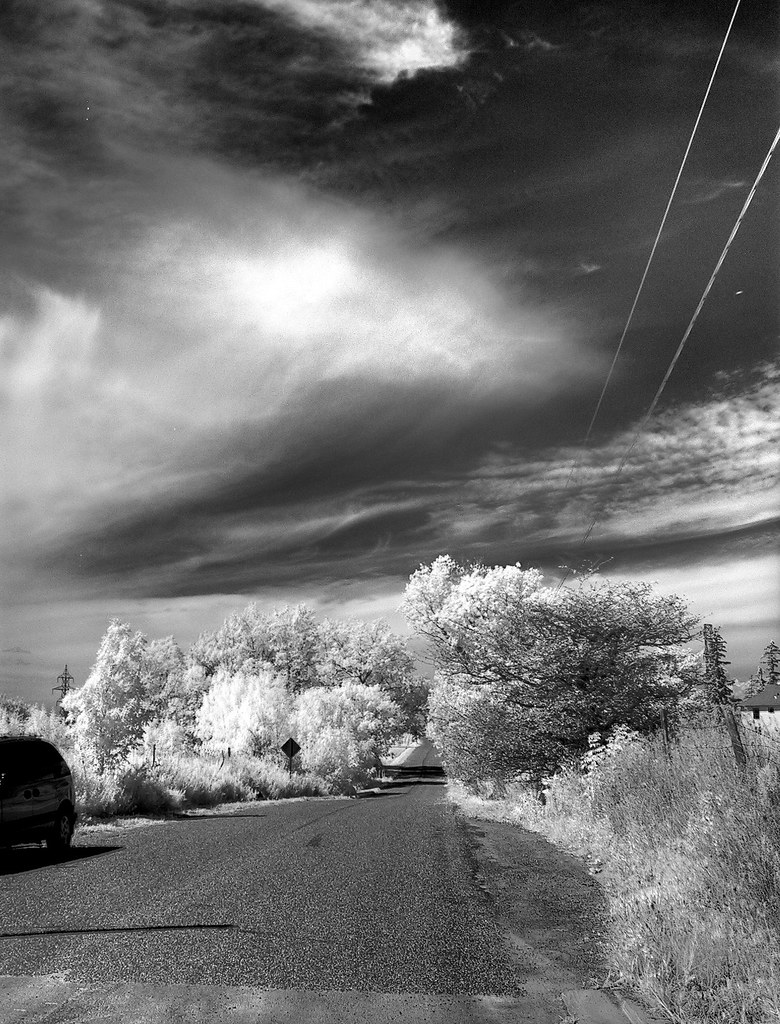
Here's a shot taken in the summer of 2006, from pretty much the same position as above, except, of course, I'm on foot. This is from my return trek that day; I'd already crossed the bridge from the other side. Notice how much the foliage has already eaten into the road on the right, after just a couple of years.
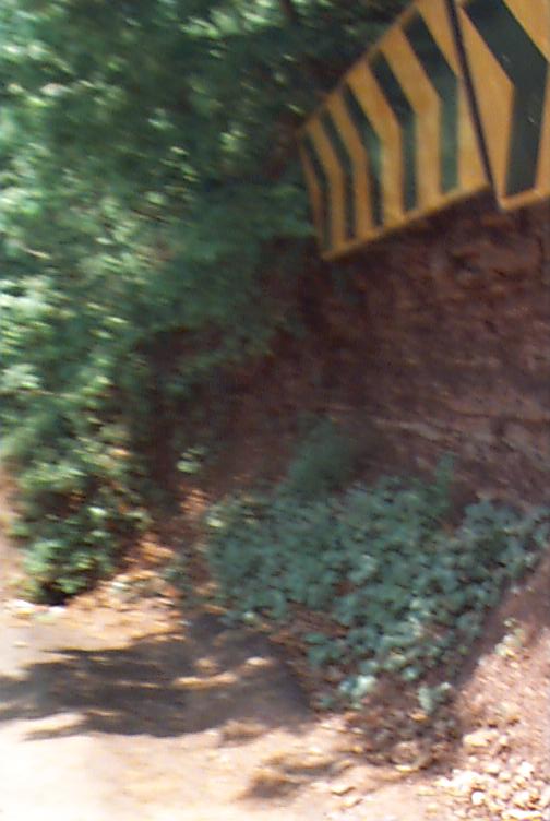
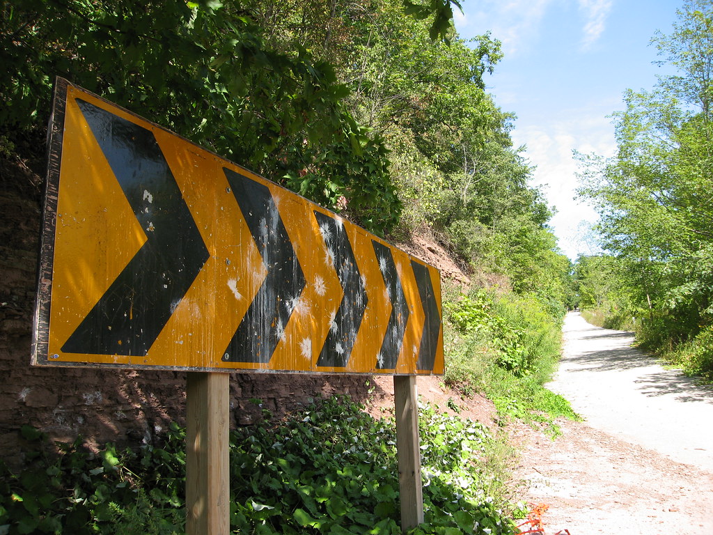
I remember I wanted to get a shot of the bridge, but this was, remember, 1999. I was using a very early model digital camera, not even a single megapixel (as you can tell) and the reaction time on it was just awful. I took this shot just a tad too early... as you can see, it's a shot of the hazard sign at the bottom of the road as you come to the turn -- which is a very hard 90 degree turn (look at the aerial shot and you'll see what I mean)... by the time the camera had saved this image and was ready for the next, we were across the bridge and heading back up. I didn't know at the time the road would be closed for good, so I didn't bother shooting another.
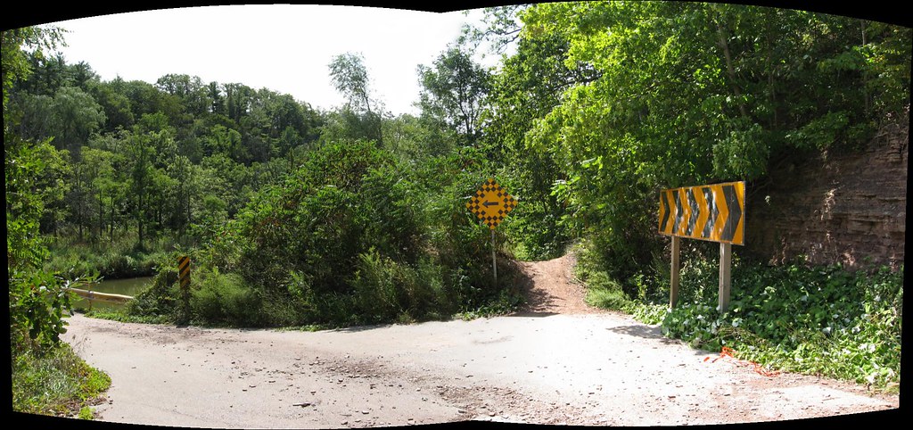
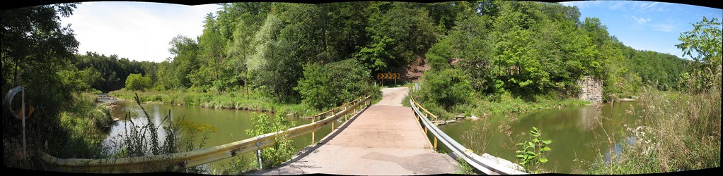
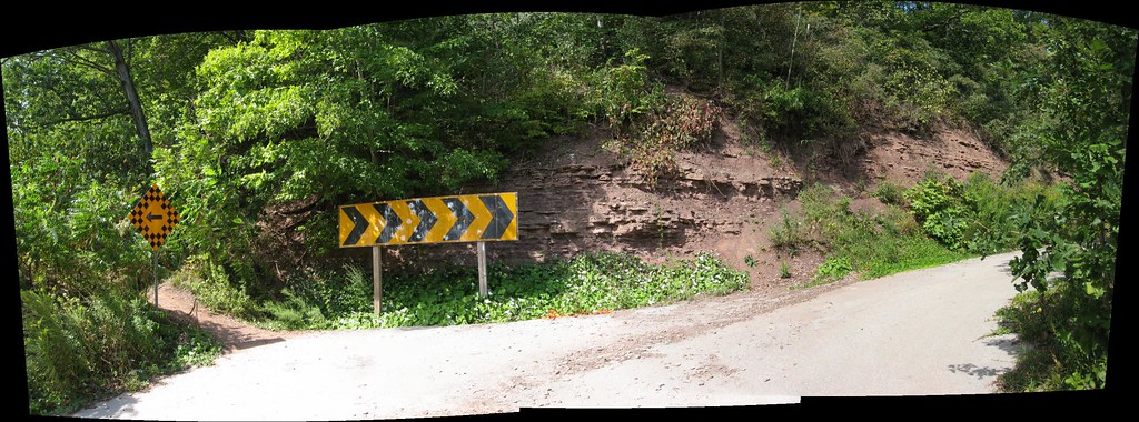
Below is a shot from just about the same position as above in 2006. It's a wider angle shot (well, actually a panorama of a couple of shots) showing the turn. Notice that there used to be two warning panels fixed to the cliffside in 1999; they were replaced by a single sign sometime between then and 2006.
Well, that's it for the old stuff and the comparison shots, so from here on in, it's 2006 all the way, and in chronological order, I think.
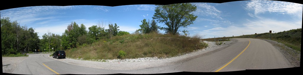
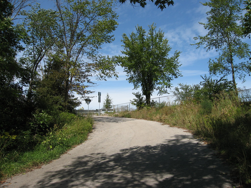
Below is a panorama of the southern end of 4th Line where it's blocked to traffic. At one time, it continued on more or less straight along my right shoulder in this shot, but once the 407 was built (just off the the right), 4th Line had to reconnect with itself by an underpass further east.
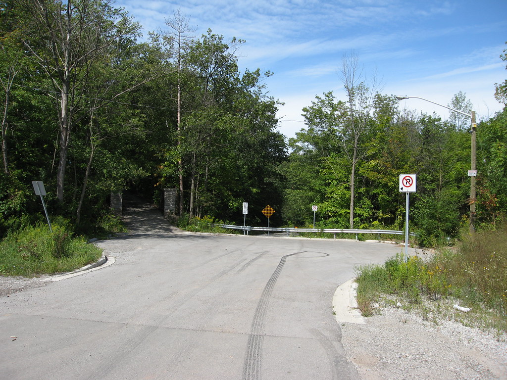
Don't you love the skidmarks? Bet there's a matching pair in the guy's shorts.") But this far, no farther! Heading north from here can only be done on foot. Or bike, I guess.
But this far, no farther! Heading north from here can only be done on foot. Or bike, I guess.
Rollerblades...
I should stress here that these next several views are from the opposite direction of the 1999 shots, which were taken from the north looking south. These are taken from the south heading north...
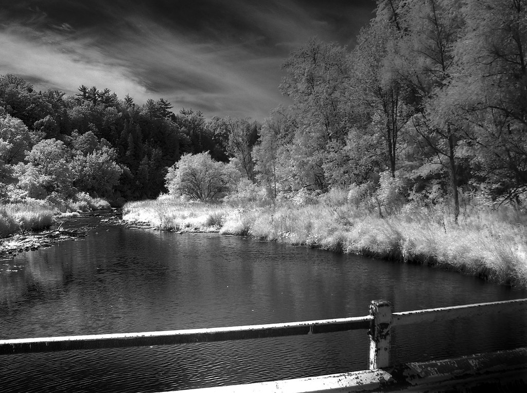
Below is an infrared shot looking upstream (on the left in the previous image). Later on you'll see images taken from that location looking back at where I'm standing in this shot.
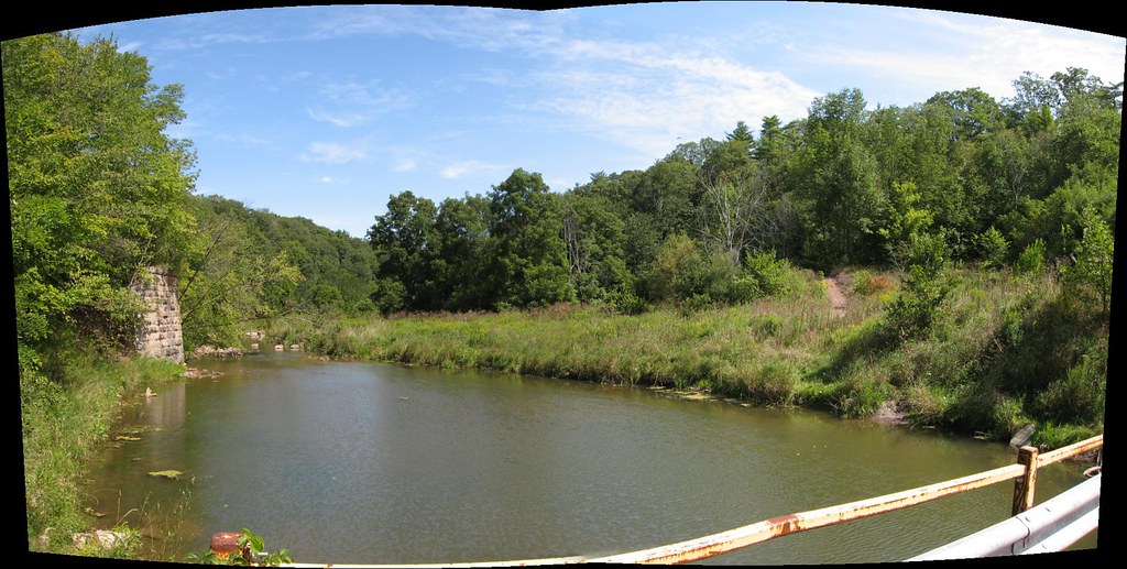
Here's a colour shot looking downstream. Don't you wonder what that impressive stone abutment there is all about? I've looked in the aerial shot time and again but I just can't see any evidence of a road or a bridge or anything hinted at on the other side. I really wonder what it's there for. It made a nice perch later on for shooting down the valley.
Here's that sharp turn, but seen from the south side instead.
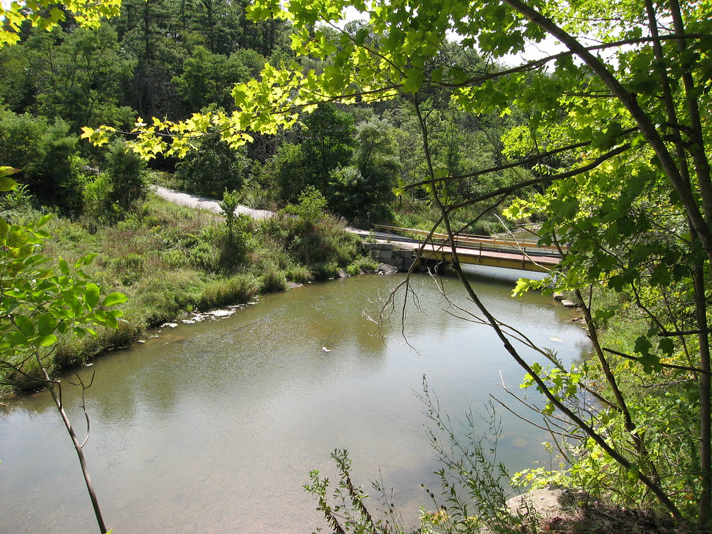
And there's the bridge itself, as seen from the mysterious abutment.
Approaching the heights where my buddy was parked in the winter of 1999.

Infrared shot more or less corresponding to the winter shot in which we were leaving. The foliage on the trees blocks the view of the farm houses.
Back down at the bottom. Looks like someone's been using the warning sign for paintball practice. But this shot gives you some idea of how steep and narrow the rise is, and why Halton's probably closed the road now that it's been rendered superfluous by other, newer routes.
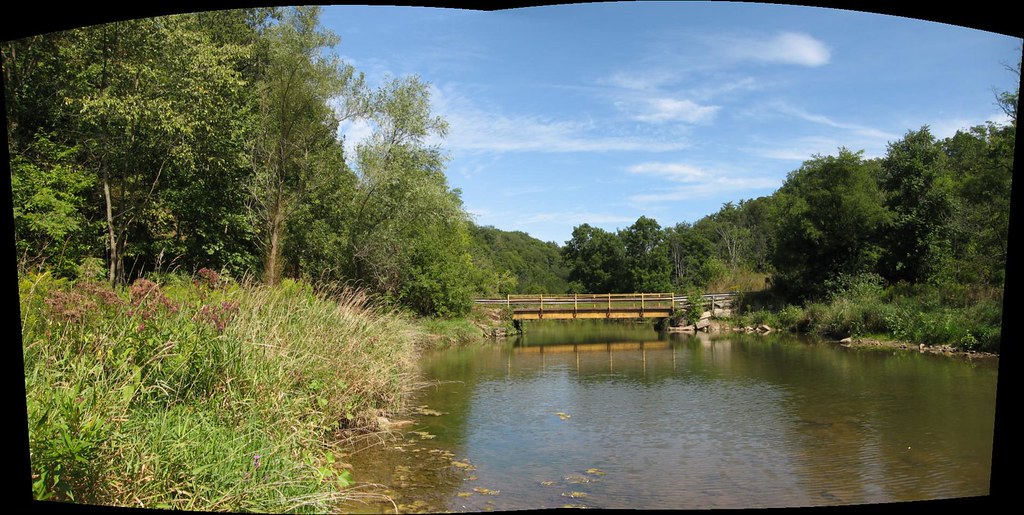
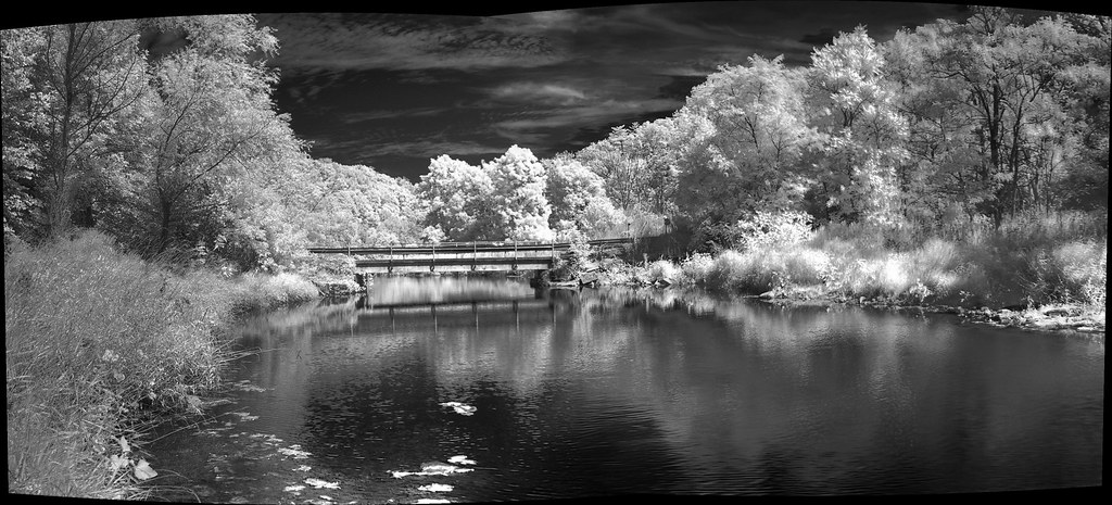
These two shots below, colour and infrared, were taking from standing in Sixteen Mile Creek just upstream from the bridge. Compare the view to the earlier shot looking in this direction from the bridge itself.
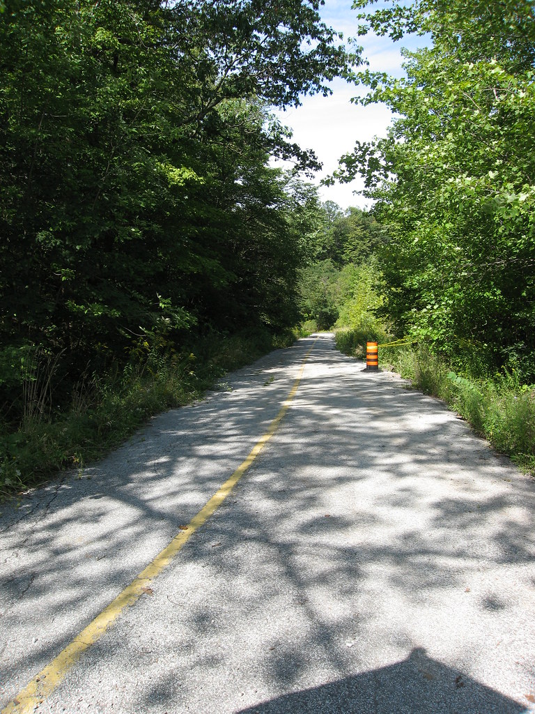
Home again, home again, jiggity-jig. I guess these next few shots show what I was trying to capture riding shotgun in May, 1999...
Here's the area from the air, thanks to Google. The shots I took from the 90s approach from the upper left. The shots from 2006 I was parted at the lower right.
Below, winter of 1999. February, I think. At the time, the road was still open to you in warm weather. But of course, in cold, it was closed. This is what it looked like then.
The shot below is taken from the same position as that of the shot above, but around seven years later. If you look closely, you'll recognize some of the trees as identical.
Notice the signs are gone, however.
...And back to 1999.
The bridge is at the bottom, right behind the trees. This is a longer shot than it looks; I went nowhere near the bottom. Not with all that snow. It was getting into my sneakers.
So, I wrote my name, headed back up to where my buddy was waiting beside his car, and off we went, back up the north end of 4th Line.
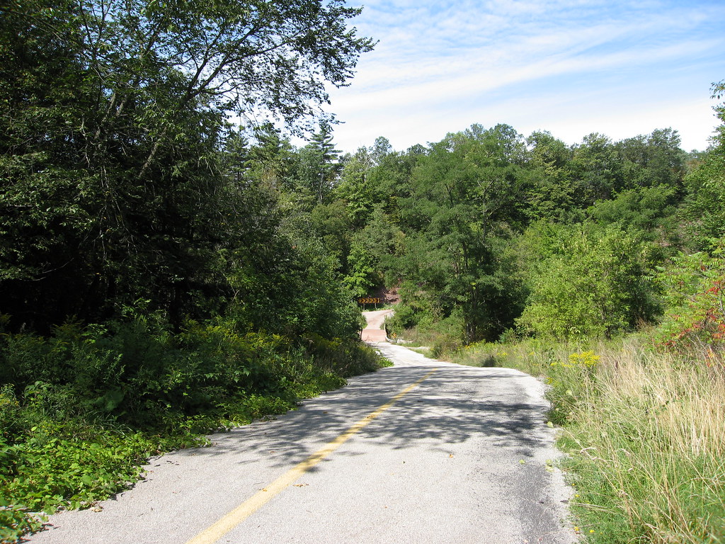
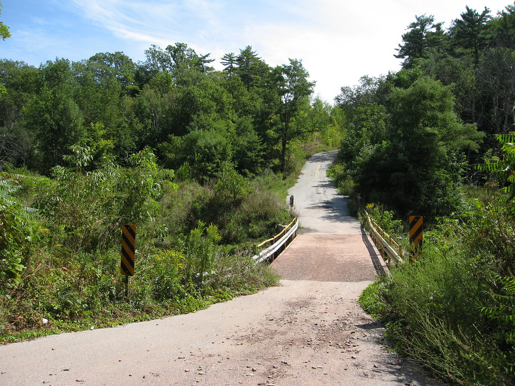
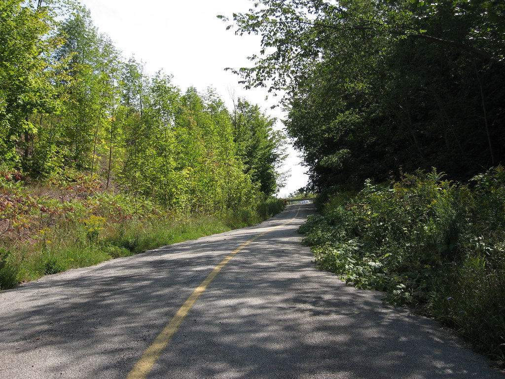
Different car, different buddy; this is May, 1999. Obviously, the road is now open to vehicle traffic, and I'm riding shotgun, manning my camera as we head down towards the bridge from the north.
Here's a shot taken in the summer of 2006, from pretty much the same position as above, except, of course, I'm on foot. This is from my return trek that day; I'd already crossed the bridge from the other side. Notice how much the foliage has already eaten into the road on the right, after just a couple of years.
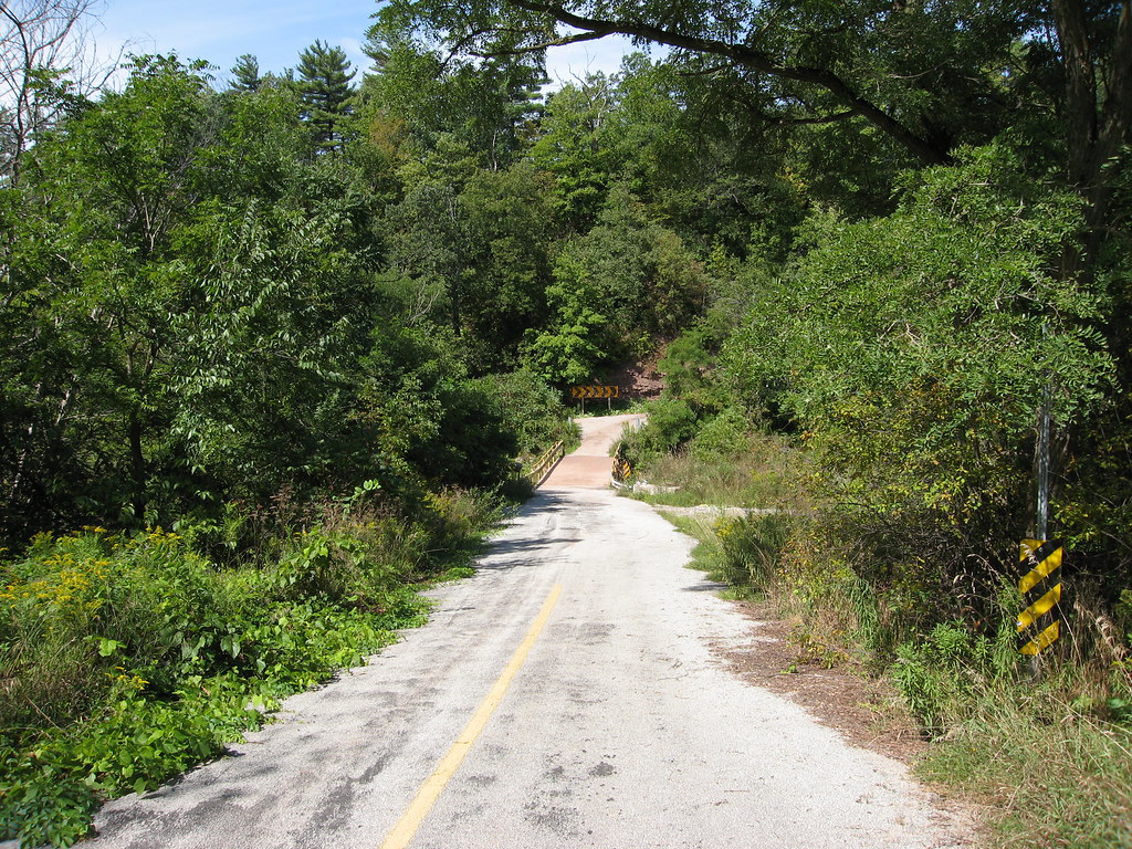
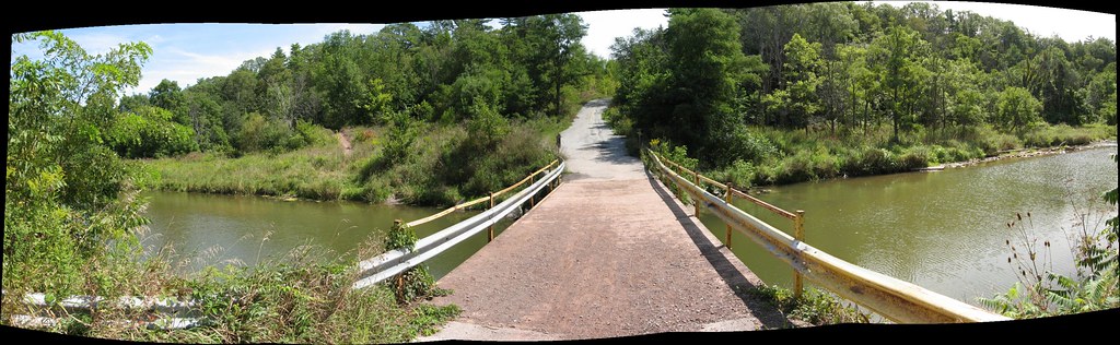
I remember I wanted to get a shot of the bridge, but this was, remember, 1999. I was using a very early model digital camera, not even a single megapixel (as you can tell) and the reaction time on it was just awful. I took this shot just a tad too early... as you can see, it's a shot of the hazard sign at the bottom of the road as you come to the turn -- which is a very hard 90 degree turn (look at the aerial shot and you'll see what I mean)... by the time the camera had saved this image and was ready for the next, we were across the bridge and heading back up. I didn't know at the time the road would be closed for good, so I didn't bother shooting another.
Below is a shot from just about the same position as above in 2006. It's a wider angle shot (well, actually a panorama of a couple of shots) showing the turn. Notice that there used to be two warning panels fixed to the cliffside in 1999; they were replaced by a single sign sometime between then and 2006.
Well, that's it for the old stuff and the comparison shots, so from here on in, it's 2006 all the way, and in chronological order, I think.
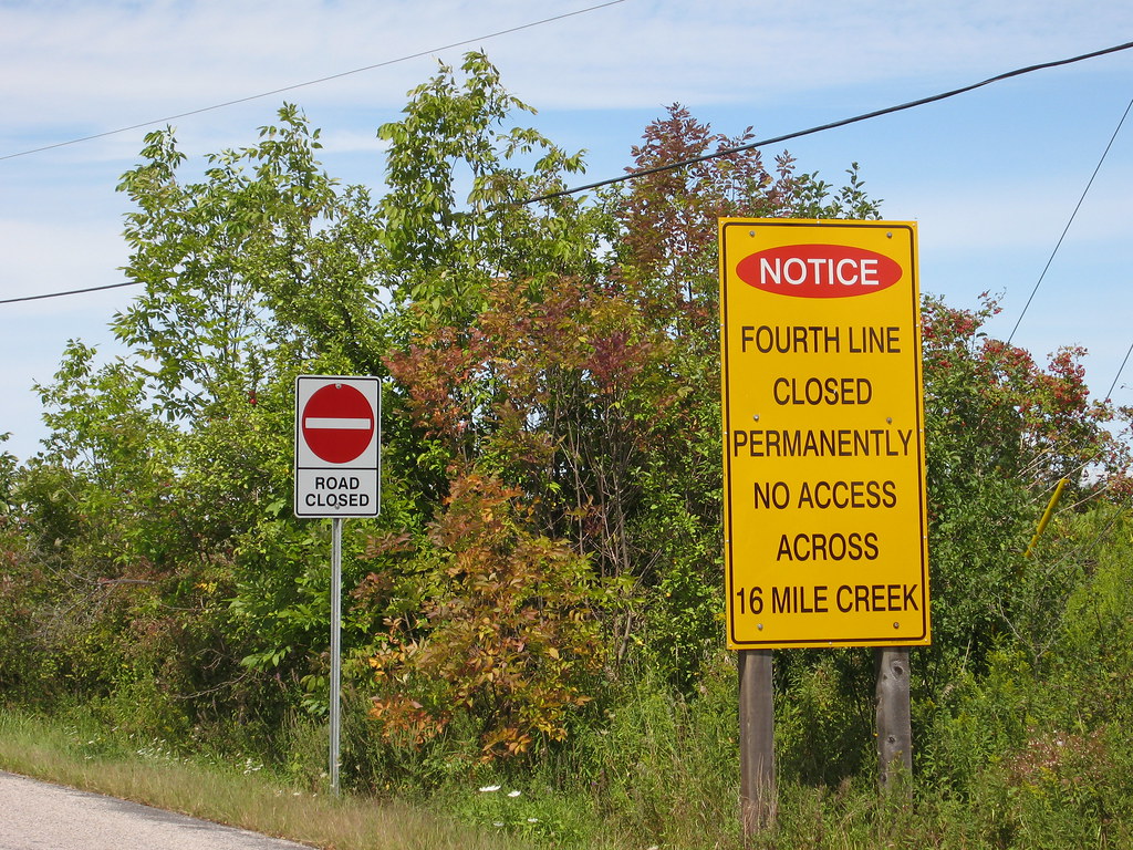
Below is a panorama of the southern end of 4th Line where it's blocked to traffic. At one time, it continued on more or less straight along my right shoulder in this shot, but once the 407 was built (just off the the right), 4th Line had to reconnect with itself by an underpass further east.
Don't you love the skidmarks? Bet there's a matching pair in the guy's shorts.
But this far, no farther! Heading north from here can only be done on foot. Or bike, I guess.Rollerblades...
I should stress here that these next several views are from the opposite direction of the 1999 shots, which were taken from the north looking south. These are taken from the south heading north...
Below is an infrared shot looking upstream (on the left in the previous image). Later on you'll see images taken from that location looking back at where I'm standing in this shot.
Here's a colour shot looking downstream. Don't you wonder what that impressive stone abutment there is all about? I've looked in the aerial shot time and again but I just can't see any evidence of a road or a bridge or anything hinted at on the other side. I really wonder what it's there for. It made a nice perch later on for shooting down the valley.
Here's that sharp turn, but seen from the south side instead.
And there's the bridge itself, as seen from the mysterious abutment.
Approaching the heights where my buddy was parked in the winter of 1999.
Infrared shot more or less corresponding to the winter shot in which we were leaving. The foliage on the trees blocks the view of the farm houses.
Back down at the bottom. Looks like someone's been using the warning sign for paintball practice. But this shot gives you some idea of how steep and narrow the rise is, and why Halton's probably closed the road now that it's been rendered superfluous by other, newer routes.
These two shots below, colour and infrared, were taking from standing in Sixteen Mile Creek just upstream from the bridge. Compare the view to the earlier shot looking in this direction from the bridge itself.
Home again, home again, jiggity-jig. I guess these next few shots show what I was trying to capture riding shotgun in May, 1999...