News   Jul 25, 2024
 557     0 
News   Jul 25, 2024
 608     0 
News   Jul 25, 2024
 477     0 

Evocative Images of Lost Toronto

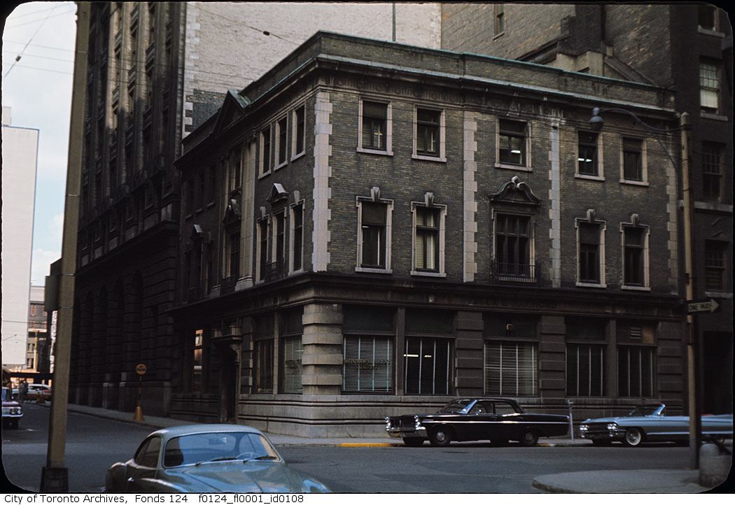
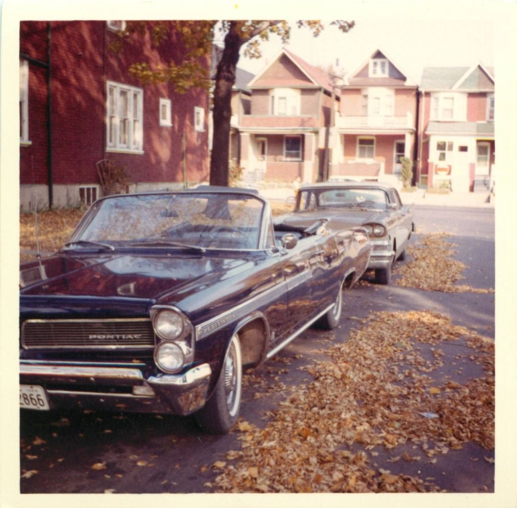
63 or 64 Pontiac & 1961 Cadillac convertible*.

(*Proper model name is 1961 Cadillac Convertible Coupe, Series 62, Style 6267, Code F, Wheelbase 129".)


Regards,
J T
 
i am drooling over here, at those gorgeous cars

i'm really fond of beetles, but those two huge parked cars on the right in the last picture are awesome

f0124_fl0001_id0108.jpg


Bottom left is a VW Karmen Ghia. I had a 1969 and by `75 it had rusted its way back to mother earth.
 
Last edited:
i am drooling over here, at those gorgeous cars

i'm really fond of beetles, but those two huge parked cars on the right in the last picture are awesome

The front car in this picture was my Dad's. Similar to that Caddy, 3 of which my Dad owned during my lifetime, as well as a black Pinto. Browning Avenue should recognize this location.

pic_704.jpg
 
That seems like it might have been taken at the 252 Carlton location. If so, that would be Broadcast Lane behind the horse.
Their main location was 533 Yonge. From Industries of Canada, 1886:

BookReaderImages.php


Image from TOBuilt.ca:

533Yonge.jpg

I wonder if the porch and wooden sidewalks were "artistic license"?
 
I wonder if the porch and wooden sidewalks were "artistic license"?

The 1880 Goad’s at Toronto Archives shows 533 Yonge as “Under Construction,†with no porch, but the 1892 revision at TPL does show a porch.
 

Attachments

  • 533 Yonge 1892.jpg
    533 Yonge 1892.jpg
    92 KB · Views: 294
From Library and Archives Canada:

Downtown:

e010859820-v8.jpg


e010859818-v8.jpg


e010861587-v8.jpg

These are nice, they show the "house" atop the King and Young building very clearly. Also note Hotel Mossop and then the change to Hotel Victoria.
Does that sign say Geo. & MattElder?
The Kensington shots are truly classic!
The Wittall Can Co. looks familiar.
 
Last edited:
Another from the Archives titled "Immigrant Women, St. Lawrence Market, 1914", showing the east side of Jarvis, just south of King:

a061303.jpg
 
"And an interesting map:"
QUOTE thecharioteer.


The shaded markings are where the THC added land(fill) to extend the Lake Shore Road area.


Regards,
J T
 
These are nice, they show the "house" atop the King and Young building very clearly. Also note Hotel Mossop and then the change to Hotel Victoria.

I was noticing this, too. I believe it is STILL the Hotel Victoria. I was asking elsewhere (the Then and Now thread, I believe) whether it had been continuously operated as a hotel or not--anyone know?. It looks like the names of the "new" proprietors replaced "European Plan" on the painted sign.
 
I was noticing this, too. I believe it is STILL the Hotel Victoria. I was asking elsewhere (the Then and Now thread, I believe) whether it had been continuously operated as a hotel or not--anyone know?. It looks like the names of the "new" proprietors replaced "European Plan" on the painted sign.

Yes, basically. There was a wikipedia page posted then as well.
 

Back
Top