News   Nov 08, 2024
 387     0 
News   Nov 08, 2024
 830     3 
News   Nov 08, 2024
 465     0 

Cycling infrastructure (Separated bike lanes)

I'll bet that Toronto's suburban councillors will not allow this:
YES! YES! YES!

That is *exactly* what this is missing:
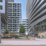
MEC_-_View_1_-_WITH_LANDSCAPING_-_Cropped.jpg


Dedicated two-stage southbound cyclist crossing at Queen and Soho

Whoever produced this render needs to be doored. First, this intersection is presently signalled. It should stay that way, with a *third phase signal* for cyclists to "enter the intersection from the side", as this is a jogged intersection, and to enter it *across the flow* is in violation of the HTA unless treated as multi-point intersection and signalled as such.

But in general, the signalling specifics needed above besides, the NYC example shown would address a huge number of potential conflicts at this and other intersections.

Toronto *just doesn't get* a lot of these concepts. I just rode the Bloor lanes to see if any further improvements had been made. It's worse than ever, and drivers and cyclists alike should all be wearing cowboy hats, it's like the wired west.

Edit to Add:

Here's the Youtube link for Lis' Sneckdown vid, so you can large screen and HD it:

"Daylighting"...I love it...
 
Last edited:
"Sneckdown":

A sneckdown[1] or snowy neckdown[2] is effectively a curb extension caused by snowfall. A natural form of traffic calming, sneckdowns show where a street can potentially be narrowed to slow motor vehicle speeds and shorten pedestrian crossing distances. Coined by Streetsblog Founder Aaron Naparstek,[3] popularized by Streetfilms Director Clarence Eckerson, Jr. and spread widely via social media,[4] the term first appeared on Twitter on January 2, 2014 at 11:19pm EST.[5] Other Twitter hashtags that have been used to describe snow-based traffic-calming measures include #plowza #slushdown #snovered and #snowspace.
[...]
https://en.wikipedia.org/wiki/Sneckdown

There's quite a few articles on-line for "sneckdowns", but it's interesting to see who else is doing this in the Anglo world, and Calgary is already there, as well as the UK: [Edit: From the Calgary article: (A shout out to the Aussies here, who, despite being snow challenged, are way ahead of the curve on this one: as far back as the 1980s, their planners were apparently shaking flour onto city streets in order to reveal traffic patterns.) ]

PressReader - Calgary Herald: 2017-02-24 - OUR TOWN: Sneckdown ...
https://www.pressreader.com/canada/calgary-herald/20170224/282578787815687
Feb 24, 2017 - The term “sneckdown” was coined in 2011 by a New York filmmaker to refer to the untrammelled snow that builds up on the road next to ...
Sneckdown: Using snow to design safer streets - BBC News
www.bbc.com/news/magazine-25788068
Jan 22, 2014 - He first started documenting snowy neckdowns in the 1990s, when opposition to neckdowns in his New York City neighbourhood was intense.
What Sneckdowns Say About Safe Street Design - CityLab
https://www.citylab.com/weather/2017/03/sneckdowns-snow-street-safety.../519990/
Mar 17, 2017 - Eckerson's latest video reveals New York City's epic sneckdowns after snowstorm Stella, helpfully compared to shots of the same streets before ...
Sneckdowns: Using Snow Pileup to Design Better Streets - New York ...
newyorkyimby.com › City Planning
Jan 29, 2016 - A sneckdown, shorthand for snowy neckdown, is a temporary curb ... On average, one New Yorker is killed or seriously injured in a traffic ...
 
Last edited:
If this is really the plan, these bike lanes are woefully inadequate for protecting cyclists.


Screen Shot 2017-04-06 at 8.49.19 PM.png


Screen Shot 2017-04-06 at 8.48.52 PM.png
 

Attachments

  • Screen Shot 2017-04-06 at 8.49.19 PM.png
    Screen Shot 2017-04-06 at 8.49.19 PM.png
    906.3 KB · Views: 347
  • Screen Shot 2017-04-06 at 8.48.52 PM.png
    Screen Shot 2017-04-06 at 8.48.52 PM.png
    960.6 KB · Views: 359
If this is really the plan, these bike lanes are woefully inadequate for protecting cyclists.
Lacking in context detail, but my immediate impression is that I wouldn't cycle along there unless complete out of other options. It's a matter of time until someone gets badly hurt or killed with what I see there. Pedestrians are also vulnerable to vehicles, as well as a cycle/pedestrian conflict.

Hard to define it without staring at it to de-construct it, but at a glance, it's just wrong in a number of ways.
 
Last edited:
Lower Don Trail Update

From this link


img_2770.jpg


With above zero temperatures now the norm, construction crews will be returning to the work site on the Lower Don Trail next week. To facilitate the construction traffic in a safe manner, the section of trail between Pottery Road and Riverdale Park Bridge will remain closed until July 2017.

We apologize for this extreme ongoing inconvenience, but unfortunately the contractors and City project team were previously overly optimistic with the date for re-opening the trail in the spring. City staff have pressed for the trail to be reopened as soon as possible, but with public safety concerns on site, July remains the projected date for reopening.


img_2758.jpg

Belleville Rail Underpass tunnel in progress

On the positive side, major works have been accomplished, such as the installation of the trail bridge at Pottery Road, and more recently the main concrete work for the Belleville Rail Underpass tunnel. The next tasks will include large amounts of soil movement for grading and drainage works. After this, crews will be planting, repairing sections of trail, paving, top soil placement, grading and seeding.

The City is also looking forward to required works by Metrolinx related to their rail crossing, to allow for the connection of the trail across the new Pottery Road bridge to the new Bayview multi-use trail to Rosedale Valley Road.

Glad to see the Belleville Rail Underpass progressing. With it looking likely that VIA trains could be using the Don Branch in the future, this separation between cyclists and trains is important.
 
Lacking in context detail, but my immediate impression is that I wouldn't cycle along there unless complete out of other options. It's a matter of time until someone gets badly hurt or killed with what I see there. Pedestrians are also vulnerable to vehicles, as well as a cycle/pedestrian conflict.

Hard to define it without staring at it to de-construct it, but at a glance, it's just wrong in a number of ways.

Maybe a stupid question. Why do they still use lights on both sides of the street? Why not extend the center pole supporting the LRT wires and have the lights there?

You then eliminate the poles on either side of the street (beautification benefit).

The grassy area between the sidewalks and the street can then be repurposed to make a wider bike lane (with bollards separating it at the roadway)
 
Why not extend the center pole supporting the LRT wires and have the lights there?
Part of the issue is the limitations of the rendering, it's not an engineering drawing. That catenary, for instance, is just plain wrong, unless they have a plan to use something radically different.

You are right though, on 'reducing the clutter' which some older cities (especially European) demand no catenary in historical sections, and LRT has to run on battery power through them.

To flip this over to answer your point on a better way of doing this as per cycle lanes, if there was a physically separated lane, or one located on the grassy area as per your suggestion, it would take more than bollards for me to feel safe, or for others to feel safe on that road, It would have to be a barrier. Instinct alone would alarm a serious cyclist with anything less than that. Cars are going to zoom and weave along there, posted speeds be damned. And the intersection as rendered also has to be addressed.
 
Last edited:
Today council will vote whether to approve new traffic lights at Simcoe & Richmond. This is the intersection of two major bike routes, each with separated infrastructure for bikes.


Screen Shot 2017-04-26 at 12.07.02 PM.png
 

Attachments

  • Screen Shot 2017-04-26 at 12.07.02 PM.png
    Screen Shot 2017-04-26 at 12.07.02 PM.png
    975.1 KB · Views: 367
Why is there no lights here to begin with?

That's a good question. I am always amazed at that intersection that there are no traffic controls of any kind. There are always pedestrians and cyclists headed both ways on Simcoe, waiting for brief breaks in the constant traffic on Richmond, to dash across at high speed.
 
The Richmond lights are a good thing, but lights at Simcoe/Queen and Simcoe/Dundas as well would essentially extend the Simcoe St. bike lanes to College (with a few jogs north of Dundas)
 
Do Nothing is by far the most likely (short-term) solution if council doesn't want to add lights.
Maybe that is a problem. It should be presented as a binary option: Either we put in lights, or we change the intersection to be more accomodating to pedestrians and cyclists.

'Doing Nothing' is unacceptable. If lights are such a problem to suburban councilors, then they are free to argue and vote in support to option B.
 

Back
Top