News   Dec 04, 2024
 440     0 
News   Dec 04, 2024
 390     0 
News   Dec 04, 2024
 753     0 

Beltline Trail

Beltline ‘Lost Stations’ Project

2019 planning statement:
“The Beltline ‘Lost Stations’ Project is a way to highlight the trail’s railway history and the communities it runs through, and to enhance and bring a sense of place to the trail for future generations. Using three ‘lost stations’ between Eglinton and Mount Pleasant as focal point, a design concept is being created to celebrate the historical, cultural and botanical features of the Beltline.”

Preliminary Design (2019 PDF):https://joshmatlow.ca/wp-content/up...LINE-STATIONS-PRESENTATION-PANELS_reduced.pdf

Recent BlogTO post:
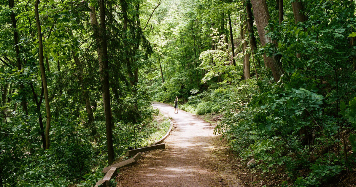
There are 3 “stations” currently under construction - Yonge, UCC and Eglinton. More possible in the future if these are successful.

Josh Matlow's newsletter update yesterday:
"...the construction of the Beltline Trail Lost Station at Yonge and Upper Canada College is going very well and most of the construction should be completed by the end of September, weather permitting. The Eglinton Beltline Lost Station is expected to be completed by the end of the year."

Pic of Yonge on September 11:

0499A611-F7D5-4899-B18A-30046B8B1074.jpeg
 
Last edited:
“The Beltline ‘Lost Stations’ Project is a way to highlight the trail’s railway history and the communities it runs through, and to enhance and bring a sense of place to the trail for future generations. Using three ‘lost stations’ between Eglinton and Mount Pleasant as focal point, a design concept is being created to celebrate the historical, cultural and botanical features of the Beltline.”

Preliminary Design (2019 PDF):https://joshmatlow.ca/wp-content/up...LINE-STATIONS-PRESENTATION-PANELS_reduced.pdf


There will be 3 “stations” - Yonge, UCC and Eglinton. This is Yonge as of September 11:

View attachment 269105

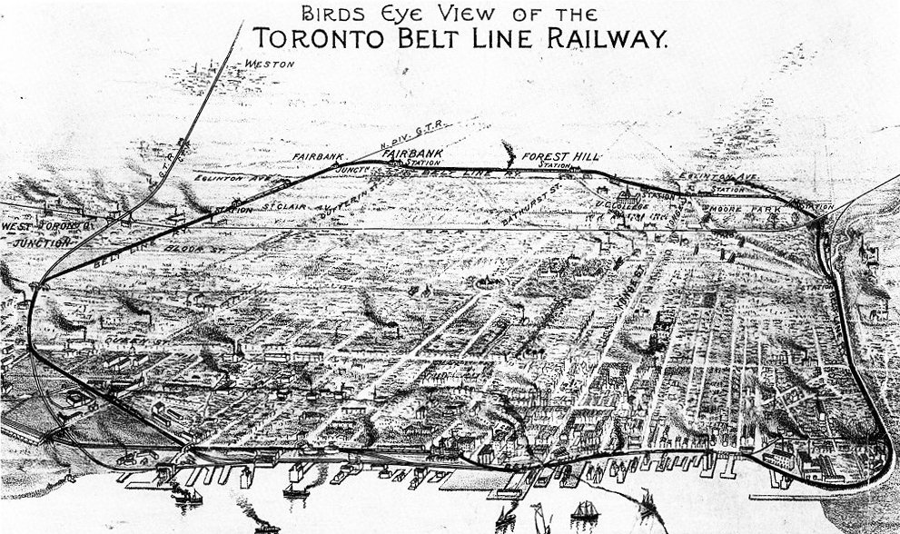
Here is a list of stations along the (Belt Line Railway) Don Loop listed in counter-clockwise order. None of the Belt Line stations exist today.
  • Union Station (GTR) - located at Station Street; not today's Union Station.
  • Church Street on the Esplanade.
  • Berkeley Street on the Esplanade.
  • Don Station (TBL) - a small station located at the south side of Queen Street on the east side of the tracks;[9] not the same building as the Don railway station opened by the Canadian Pacific Railway later in 1896 to replace the TBL station.
  • Winchester Street (TBL)
  • Rosedale Station (TBL) - located near today's Bayview Avenue interchange to the Don Valley Parkway and Bloor Street.
  • Moore Park Station (TBL): Located south of Moore Avenue, Moore Park had a large station that was more ornate than the others. John T. Moore, a vice-president of the railway and an owner of property adjacent to the station, paid $300 for the extra ornamentation. Moore Park Station was demolished by 1945.
  • Yonge Station (TBL) - located on the east side of Yonge Street at Merton Street; also called the Merton Street Station in some sources.
  • Upper Canada College Station (TBL) - small station[10] located near Avenue Road between Upper Canada College and Eglinton Avenue.
  • Eglinton Station (TBL) - located on the south side of Eglinton Avenue east of Spadina Road below the bridge crossing.
  • Forest Hill Station (TBL) - located west of Bathurst Street.
  • Fairbank Station (TBL) - located at Dufferin Street.
  • Fairbank Junction where the Belt Line joined the Grand Trunk Railway line.
  • Unknown station at St. Clair
  • Unknown Station at connection with CPR
  • Spadina Avenue
From link.

Toronto_Belt_Line_Railway_Map.jpg
 
A lot of my friends think they should pave the Beltline. Whats everyones thought on that?

I think its basically nice as is............a nature trail at points.

The only compelling argument for paving, I think, would be if they intended it for heavy winter use AND they were going to salt/plow.

I don't expect that is the case, the south-east portion is in an actual ESA and Ravine and they wouldn't be allowed to there; further west, it often drains into people's yards.

If you're not going to consider it as an all-season trail (at least for bikes), then I say leave it alone.

Unless they use permeable paving. Which Toronto will not use because it would be more expensive than regular paving materials and methods.

 
I think its basically nice as is............a nature trail at points.

The only compelling argument for paving, I think, would be if they intended it for heavy winter use AND they were going to salt/plow.

I don't expect that is the case, the south-east portion is in an actual ESA and Ravine and they wouldn't be allowed to there; further west, it often drains into people's yards.

If you're not going to consider it as an all-season trail (at least for bikes), then I say leave it alone.

I'm on the fence with this one.

The only thing I want is those damn curb cuts! How ridiculous is it that they spent all that money on those special crossings at Avenue, Bathurst, etc and the curbs at many of the road crossings aren't even cut!

Screenshot 2020-09-13 145754.png
 
I'm on the fence with this one.

The only thing I want is those damn curb cuts! How ridiculous is it that they spent all that money on those special crossings at Avenue, Bathurst, etc and the curbs at many of the road crossings aren't even cut!

View attachment 269269

NOT curb cuts, but RAISED bicycle AND pedestrian crossings.

mount-roskill-walking-and-cycling-speedtable-web.jpg

With YIELD (shark's teeth). The motorists will HAVE to slow down at the hump.
From link.

Should be used for both cyclists AND pedestrians.
 
I think its basically nice as is............a nature trail at points.

There's no reason why a "nature trail" couldn't be paved. The outer sections of the Don Valley trail system work quite nicely in this respect with the greenery encroaching right to the edges of the paving.

As for the section below Moore Avenue, however, needs something done to it. The trail there is so heavily used, and with so few delineations to it that it may as well be 50 feet wide in a lot of places. I'm not sure that paving it is the answer, but the status quo isn't either.

Dan
 
I dont understand this project. We are glorifying the lost stations of a failed rail line that was in service for 2 years?
Creates a rest stop for pedestrians and cyclists along the way, with benches, trash cans, and maybe a roof* for sudden thunderstorm downpours.

*Grounded of course for lightning protection.
 
Last edited:
Creates a rest stop for pedestrians and cyclists along the way, with benches, trash cans, and maybe a roof* for sudden thunderstorm downpours.

*Grounded of course for lightning protection.

Then just create some nice shelters. I dont understand the desire to mimic the failure of the Beltline railway in any way.
 
Then just create some nice shelters. I dont understand the desire to mimic the failure of the Beltline railway in any way.
It makes for a more novel pedestrian experience. Regular pedestrian shelters and benches can be boring. Embracing some of the history and providing people with an "oh, that's cool" moment might seem small, but it adds character and makes a city feel more alive than a bunch of arbitrarily placed infrastructure.
 

Back
Top