News   Apr 17, 2024
 1K     0 
News   Apr 17, 2024
 324     0 
News   Apr 17, 2024
 2K     1 

Transit Fantasy Maps

looks great - one suggestion would be to extend R1 to Stoney Creek, which is more similar to the service pattern Metrolinx is planning for Confederation / Stoney Creek GO, which should see the same service level West Harbour gets.
 
Here's my fantasy for how the planned all-day GO train services would be organized. Rather than displaying 'lines' (e.g. Lakeshore West, Lakeshore East) with various services patterns which are not shown on the map, this map displays 'services' (e.g. RE1, R1, S1). This makes it much easier for people to understand the different stopping patterns, as well as the through running which occurs at Union.

This organisation is inspired by DB's Regio and S-Bahn services in Germany. All services can be operated on the infrastructure which is already planned or existing.

View attachment 435950
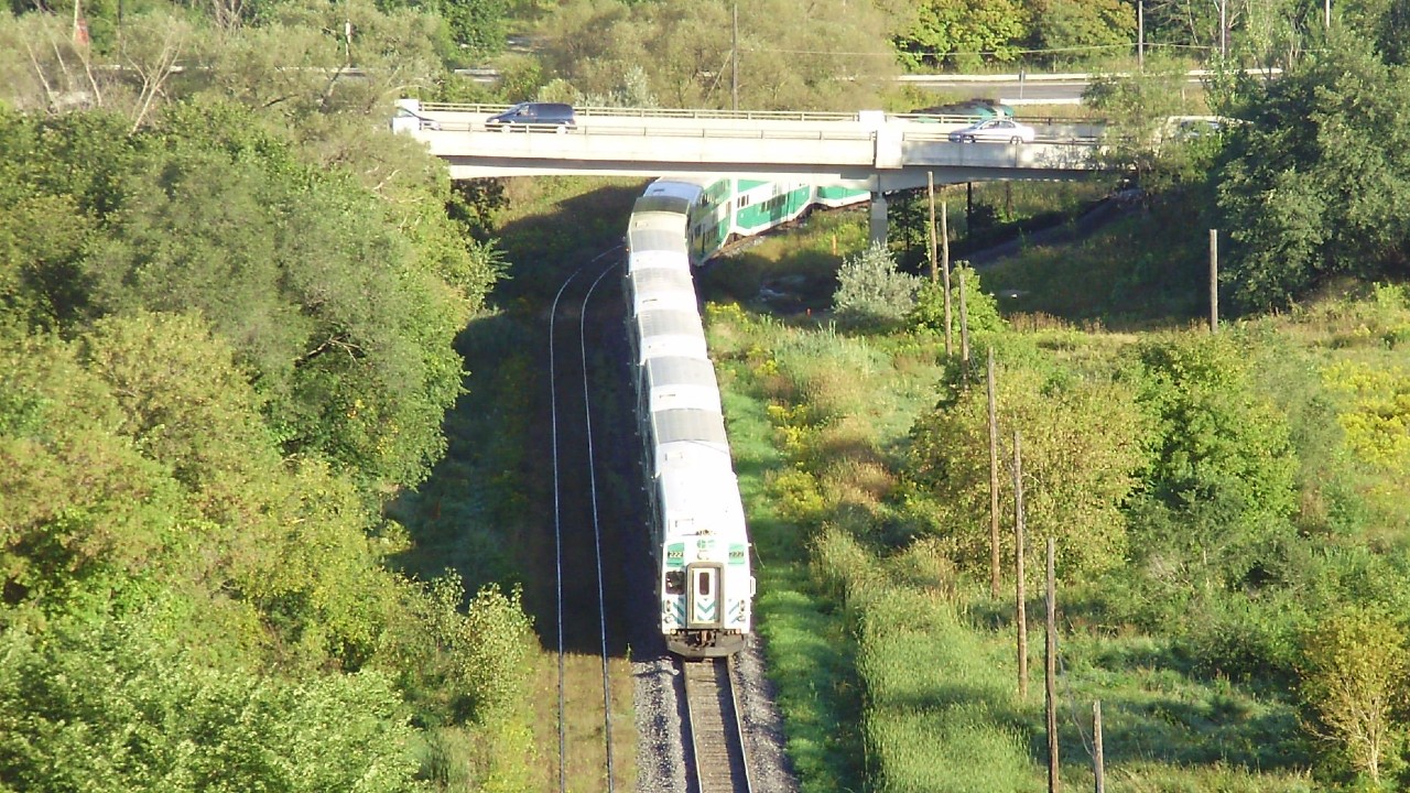
Local services stop at every station along the route. They typically operate every 15 minutes, though on the outer edge of some routes, the service drops to every 30 minutes and alternates with Regional trains to form a combined 15-minute service. They are always operated by electric trains.
Regional services make limited stops within the core service area, and then make all stops in the outer suburbs. They typically operate every 30 minutes. They may be operated by electric or diesel trains.
Regional Express services connect major cities and only stop at key hubs while they overlap with other services. They typically operate every hour. They are always operated by diesel trains.

I also renamed several stations for a couple reasons.

Specify community where station is located:
Old NameNew NameNotes
CasablancaGrimsby
ConfederationStoney Creek
West HarbourHamilton Harbouralso avoid confusion with East Harbour
East HarbourToronto Harbouralso avoid confusion with West Harbour
Allandale WaterfrontBarrie Allandale

Avoid confusion with similarly named station:
Old NameNew NameNotes
ScarboroughScarborough Junctionavoid confusion with Scarborough Centre
EglintonEglinton Eastavoid confusion with Eglinton (TTC)
WoodbinePearson Junctionavoid confusion with Woodbine (TTC)
Mount PleasantBrampton Westavoid confusion with Mount Pleasant (TTC)
BramaleaBramalea Southavoid confusion with Bramalea terminal
OshawaOshawa Southavoid confusion with Oshawa terminal / Oshawa Centre station
Great work! It's clear what each service is for.
Also crazy that riders can only access one line / won't be able to change trains at Front or Liberty Village (not that it's your map's fault).
 
Perhaps this point has been made before, but looking at the official TTC streetcar map today, it occurred to me that it is actually a fantasy map. Due to various construction projects, it currently bears very little resemblance to actual service.
IMG_9758 (2).jpg
 
I mean honestly, this isn't surprising with either Toronto's geography or a budget.

My take is that at the end of the day, the next thing that approaches a downtown connection really is the GO Midtown. Beyond that, what further downtown transit could even be anticipated?

Realistically the possibilities would seem to be:
  • some kind of enhanced surface service on Bay
  • surface imrpovements on the streetcar lines
  • a GO tunnel
  • A second relief line would seem vaguely possible in the long term, being something of a mirror of the OL, entering from a northerly direction and dipping south, but the details are really very vague
    • I wonder if this might actually be most appropriately done with creation of an underground streetcar corridor - a King tunnel inspired by the 1945 Queen plan would actually seem a very nice supplement to the OL
  • Edit: some kind of surface lanes for accessing the Union Station Bus Terminal would seem possibly reasonable, but we probably are headed in the direction of limiting the number of busses going all the way there.
as far as what I could see as an enhanced streetcar network that actually fits with the OL, contemplate something like the below,with today's routes using it, and purely surface routes operating on the core segments only:

View attachment 427900

If we're going to do this, we might as well segregate all the e-w streetcar routes from private traffic, and make the area between the YU subway car-free. We could have multiple branch lines for both the Bay Street and King Street Tunnels.

That way the streetcars become full fledged LRT lines similar to how in San Francisco or the Boston Green Line the various branches of the streetcar metro converge on the downtown core.

View attachment 427916
Theres so much potential for tram lines and bike streets downtown if only we reclaimed space from private vehicles.

I finally found the twitter post that inspired this. I thought it was on this site, but apparently not, its from twitter


1669656544966.png

Queen Street Subway
I feel like this user might be on this site.
 
Generally I like this, but I have some questions and comments. First, what is the diversion going around Dundurn-Locke for? And where would that realistically go? There isn't exactly room around Dundas. Some of these lines are too close together, for visual purposes- Richmond Hill and Stouffville (now just tracks for other services, but I digress) are not the same line, and should have some distance between them. With the number of services in the east, I think you are going to have to further distort the GO map from here. There is not really room to cram this all in without it looking congested. Because many of these are interlined services, why not make the strokes narrower when they converge? I understand you want to show the higher levels of service, but the USRC and RH-Stouffville corridor(s) look kind of silly being this large. Essentially, if you are going to make the map geographically inaccurate, you may as well try to space things out to be as visually appealing and representative of the user experience as possible.
Hello, I created that map! The diversion around Dundern-Locke was mentioned in an old Metrolinx pdf on how to provide two-way all-day service to Hamilton GO Centre, it would've been a line in the middle of the highway right next to the rail corridor. All lines on this map were proposals from the government, or large organisations. If you look a little bit closer, the Richmond Hill and Stouffville Lines are separated, though in my final version of the map I did spread everything out more. I did not make the lines more narrow because I was intentionally copying the official GO Transit map, and making the lines smaller would be too much of a departure from that.
Final version of the map and the BlogTO article about it: https://www.blogto.com/city/2022/11/map-every-go-transit-line-ever-proposed/
 
Hello, I created that map! The diversion around Dundern-Locke was mentioned in an old Metrolinx pdf on how to provide two-way all-day service to Hamilton GO Centre, it would've been a line in the middle of the highway right next to the rail corridor.
Ah, I had no idea! Thanks. Do you have any documents pertaining to this diversion?
 
My updated concept for a Windsor Rapid Transit network. It contains 3 LRT lines and 3 BRT lines and provides coverage to all major areas, including some small suburban centres in Lasalle and Tecumseh.

Windsor Transit 1080p.png
 
My vision for the Toronto subway colour-coded by grade seperation type.

Red = underground
Orange = at-grade
yellow = elevated

This represents existing and planned lines, as well as a few that are my own additions.

I've tried to limit tunnelling as much as possible to minimize project costs. With the exception of the new downtown subway line, most of my proposed lines are almost entirely at grade or elevated.

OVERALL PLAN:
Overall.jpg

Notable lines include:
  • Line 2 extension to Mississauga. Would involve an at-grade extension along the Milton line, a tunelled connection to sherway, then at-grade again along the Milton Line to Cooksville and a tunnel to Square one.
  • OL Extension to Bramalea City Centre. At-grade along LSW corridor, then along the Gardiner, Canpa Sub, Etobicoke Hydro Corridor, Airport Rd, Kitchener Corridor, and through green spaces in Bramalea to Bramalea CC.
  • Dufferin / Lakeshore Subway. This would be a fairly winding route starting at Dufferin and Eglinton, running down to Ontario Place, connecting to Billy Bishop, CityPlace, SouthCore, Union, Queens Quay East, the Portlands, East Harbour, and elevated along Lake Shore East to the Beaches.
  • OL Extension North to Markdale Mall. Elevated along Don Mills, then at grade along the east side of the 404 to Steeles, up a hydro corridor to Downtown Markham, then up Kennedy and along Hwy 7 to Markdale.
  • Yonge Extension to Major Mackenzie - At grade along the Richmond Hill corridor.
  • Spadina extension to Major Mackenzie - Elevated along Jane St.
  • Sheppard West extension - underground to the ravine east of Bathurst, where it would emerge and run elevated to Sheppard West. Not shown, but this could potentially extend elevated into the planned Downsview Airport redevelopment.
  • Sheppard East Extension - in tandem with the west extension, this would convert the Sheppard Subway to OL technology. Would tunnel under the 404 before becoming elevated to Agincourt. Would run at-grade along the Stouffville Corridor under the 401, then use the old SRT corridor to connect over to Centennial College. Would run at grade along the south side of the 401 then elevated along Morningside Avenue to reach UTSC.
A few zoom-ins in key locations:

DOWNTOWN:

Downtown.jpg


SHEPPARD:


Sheppard.jpg
 
My vision for the Toronto subway colour-coded by grade seperation type.

Red = underground
Orange = at-grade
yellow = elevated

This represents existing and planned lines, as well as a few that are my own additions.

I've tried to limit tunnelling as much as possible to minimize project costs. With the exception of the new downtown subway line, most of my proposed lines are almost entirely at grade or elevated.

OVERALL PLAN:
View attachment 448470
Notable lines include:
  • Line 2 extension to Mississauga. Would involve an at-grade extension along the Milton line, a tunelled connection to sherway, then at-grade again along the Milton Line to Cooksville and a tunnel to Square one.
  • OL Extension to Bramalea City Centre. At-grade along LSW corridor, then along the Gardiner, Canpa Sub, Etobicoke Hydro Corridor, Airport Rd, Kitchener Corridor, and through green spaces in Bramalea to Bramalea CC.
  • Dufferin / Lakeshore Subway. This would be a fairly winding route starting at Dufferin and Eglinton, running down to Ontario Place, connecting to Billy Bishop, CityPlace, SouthCore, Union, Queens Quay East, the Portlands, East Harbour, and elevated along Lake Shore East to the Beaches.
  • OL Extension North to Markdale Mall. Elevated along Don Mills, then at grade along the east side of the 404 to Steeles, up a hydro corridor to Downtown Markham, then up Kennedy and along Hwy 7 to Markdale.
  • Yonge Extension to Major Mackenzie - At grade along the Richmond Hill corridor.
  • Spadina extension to Major Mackenzie - Elevated along Jane St.
  • Sheppard West extension - underground to the ravine east of Bathurst, where it would emerge and run elevated to Sheppard West. Not shown, but this could potentially extend elevated into the planned Downsview Airport redevelopment.
  • Sheppard East Extension - in tandem with the west extension, this would convert the Sheppard Subway to OL technology. Would tunnel under the 404 before becoming elevated to Agincourt. Would run at-grade along the Stouffville Corridor under the 401, then use the old SRT corridor to connect over to Centennial College. Would run at grade along the south side of the 401 then elevated along Morningside Avenue to reach UTSC.
A few zoom-ins in key locations:

DOWNTOWN:

View attachment 448469


SHEPPARD:


View attachment 448471
Great plans overall. The only changes i would make would be to keep Sheppard East on Sheppard until just before McCowan (Allowing a connection to the line 2 terminus) and then take it at grade along the CP corridor to Malvern. Also, I would elevate the OL along the Queensway between parklawn and Canpa instead of the Gardiner.
 
My vision for the Toronto subway colour-coded by grade seperation type.

Red = underground
Orange = at-grade
yellow = elevated

This represents existing and planned lines, as well as a few that are my own additions.

I've tried to limit tunnelling as much as possible to minimize project costs. With the exception of the new downtown subway line, most of my proposed lines are almost entirely at grade or elevated.

OVERALL PLAN:
View attachment 448470
Notable lines include:
  • Line 2 extension to Mississauga. Would involve an at-grade extension along the Milton line, a tunelled connection to sherway, then at-grade again along the Milton Line to Cooksville and a tunnel to Square one.
  • OL Extension to Bramalea City Centre. At-grade along LSW corridor, then along the Gardiner, Canpa Sub, Etobicoke Hydro Corridor, Airport Rd, Kitchener Corridor, and through green spaces in Bramalea to Bramalea CC.
  • Dufferin / Lakeshore Subway. This would be a fairly winding route starting at Dufferin and Eglinton, running down to Ontario Place, connecting to Billy Bishop, CityPlace, SouthCore, Union, Queens Quay East, the Portlands, East Harbour, and elevated along Lake Shore East to the Beaches.
  • OL Extension North to Markdale Mall. Elevated along Don Mills, then at grade along the east side of the 404 to Steeles, up a hydro corridor to Downtown Markham, then up Kennedy and along Hwy 7 to Markdale.
  • Yonge Extension to Major Mackenzie - At grade along the Richmond Hill corridor.
  • Spadina extension to Major Mackenzie - Elevated along Jane St.
  • Sheppard West extension - underground to the ravine east of Bathurst, where it would emerge and run elevated to Sheppard West. Not shown, but this could potentially extend elevated into the planned Downsview Airport redevelopment.
  • Sheppard East Extension - in tandem with the west extension, this would convert the Sheppard Subway to OL technology. Would tunnel under the 404 before becoming elevated to Agincourt. Would run at-grade along the Stouffville Corridor under the 401, then use the old SRT corridor to connect over to Centennial College. Would run at grade along the south side of the 401 then elevated along Morningside Avenue to reach UTSC.
A few zoom-ins in key locations:

DOWNTOWN:

View attachment 448469


SHEPPARD:


View attachment 448471
If we're talking fantasy, I'd like the following blue subway line added to downtown.
Add Spadina King Sherbourne Line.png
 
I really do like this a lot, but I’d want to consider that southern relief line being built as streetcar tunnels with through routing and surface running further up Dufferin.
 
If we're talking fantasy, I'd like the following blue subway line added to downtown.
View attachment 448744

At one point I had come up with a plan that was basically a bunch of nested 'U' 's each line getting wider E-W as they moved North until they reached the entirely flat Bloor line. The lines I had were.

- King: From St Clair W station (Connection with YUS Line) South on Bathurst, East on King, North on Parliament/Bayview stopping at Pape/Donlands/Millwood (Interchange with the Queen Line)
- Queen: From Eglinton W Station (Connection with YUS and Eglinton Lines) South on Dufferin, East on Queen follow the rail corridor NE, N on Pape railway corridor again, Don Mills. Ending at Don Mills station (Sheppard Line)
- Dundas: From VMC Station (Connection with YUS Line) South on Jane/Weson/Keele/Dundas, East on Dundas, North on Woodbine/O'Conner, Ending at Eglinton & Victoria park (Interchange with Eglinton and College Lines)
- College: From Pearson Airport (Connection with Eglinton Line) East on Dixon, South on Weston/Jane, East under High Park, East on College/Carlton, Cross the Don, East-North East along the rail corridor, North on Dawes/Victoria Park, East on Ellesmere, Ending at Mccowan (interchange with Bloor-Danforth and extended Sheppard line)

But it was a purely Fantasy proposal
 
Per @Northern Light 's suggestion:

Interesting post and interactive map by @Reecemartin :

Soooo many flaws with this proposal.. running 7-minute headways on an active CP line? A 700m+ ped bridge to connect a station in said rail corridor to the nearby Ontario Line station? Massive expropriation to build long trenches/tunnels in wealthy suburbs?

All of this to basically copy+paste the Ontario Line alignment 1.5km west? I like the changes to station placement on the north end of the line, but the cost of this thing overall would be waay more than how its being presented.

FWIW, I think most of the benefits could be achieved by just extending the Ontario Line above ground to Oriole/Leslie Station. Or even, extending it to where Don Mills meets the RH corridor (just south of Bond Ave.) and making a new interchange there. They can (and I believe.. are/have?) building new passing tracks on the MX-owned part of the corridor, and can create some layover areas near the DVP and up near Steeles to run pretty frequent service on the publicly-owned part of the corridor. Run some peak-hour express trips from RH Centre to Union (with 1-2 intermediate stops) and run more frequent DMUs between the Ontario Line and Steeles (and beyond to RH Centre as much as possible) during the daytime.
 

Back
Top