News   Apr 26, 2024
 2K     4 
News   Apr 26, 2024
 437     0 
News   Apr 26, 2024
 1K     1 

General cycling issues (Is Toronto bike friendly?)

Just because it looks nice on a map doesn't mean it's useful in any way. I'm not a fan of the multiuse paths next to streets since I usually bike at 30km/h+ and those paths are very dangerous at intersections when going at those speeds. When riding from Northwest Brampton, I usually end up just using Kennedy and then Matheson to get into Toronto.
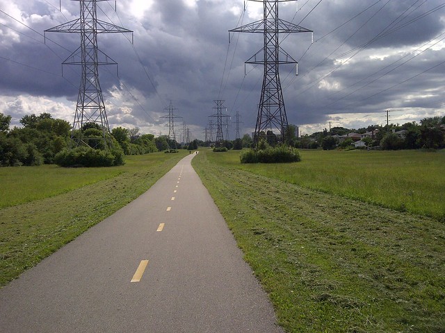
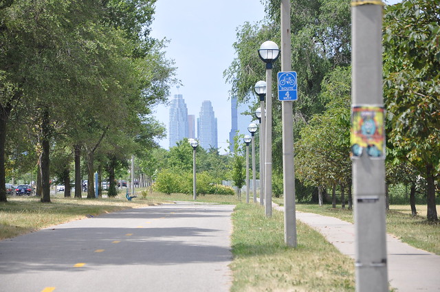
I've got to agree completely. If your intent is to get from one location to another, and 'fly' doing it, dedicated trails, especially Rail Trails are the way to do it, albeit you can also take your time. This is why I differentiate between 'municipal bike paths' and actual 'trails'. It does not follow that on actual trails you don't observe all rules of etiquette and safety, you must...and also common sense for your own well-being, like carrying water, maps (I also carry a compass and tools, spare tube and folded tire) insecticide and perhaps sun-block. They don't weigh that much, but are insurance against eventualities.

One of my greatest beefs with the much touted route along the Lakeshore (I forget what it's called now) is that it meanders and is slow speed. Some back roads and almost all Rail Trails, you can make incredible time on by sustaining a pace, something you can't do on park paths. And I'm going to state something anathema to my own expressed love for trails.
Just because it looks nice on a map doesn't mean it's useful in any way. I'm not a fan of the multiuse paths next to streets since I usually bike at 30km/h+ and those paths are very dangerous at intersections when going at those speeds. When riding from Northwest Brampton, I usually end up just using Kennedy and then Matheson to get into Toronto.
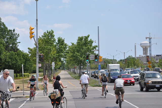
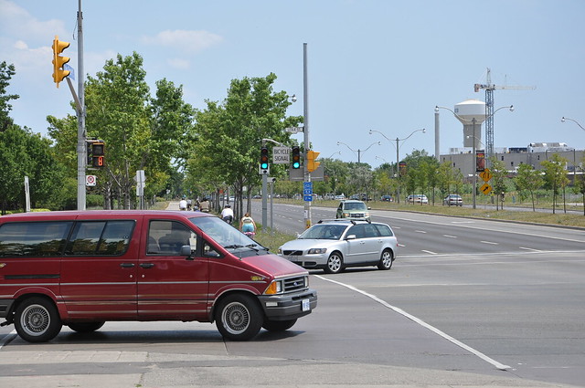
I state this with provisos, but I agree completely, as much as I hate dealing with cars, sometimes better the devil you know than the one you don't. 2000 nails it. As odd as it must sound, there's much greater *predictability* dealing with cars than other urban cyclists, or on paths that continually intersect roads with drivers turning. When there's a bike lane on a road next to a busy bike path adjacent (as occurs a lot on the Lakeshore path around the Exhibition) I take the road.

That being said, I'll take the Rail Trails out of town any day! (And some very quiet back roads). There's very few ways to safely cycle out/into Toronto. Which means taking GO to where the safe roads/trails start.
 
Last edited:
I stopped taking the Waterfront Trail between Mimico and Port Credit and now take Lakeshore. The Martin Goodman Trail is pretty good, it doesn't meander, and it's fairly wide. At traffic signals, cyclists are permitted and expected to ride through the crossings. If I head west, I start my ride early enough (at 10 and 11) that the trail isn't super-packed by the time I use it. I'll continue through to Mimico, but will often take Marine Parade Drive now instead of the Humber Bay Shores segment.

Sometimes I take the improved Waterfront Trail between Port Credit and Clarkson, ignoring the "dismount to cross" signs along the side-of-road alignment, but keeping my eye out for motorists at intersections. I never go that fast; when I'm riding, my speed averages 20 km/h, though I'll ride faster on some streets and slower on busy paths and trails.
 
The "Waterfront Trail"...that's it! In town, it's useful, what I've long ago learned to not use it for is distance, as going east, it has to go all over the place to get around Frenchman's Bay, and many other obstacles. When it was first being promoted, I figured "wow, I can cycle to Port Hope and further on it". lol...no such luck, they hyped it far beyond its actual usefulness, and I realize they have improved sections, some of which I used to use anyway, e.g. along Lakeshore Rd from Newcastle to Port Hope (I used to live near Port Britain as a kid for a few years) but if you really want to make time on back roads, you pretty much have to get north of Hwy 7 on the east side of TO.

What readers might want to consider is renting a van w/ driver (like Joe your handy local mover guy) to take a group of you out of town, drop you off at a trailhead (GO buses can only take two bikes, albeit most drivers will allow you to load a third/fourth underneath if it's an MCI coach) (some double decker drivers will load a bike in the rear space, but best you know them to ask to do that) and take a GO train back into TO (two bikes at each end of most of the cars). Say you pay your lift $100, and there's five of you, that's $20 a piece, for an incredibly fun day. You might consider arranging to be picked up too, but it's rare you arrive when you think you are doing distance.

I'll detail more on this later, but with groups, only one person needs to carry tools, someone else carry food/drink, and so forth. Spread the load. I'm trying to get my old Psyche-Cycle group back together, some of them are too old, so the numbers have dwindled.
 
The main problem I see with multi-use paths is that bicyclists, like me, want to use it as transportation, meaning fast riding. Many of the paths seem to be designed by non-bicycle users, thinking it would be used for a s-l-o-w recreational pastime and will be used at a leisurely pace .
 
I also think that once out of the city, on real Rail Trails for instance, those on foot (mostly hikers) tend to be much more aware of protocol and etiquette, as do most of the cyclists. The norm on proper trails is 'awareness'...something you rarely get on urban multi-use trails.
 
Mild Alert!

I did the GO train to Malton today, the West Humber Trail is better than ever, it's been five years + since I did it last, and as ShonTron states, the road from Claireville Reservoir under the 427 is now seamless, I remember picking my way past dead syringes and sharp rocks getting under that stretch, all very well up that end...but the Trail is hopelessly blocked going under the 401. Next time, I'll try the Weston Rd side diversion, today I gambled wrong, took the Islington diversion. Yikes! Nirvana absolutely shattered...

Ya know, this is the Don Valley blockage all over again. They might as well post "You can't fugging come in so fug off". At least it would have more passion than what they do post.

Who runs these departments? Do they give them IQ tests, and if they fail, they get the job? Anyway, what an incredible day, got to get out do more miles, but would like to hear of creative diversions on the Humber Trail.

Confession: I had every intention of taking GO to Guelph and cycling down to Hamilton, take the Express back into TO...but the thought of two hours + on GO is enough grounds for divorce, let alone a day trip.

In the event, the West Humber was an exquisite choice, detour besides.
 
Last edited:
Is this what Denzil Minnan-Wong and his clique of anti-bicyclists on council are so afraid, very afraid of:


Afraid of turning more parts of Toronto's streetscape over to the bicycle?

Yes. That is exactly what DMW is afraid of.

“My concern is … the creep that there be bike lanes all across Bloor; you know, from one end to the other. Are there going to be bike lanes on the Danforth next?”
 
Yes. That is exactly what DMW is afraid of.

“My concern is … the creep that there be bike lanes all across Bloor; you know, from one end to the other. Are there going to be bike lanes on the Danforth next?”
lol...did he really say that? What a &^%$ing loser...
 
lol...did he really say that? What a &^%$ing loser...

Yea he really said it. And yet this is the guy that John Tory picked as deputy mayor, and appointed to over a dozen committees.

image.jpg
 

Attachments

  • image.jpg
    image.jpg
    87.4 KB · Views: 412
The main problem I see with multi-use paths is that bicyclists, like me, want to use it as transportation, meaning fast riding. Many of the paths seem to be designed by non-bicycle users, thinking it would be used for a s-l-o-w recreational pastime and will be used at a leisurely pace .

I don't think this is so much the case anymore. New paths still have issues of course, but they are good enough that there is clearly some thought going into them. The Finch Hydro Corridor bike path (built 2011-present) is a good example. There are very few pedestrians, and those that do exist are easy to overtake safely thanks to the clear markings (dashed centre line with directional arrows) and the path's generous width. At intersections, the path always has a dedicated bicycle crossing with bicycle signals. Whereas many older paths are little more than widened sidewalks, the 400-to-Yonge segment of the Finch Path is is more like a miniaturized two-lane highway.
27910983995_1a9139b907_z.jpg


I often cruise at 40km/h along that path, and have never really encountered any issues. Of course I slow down and ring my bell if there is any indication of unpredictability (such as kids), but for an average jogger or pedestrian it suffices to just move over into the opposite lane.

Just because it looks nice on a map doesn't mean it's useful in any way. I'm not a fan of the multiuse paths next to streets since I usually bike at 30km/h+ and those paths are very dangerous at intersections when going at those speeds. When riding from Northwest Brampton, I usually end up just using Kennedy and then Matheson to get into Toronto.

It's quite possible to make a side of road path that is perfectly safe, they're all over the place in the Netherlands. The highest-scoring bike path I've ever reviewed is even a side-of-road path. The mid-block design is pretty easy, just make sure the path is wide enough, and if there are a significant number of pedestrians then provide a sidewalk as well.

27835527461_334234cbb9_z.jpg


But at intersections, conflicting left turns absolutely must be fully-protected, since drivers would otherwise be looking up the road for a gap, unaware of a bicycle coming from behind at 30 km/h. And here should also be some measures to manage right-turn conflicts, such as protected signals and right-on-red prohibitions.

Unfortunately I've not seen any best-practice examples in Ontario. We sometimes get the mid-block cross-section right, but then at intersections cyclists just get dumped onto the sidewalk. I think the best example I've seen is the Lakeshore Blvd East north-side bike path, since it has a separate sidewalk, one of the intersections is protected from left turns by a dedicated signal (Leslie), and one of the intersections prohibits the conflicting right turns on red (Carlaw).

27835545001_d96646d6ca_z.jpg


Unfortunately, there are no measures to manage conflict with right turns off Lakeshore, and those aforementioned turn restrictions are only at one intersection each. Also, the path is not always delineated through the pedestrian conflict area, which results in annoyed pedestrians and disrupted cycling flow.

27299277823_3e96c52980_z.jpg
 
I don't think this is so much the case anymore. New paths still have issues of course, but they are good enough that there is clearly some thought going into them. The Finch Hydro Corridor bike path (built 2011-present) is a good example. There are very few pedestrians, and those that do exist are easy to overtake safely thanks to the clear markings (dashed centre line with directional arrows) and the path's generous width. At intersections, the path always has a dedicated bicycle crossing with bicycle signals. Whereas many older paths are little more than widened sidewalks, the 400-to-Yonge segment of the Finch Path is is more like a miniaturized two-lane highway.
27910983995_1a9139b907_z.jpg


I often cruise at 40km/h along that path, and have never really encountered any issues. Of course I slow down and ring my bell if there is any indication of unpredictability (such as kids), but for an average jogger or pedestrian it suffices to just move over into the opposite lane.
That's a beautiful path (although those dark clouds would make me want to move quickly!). Out of curiosity, if I were to try to string and out-and-back or loop ride up to the trail from downtown, what's the best way to get there? Any good cycling infrastructure to reach it?
 
Unfortunately I've not seen any best-practice examples in Ontario. We sometimes get the mid-block cross-section right, but then at intersections cyclists just get dumped onto the sidewalk. I think the best example I've seen is the Lakeshore Blvd East north-side bike path, since it has a separate sidewalk, one of the intersections is protected from left turns by a dedicated signal (Leslie), and one of the intersections prohibits the conflicting right turns on red (Carlaw).

I just saw someone fall off a bike and get hurt on Saturday on this bike path on Lake Shore when I was walking along it. There is a railway track crossing the bike path near Carlaw Avenue, and the bicyclist hit it and fell over. Fortunately the bicyclist only got a few cuts and bruises. But this clearly shows how much of a hazard streetcar tracks are for bicyclists in Toronto, and why bicycling is dangerous.
 

Back
Top