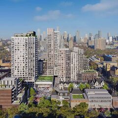
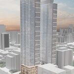
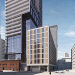
At the recent Bloor and Bathurst public consultation held by Westbank Corp for their proposed redevelopment of the Honest Ed's and Mirvish Village site, besides a ballroom full of presentation boards, there was also a wooden scale model of the Henriquez Partners Architects design for the project. The model—which we did not feature in our first article yesterday—helps the viewer get a sense of the scale of the project as it allows comparison with the surrounding built form of the city.
It's no surprise that whenever a developer proposes taller, denser buildings than those being replaced, there will be local opposition to the new height, as well as questions about the strain the project could put on local infrastructure. Frequent readers of UrbanToronto will be well aware of the City of Toronto's initiatives to intensify development at major intersections and near rapid transit stations. It's something that Ontario's Places To Grow Act mandates as a way of making cities more efficient, of reducing everyone's carbon footprint, and of saving farmland from conversion into tract subdivisions. The message sounds counter-intuitive to some people who would rather not see the city getting any bigger, but by building bigger and taller in our cities we actually take pressure off the environment compared to the sprawling suburban-style development which was prevalent before the greenbelt was put in place around Toronto.
The question is still, however, how big is the right size when you're intensifying in at the midst of an existing neighbourhood? That's something which will be worked out over the next months as the public consultation and Planning Department scrutiny of the proposal progresses. Formulas will be applied, and after weighing all the pluses and all the concerns, the Planning Department will ultimately either recommend approval or may negotiate on some of the numbers.
We can get a better handle on the proposal with a through look at the scale model, seen below from many angles in a 2-minute video, and by considering 3 of the presentation boards from Tuesday night which concern scale, massing, and shadowing on the neighbours.
The Bloor and Bathurst proposal includes many small buildings side-by-side. The three tallest would be 21, 22, and 29 storeys, with the tallest at the corner of Bloor and Bathurst itself, closest to the subway station. Across all corners at this intersection are lower-rise commercial buildings. The City is currently studying the intersection's potential for redevelopment with the Bathurst Bloor Four Corners study, which you can read up on here.
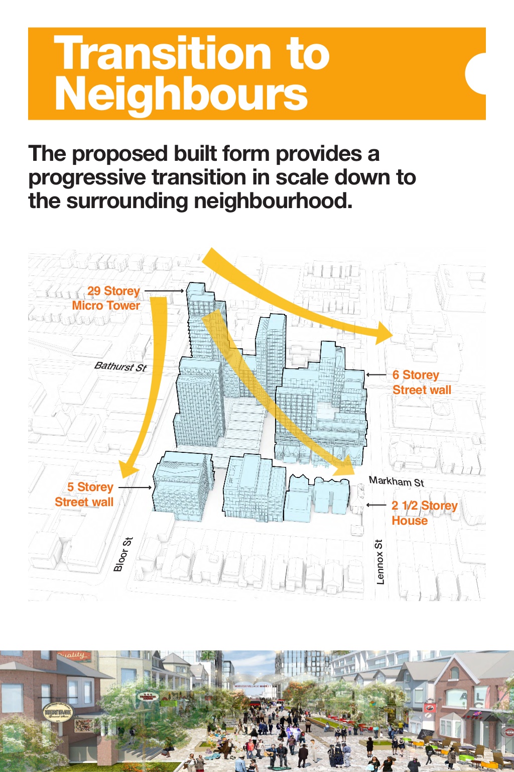 Height transition: Presentation board from the Bloor and Bathurst public consultation, image courtesy of Westbank Corp
Westbank's Transition to Neighbours presentation board shows how the buildings are massed, with heights gradually decreasing as one moves west or south from the Bloor-Bathurst intersection. This is meant to keep the new buildings from looming over the adjacent low-rise homes west of Markham Street and south of Lennox Avenue, as relatively short buildings would be built close to these edges of the development.
The next board addresses "loom" another way, looking at how big these buildings are, and how far apart they are spaced.
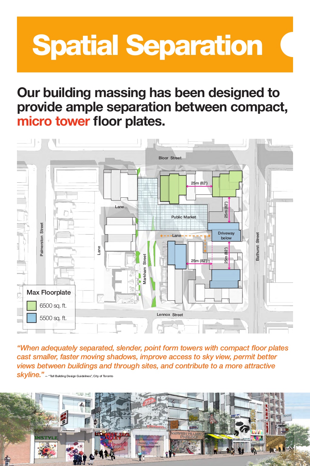 Separation: Presentation board from the Bloor and Bathurst public consultation, image courtesy of Westbank Corp
The Spatial Separation presentation board shows that two of the taller towers (in green above) are proposed with 6,500 square foot floor plates. This is less than the 7,500 to 8,000 square feet that the City normally sets as a maximum for point towers. Three shorter buildings (in blue above) are even smaller, with only 5,500 square foot floor plates. The trim size of these buildings promises shorter and narrower than normal shadows and more "sky" when looking up—essentially a smaller visual impact than what we get from the vast majority of what normally gets built in Toronto.
The presentation board also shows that each of these buildings is 25 metres from the next, which is the City's minimum recommended separation distance from tower to tower, ensuring some privacy for residents, adequate sunshine reaching the units, and minimal shadowing from adjacent buildings.
Speaking of shadowing, how would the new buildings effect their surroundings shadow-wise? The Shadow Studies presentation board below gives a partial look at the answer.
The City asks for shadow studies to be completed for new projects which show where new shadows would be cast (known as Incremental Ground Plane Shadows in the maps below) on March, June, and September 21 of each year. Shadows are longest in December of course, and can be so long already that there's little point in considering additional shadowing then: there's nothing growing outside, and people aren't typically sunning themselves in their backyard then either. In June, the sun is at its highest and the shadows are shortest and fairly negligible, so that leaves he equinoxes of the year in March and September when the sun is throwing an average shadow.
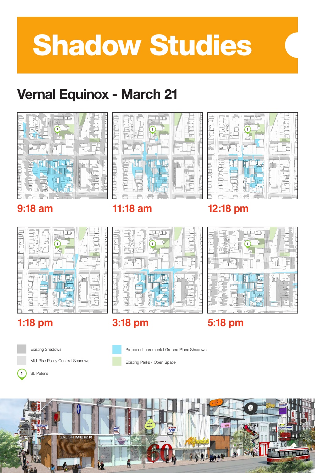 Shadows: Presentation board from the Bloor and Bathurst public consultation, image courtesy of Westbank Corp
In the maps above you can see in light blue where new shadows will be falling at six times during the day on March 21 (and on September 21; it's the same). (Click on this or any image to see it larger.) The light green areas on the maps are nearby open space, which the study shows will not be impacted by new shadows.
It's this shadow study (along with further shadow maps), and other studies including ones on transportation, wind, and more which will help the City decide whether or not it considers the proposal to be good planning. As more information becomes available in the coming weeks and months, it will be made available on the City's Community Development web page for the area, and likely on Westbank's page as well. There's much more on Westbank's page already, which can be accessed here.
Want to know more about the proposal now? We have many renderings posted in our dataBase file for the project, linked below. Want to talk about it? Choose the associated Forum thread link to get in on the conversation, or leave a comment in the space provided on this page.

 2K
2K 


