News   May 02, 2024
 1K     2 
News   May 02, 2024
 483     0 
News   May 02, 2024
 359     0 

Miscellany Toronto Photographs: Then and Now

There are actually some interesting ghost stories about Queen's Park that suggest some of the prior patients still wander the halls, particlarly the downstairs hall by the cafeteria. See torontoghosts.org for other stories about Toronto area "haunts", no pun intended.

Doors Open this year was supposed to revolve around the ghost stories like this. I was disappointed that the theme seemed to have been dropped. At least when I was there.
 
TNKingstonatMcNabc1962_zps44bb99c5.jpg
 
My very first post (#41) on UT, a little more than 5 years ago, outlined the history of "College Avenue", and its parallel road way "University Street":

http://urbantoronto.ca/forum/showthread.php/9540-University-Avenue-Toronto-s-Grand-Avenue/page3

1890 Goad Atlas:


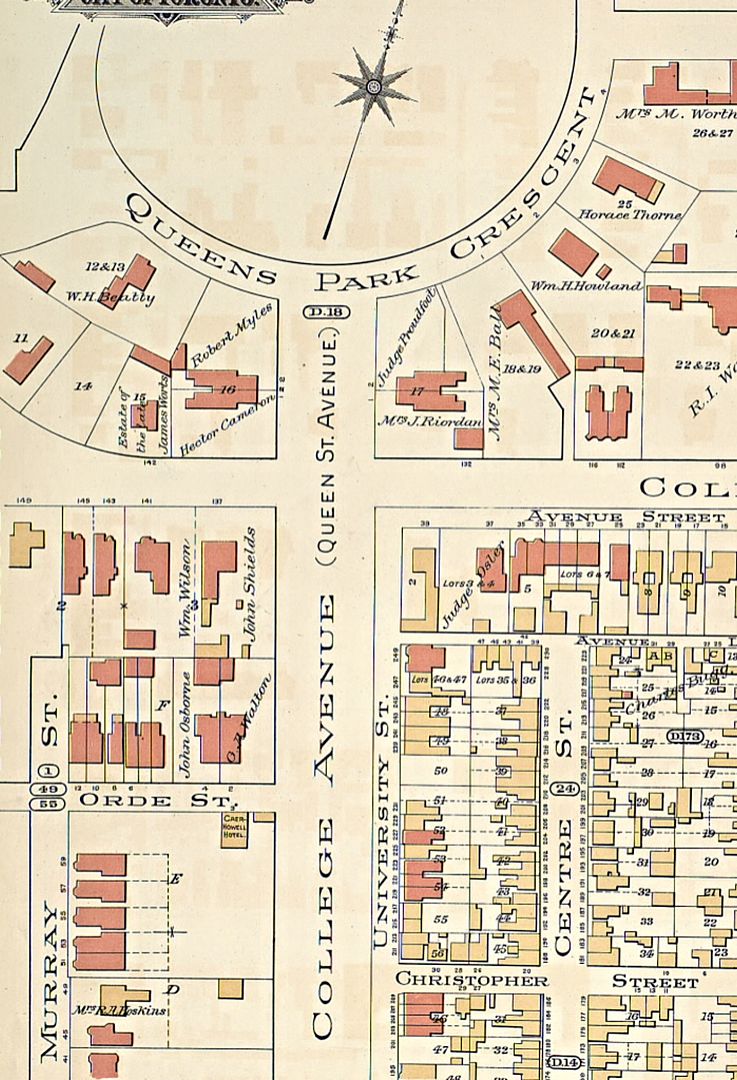
The name "University Avenue" appears for the first time in the 1899 edition of the Goad Atlas.

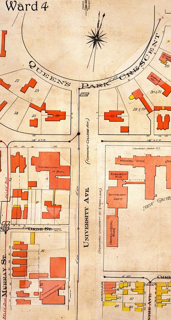
On the 1924 map, it makes reference to "Park Lane", (a name which appears on the 1858 Boulton map, but none of the Goads) further confusing the issue:


However, the 1874 Hart Rawlinson Compilation map shows a dotted line running up the centre of "College Avenue", which undoubtedly determined the centre-line of the future Provincial Legislature Buildings and the statue of John A., illustrating again why the centre medians of today's University Avenue are "off-centre" with both the statue and the provincial parliament buildings.


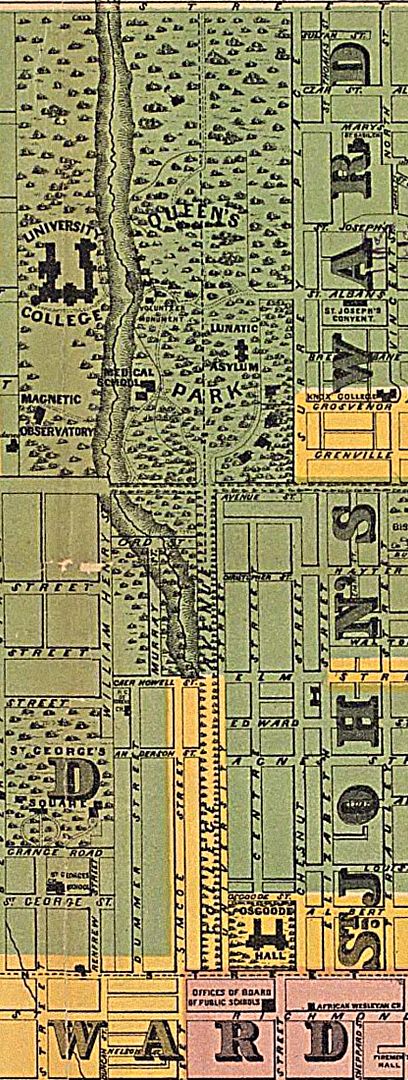
http://oldtorontomaps.blogspot.ca/2013/01/1874-hart-rawlinson-city-of-toronto.html

Love the "Lunatic Asylum in the the 1874 Hart Rawlinson Compilation map" !!!
Hasn't changed much in 140 years! ;<}}
 
Then, late 70s, early 80s.. Front and Church S.E. corner.


1248_zps5f7c5259.jpg


Now. March 2014

1249_zpsa68bd3b2.jpg

Your earlier pic, Mustapha, and the glimpse of Redpath Sugar, reminds me once again what an urban design (and architectural ) disaster it was to build that parking garage and social housing building at the foot of Church Street, thereby blocking the view of the water enjoyed by most other north-south streets. Unfortunately, a building that will probably be with us for quite a while....

1910:


1913:


1910: Church Street Slip (note St. James spire behind):


Filling in the slip, 1927:

churchslip.jpg
 

Attachments

  • churchslip.jpg
    churchslip.jpg
    99.9 KB · Views: 870
Last edited:
Your earlier pic, Mustapha, and the glimpse of Redpath Sugar, reminds me once again what an urban design (and architectural ) disaster it was to build that parking garage and social housing building at the foot of Church Street, thereby blocking the view of the water enjoyed by most other north-south streets. Unfortunately, a building that will probably be with us for quite a while....

One of the proposals in the Lower Yonge Precinct Plan that is coming to the TEYCC in August will be to create a street under the rail berm linking Church with Cooper. Undoubtedly the (very ugly) parking garage will not go anywhere (and people live upstairs) but the St Lawrence Neighbourhood Improvement Plan had a recommendation (Project 7) to 'do something' with the north side of it (See: http://www.toronto.ca/legdocs/mmis/2008/te/bgrd/backgroundfile-9479.pdf ) This may be the stimulus to 'do something' and also develop the equally ugly surface parking lot at The Esplanade and Church.
 
How did they fill in all that land south of the railway tracks? Was it just fill from digging the foundations for all the skyscrapers? Where did they get all that fill? How was it made stable enough to build 40 storey buidings on?
 
Last edited:

Back
Top