News   Apr 26, 2024
 2.3K     4 
News   Apr 26, 2024
 562     0 
News   Apr 26, 2024
 1.2K     1 

Brampton Transit/Zum

Grrrr. 32 minutes! Me no like.

The only mitigating factor that least this is for only a few hours between weekday rush hours (rather than over a full day), but 32 minutes don't sync with the schedules of other routes from the terminal.
 
The 511 will not be servicing Signal Hill Ave, unless the online schedule is incorrect? The 511 will travel down Finch Ave, and won't connect with the 60.
 
For 53/54, might be better to have them operating in the same direction, for combined 16 minutes.

I'm still shocked that BT adjusted route 10 and it is still so useless, arguably even more useless than before. How is anyone supposed to use this route? Like, if someone lives near Shopper's World, and they are coming home from their workplace on Orenda/Rutherford, they are supposed to ride Route 10 all the way to Bramalea City Centre and back down to Steeles to connect to 11? Who would do this? Route 40 has similar problems.

BT needs to get rid of both these routes and instead provide full two way service on Rutherford S and maybe convince MT to extend the 51 Tomken along West Dr to the Bramalea terminal, because off hand I can't think of any worse route designs in the GTA than BT routes 10 and 40.
 
Last edited:
The final layout of the new terminal is posted on-line:

http://www.brampton.ca/EN/residents...ents/1072 Gateway Terminal Brochure_Print.pdf

I haven't been by there for a while, but I'll see about visiting during opening week. The layout is generous to fit all the buses (unlike the two previous Shoppers World terminals), it's a very short walk to the GO buses to Union Station, it's efficient for operations and the signals at both entrance and exit should make it easy for buses to arrive and depart, though I wonder how it will mess up the local traffic adding more signals and buses pulling in and out. It would be nice to see the parking lot in front of the new Target to accomodate pedestrians to Shoppers World.

Long-term, I understood the 53 and 54 would be pulled apart and the 54 James Potter extended to the north west (which, as I was once told, is why it was named James Potter and not Charolais).
 
Last edited:
Wow that's actually quite an interesting design. I like that the Southbound Main/Hurontario buses are on the street, and the Westbound Steeles buses are on the street as well. Seems so...logical!

Nicely done.
 
Wow that's actually quite an interesting design. I like that the Southbound Main/Hurontario buses are on the street, and the Westbound Steeles buses are on the street as well. Seems so...logical!

Nicely done.

I agree. It seems designed with bus flow first are foremost in mind. The L shape is a pretty unique shape for a terminal. Just speaking from my experience in Ottawa, most Transitway stations are either side or island platform stations in a straight line.

Also, the design would fit quite well with having an in-median LRT station connected via underground walkway. I can see this becoming a pretty big intermodal point along the Hurontario LRT.
 
Another thing I like is that pedestrian "desire lines" are recognized, with three official, marked ways to access Shoppers World, and a new pedestrian crossing of Main Street. The old terminal on Steeles had signs that supposedly prohibited pedestrians from walking into the terminal from Steeles (and the long way around), but no one would follow that and cut through the short way across a wide asphalt bus driveway. The entrance in and out from Steeles via the signalized general mall entrance/exit was always jammed with cars and buses (especially with the 3-way stop at a four-way intersection, with the popular Oceans supermarket there), and this takes care of that.

The constricted L-shape is due to land availability (but an efficient and intuitive layout), but yes, it is built with the future LRT in mind, though I doubt an underground passage will ever be part of that.
 
Had my first look at Shoppers World new Terminal and it will not be 100% complete on Nov 26 opening day. Work will be taking place next week to finish it as well plant the trees.

Very cheap way of building it by using the curb lanes as loading bays on the 2 streets with a small portion of SW land being used for the terminal.

The shelters are more wind breaker and very cheaply constructed.

The area is still fence off from the sidewalk as well the new Target parking lot. Don't think the walkway on Target parking lot will be open to the public with construction taking place on the old Zellers.

As to the comment of a tunnel from the LRT platform to the terminal is not going to happen as it was never in the plan as well being to costly in the first place. Since the stop is an centre platform, riders can access it at Steeles Ave and possible at the north end.

It will be interesting to see how riders and buses handle this terminal next week.
DSC_2012326239.JPG

DSC_2012326236.JPG

DSC_2012326246.JPG

DSC_2012326249.JPG

DSC_2012326232.JPG
 
The walkway along the north side of Target is not complete or open at this time as well the other one.

The finishing work is taking place during the night and still a lot to do. A quick video.
[video=youtube;-U2CAg9CeWM]http://www.youtube.com/watch?v=-U2CAg9CeWM[/video]
 
Since Target won't open until February or March, that's not such a big deal, though the walk to the next closest mall entrance is annoying for now, especially in winter.

The shelters aren't great, but since there's a full-length canopy, it's not too bad, and yes, the glass panels appear to be wind blocks (which are of some use). But the indoor area at least has warmth/air conditioning and there's next bus displays inside.
 
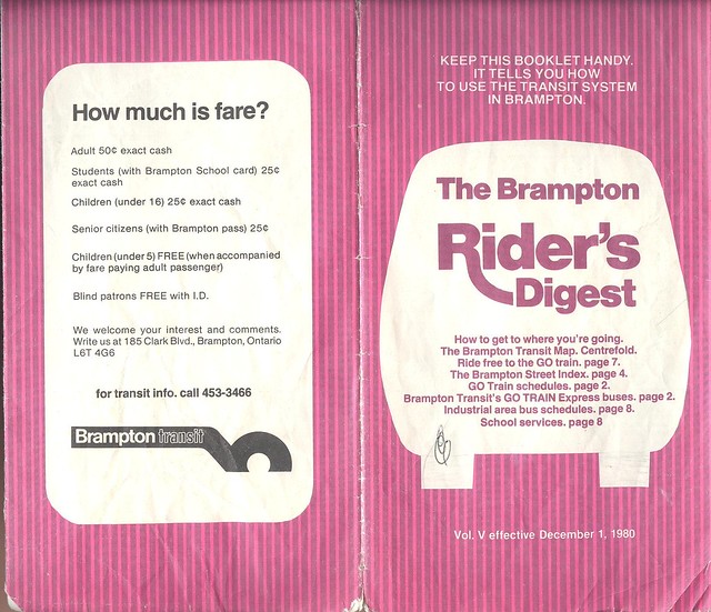
I've scanned my copy of the 1980 Brampton Transit map, and plan to scan more over the next little while. Enjoy!

8330481244_01abd0078c_z.jpg


Click for larger image:


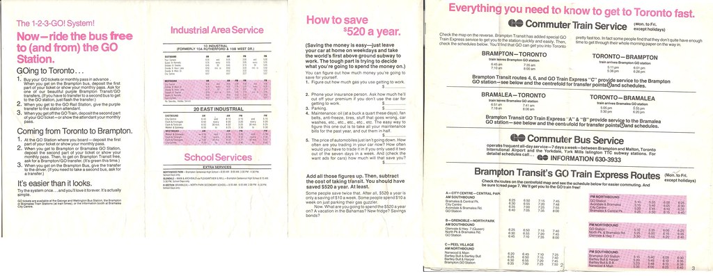
I also scanned most of the back, which has the GO Train schedule, an explanation of the free GO transfer (in the period before GO was POP) and a call to ride "the world's first above ground subway".

 
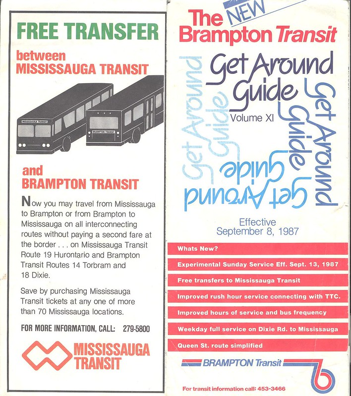
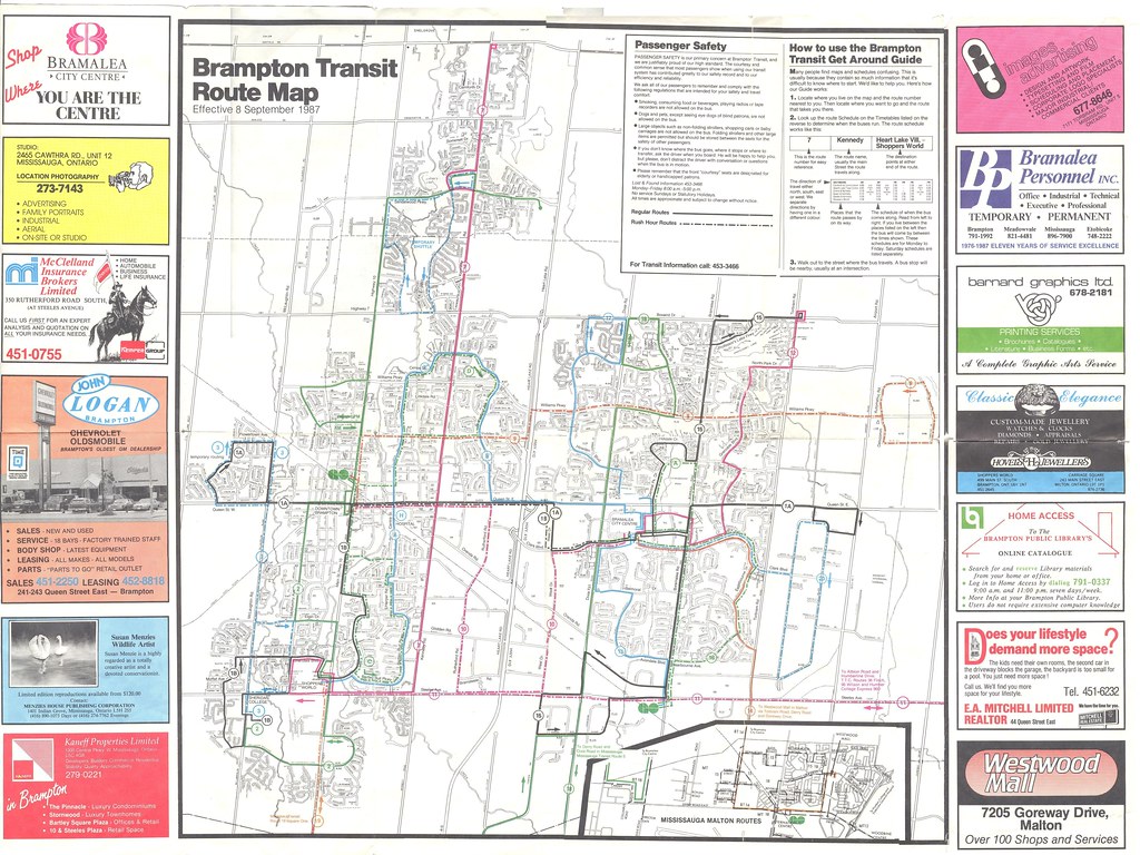
Here's the September 1987 map. It's looking a little more familiar (the strange 4 Glendale, 5 Church and 3 Mill/Bartley Bull are gone) and the buses are now crossing the border.

Note the following:
The 11 Steeles only goes to Humberline Loop (and did until 2000 or so) and is rush hours only in 1987.
No Sunday Service (though the cover hints at the first of several Sunday service trials, permanent Sunday service didn't get instituted until 1997).
The Route 1B took Main Street while Route 2 Main took McMurchy.

8330927322_0f67be984a_c.jpg


Click for larger size:


Back, including schedule summaries and GO information.


Back
Top