News   Jun 28, 2024
 4K     5 
News   Jun 28, 2024
 1.9K     2 
News   Jun 28, 2024
 662     1 

TTC: Flexity Streetcars Testing & Delivery (Bombardier)

Though I can see the advantage of far-side stops I think that boat has sailed as the TTC are busily making curb cuts at existing streetcar stops so that people in wheelchairs can reach the new accessible streetcars. They have been working on the "island stops" on Bathurst and Queen and are now on the Queen cuts.
 
Why do common practices in the rest of the world regarding streetcar/tram operation have no bearing on what happens here?

I loved riding the streetcar in Poland, and it never struck me as slow. Whereas here, they're hell.
 
I think Toronto is the only city I've been to that allows request stops for streetcars. Every other city has designated stops and vehicles stop there regardless. That, plus the greater stop spacing in most cities, allow drivers to accelerate to a reasonable level and then stop in known places, and they probably don't have to drive slowly and scan the stops to see if people are going to get on or off.

Also, yes to far-side stops. That, coupled with required stops allows you to build in some innovative traffic light signaling. For example, if the streetcar stops on the far side, you can restrict movement onto the lane that the streetcar is parked in, effectively allowing passengers to enter and exit safely and giving the streetcar a headstart on moving forward before car traffic catches up to it. Here's a diagram showing the kind of signaling that you could institute as soon as streetcars make it to the far side stop:

The streetcar immediately triggers a red light behind it and a green for the perpendicular road, but disallows any turns in the direction of where the streetcar is.

The problem is that in order to selectively control turning movements, you need separate turning lanes, and there isn't space for them on our downtown streets.

One option which doesn't require turning lanes would be to instead have an westbound-only through/left phase when the eastbound streetcar is at the stop, and a no-right-on-red restriction for northbound and southbound.

Though I can see the advantage of far-side stops I think that boat has sailed as the TTC are busily making curb cuts at existing streetcar stops so that people in wheelchairs can reach the new accessible streetcars. They have been working on the "island stops" on Bathurst and Queen and are now on the Queen cuts.

Are you sure you really mean curb cuts, and not streetcar platforms? Curb cuts are just an incision into the curb to allow a wheel to roll up it. They are incredibly cheap and inconsequential.

If on the other hand you are referring to curb extensions, which extend out from the sidewalk to the streetcar door (like on Roncesvalles), then it is something that would more expensive to change.
 
Last edited:
The problem is that in order to selectively control turning movements, you need separate turning lanes, and there isn't space for them on our downtown streets.

One option which doesn't require turning lanes would be to instead have an westbound-only through/left phase when the eastbound streetcar is at the stop, and a no-right-on-red restriction for northbound and southbound.

Sorry, what I meant to say is that the diagram I posted above would show you what sort of traffic moves are permissible in that instance. I wouldn't change any lane configurations, I'd just hang electronic signs like these next to traffic lights telling motorists what they can't do:

electronic-no-left-turn-train-sign-720x480.jpg


So, based on the diagram, northbound traffic would get a "Green/No-Right Turn" and southbound traffic would get a "Green/No-Left Turn". Eastbound/Westbound traffic would get a red with the usual traffic laws applying. The no right on red for the Westbound traffic is to allow pedestrians to cross safely to/from the streetcar.
 
Last edited:
Are you sure you really mean curb cuts, and not streetcar platforms? Curb cuts are just an incision into the curb to allow a wheel to roll up it. They are incredibly cheap and inconsequential.

If on the other hand you are referring to curb extensions, which extend out from the sidewalk to the streetcar door (like on Roncesvalles), then it is something that would more expensive to change.

I mean curb cuts and I agree they are fairly cheap to make BUT they are making MANY of them so that wheelchairs etc can reach all doors of the new streetcars. For locations take a look at the TO-InView website (click on TTC work). See: http://map.toronto.ca/maps/map.jsp?app=TO_INview2013
Described as:
"Project: CWP & Curb cuts
On Street: QUEEN ST E
Project Description: Installation of new curb cuts including sidewalk and curb modifications to facilitate new accessible LRT vehicles. In addition, installation of ticket vending machines on streetcar routes. "
 
I hope that future LRVs are longer in length with MU operation available, imagine how many people could be moved along the streetcar routes.

Some of the above posts talk about the future DRL and related congestion on Yonge. Given how the Queens Quay streetcar ROW link was completed back in 2000 with no senior level government funding and little EA planning, it goes to show how easy and affordable it can be to build some light rail. There is little car traffic on Yonge so a streetcar ROW would be easy to make room for. These days people want more for less, we would rather shop at Wal Mart, Target and No Frills than Loblaws and the Bay. Same goes for transit, more for less, more bang for the buck...

What are you proposing for Yonge, exactly? A streetcar ROW? From where to where?

There is generally an over supply of vehicle space on part of Yonge, but I think it's critical the excess is allocated to pedestrians first. The sidewalk space on Yonge is tiny. Cul-de-sac's in Scarborough have wider sidewalks.

The sidewalks on Spadina Ave. actually had to be cut back and narrowed in order to put in the then dubbed Spadina LRT ROW. The sidewalks get especially narrow near Wellington and Front St. and with CityPlace built, it does make the sidewalk less hospitable with a more or less Spadina Expressway-esque street enviroment with the street's six lanes of car traffic.

I don't know how seriously an LRT on Yonge would be taken, but when I try riding the subway northbound around 3-6 pm, it can get completely packed. Since the line was never built with two sets of tracks for express and local, a surface level pressure relief LRT line could work, with a centre ROW with half of the side lanes for wider sidewalks and the other half for bike lanes. I could see it running from Union Station to Eglinton, perhaps as a continuation of the Bay st. streetcar tunnel and emerge where feasable.

Turning more downtown streets over to Streetcars, bicycles and pedestrians is the only way. I also see how gridlocked it is on say King St is and it is obvious what needs to be done. With the purchase of new automobiles on a steady decline in Canada since 2002 and some new condo towers like the new RCMI tower at University and Dundas not even having any underground parking, it is obvious that more people are coming downtown not expecting to use their cars. It will be for sure a major upheaval of a decision to start pushing cars out of the city, but gradually it will come. And with more light rail in the inner suburbs and 905, more dense downtown living will come to more areas, and it will probably build momentum and accelerate at a further rapid rate as we head closer to 2050. Obviously some of the LRT/Streetcar ROW planning of the 1980s demanded tunnelling the ROW where necessary, but even when I look at the St. Clair ROW by the CN Weston Sub., the street has only one open lane of traffic each way, so obviously there is already a willingness by the city to start pushing out the automobile.

I also look to the very original plans for rapid transit in this city from the 1910s, that would have called for funnelling the city streetcar lines into underground streetcar lines along Yonge and Queen St. An artist rendering for the Yonge St underground streetcar line would have also had parallel surface level streetcar service on top. Pull up a copy of Mike Filey's Not A One Horse Town book and one of the pages has the illustration. Quite an interesting system that would have been, a whole web of streetcar service funnelling into the downtown, thus what would have made Toronto a streetcar only city with streetcars everywhere, which I am sure would have never allowed a Streetcars vs Subways spat that this city witnessed around the late 1970s/early 1980s and more recently. It probably also would have blocked this city from ever being given the ICTS SRT, which I am sure deepened Scarborough's feelings about how the city treated them. Of course the originally planned Scarborough LRT from the 1970s would have had no issues, whereas the SRT's ICTS magnetic propulsion rail wouldn't work with snow and ice covering it in the winter time even to the present time...
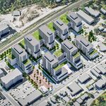
 
The sidewalks on Spadina Ave. actually had to be cut back and narrowed in order to put in the then dubbed Spadina LRT ROW.

I'm going to nitpick this. The sidewalks were cut for 4 to 6 lanes of traffic in each direction.

With 2 to 4 lanes of traffic Spadina could have very wide widewalks with tons of room for shops to spill out onto them.
 
Spadina was pretty wide open before the work was done to put in the Spadina LRT/510 Spadina streetcar around 1994-1997.

The original right of way that existed into the early 20th century had little space for automobiles then. Allocating half of the 510's capital budget for the short tunnel at Bloor and the massive portal south of it ate up roughly half of the funds, and it's not like the St. Clair ROW has any grade seperation. What became of Spadina south of Richmond indicates that then Metro council still had fancy for some revival of the Spadina Expressway. I was watching CP24 Rewind one time when they still showed re runs of City Pulse and there is Mel Lastman back in the 1980s calling for a revival of the Spadina Expressway. Really the street is a gridlocked eyesore even when you get further south to the railway overpass. The avenue corridor is so wide that you could even go so far as to have two sets of streetcar tracks for express and local service with express LRVs serving the DRL and GO train shoulder station terminal. One of the earlier plans for the Spadina LRT called for it to mainly link Cityplace with the Bloor line and Spadina subway. Even with that much road space dedicated to streetcar rights of way for you would still have room for bike lanes and increased sidewalk width, perhaps as a full fledged transit mall with allocation for delivery truck access.

It's just a question of when people will be truly ready to commit to transit priority with surface level transit service being at the same levels it once held back in the 1940s, and finally reversing the decades of transit funding cuts for operations and maintenance once and for all that stretch as far back to the latter part of the 1980s...
 
Last edited:
Testing the TTC's New Streetcar: Speed Testing in Pantograph mode

[video=youtube;8kcfA_TxohI]http://www.youtube.com/watch?feature=player_detailpage&v=8kcfA_TxohI[/video]
 
Turning more downtown streets over to Streetcars, bicycles and pedestrians is the only way. I also see how gridlocked it is on say King St is and it is obvious what needs to be done. With the purchase of new automobiles on a steady decline in Canada since 2002 and some new condo towers like the new RCMI tower at University and Dundas not even having any underground parking, it is obvious that more people are coming downtown not expecting to use their cars. It will be for sure a major upheaval of a decision to start pushing cars out of the city, but gradually it will come. And with more light rail in the inner suburbs and 905, more dense downtown living will come to more areas, and it will probably build momentum and accelerate at a further rapid rate as we head closer to 2050. Obviously some of the LRT/Streetcar ROW planning of the 1980s demanded tunnelling the ROW where necessary, but even when I look at the St. Clair ROW by the CN Weston Sub., the street has only one open lane of traffic each way, so obviously there is already a willingness by the city to start pushing out the automobile.

Gonna have to fact check you a bit on those parts I have bolded.

Bolded part #1.....yes, 2002 was the high-water mark for new car sales in Canada....you know what the 2nd biggest year for auto sales ever was? 2012! Yes there were some poor years in between (often are during recessions and credit crunches) but to say that represents a "steady decline" wrong.

Bolded part #2....if by "some" you mean 1 then yes you are right...there is one condo building built without parking. there is one proposed rental building in the Bay/Dundas area with no parking but a) the proposal uses the Eaton Centre parking lot as meeting the parking requirements {proposal is from CF} and b) it has not been approved. So, in summary, 1 does not make a trend ;)
 

Back
Top