Toronto Westdale | 134.7m | 40s | Sorbara | Graziani + Corazza

It was just an enlargement and traffic 'easing', typical of the 1960s (I believe). You can see the alignment of 'Old Albion' with its own, much smaller, bridge here, and 'new Albion', so to speak, just west of it.
View attachment 431283

Thanks.

This makes me realize now......I've walked through this area on the valley trails...........and this road alignment choice created a whopping 2.3 acres of stranded space between the old and new Albion alignments.

This space, as currently constituted offers no recreation value to speak of, very limited ecological value and and no development value either. How wasteful!

1665146472159.png


This also made me look at the distance between the existing cycling/pedestrian access to the valley for this area (off the old Albion alignment) to the subject site, its ~700M

Worth noting, the subject site is directly across from the valley, in a section where the slope isn't brutally steep, and as such an access is plausible as little as 80M away. (though the bike trail is on the other side of the river, so it would be a lengthy access, and one requiring a pedestrian bridge across the river.
 
Last edited:
Thanks.

This makes me realize now......I've walked through this area on the valley trails...........and this road alignment choice created a whopping 2.3 acres of stranded space between the old and new Albion alignments.

This space, as currently constituted offers no recreation value to speak of, very limited ecological value and and no development value either. How wasteful!

View attachment 431284


This also made me look at the distance between the existing cycling/pedestrian access to the valley for this area (off the old Albion alignment) to the subject site, its ~700M

Worth noting, the subject site is directly across from the valley, in a section where the slope isn't brutally steep, and as such an access is plausible as little as 80M away. (though the bike trail is on the other side of the river, so it would be a lengthy access, and one requiring a pedestrian bridge across the river.
For many years, Albion was northbound on the original bridge, and southbound on the new one. When it came time to refurbish the aging bridges, they opted to move Albion over completely to the new alignment, and replace the old one with just a cheapie bridge for pedestrians and cyclists… which was a good move; that land between the alignments is no longer stranded.

42

That certainly reduces the 'stranding' effect...........

Though, the new Albion still forms a substantial barrier to wildlife which would have to cross Albion to access the 'stranded' parcels. (Albion, of course would still be there, on its old alignment, but the 'land in the middle' could be consolidated to be contiguous to the valley in a more useful way.)

I appreciate that one could argue for it being contiguous, as is, to the valley to the east.........however.........

The topography (steepness of slope) into the valley on the west is considerably greater than to the east of Albion, this makes the top lands more difficult to access for wildlife, just as it would for people.

1665153143204.png


Each line above represents 1M change in elevation. You can see how much denser the lines, and steeper the drop is on the west side.

*****

If one preferred a recreational purpose to the top lands, I think a fair case could be made for that; but it needs to be said, none has been implemented thus far.
 
So now @interchange42 has gone and sent me down the rabbit hole!

I was trying to look up the EA for the last Albion Road re-alignment (so far without success) to see how they weighted the options and why..............

When I discovered a much older Albion Road re-alignment........


From the above: (Where Albion used to cross the Humber River)

1665154279373.png

1665154300978.png


I know I don't have the old alignment correct; but following the above, I show where Norris Place is today, and a very crude estimation of where Albion would have crossed the Humber, obviously at a much lower elevation:

1665154832892.png


Ha, I'm finding my way through the warren of tunnels!

I sometimes forget all the tools I have access to!

Here's the aerial pic of this area in 1953:

1665155342325.png


Note the old Albion Road with the Norris Place alignment still exists, but the new Albion has either been built or is under construction.

***

Lets go back further to 1950!

1665155571004.png


Albion Road's old alignment can be seen in the top left of this photo!
 
Very interesting finds! But that's Flindon Road, not Norris Place, that was the old alignment…

42
 
You can see in the aerial views above that it was Flindon Road that was continued to Musson's bridge to cross the Humber when you compare them with the Google map with satellite background you have above. If we zoom in a little more to the Google Map…

MussonsBridge.jpg


42
 
You can see in the aerial views above that it was Flindon Road that was continued to Musson's bridge to cross the Humber when you compare them with the Google map with satellite background you have above. If we zoom in a little more to the Google Map…

View attachment 431318

42

I thought that looked correct myself, but took the author's word from the site I linked that it had been Norris; I wondered if there had been multiple roads crossing the Humber at one point.
 
Gather round the campfire, children and I will tell the tale of this area. Open up google maps and follow along:

Originally Albion Road crossed the Humber on the current alignment of Flindon Road. Wilson Avenue ended at Weston in an uncomplicated T-intersection.

In the 1950s, Albion Road was re-aligned to run to the south along a new bridge and a new street, Walsh Avenue, was built as a connector between Albion and Wilson. It was now possible to travel from Wilson to Albion without jogging on Weston.

A short new street called Blondin Avenue was built between Wilson and Weston, paralleling Walsh. Weston Rd. trolley busses turned around here at a loop called Blondin Loop. It was around this time that the area changed from rural in character, to suburban.

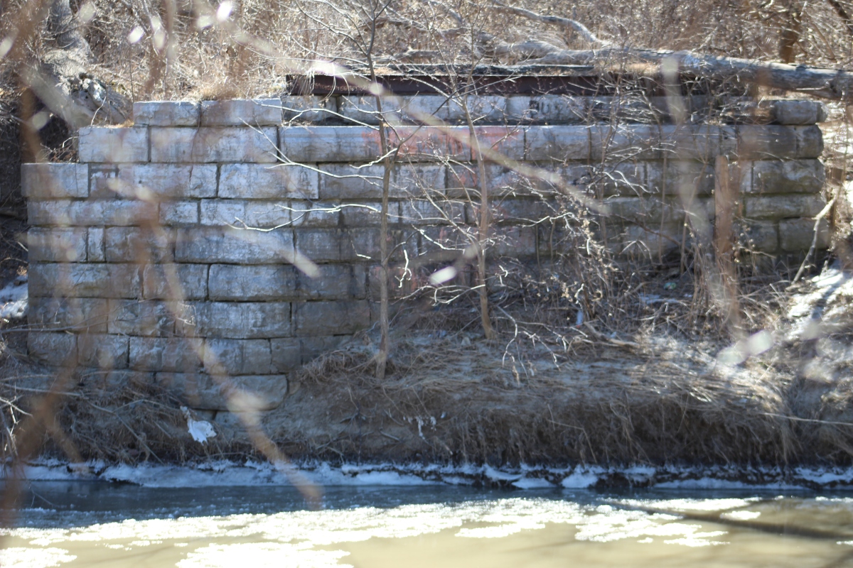
By around 1960, Flindon Road bridge was demolished, leaving Albion as the only crossing over the Humber in the area. The remains of this bridge are still visible today to those who walk to the end of Flindon Road.

In the early 60s, obnoxious slip lanes were constructed on three sides of the Albion/Walsh/Weston intersection, foreshadowing what was to come.

In the mid 1960s, the rail line to the east was grade-separated in the form of a flyunder for Wilson. This necessitated cutting off Ann Arbour Rd. from Wilson, which was the only way to access the neighbourhood to the north from Wilson.

Around this time, Highway 401 was widened to it's present width. The new highway ramps necessitated the destruction of Wilson between Blondin and Albion, along with the demolition of a few properties.

Around this time the obnoxious slip lanes were joined by an obnoxious jughandle on the northwest corner.

Four houses were demolished in the late 1960s to create a new road, Matthews Gate, to restore access to the neighbourhood to the north.

In the early 1970s, two major changes happened in the area. The first was the widening of Albion Road. Now, long ago a westward extension of Wilson had been planned. It would have crossed Weston, turned north paralleling Albion, then turned west along Berry Creek and met up with Bergamot Avenue. This would have allowed traffic from Wilson to continue west on Rexdale Blvd, and explains why Bergamot has such a wide right of way for a residential street. Ultimately it didn't happen due to pressure from local residents who didn't want the Berry Creek ravine destroyed. However, the bridge from this plan was eventually built, and used to accommodate a widened Albion Road. Albion would now split. Westbound traffic would continue over the existing bridge, and Eastbound traffic would dip south and travel over the new bridge. if you've ever wondered why Albion crosses the river at this angle, it's because the bridge wasn't planned for Albion at all, it was planned for a Wilson extension!

The second major change was the construction of the flyover monstrosity at the Albion/Walsh/Weston intersection, which exists to this day. I could write a fucking essay about how much I hate this thing. Anyways...

A candidate for Toronto's shortest street was built as an extension of Matthews Gate called Kelvin Avenue. This allowed Traffic from Wilson/Walsh to access the now orphaned western stub of Wilson.

In the late 70s, Blondin Ave was turned into a cul-de-sac to prevent traffic on Weston heading to Wilson from cutting through the street.

Around 1990 the entire block of homes between Walsh and highway 401 was razed to facilitate a new development, which we know never came. The lot has sat vacant ever since.

At some point, what was left of Blondin was either torn up or became overgrown. Toronto's aerial street photograph archive ends in 1992, and google maps street view begins in 2007, so I don't know when. The utility poles that once served the former street were removed between the 2009 and 2011 street views.

Around 2000, the eastbound Albion bridge was widened to accommodate all traffic lanes and the old westbound bridge was turned into a pedestrian path. For those keeping track, that means there have been four different arrangements of Albion crossing the Humber since the 1950s!

So yeah, that's the interesting and kind of depressing story of this intersection. Hopefully this new development is nice and brings something good to the area, which currently really sucks.

And I'd do unspeakable things to get that highway-style interchange ripped up.
Thank you very much for laying all this information out, I doubt such a comprehensive history of the areas road network exists anywhere else on the internet! It's shocking that in the 1990's the city allowed for a whole block of still not that old suburbia to be razed, looking on google maps I had no clue that the site had not always been greenfield. I do have one question, is there any reason that Walsh was not simply absorbed into Wilson and the quite short stub of an arterial retired as a street name?
 
This one is the subject of An Appeals Report to the next meeting of EYCC:


OLT Dates:

1711117040477.png


The first problem this proposal faces is not one I saw coming......... but the proponent's Planners ought to have.

1711117172872.png

1711117197494.png

****

The above causes the site to flop the Provincial Policy Statement evaluation, the below causes it to fail tests under the OP and secondary plans:

1711117336290.png


This sums it up:

1711117402264.png


The City has all sorts of issues w/how this proposal contravenes the Tall Building Design Guidelines:

1711117487791.png


The proposal is also called out for being way too car oriented with way too many pedestrian/vehicle conflict points - I 100% agree!

*****

City Planning is very constructively telling the applicant exactly what will get them to approval here:

1711117626306.png

1711117662237.png


And a whole bunch more if you follow the link.
 
That's great i'm glad they called out a whole bunch of issues in this proposal, because frankly this whole POS needs to go back to the drawing board. The city pretty much touched on the myriad of issues here and the whole layout of this plan is a dysfunctional mess.

The cherry on top for me are the issues that the GTAA and NavCanada have with this here, that's good. Either the Sorbara Group comes up with a competent thought out plan here, or they should flip it to someone who will actually utilize the site in a coherent manner.

Nice extractions @Northern Light
 

Back
Top