Toronto Ontario Line 3 | ?m | ?s

I'm not sure Brampton needs more than a REX on the Georgetown line and the surface LRT/BRT to Mississauga. Is there much in the way of projects going on around the Brampton railway station to increase the density of that node? I do hope they acquire that property on Mill St south of Railroad St though so trains might eventually be able to come up from Streetsville and into Brampton Station before heading over the top of the city.

I think the best use of that line is for a train from Orangeville to Toronto via Streetsville. A platform could be built either just north or south of the diamond, with a walkway linking it to the station building.

It wouldn't be as well connected as sending the trains into Brampton station, but the property has much greater potential than just to be used as a connecting track for the trains.
 
Okay, another question...

I seem to remember that someone took the TTC ride guide and removed all the routes to make a base map. Does anyone recall where I saw that?
 
You guys are so fully of energy and idealism and that is fantastic. The difficulty is, as a forum member (and somebody on Facebook), while I am tempted to join, I just feel I do not know enough about this concept. Is it financially viable? Who owns the tracks? Is transit on railway tracks even a good idea (and is it close enough to density modes)? Why was it not carried out? How does this differ from Go Transit? And does Transit City make this redundant?

Unfortunately there are not a lot of facts (just a lot of promises and nice sounding phrases) on the page to help anyone make a decision. I just read the page and have a thousand questions.
 
The group was only created the other day, so there's alot to flush out before a finished proposal is ready.

Alot of the questions you have asked are really good points, and stuff the group will address in due time.

Keep the questions and constructive criticism coming. I think i speak for everyone involved when I say that respectful critique will only make the finished product better.
 
I looked back to some research I did for a university presentation last year - I was looking at a subway along Queen at the time, but most of the information makes sense if someone wants to just reroute the route itself.

Here are maps of projected density in Toronto as of 2021, with both a DRL (under queen) and that line extended up Don Mills and into Weston, as well as just a subway map of the line.

I still have the powerpoint presentation I did, estimating cost and ridership, and I actually made a handy little excel tool that calculates subway cost (it's obviously not ENTIRELY accurate), but it's pretty good, based upon length of lines, stations, etc. if anyone wants that. Let me know. I know this is all for Queen, but... it's pretty similar in idea.

queenoverallsubway.jpg


I had these as embedded images, but... forgot how big they were.

http://www.abandonedplanet.net/personal/2021queen.jpg


http://www.abandonedplanet.net/personal/2021full.jpg

Note the areas of VERY high density west along King... regardless of where you route it (I probably prefer King at this point, but Queen, King, Front, whatever...) that covers a lot of people. It almost looks like the line is perfect for where the city is going to grow.
 
Here's some short answers to alklay's questions.

1. Is it financially viable? 2. Who owns the tracks? Is transit on railway tracks even a good idea (and is it close enough to density modes)? 3. Why was it not carried out? 4. How does this differ from Go Transit? 5. And does Transit City make this redundant?

1. At least as viable as any other transit project. Remember, the Transit City manifesto starts by saying the city cannot afford and has no intention of paying for the new lines, but here we are one year later and the projects are underway. A DRL would quickly pay for itself in increased taxes.

2. It wouldn't be entirely in the rail corridor, particularly along Front Street, but when there's space available or negotiable in corridors, why not take advantage of it?

Looking just south of Bloor/Danforth, it runs through extremely dense areas filled with trip generators, especially between the CNE and the West Don Lands, where stations would be literally feet from CityPlace, the SkyDome, Convention Centre, ACC, the St. Lawrence 'hood, pretty much everything along Queen's Quay and, most importantly, the entire central business district. In the stretches where it turns up to the B/D line, it'd run through areas that are as dense as any other in the city, like Parkdale or Riverdale, not to mention intercepting the east/west downtown streetcar routes. All of these areas are underserved by useful transit, and given the usual state of the Spadina or Queen streetcars, one could say these areas are not served by any transit at all.

3. It wasn't carried out for the same reasons hardly anything has been done for transit in Toronto in decades: bickering municipalities, lack of funding, etc. Jack Layton and others didn't want downtown to have great transit because they wanted development to occur in the suburbs.

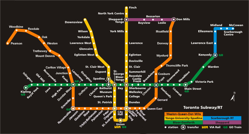
4. It's a high frequency subway line from Pape (Greektown) to Union (downtown) to Dundas West (Roncesvalles) and possibly beyond, not a commuter train that only stops every 5-6 km. It wouldn't require additional fare, it would be a seamless addition to the subway network.

5. Transit City offers absolutely no transit improvements for downtown and could cause massively increased crowds on existing subway lines, especially Yonge. Clearly, a downtown line is desirable even with today's level of crowding. Future Transit City-related plans could include extending Don Mills and Jane streetcars to Union Station, but only a subway line would also be able to handle the large crowds that would ride the line. Frankly, people will not switch from the Yonge line to streetcars that aren't grade separated, greatly diminishing the relief value of such a line.
 
Okay, another question...

I seem to remember that someone took the TTC ride guide and removed all the routes to make a base map. Does anyone recall where I saw that?
Okay, seriously, if anyone knows where to get this, please post it. I've been looking for something like this for a long time.
 
Great responses, Scarberian. Questions just like these are what's going to be asked about the DRL and we need proper answers in response.
 
I'd only add that the downtown rail corridor is already owned by GO Transit (i.e. the Provincial Government) and there's loads of room for additional tracks, so no property acquisition costs there.
 
It's being argued as something we can't afford not to build, with all the density, new, development, and the crowded Yonge line. But considering that it sounds like it will be built mostly above ground on rail corridors, won't there be reliability problems when the snow falls?
 
It's being argued as something we can't afford not to build, with all the density, new, development, and the crowded Yonge line. But considering that it sounds like it will be built mostly above ground on rail corridors, won't there be reliability problems when the snow falls?

If built correctly, it will be no more unreliable than the open air sections of the existing TTC subway.
 
I think the best use of that line is for a train from Orangeville to Toronto via Streetsville. A platform could be built either just north or south of the diamond, with a walkway linking it to the station building.

It wouldn't be as well connected as sending the trains into Brampton station, but the property has much greater potential than just to be used as a connecting track for the trains.

The platform would have to be on the north-east side of Mississauga Rd as there is no room on the other side. It would be next to the sidewalk and only 200 feet from Britannia Rd. It would connect with MT routes 39 and 44.

If you put another stop up a Derry Rd, it would open this area up to better transit and help with development of employment for that area.

I was talking about downtown Brampton. A train to Orangeville would use the same platforms as Milton Trains at Streetsville.
 

Back
Top