kotsy
Senior Member
You nailed it, Kotsy. That is what Toronto is now.
Thanks for watching!
You nailed it, Kotsy. That is what Toronto is now.
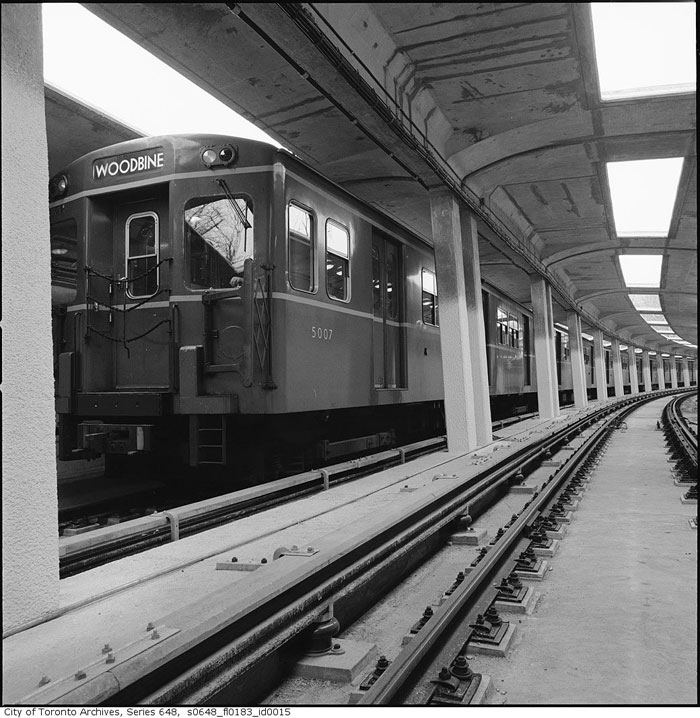
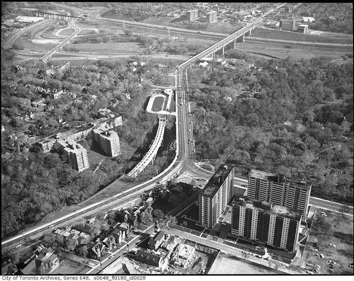
Line 2 had a partly-covered bridge over the Rosedale ravine, until the vent opening were covered over with concrete to reduce "noise".
/https://www.thestar.com/content/dam/thestar/news/2007/10/21/concretes_liberating_allure/rosedale_valleybridge.jpeg)
From link.
They could cover the open sections of the Ontario Line to reduce "noise", but likely they just cover it with concrete instead of glass.

Though there was also a viable subway deck on the Rosedale portion of the Prince Edward Viaduct, the TTC found it didn’t quite line up with the planned location of Sherbourne station, so a new bridge was required.
The solution, supplied by architect John B. Parkin and U.S. engineering firm DeLeuw, Cather & Co., was an open spandrel structure with a sweeping reinforced concrete arch. The deck, almost 17 metres above the valley floor, was almost entirely enclosed to prevent train noise disturbing residents of the nearby Kensington Apartments.
Two rows of skylights provided ventilation through the roof of the bridge, but were later covered. Now it’s hard for subway riders to discern that they’re traveling high above a ravine, save for an increase in noise as the train rumbles along its concrete guideway.

Line 2 had a partly-covered bridge over the Rosedale ravine, until the vent opening were covered over with concrete to reduce "noise".
From link.
They could cover the open sections of the Ontario Line to reduce "noise", but likely they just cover it with concrete instead of glass.
Any idea when that rendition of Keele is from? I wasn't aware of there being a period after Bloor was the definite route but before and extension beyond Keele was confirmed.
It's not really as spectacular as the view from the Prince Edward viaduct is. The one on question is beside the bridge over Rosedale Valley road and is fairly short.Imagine the spectacular views that riders would have had if this wasn't enclosed.
Omg I'm so excited for unique architecture and beautiful, neighbourhood defining transit stations.

Looks like it - the description says "... where the subway will be built..."
Thanks for posting.
Just a rough guess on the route based on the above. I assume they are trying to avoid as many buildings as possible? This aerial might be outdated and some new construction may have started.
View attachment 246246