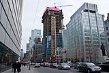
My red line follows the lines of perspective exactly, due to the roof of Bay Adelaide. Assuming BA it is parallel to Adelaide Street, the angle the roof and red line slope to the right of the picture is the actual vanishing point for that line. It is not arbitrary at all, but the science of optics.
Certainly their are some unknown variables that will vary the accuracy of the red perspective line and therefore the Shangri-la Top Out point such as:
1) If Adelaide Street varies from a straight line from Bay to University.
2) If the elevation of the ground along Adelaide is not a constant.
3) If Bay Adelaide Tower is obliquely placed and it is not square with Bay and Adelaide Streets.
Using Google Earth, I considered all of those factors and ruled them all out as variations great enough to distort the line from its intended purpose, which was to approximate the final height of Shangri-La.
The key word in all of the above is...
APROXIMATE
This was just a quick exercise to help poor flummoxed
dt_toronto_geek get a grasp of SL from his vantage point. When I do renders, I take even more care and consult more resources to get the heights right.


