


drum118
Superstar
The QQ has been around shortly after 1919 when the road was built after the lake was fill in for commerical use and slips for ships with the QQ termilal been built in 1926 as a cold storage.
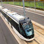
The two photos where shot from different locations with the 2nd one west of Bay and the 1st just west of Yonge.
The two photos where shot from different locations with the 2nd one west of Bay and the 1st just west of Yonge.