crs1026
Superstar
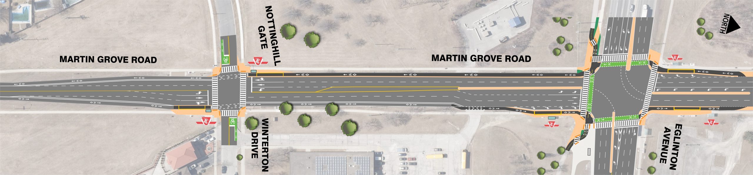
Off-topic but this is an overkill amount of lanes for anyone to cross Kipling Avenue. Why??
Because Etobicoke is the Land of the Auto.
This cries for entrances to the station from all four corners of the intersection. The number of pedestrian crossings to access the LRT and/or transfer to surface transportation is significant.
This is literally a killing zone… I’m not being hyperbolic, pedestrian safety is very poor..
- Paul
")