Toronto 72 Perth | 53.55m | 16s | Castlepoint Numa | Studio JCI

A couple overhead views showing the current state of the site, along with a massing context diagram:


perth.jpg
perth2.jpg
perth3.jpg
 
Last edited:
Could probably be a few stories taller. Still, overall looks good.
 
Last edited by a moderator:
Part of this announcement about affordable housing:

The first project between Castlepoint Numa and WoodGreen will be a 108-unit rental building with 10 to 15 affordable apartments located at 72 Perth Avenue. It is scheduled for completion in the fourth quarter of 2024.


Affordable housing at 72 Perth

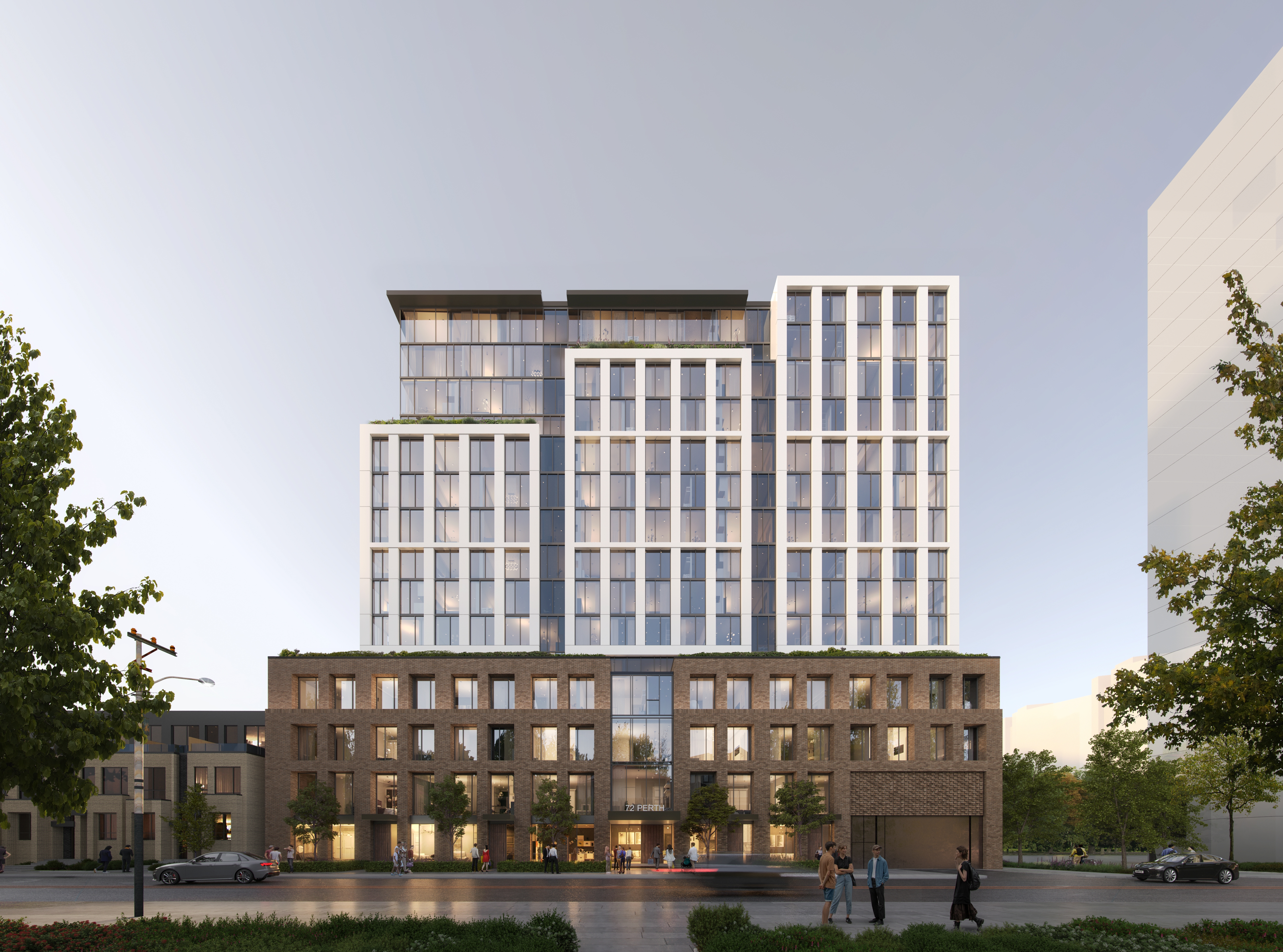
The first project between Castlepoint Numa and WoodGreen will be a nine-storey, 108-unit rental building with 10 to 15 affordable apartments at 72 Perth Ave., just south of Bloor Street West and within a five-minute walk of the Dundas West subway and Union Pearson Express stations. It fronts on the West Toronto Railpath pedestrian and bicycle path.

“The location is phenomenal,” said Fancello. “Besides Union Station, this is probably the most well-connected part of the city.”

Fifty-five per cent of its units will have two or more bedrooms. Of those, Fancello said 20 per cent will be even larger to meet City of Toronto guidelines. The building will feature indoor and outdoor amenities, including a children’s play area, a dog run and dining areas.

The project is scheduled to break ground next year and be completed in Q4 2024.


72 PERTH AVE
Ward 9: Davenport

To permit the increase in dwelling units (from 108), and overall building height to incorporate a geothermal heating and cooling system provided within the 10-storey mixed-use building, currently under review by Site Plan Control Application (File Number 21 226455 STE 09 SA). There will be a total of 128 residential dwelling units within this building.
 
I have no issue with height increase, but feel this street was a total missed opportunity. The townhouses to the south should have been higher density and less monotonous and all of it should have been made into a retail/commercial/mixed use street for pedestrians to walk down to connect Bloor to the south Junction Triangle commercial/office/culture/entertainment zone.

Either that or the houses on Sterling should be rezoned and allowed to adapt into retail use and the streetscape redesigned as the main connection for pedestrians (that section of Sterling could maybe be closed to cars as well and it could be made into a really incredible fine grain urban are like Kensington Market). Or both. We're building out this interesting mixed use area to the south with offices and art galleries and breweries, etc. and a bunch of housing is coming into the area with residents who would be walking up these streets, but there's no real primary connection to connect that neighbourhood to Bloor.

The Railpath is the connection I guess, and the Railpath is great, but it's hard to even find how to get up onto it at Bloor and know where it goes and it takes you out of your way depending on where you're coming from. If pedestrians could be beckoned south by the presence of a mixed use street, that would connect up these areas in a much more cohesive fluid way. It would be great urbanism and city building and make this area even better!
 
Last edited:

Back
Top