I mean, I read through their report. I understand what they are getting at, but they are diagnosing the wrong thing as the problem.
- Built form and density of the land that gets developed is independent of where through traffic is routed
- Communities should not be centred on highways, as they suggest. They should be centred on transit.
- You need truck routes to support jobs and services. It is madness to try and make an 'urban complete street' that has the function of also being a truck route. Imagine the noise. Imagine the danger for pedestrians to cross.
So the answer is:
- Build a highway. At least, reserve the ROW for future highway construction. This is a limited access road--no development along it even if for now it has signalized intersections. I'd say you could repurpose Winston Churchill for much of its length here.
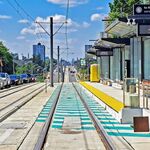
- Provision ROWs at least, or go ahead and build surface rail ROW as a transit backbone (GO). In this area, we could branch off the Kitchener line running roughly N/S between Brampton and Georgetown, turn SW and pass between Milton and Mississauga. You might even be able to snake alongside the 403 to connect with Lakeshore line)
- Build complete 15 minute neighbourhoods as nodes along the the rail ROW. Require high population density (can be achieved with low and mid-rise built form), mix of uses surrounding the transit station. Make the community prioritize local active transportation, make cars slow for local travel (more circuitous).
Here is a quick depiction of what could be done here. 35km of new rail ROW, link Kitchener, Milton and Lakeshore lines, room for 10 new GO stations, each one could support 35k people + jobs or 25k residents, housing for 250k new residents in the GTA. It blows me away that we think ahead for highway ROWs but not for commuter/regional rail. Yellow is the new highway, mostly following Winston Churchill (going around Norwal). Restructure the arterials to go around the edges of each node. At each station, have a square/public space with shopping/dining, with commerial development above (office). A bit further from the station, have residential towers/midrise, and 500m away more lowrise townhouse/semi/detached.
The highway should be a highway. Not all development needs to follow arterial streets. They aren't very livable. We're stuck with that for our existing development, but it is not the only way to build greenfield areas.