News   May 03, 2024
 645     0 
News   May 03, 2024
 424     0 
News   May 03, 2024
 223     0 

Road Safety & Vision Zero Plan

This is the kind of Vision Zero solution that actually makes a difference and should be implemented everywhere.


Screen Shot 2018-10-31 at 2.27.03 PM.png


Dqw2qnYU0AA2y8d.jpg-large.jpeg
 

Attachments

  • Screen Shot 2018-10-31 at 2.27.03 PM.png
    Screen Shot 2018-10-31 at 2.27.03 PM.png
    42.4 KB · Views: 721
  • Dqw2qnYU0AA2y8d.jpg-large.jpeg
    Dqw2qnYU0AA2y8d.jpg-large.jpeg
    433.3 KB · Views: 745
That's what I posted in the ION thread: pedestrian friendly turn geometry makes a big difference. Now let's get better lighting for crossings. I would argue the turn closer to the camera is still lacking, however.
 
That's what I posted in the ION thread: pedestrian friendly turn geometry makes a big difference. Now let's get better lighting for crossings. I would argue the turn closer to the camera is still lacking, however.
I say a *huge* difference...and no less than NYC has promoted this in North Am.
I would argue the turn closer to the camera is still lacking, however.
I'm hyper-alert at intersections like that, just the will to survive and years of cycling, let alone walking, and my immediate attention was caught by the dog on the opposite corner. My synapses flashed: "One way street?" (Edit: It is, but there's a reason they put bollards out from the curb, traffic can still cut across that corner)

The reason being I walk long distances with Big Black Lab when I'm not cycling, I'm clinically 'kinetic' (ex hyper-kinetic, but still with the energy of a twenty year old), and having your dog wait that close to the marked lane is inviting disaster. Perhaps I'm overly protective, but I'm continually boggled by persons with babies in strollers, and dogs on leashes being pushed instead of pulled into the intersection without knowing what's coming due to parked cars or anything blocking sight lines.

Pedestrians and cyclists have to change behaviour as much as motorists, albeit the potential damage of a vehicle and responsibility of the driver far outweighs that of either.

Here's a Google Street View of the intersection prior to bollards:
https://www.google.ca/maps/@43.6656...4!1s2lM5VJIJjENipm4DG7GJoQ!2e0!7i16384!8i8192
 
Last edited:
I'm hyper-alert at intersections like that

Yep. I am a very active walker - 6-7 km every night for the last 10 plus years and 12+ a day on weekends - but until I started following urban planning matters two-three years ago, I was much less aware as a pedestrian. These days, I will change my route and literally go out of my way to avoid car friendly turns if I see a car approaching.
 
Remember this:

leafy-neckdown.png

From link.

From 11 months ago at this link.

From July, 2018, at this link.

Locals oppose 'horrendous' redesign of Regal Heights intersection
Community activist says city staff jumped the gun and now neighbours are up in arms

news2-regal-heights-cd5d5dc1.jpeg


As if on cue, a few minutes into an interview with Regal Heights neighbourhood resident and community activist Dave Meslin about a local intersection redesign at the corner of Regal Road and Springmount Avenue, a couple of young men drive by the newly designed intersection in a van and comment “stupid f***ing plastic things.”

Neighbourhood streets are increasingly dangerous, and with the city having a hard time implementing its Vision Zero agenda, local residents are creating their own solutions, whether it be signs telling motorists to slow down, or a hashtag inviting people to share their experiences of dangerous roadways. But when neighbourhood activism meets city bureaucracy the collision between the two can be “messy,” according to Meslin.

This is a neighbourhood, adjacent to Wychwood, with some history of community activism and public space projects.

Last year, he and a few of his neighbours got together and temporarily transformed the intersection of Regal Road and Springmount Avenue into something that put pedestrian safety first, while also highlighting the amount of wasted public space that could be put to better use.

Essentially, they rearranged the intersection with chalk and leaves raked from a neighbouring slice of greenery. The fix, though temporary, worked wonders and freed up a couple thousand square feet of public space. News of the project went viral.

From September, 2018, at this link.

Regal Road & Springmount Ave. Intersection — Announcement of Informal Community Discussion

I’d like to invite you to an important community discussion about the Springmount/Regal intersection. There seems to be a consensus in the neighbourhood that the current pilot project isn’t working. The plastic bollards are horrendous, the vehicle lanes are too narrow, and cyclists feel squeezed

Imagining Regal Heights Gateway

Gateway-meeting-3.jpg

Gateway-meeting-2.jpg

Gateway-meeting-1.jpg
 
Portland Will Grow — But Without Adding Cars

See link.

Nine miles of new bus and streetcar lanes. Thirty miles of new and upgraded low-stress bikeways. One thousand fewer parking spaces. That’s what’s on tap for central Portland after a 3-0 City Council vote yesterday.

The congestion battle plan, called “Central City in Motion” [PDF], would maintain the current amount of space for car traffic — roughly 39 percent of the city’s overall land — but remove parking spaces so that 6 percent of the land area would be set aside for bus and bike lanes, up from the current 4 percent. It is aimed at managing congested in the rapidly growing central city area, which encompasses about five square miles.

The $72-million plan includes 18 major projects, each of which adds either bike or bus lanes or both. These projects, city staff says, will increase the total people-carrying capacity of the streets by an average of 60 percent.

portland-street.jpg


Portland officials say the plan is needed because they anticipate big growth in the central city in the next two decades. Over the 5-square mile area, the city projects a 130-percent increase in residents and a 40-percent increase in jobs over the next 20 years. Without growth in the number of people using bikes and buses, that would lead to a 47-percent increase in traffic.

“We can’t add new streets, but we can use the streets we have more productively,” the city wrote in its plan.

Portland takes inspiration from the plan from Seattle, which has added 60,000 jobs in its downtown area this decade without increasing the number of cars on the road, thanks largely to strong transit investments.

Bus and bike lanes increase the potential carrying capacity of Portland’s streets, but only time will tell if the new street treatments are enough to motivate people to take full advantage, Sightline Institute’s Michael Andersen pointed out.

The plan promises to “create or improve more than 30 miles of low-stress bikeways,” and make safety improvements at 100 intersections. Since nearly half of the traffic crashes that result in fatalities or injuries take place in central Portland, the plan promises to greatly improve safety as well.

The plan was the result two years of public engagement from city planners.
 
Paris Leads ‘Vision Zero’ New York With Pedestrianized City Center

From link.

car-free-paris.jpg

A big part of central Paris won't have cars, under a new plan. French speakers will notice that the map refers to the existing Sunday car-free hours. This is the scheme that would be expanded under the mayor's plan. Photo: City of Paris

Yet another European city — this time, Paris — is showing us just how narrow Mayor de Blasio’s Vision Zero really is.

Paris Mayor Anne Hidalgo has announced a plan to pedestrianize “the center of the French capital, which includes landmarks such as Notre Dame Cathedral,” the BBC reports on Thursday.

The plans would severely restrict traffic in the center arrondissements of the City of Light, with electric shuttles transporting people, AFP reported. Hidalgo is spinning it as a necessary move to reduce air pollution, but said it was residents who called for the pedestrianization, not the city government.

The move follows a similar effort in London and 
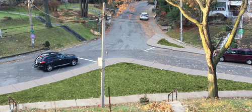
Madrid, leading many to wonder why New York does not eliminate cars in a small area, such as south of Chambers Street.

Where "New York" is mentioned, read it as "Toronto".
 
Though to be fair, central Paris is very dense with amazing public transit. Toronto is obviously not that.
 
Though to be fair, central Paris is very dense with amazing public transit. Toronto is obviously not that.

I'm of the view this would be do-able in Toronto in the medium term, but not now.

There's no question that the Relief line would be necessary for a full downtown shift like that, or even something close to that.

Moreover, that would not be enough, GO service would have to be fully at the RER level, and perhaps better (every 10m off-peak, and near subway frequencies in rush hours).

Streetcars would be fine (subject to the additional 60 vehicles that talked about from time to time), as the removal of traffic would vastly increase their attractiveness and their capacity.

Both Union and the Line 1 stations from Bloor south would have to be enlarged. (Union being a platform and access/to and from issue, and Y-B requiring much larger mezzanines and a new EB platform. Other stations would require less investment, but still something.

In the interim there is the potential for some small scale projects to move us in this direction.

King's College Circle, Tower Rd/Hart House Circle at U of T
Willcocks at U of T
John Street
Gould and related streets at Ryerson

Then I would like to see Market street style treatments moving us in this direction for Scott and Colborne

Followed by bike lanes along Bloor through downtown.

Much beyond that requires substantial new transit capacity.

Something we need to begin to working to deliver ASAP, but something that's unlikely to be here before 2028 at the earliest.
 
While Toronto seems to be doing zero on the road safety zero plan, other cities are actually doing something.

A Dutch town put traffic lights in the pavement because people won't stop staring at their smartphones

From link.

58a5e3d0dd0895802f8b4722-960-563.png

58a5e3d0dd0895802f8b4723-960-720.png


A Dutch town has introduced an unusual way of trying to keep smartphone-addicted residents safe: Installing traffic lights in the pavement.

Bodegraven, in the Netherlands, has put strip lights in the floor at a pedestrian crossing — meaning people who stare at their phones all day will see them, preventing them from wandering dangerously into traffic. (We heard about the news via the BBC.)

Apart from their unusual location, they work just like ordinary traffic lights: Green means go, and red means wait.

The lights are built by HIG Traffic Systems, a company based in the town, which hopes to sell them more widely to other towns and cities, The Guardian reports. Right now they're just being used at a single intersection in a trial.

A spokesperson for the company told Dutch-language site OmroepWest: "Smartphone use by pedestrians and cyclists is a major problem. Trams in The Hague regularly make an emergency stop because someone looks at their smartphone instead of traffic."

However, the lights have also proved controversial. "It's not a good idea to help mobile phone users look at their phones," Dutch Traffic Safety Association employee Jose de Jong reportedly said.

"We don't want people to use phones when they're dealing with traffic, even when walking around. People must always look around them, to check if cars are actually stopping at the red signals."

Meanwhile, the Toronto Roads Department are busy twiddling their thumbs, since pedestrians (and transit) are low priority to them.
 

Back
Top