

reaperexpress
Senior Member
During this summer's GO Barrie Line weekend service trial, ridership was not very high, and that is probably because there are almost no destinations along the line other than Barrie and Downtown Toronto. Most stops have little around them except subdivisions and parking lots.
I think Maple GO Station is a great location for a development which would be a major destination, for shopping and for work. It has tons of vacant land, and is very close to destinations such as historic Maple and Vaughan City Hall. The development would also aim to improve bicycle access to the station by creating a network of bicycle paths centred around the station and providing plenty of weather-protected bicycle parking.
All the City of Vaughan seems to be doing with the site is to slowly develop it with unpleasant big-box stores. The site is currently home to a Lowe's and a WalMart, the latter of which was built since the Google image was taken in 2009.
What do you think of this idea? Feasible? Unrealistic? Flawed?
Overview
Here's the site plan, showing my proposal (Click here for full size image)

The main street would be Eagle Rock Way, lined with shops with big-box stores and apartments above. Motorized vehicles would not be permitted except for deliveries and maintenance.

McNaughton avenue would serve as a ring road around the site. It would continue to be a suburban arterial, but now with bike paths:

Detailed Site Tour
For a better sense of the pictures' locations, they are all geotagged in the Flickr set
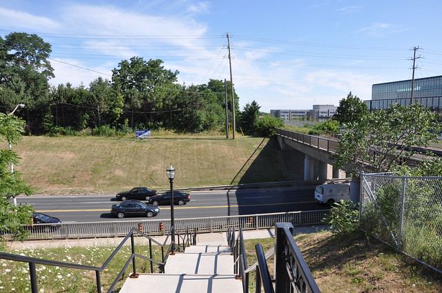
Looking south across Major Mackenzie from Station Road:
There would be a bicycle/pedestrian bridge here, providing access to the residential areas southeast of the station.
There would also be an identical bridge on the other side of the tracks providing access to Vaughan City Hall (visible on the right) and the southwest residential areas.
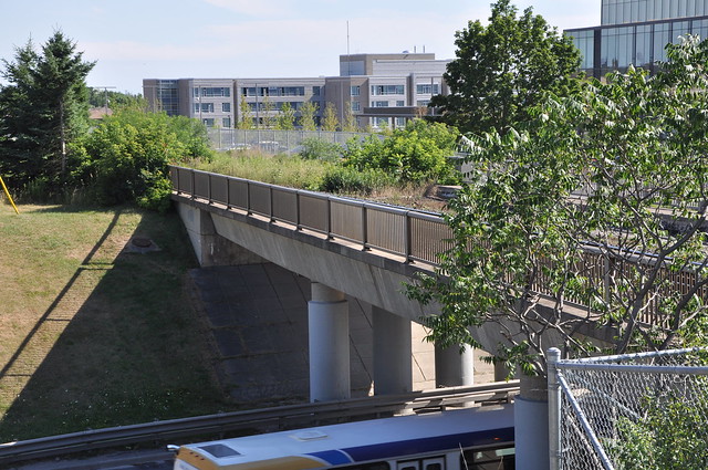
Closeup of Major Mackenzie Overpass:
This segment of the Barrie line (from Union to Newmarket) is prepared for double tracks. Note the extra space on the bridge.
Hill Street looking north:
Still at the same spot, looking the opposite direction. Hill Street would be redesigned for bicycles. Car parking could potentially remain.
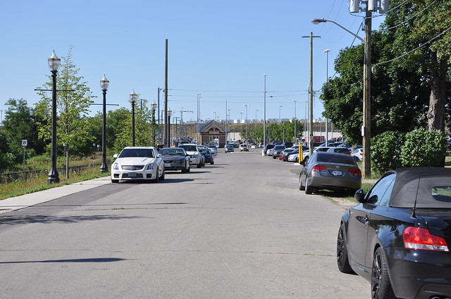
Looking northeast toward Hill Street and Station Street:
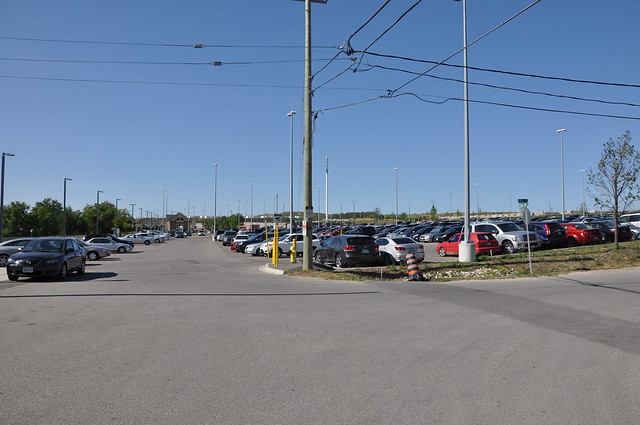
Note the topography of the site. It would naturally have been a gradual hill up from the tracks to Troon Avenue. But to accommodate the massive surface parking lots, the land has been divided into two flatter levels by a concrete retaining wall. We should restore a more gradual topography, such that the Eagle Rock would be on a continuous 4.5% grade from Troon to the station.
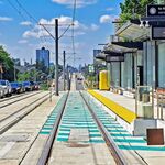
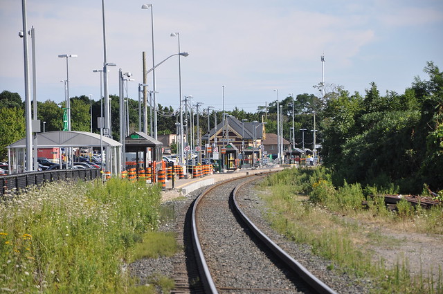
Looking south at the station from McNaughton:
There is plenty of room for a second track and platform on the west side of the station.
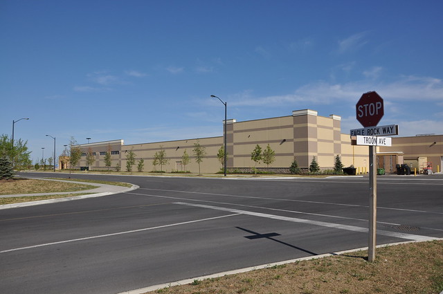
Looking southeast toward Troon Avenue and Eagle Rock:
A WalMart was recently built on the southeast corner. I'd replace it with a line of shops/apartments, followed by rows of townhouses with garages in the back (hence the alleyways).
My two main sources of inspiration for this design were the Paseo Colorado mall in Pasadena California, and the town of Houten in The Netherlands. Paseo Colorado is an example of a successful pedestrian mall in a car-dependant environment, while Houten uses a network of bike paths to achieve an incredibly high bike-and-ride rate at its central station.
I think Maple GO Station is a great location for a development which would be a major destination, for shopping and for work. It has tons of vacant land, and is very close to destinations such as historic Maple and Vaughan City Hall. The development would also aim to improve bicycle access to the station by creating a network of bicycle paths centred around the station and providing plenty of weather-protected bicycle parking.
All the City of Vaughan seems to be doing with the site is to slowly develop it with unpleasant big-box stores. The site is currently home to a Lowe's and a WalMart, the latter of which was built since the Google image was taken in 2009.
What do you think of this idea? Feasible? Unrealistic? Flawed?
Overview
Here's the site plan, showing my proposal (Click here for full size image)
The main street would be Eagle Rock Way, lined with shops with big-box stores and apartments above. Motorized vehicles would not be permitted except for deliveries and maintenance.
McNaughton avenue would serve as a ring road around the site. It would continue to be a suburban arterial, but now with bike paths:
Detailed Site Tour
For a better sense of the pictures' locations, they are all geotagged in the Flickr set
Looking south across Major Mackenzie from Station Road:
There would be a bicycle/pedestrian bridge here, providing access to the residential areas southeast of the station.
There would also be an identical bridge on the other side of the tracks providing access to Vaughan City Hall (visible on the right) and the southwest residential areas.
Closeup of Major Mackenzie Overpass:
This segment of the Barrie line (from Union to Newmarket) is prepared for double tracks. Note the extra space on the bridge.
Hill Street looking north:
Still at the same spot, looking the opposite direction. Hill Street would be redesigned for bicycles. Car parking could potentially remain.
Looking northeast toward Hill Street and Station Street:
Note the topography of the site. It would naturally have been a gradual hill up from the tracks to Troon Avenue. But to accommodate the massive surface parking lots, the land has been divided into two flatter levels by a concrete retaining wall. We should restore a more gradual topography, such that the Eagle Rock would be on a continuous 4.5% grade from Troon to the station.
Looking south at the station from McNaughton:
There is plenty of room for a second track and platform on the west side of the station.
Looking southeast toward Troon Avenue and Eagle Rock:
A WalMart was recently built on the southeast corner. I'd replace it with a line of shops/apartments, followed by rows of townhouses with garages in the back (hence the alleyways).
My two main sources of inspiration for this design were the Paseo Colorado mall in Pasadena California, and the town of Houten in The Netherlands. Paseo Colorado is an example of a successful pedestrian mall in a car-dependant environment, while Houten uses a network of bike paths to achieve an incredibly high bike-and-ride rate at its central station.
Last edited: