News   Jul 12, 2024
 1.5K     0 
News   Jul 12, 2024
 1.2K     1 
News   Jul 12, 2024
 429     0 

Miscellany Toronto Photographs: Then and Now

May 1 addition.


Then. May 19, 1915. View of King/Roncesvalles/Queen intersection [on the right of the photo] in the distance from Lake Ontario.
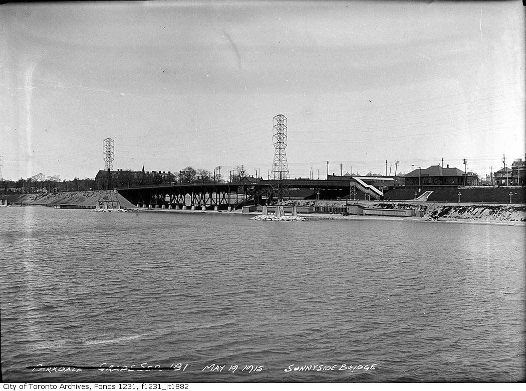

f1231_it1882.jpg


Now. March 2010. In the old photo the old Sunnyside train station can be seen at King street level. Passengers descended to and exited at track level through the sallyport [my term, don't know what else to call it]. This sallyport/concrete exit cut into the side of the embankment is buried, but not completely. If you stand on the modern pedestrian bridge (the one that takes you over the rail tracks and expressway) and look down you can see the concrete lower extremities of the sallyport. Perhaps a train buff will come along and tell me what these structures are called.
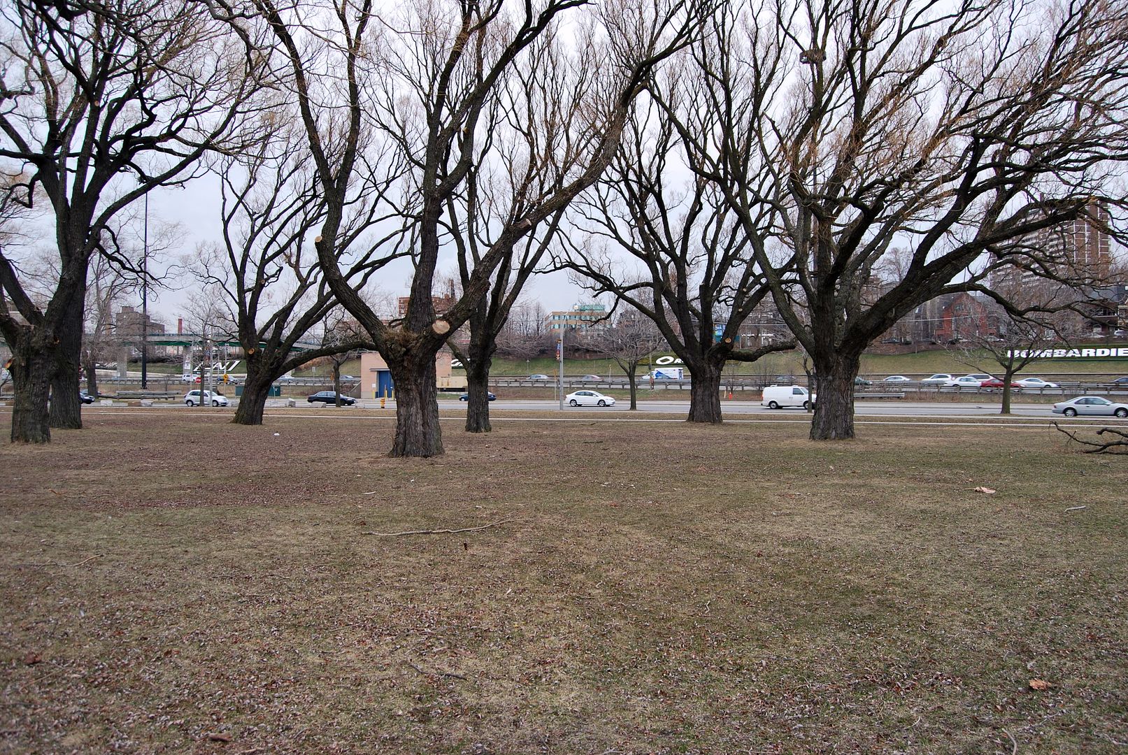

CSC_0017-1.jpg
 
Last edited:
Count me in as the latest "Mustaphan" - I've been hooked on this thread ever since I had a puff on Mustapha's 'back-in-time' ciggy and got maaaaa-gicallly transported. Keep up the good work!
 
Count me in as the latest "Mustaphan" - I've been hooked on this thread ever since I had a puff on Mustapha's 'back-in-time' ciggy and got maaaaa-gicallly transported. Keep up the good work!

Thanks Horkster and welcome to Urban Toronto. I hope you enjoy the company and contributors around our little "watercooler" here. I was kidding about the - ahem - smokes. :)


May 2 addition.


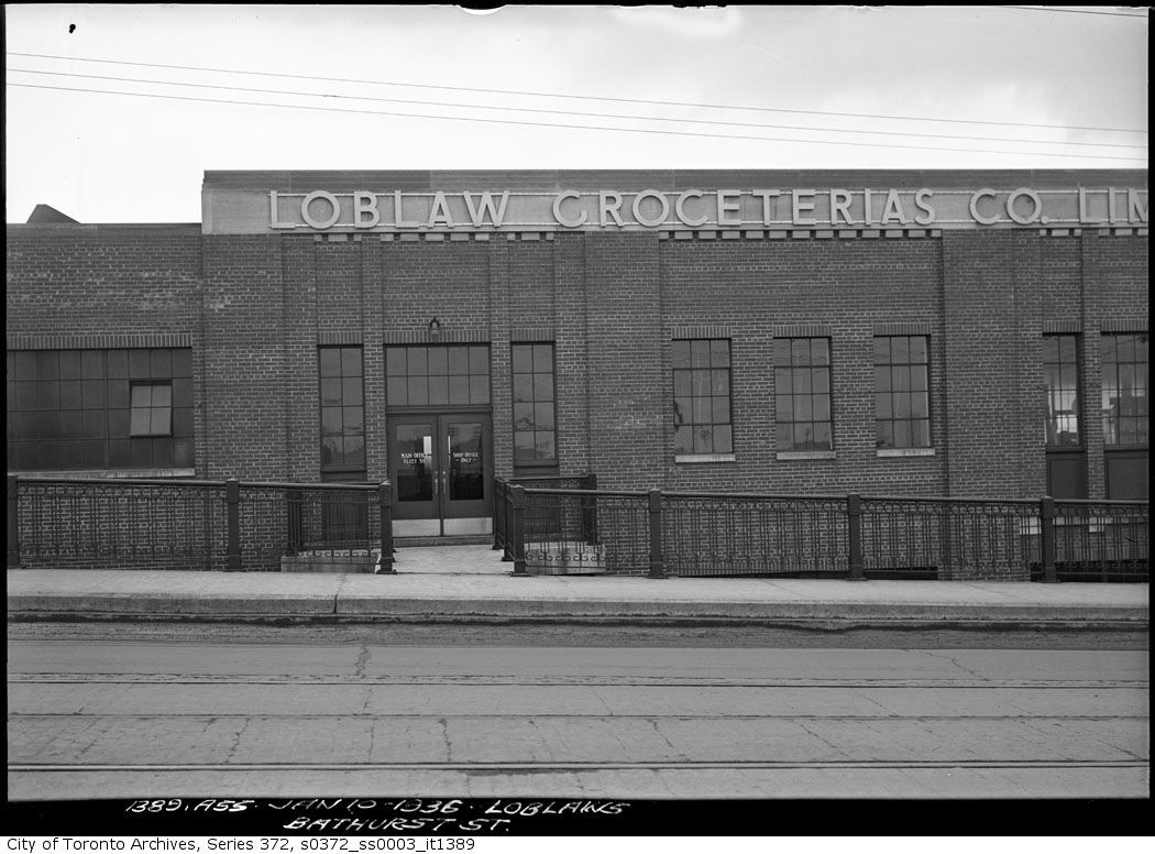
Then. Loblaws warehouse. Bathurst and Fleet street. January 10, 1936.


s0372_ss0003_it1389.jpg


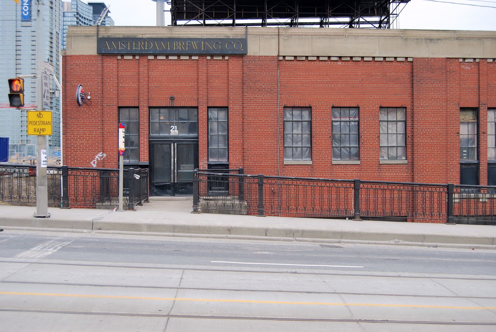
Now. April 2010.


CSC_0034-2.jpg
 

Asterix and Mustapha, thanks for extending my list of places to check out; I find the treatment of the old brick paving in this city to be fascinating and sad at the same time. One can only wonder how many reasonably intact cobble/brick streets still exist under a layer of asphalt. I also wonder why these small patches were saved, while all else around them got replaced or covered. I hope that one day we'll see some restoration of these roads. Even though it's in such a poor state overall, that brick stretch of Chiltern Hill Rd looks spectacular.
 
When was *that* jog eliminated, I wonder...

I'm guessing sometime in the '50s..

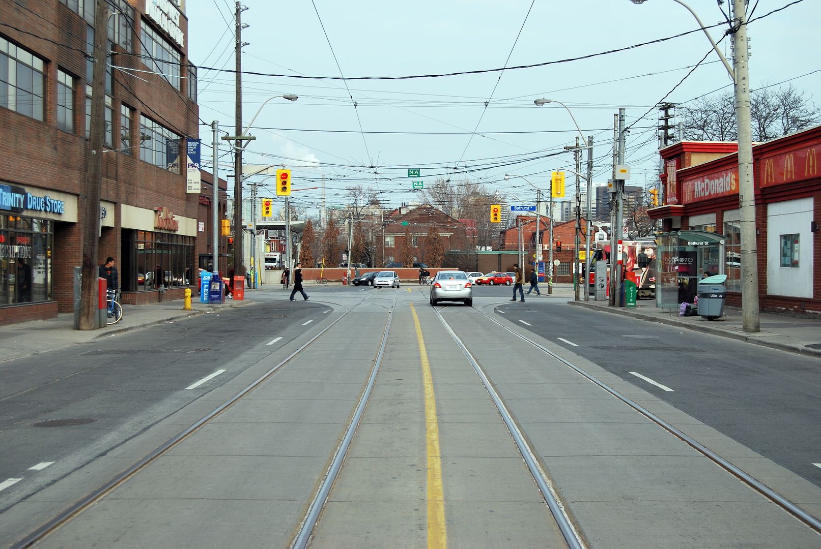
I see that the building on the SW corner of Bathurst and Dundas has changed twice throughout the years. I was already around in my teens when the 'second' building which housed Hilary's Pharmacy was demolished for the McDonalds that stands there today. Hilary's went down the street to Palmerston which used to be a music store after the demolition and has been there since.
 
Last edited:
I see that the building on the SW corner of Bathurst and Dundas has changed twice throughout the years. I was already around in my teens when the 'second' building which housed Hilary's Pharmacy was demolished for the McDonalds that stands there today. Hilary's went down the street to Palmerston which used to be a music store after the demolition and has been there since.
It's really too bad that the city ever approved a drive through in such a location. Truly shameful.
 
I'm guessing sometime in the '50s..

I see that the building on the SW corner of Bathurst and Dundas has changed twice throughout the years. I was already around in my teens when the 'second' building which housed Hilary's Pharmacy was demolished for the McDonalds that stands there today. Hilary's went down the street to Palmerston which used to be a music store after the demolition and has been there since.

And as I recall, Hilary's was a neat little International Style vernacular building (though the sign on top, topped by a spinning Penaten Creme orb, stole the show).

As for the jog elimination; 50s is plausible, but also 30s, in that a lot of urban-traffic-improvements already happened in that period (whether the College/Carlton elimination, or the stringing-together of Dupont)

Ah yes I do remember the Penaten Creme Orb so much. I just know the neighbourhood which I live in way too well, the recent development in my area is a demolition of a sort of substandard housing on Claremont and replaced it with a modern 3 storey housing.

I wonder if anyone has photos of the two warehouses on Claremont and Euclid before they got demolished for row housing.
 
It's really too bad that the city ever approved a drive through in such a location. Truly shameful.

Seldom used; thankfully.

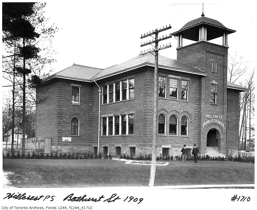
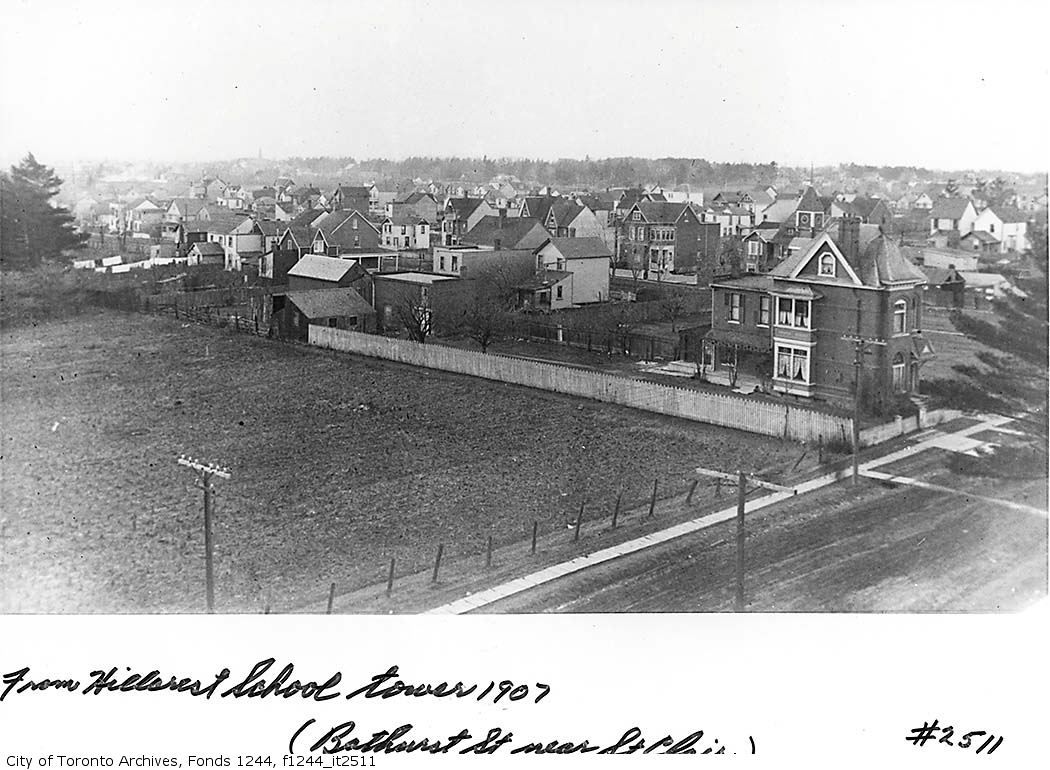
A view from the tower of Hillcrest, looking NW:

hillcrest.jpg

Looks like a tilled field in the foreground. Quite the mixture of wood and brick houses - it would be interesting to walk that street and see what's extant.


May 4 addition.


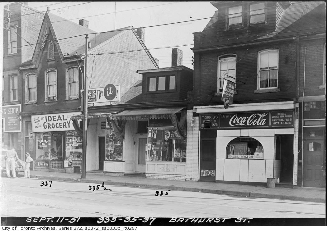
Then. E side of Bathurst street just S of Dundas street. September 11, 1951.


s0372_ss0033b_it0267.jpg


Now. February 2010.


CSC_0037-1.jpg
 
Okay; proof that the jog elimination was more likely 50s than 30s, unless shops still existed within that Bathurst/Dundas gore post-elimination. (And probably also as part of the long-term slum clearance programme that ultimately led to Alexandra Park--that definitely looks like what once might have been characterized as "slum retail".)
 
Seldom used; thankfully.


Looks like a tilled field in the foreground. Quite the mixture of wood and brick houses - it would be interesting to walk that street and see what's extant.


May 4 addition.


Then. E side of Bathurst street just S of Dundas street. September 11, 1951.


s0372_ss0033b_it0267.jpg


Now. February 2010.


CSC_0037-1.jpg

I laugh at the Now picture

Serves the people right if they want to left turn after buying McDonalds, then again, it isn't hard to get back the other way in that area iirc. I also noticed that the picture was taken 60 years before 9/11.

I also wonder if the houses west of Bathurst and south of Dundas were mostly slum housing.. If thats the case, i'm probably living in one of them now, just very renovated :p.

I also have a question. If I were to do research on my House in the Toronto Archives, would they have EVERYTHING? Like when the house was built + interiors?

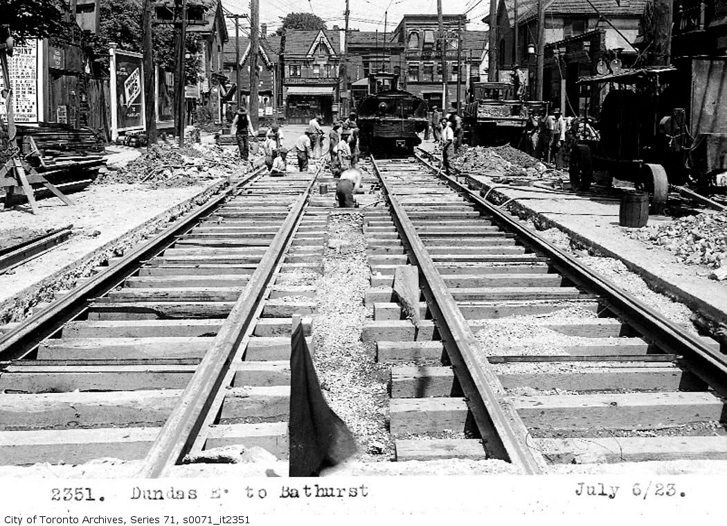
ANOTHER edit. I found some pictures of the Jog Elimination. It seems it was eliminated around 1953/1954 according to the Toronto Archives.

s0372_ss0058_it2402.jpg


s0372_ss0058_it2401.jpg


also, as of 1953, that Hiliary's Pharmacy building has still not yet been built.

s0372_ss0058_it2400.jpg


heres another photo of Dundas west of Bathurst. I'm suprised that the corner where Eastern Legend Cuisine/Subway/Rogers Computer now stands used to be a Gas Station.

s0071_it10503.jpg
 
Last edited:
I found some pictures of the Jog Elimination. It seems it was eliminated around 1953/1954 according to the Toronto Archives.
s0372_ss0058_it2402.jpg

s0372_ss0058_it2401.jpg

Interesting that in the first picture there is what looks like a school building - the original Ryerson Public School? - quite close to Dundas. A later building is there now.

In the second picture there is the car repair garage - it's still in business.


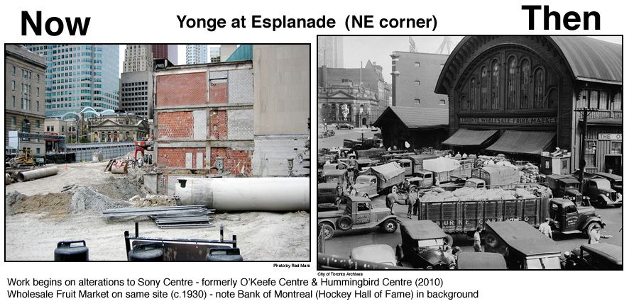
May 5 addition by Goldie. He sent me this 'combo' picture to post. I'm taking a break today. :)

Now photo on the left by Red Mars.


Yonge-Esplanade.jpg


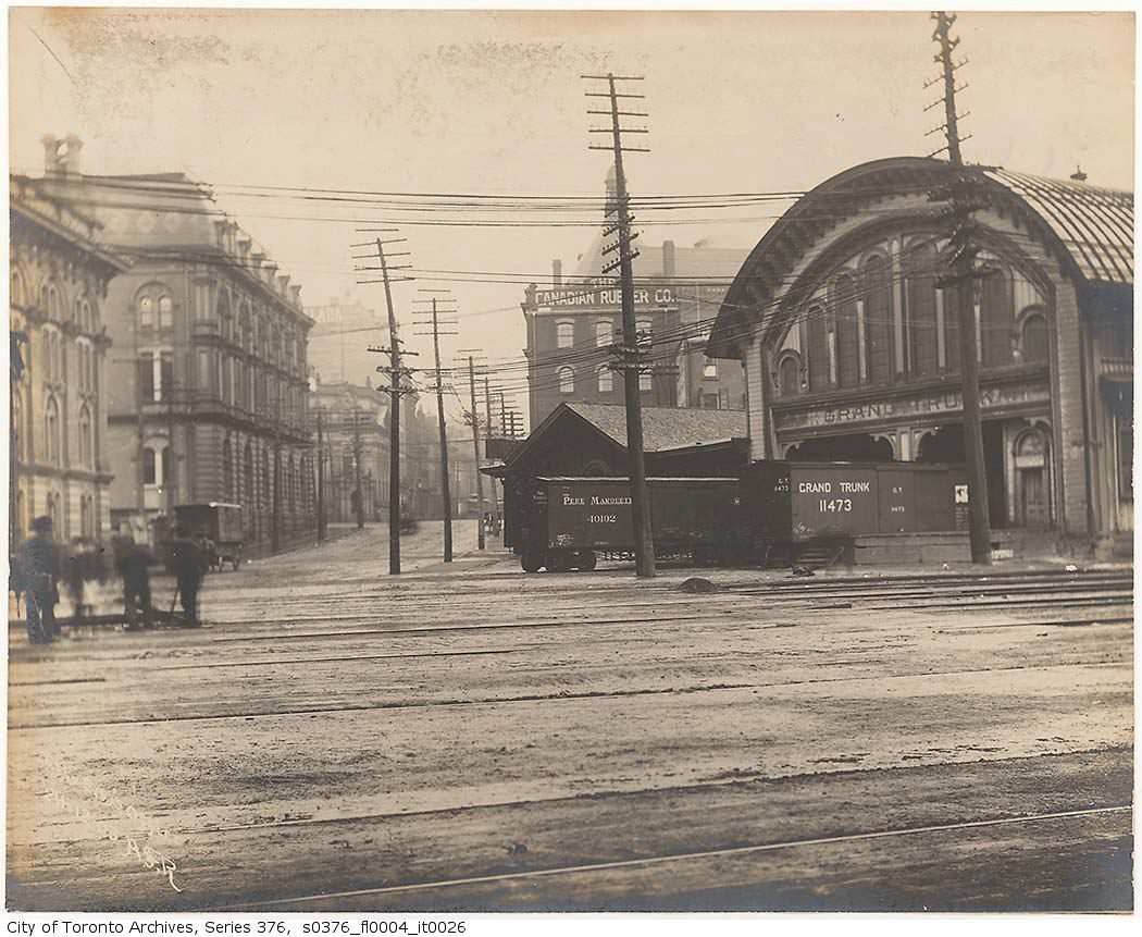
The fruit market was built in 1866 by the Grand Trunk Railway as one of their stations. The last trains ran through in 1882. Fire destroyed it in 1952. The O'Keefe/Hummingbird/Sony Centre opened on the site October 1 1960.


s0376_fl0004_it0026.jpg
 
Last edited:

Back
Top