News   Jul 12, 2024
 1.4K     0 
News   Jul 12, 2024
 1.2K     1 
News   Jul 12, 2024
 408     0 

Miscellany Toronto Photographs: Then and Now

Funny. I only noticed the nicely repaved Mt. Pleasant the other day. It only took two decades or so for them to finally get around to cleaning that up.

Correct me if I'm wrong but I believe the loop was shut down when the TTC moved to its new longer street cars meaning that it was impossible for the new cars to actually utilize that loop.

db

"The Last Days and Why They Came

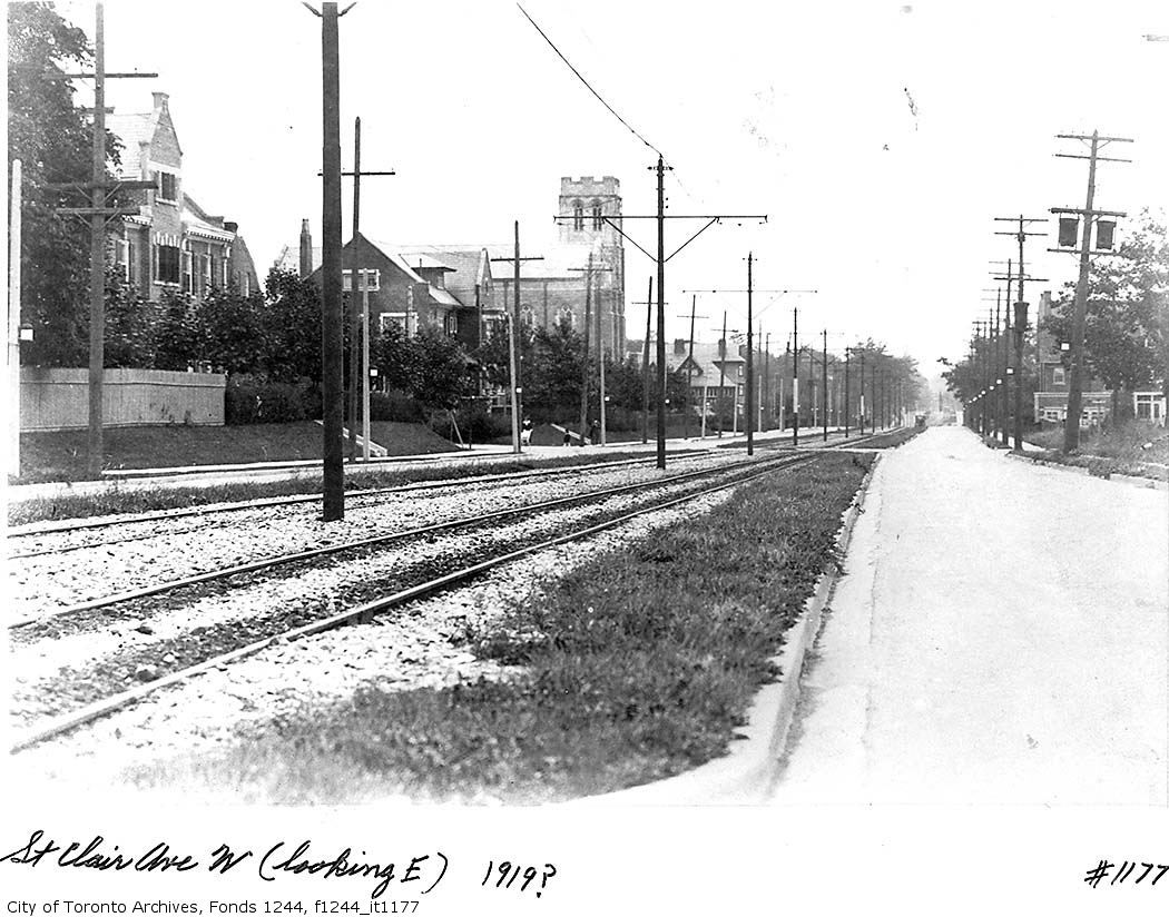
The Mount Pleasant streetcar stopped operating after July 24, 1976, long after the TTC decided to abandon its streetcar abandonment program. With the Rogers Road streetcar abandoned two years before, the TTC had enough streetcars to maintain service on Mount Pleasant and continue its PCC rebuilding program. So, why did Mount Pleasant fall?

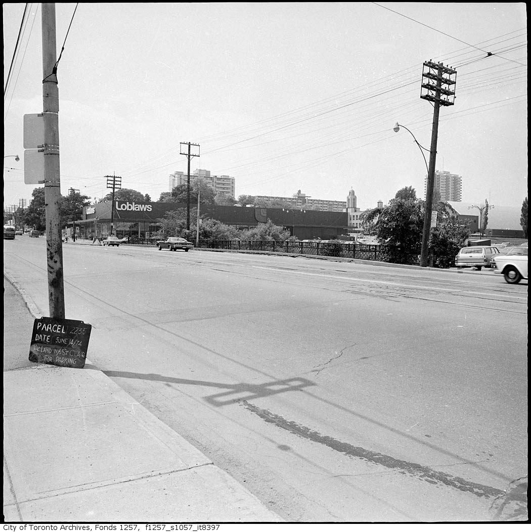
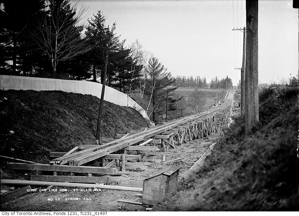
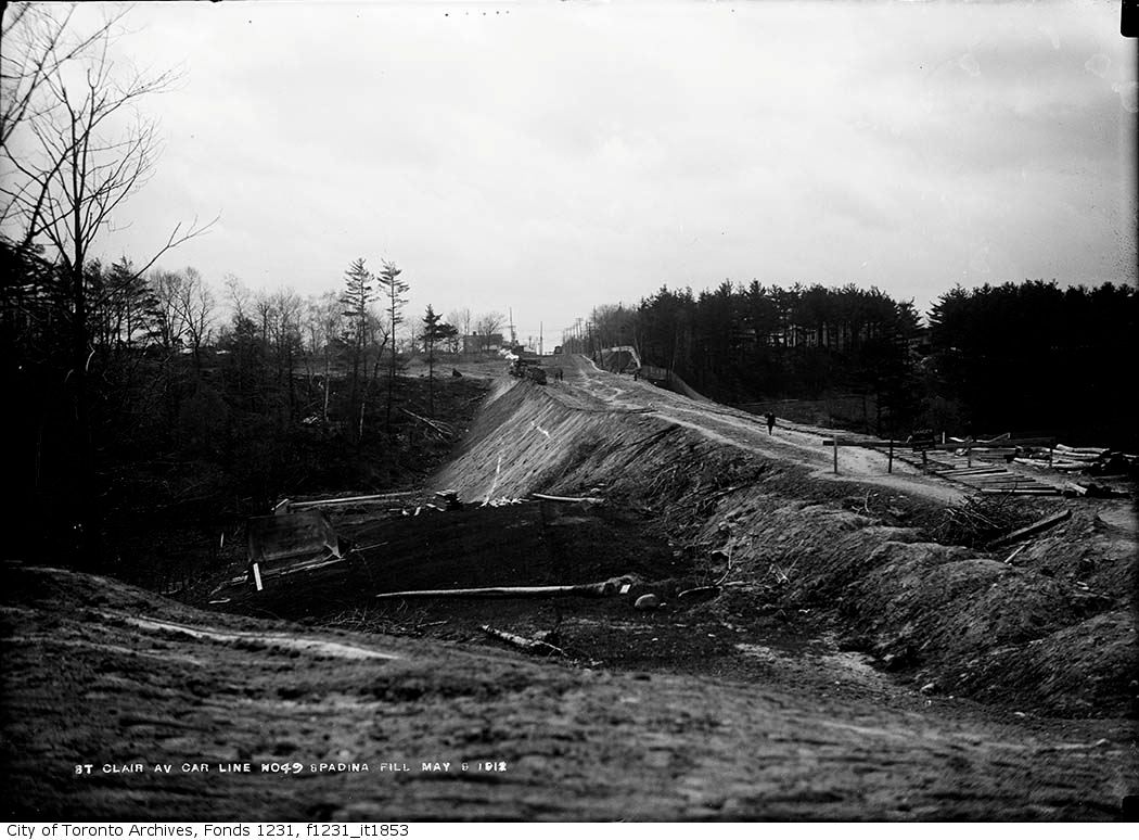
The blame can be laid at the feet of the Metro Roads Department. In March 1976, the Roads Department closed Mount Pleasant to reconstruct the bridge over the former Belt Line Railway. At that time, the track on Mount Pleasant was the same track that had been laid down in 1925, when the route was first built. The road construction forced the TTC to consider whether or not to rehabilitate the whole line. The TTC did a cost estimate and found that retaining streetcar service would cost $875,000, compared to $440,000 for conversion to trolley coach and $249,000 for conversion to diesel buses.

Based on those numbers, it would seem that the TTC would have favoured conversion to diesel buses, but a further cost analysis pointed out that although diesel buses and trolley buses cost less to operate per year than streetcars, this cost savings was nullified by the fact that it would take five buses to meet the carrying capacity of the four streetcars then serving the line. Community activism provided further pressure, with the South Eglinton Ratepayers and Residents Association making a number of presentations to TTC Board meetings and chartering Peter Witt #2894 to promote its campaign to retain streetcar service. The TTC bowed to public pressure and announced that streetcar service would be retained.

It didn’t happen. Three months later, public notices appeared along the line announcing that service would end at the end of July. The TTC was forced to reverse its decision through the direct intervention of the Metro Roads Department, in response to complaints from car drivers about streetcars ‘obstructing’ their progress. This reversal was made without any community consultation, and it was a sad comment that drivers from outside the community could effectively override the desires of people living within that community.

Streetcars stopped running on Mount Pleasant after the last St. Clair night car departed Eglinton Loop at 5:15 a.m. on July 25, 1976. Night Service by the same cars to Moore Park Loop continued until the 1st of October that year, before it too was cut back to St. Clair Station and the tracks abandoned. Mt. Pleasant has not had night service ever since.

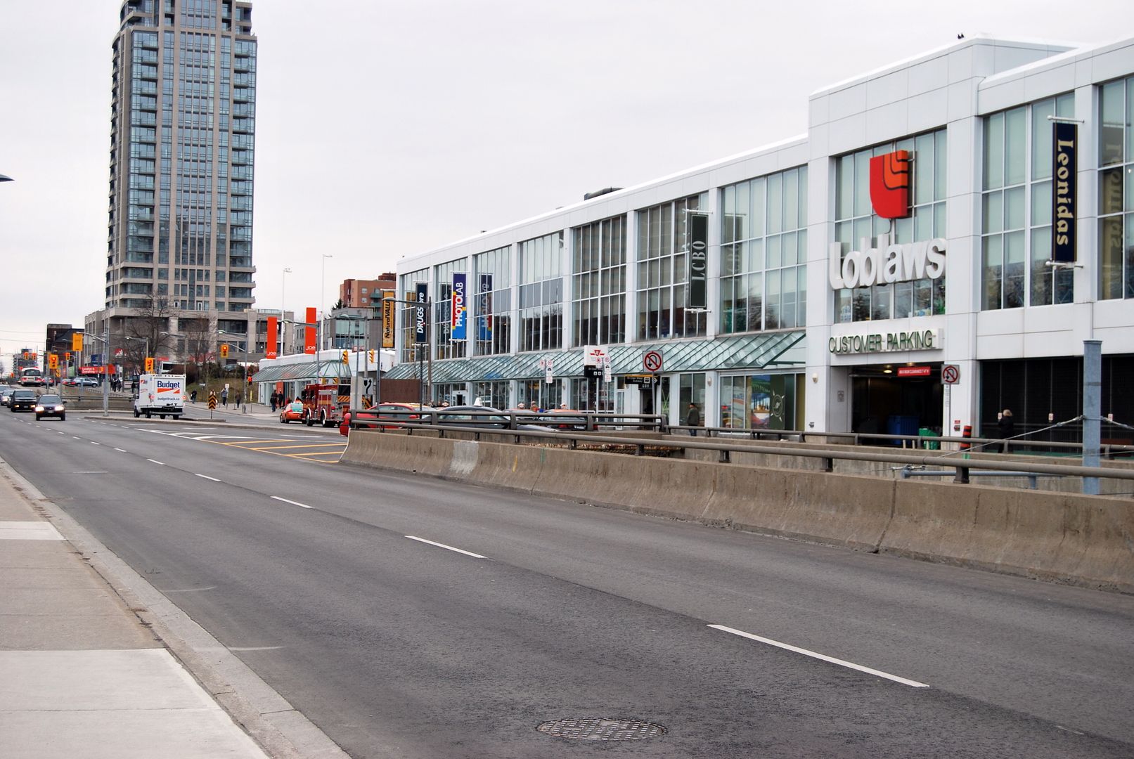
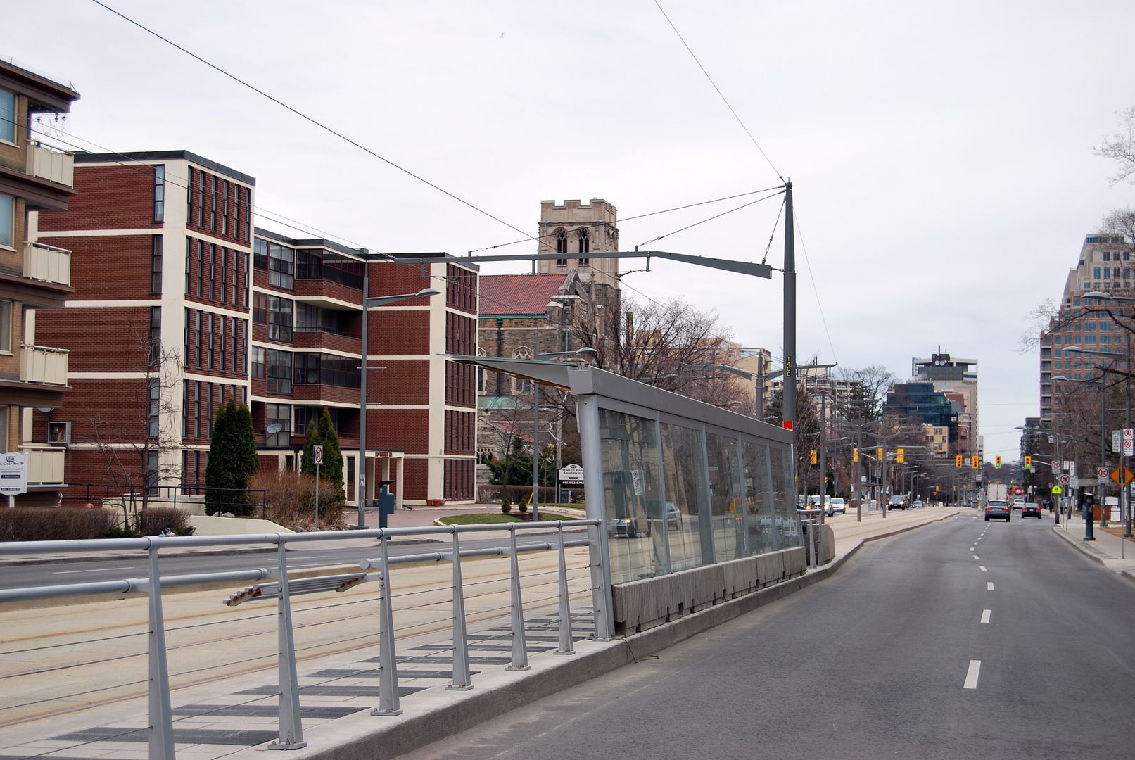
Echoes of the Mount Pleasant streetcar continue to this day. The Mount Pleasant trolley bus started running about a year after abandonment, following the same route. Eglinton Loop still exists, albeit beneath a new commercial/residential development. These echoes are fading, however: Moore Park loop was turned into a parkette soon after abandonment, and the trolley coaches disappeared in 1992."


http://transit.toronto.on.ca/streetcar/4114.shtml
 
Only the loop trackage is still there, under the grass of course

The rest of the track is now removed from a recent repaving of that intersection. Went by it when our family was heading over to Mt. Pleasant Cemetary. Before the repaving, you could easily see the St. Clair to Mt Pleasant curve tracks..

Thanks TKWizard. The repaving... it never occurred to me why things were so smooth on this stretch. My kids called the curve tracks "ghost tracks". Welcome to Urban Toronto.


While I know that nowadays a return to cobblestone and brick paving is impractical for most of our streets, that Withrow/Logan shot makes me wish that all of our older residential streets were cobble/brick. The traffic is generally slower and lower in volume, so it works for practicality reasons, and it just suits the narrow streets lined with historic homes so well. Sadly I don't think we'll see much in the way of reinstating brick paving anytime soon, so I'll have to make do with what little remains. That shot has given me another place to check out, as I'm always trying to find roads paved in materials other than concrete/asphalt.

Keep up the good work Mustapha, and our other contributors, I can't say enough how much I love this thread.

egotrippin, if you like brick paving be sure to check out the small section of Highbourne road betwen Oxton and Kilbarry. It looks original to me. I remember our family car rumbling over it in the 1960s through here on the way downtown.
 
Last edited:
April 20 addition.


Then. St. Clair Avenue W. looking east. Timoth Eaton Church in the distance. "1919?" according to the photo caption. [The church went up in 1914.]


stclairtimothyeaton.jpg


Now. March 2010.


CSC_0009.jpg
 
I wonder which Chiltern Hill the Toronto street naming committee were thinking of when they named that road. There are between 10 and 20 hills and they don't all have names.

/cheers from the middle of the Chiltern Hills in the UK

NoMoreATorontonian

I'll be inspecting TO in three weeks time if the volcanic cloud would just go away.
 

A better example; I defer. :)

I wonder which Chiltern Hill the Toronto street naming committee were thinking of when they named that road. There are between 10 and 20 hills and they don't all have names.

/cheers from the middle of the Chiltern Hills in the UK

NoMoreATorontonian

I'll be inspecting TO in three weeks time if the volcanic cloud would just go away.

A hopefully not too premature "Welcome home".


very classy how it transitions from concrete to brick

The red brick really makes the street "pop" visually.


April 21 addition.


Then. St. Clair W looking at the Loblaws store c1970? Wells Hill avenue is behind the photographer.


f1257_s1057_it8397.jpg


Now. March 2010.


CSC_0010.jpg
 
...according to the board leaning against the pole.

That chaulk board appears in many photos... Someone with way more time than me could make an interesting video, keeping the chaulk board in the same place and scoll through all the various photos.

And Uncle Teddy, what the photo doesn't show is the wonderful ravine just to our left, which continues 2 blocks north. "Urbanizing nicely" would be to move the subway station and Loblaws, tear up the foot ball field farther north, and return the ravine to a (more) natural state... Never going to happen, of course, but as a bike rider that has to ride up St. Clair, across at the light, then through the neighbourhood to get back to the ravine I can dream! And there is a growing understanding that those sort of changes benefit a city, like the end of this TED video:

http://www.ted.com/talks/lang/eng/eric_sanderson_pictures_new_york_before_the_city.html

400 years after Hudson found New York harbor, Eric Sanderson shares how he made a 3D map of Mannahatta's fascinating pre-city ecology of hills, rivers, wildlife -- accurate down to the block -- when Times Square was a wetland and you couldn't get delivery.
 
...return the ravine to a (more) natural state... Never going to happen, of course, but as a bike rider that has to ride up St. Clair, across at the light, then through the neighbourhood to get back to the ravine I can dream!
.
f1231_it0833.jpg
 
That chaulk board appears in many photos... Someone with way more time than me could make an interesting video, keeping the chaulk board in the same place and scoll through all the various photos.

And Uncle Teddy, what the photo doesn't show is the wonderful ravine just to our left, which continues 2 blocks north. "Urbanizing nicely" would be to move the subway station and Loblaws, tear up the foot ball field farther north, and return the ravine to a (more) natural state... Never going to happen, of course, but as a bike rider that has to ride up St. Clair, across at the light, then through the neighbourhood to get back to the ravine I can dream! And there is a growing understanding that those sort of changes benefit a city, like the end of this TED video:

http://www.ted.com/talks/lang/eng/eric_sanderson_pictures_new_york_before_the_city.html

There are a number of photos in the Archives of the Bathurst/St. Clair area, illustrating when it was once known as the Fleming Estate. Here's a shot looking west towards Bathurst:

FlemingestateNEcornerbathstclair-2.jpg


Looking north (just east of Bathurst):

FlemingestateNEcornerbathstclair-1.jpg


The Fleming Estate:

FlemingestateNEcornerbathstclair191.jpg


fleming1.jpg


fleming2.jpg


Looking east on St. Clair from Bathurst 1910:

fleming1910.jpg


1911:

stclair1911.jpg


Looking west:

fleming4.jpg


1935 (underneath the playing field and Loblaws was a garbage dump):

fleming31935.jpg


1940:

flemingdump1940.jpg
 
Then: June 14th 1974 according to the board leaning against the pole. The summer of Watergate.

And another giveaway of a later-than-1970 date: the new Don Watt Loblaws "look" (adopted around 1972/73)--and I wouldn't be surprised if the St Clair location was one of the first if not the first to acquire said "look" (hey, it was the Forest Hill store, and the Weston family vibes are worth considering)
 

Back
Top