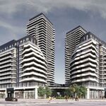


299 bloor call control.
Senior Member
The first meeting is next Wednesday night at the National Ballet School.
They even created a Facebook (!) group.
http://www.facebook.com/group.php?gid=6949283325
I'll be there for that first meeting... there's so much that needs to be done to that street.

[FONT=Arial, Helvetica, sans-serif]This site was last updated March 7, 2008[/FONT] [FONT=Arial, Helvetica, sans-serif]Study overview
The City of Toronto has started a Class Environmental Assessment (EA) to study and develop streetscape improvement plans and traffic lane modifications along the Jarvis Street corridor from Bloor Street East to Queen Street East. The study will be an opportunity for the public to provide input into a design concept for Jarvis Street that will: [/FONT]
- [FONT=Arial, Helvetica, sans-serif]Meet the aesthetic and historic objectives of the area[/FONT]
- [FONT=Arial, Helvetica, sans-serif] Improve the streetscaping features[/FONT]

[FONT=Arial, Helvetica, sans-serif]Study area map
Jarvis Street is a north-south arterial road and primary commuter route. View map of study area in PDF format[/FONT][FONT=Arial, Helvetica, sans-serif] (PDF). [/FONT]
[FONT=Arial, Helvetica, sans-serif][FONT=Arial, Helvetica, sans-serif] Study purpose[/FONT]
To improve the public realm in a manner that compliments the existing built form and redevelopment in the area.[/FONT]
[FONT=Arial, Helvetica, sans-serif]The streetscaping opportunities along Jarvis Street will provide:[/FONT]
[FONT=Arial, Helvetica, sans-serif]The envisioned Jarvis street will be safe and accessible, attractive, educational, environmentally sound, business friendly, and support vibrant communities.[/FONT]
- [FONT=Arial, Helvetica, sans-serif]Improvements to celebrate the diverse cultural and historical elements[/FONT]
- [FONT=Arial, Helvetica, sans-serif] Enhance the pedestrian environment[/FONT]
[FONT=Arial, Helvetica, sans-serif]People from local neighbourhoods, across Toronto, and beyond will recognize Jarvis Street equally as a transportation corridor as well as a desirable destination.[/FONT]
[FONT=Arial, Helvetica, sans-serif]Key elements of the study will include:[/FONT]
[FONT=Arial, Helvetica, sans-serif]Background
- [FONT=Arial, Helvetica, sans-serif]Identify opportunities for streetscaping along Jarvis Street between Bloor Street and Queen Street[/FONT]
- [FONT=Arial, Helvetica, sans-serif] Identify preferred alternative solution to meet the streetscaping initiatives of the City and establish a sense of place along Jarvis Street[/FONT]
- [FONT=Arial, Helvetica, sans-serif]Identify timing for implementation of the preferred alternative(s)[/FONT]
- [FONT=Arial, Helvetica, sans-serif] The study is following the planning and design process for a Schedule “C†project under the Municipal Class Environmental Assessment.[/FONT]
A comprehensive transportation study was completed by the project consultant in January 2005 assessing the traffic conditions along Jarvis Street and adjacent streets. The City of Toronto’s Traffic Operations Section has signed off on the Jarvis Street Streetscape Traffic Study 2005[/FONT][FONT=Arial, Helvetica, sans-serif] (PDF) [/FONT][FONT=Arial, Helvetica, sans-serif]which evaluated existing and future traffic conditions and recommended that the removal of the reversible centre lane se carried forward for further study to determine physical feasibility and for public input.[/FONT]
[FONT=Arial, Helvetica, sans-serif]You'll need the free Adobe Acrobat reader to view PDF files.[/FONT]
[FONT=Arial, Helvetica, sans-serif]Public consultation
The first Jarvis Streetscape Open House will be held on Wednesday, March 19, 2008.[/FONT]
[FONT=Arial, Helvetica, sans-serif]Location:[/FONT] [FONT=Arial, Helvetica, sans-serif]Canada's National Ballet School
400 Jarvis Street, Town Square[/FONT] [FONT=Arial, Helvetica, sans-serif]Time: [/FONT] [FONT=Arial, Helvetica, sans-serif]6:00pm to 9:00pm
A presentation will be made at 7:00pm[/FONT] [FONT=Arial, Helvetica, sans-serif]Visit the Facebook Group: Jarvis Streetscape Improvement[/FONT]
[FONT=Arial, Helvetica, sans-serif]Related information[/FONT]
[FONT=Arial, Helvetica, sans-serif] Related projects[/FONT]
- [FONT=Arial, Helvetica, sans-serif]Jarvis Street Streetscape Traffic Study, 2005[/FONT]
- [FONT=Arial, Helvetica, sans-serif]The Official Plan policies apply directly to the Jarvis Street Streetscape Improvement projects aim to create a vibrant public realm and balance the needs of all road users[/FONT].
[FONT=Arial, Helvetica, sans-serif]Contact us
- [FONT=Arial, Helvetica, sans-serif]Allan Gardens Landscape Revitalization Strategy[/FONT]
- [FONT=Arial, Helvetica, sans-serif] City of Toronto Walking Strategy[/FONT]
- [FONT=Arial, Helvetica, sans-serif]Jarvis Slip Public Space – Waterfront Toronto Corporation [/FONT]
If you have questions or would like to be placed on our mailing list, please contact us:[/FONT]
[FONT=Arial, Helvetica, sans-serif]Maogosha Pyjor[FONT=Arial, Helvetica, sans-serif]Media inquiries
City of Toronto, Public Consultation Unit
Tel: 416-338-2850
Email: Jarvis@toronto.ca
Facebook Group: Jarvis Streetscape Improvement[/FONT][FONT=Arial, Helvetica, sans-serif]24 Hour Comment Line: 416-397-7777
Fax: 416-392-2974
TTY: 416-397-0831
Mail: City of Toronto, Public Consultation Unit
55 John Street, 19th Floor, Toronto ON, M5V 3C6[/FONT]
All media inquiries can be directed:[/FONT]
[FONT=Arial, Helvetica, sans-serif]Steve Johnston
Communications and Consultation
Tel. 416-392-4391 [/FONT]
They even created a Facebook (!) group.
http://www.facebook.com/group.php?gid=6949283325
I'll be there for that first meeting... there's so much that needs to be done to that street.
