News   Nov 28, 2024
 78     0 
News   Nov 28, 2024
 500     1 
News   Nov 28, 2024
 569     0 

GO Transit: Construction Projects (Metrolinx, various)

For the record, the speed limits of the various switches in CN usage are fairly variable, in the sense if they are used back-to-back (to form a crossover) they are allowed a certain speed:
#20 - 45mph
#16 - 30mph
#12 - 15mph

Thanks for that information. Since we're on the topic, according to the GO Transit Track Standard Plans, the maximum recommended speeds through turnouts is the following (where L = lateral and E = equilateral):
  • no. 8 L: 15 mph, not to be used outside of yards
  • no. 10 L: 15 mph
  • no. 12 L: 15 mph, unless all welded: 25 mph
  • no. 16 L & E: 30 mph
  • no. 20 L: 45 mph
  • no. 20 E: 70/55/50 mph
The lead length -- in other words, the straight-line distance between the end of the switch rail and the crossing (frog) -- for each of these turnouts is the following:
  • no. 8 L: 60' 11" (18.57m) or 67' 10 3/4" (20.69m)
  • no. 10 L: 81' 6 1/2" (24.85m)
  • no. 12 L: 98' 1" (29.90m)
  • no. 16 L & E: 118' 5" (36.09m) or 139' 1 1/2" (42.41m)
  • no. 20 L: 156' 0 1/2" (47.56m)
  • no. 20 E: 167' 0" (50.90m)
I've found this useful to reverse-engineer turnout geometry from aerial photos or other photos where there's a usable reference point for measurement.

Additionally, the design manual states the following:
8. On main track, only number 12 lateral and number 20 lateral turnouts shall be permitted, unless authorized by the CM Senior Manager of Track and Structures in writing.
a. Equilateral turnouts may be installed in select locations upon approval in writing from the CM Senior Manager of Track and Structures.

I should add for everybody's benefit that the numbers cited above are merely reference designs. They do not necessarily reflect any given turnout, most of which were designed and installed by other railways over many decades. Also, I'm a signalling engineer, so track geometry is at the boundary of my knowledge area: please take this with a grain of salt.
 
The modern stuff is eminently flexible, but it’s common practice to not install 3-colour signal heads unless the design needs them…. so physical mods sometimes have to happen before the changes can be made, to provideall the aspects required.. I don’t know that that’s the situation here.

It's certainly the case for the western approach to Waterdown, as the eastbound signal on T3 will need to be changed to protect the new switch. I'd imagine it will change to a three-head signal so it can show (slow/diverging) to limited in case an eastbound movement is routed straight through the pocket track.

1642033698386.png
 
^The Heritage Road yard has been in the works on and off for over a decade.

No mention of a flyover - would this not logically be placed in the same general area? One TPAP study vs two?

One wonders if moving the layover yard away from Georgetown is needed in order to make changes to the tracks and platforms as a prerequisite to the flyover plan (or a no-flyover plan)…. so no path forward on those until the yard is built….. Ddoes ML have a Gantt chart for the overall Kitchener upgrade ? It all seems very piecemeal.

- Paul
 
^The Heritage Road yard has been in the works on and off for over a decade.

No mention of a flyover - would this not logically be placed in the same general area? One TPAP study vs two?

One wonders if moving the layover yard away from Georgetown is needed in order to make changes to the tracks and platforms as a prerequisite to the flyover plan (or a no-flyover plan)…. so no path forward on those until the yard is built….. Does ML have a Gantt chart for the overall Kitchener upgrade ? It all seems very piecemeal.

- Paul


Previous documents have suggested the "Silver Grade Separation" would be located closer or at the Credit River - not here. Recently, Metrolinx presented to Brampton Council and were asked about this grade separation. Apparently it's being designed. If you want the link with the video of where the comment was said just let me know and I'll post.

Metrolinx has a document that I think talks about different phases or stages for the Kitchener Line west of Bramalea. I think @ShonTron posted it a few months or over a year ago? Maybe he can repost? Going by memory here.
I find it kinda funny how they call it the "Silver Grade separation" when it's nowhere near the actual silver junction. I believe it's supposed to be located between the credit river and heritage road layover
 
The Kitchener Service Expansion business case outlines two scenarios for Silver Junction - the first would have no grade separation and a crossing on either side of Georgetown GO to allow the CN mainline to be disrupted by GO only once per hour in off-peak periods. The other scenario includes the fly-over near Silver Junction which allows more operational flexibility, quicker travel times by removing the scheduled meet in Georgetown, and future expansion beyond 1 train/hr in off-peak. (Business Case, p. 50)

(As an aside, I noticed for the first-time that service extension to SWO was mentioned in the business case as a future opportunity being discussed within Metrolinx and with Stakeholders)
Where is the extension to SWO mentioned in the business case?

Edit page 52
Screenshot_20220113-161320_Drive.jpg
 
Jan 14/22
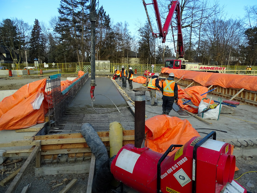
They were pouring concrete for the new bridge sidewalk that is wide as well the east retail rail section at Port Credit north parking lot. The west rail wall will be pour next week and most likely the concrete road pad for the north end at the bridge.

They were removing the poles at the east end that were used for reserve parking spot that have been removed from service.
51820357062_cb9a3ba479_b.jpg

51822028185_279b179d7b_b.jpg

51821647079_85eb5a8c38_b.jpg

51822028110_325f1d4dcd_b.jpg

51820358102_43b3eafe89_b.jpg

51822029080_73534db93b_b.jpg
 
Jan 14/22
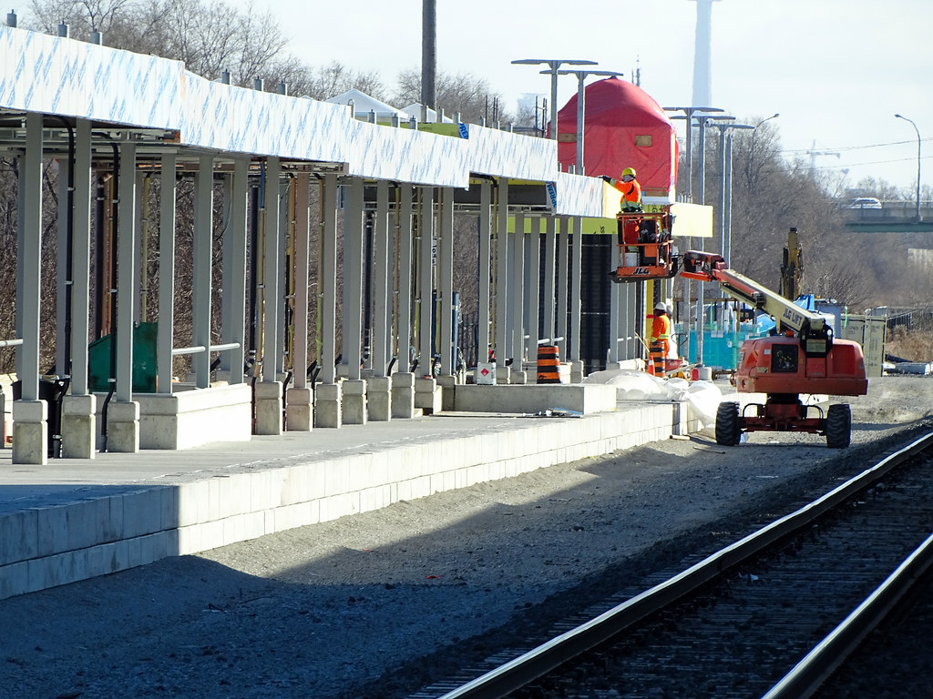
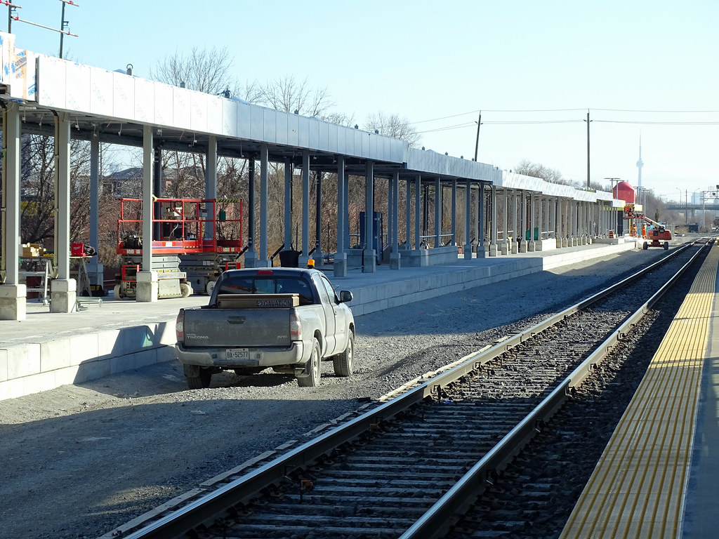
They about to start installing the glazing for the ne platform at Weston GO station. The track road bed is ready for rail to be install once the flashing work is done in the coming months. Platform could be in service come June once the station track is place as well join to the rail that is in place at each end along with testing.

Been cold and windy, didn't do my normal walk of the platform
51821671619_1073bb07e1_b.jpg

51821440893_18ea5749fe_b.jpg

51821329101_8c67566619_b.jpg

51821671319_8f7e90534f_b.jpg

51820381527_9d397bafda_b.jpg

51821671164_12dec6037b_b.jpg
 
Jan 16
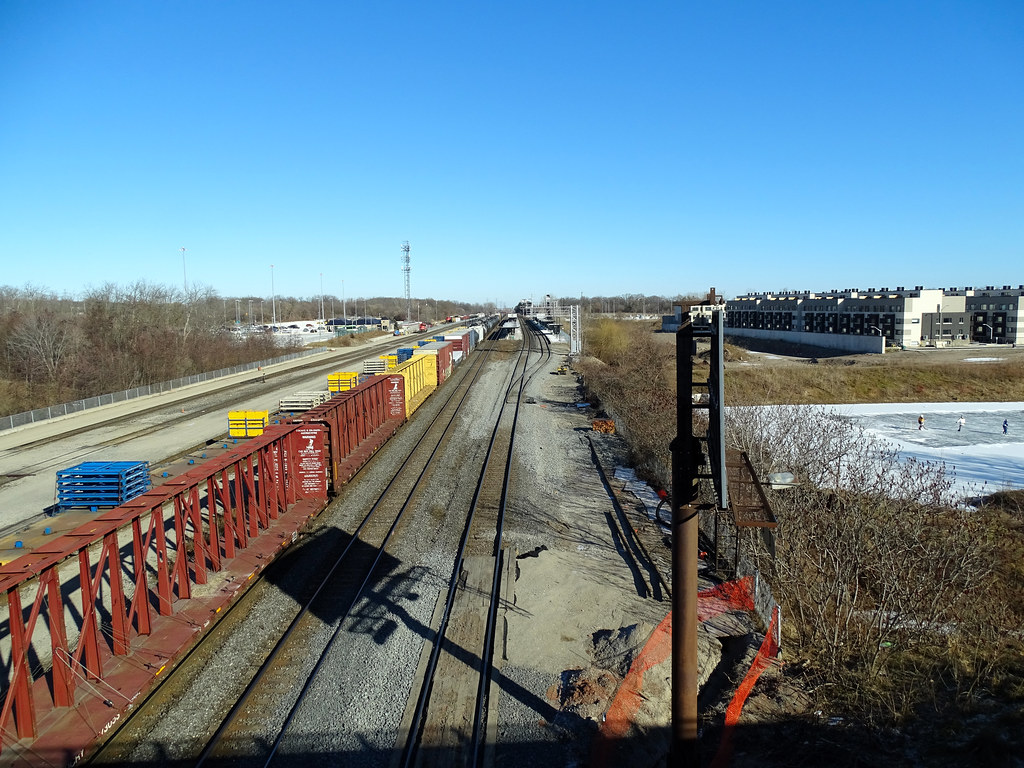
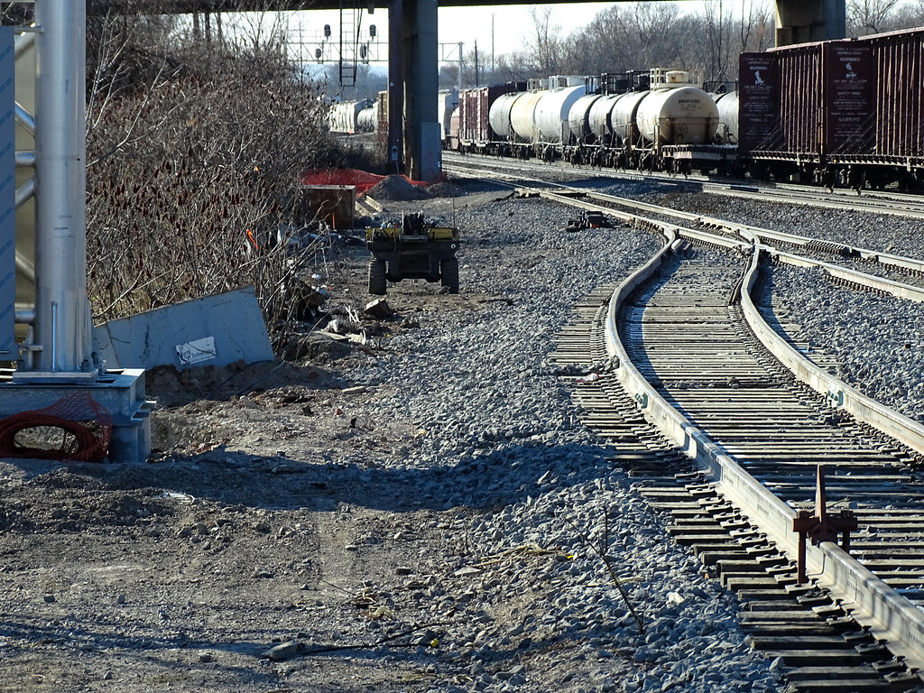
Based on what I saw today confirmed what I thought of the the new switch issue. The distance between the end of the platform and the Waterdown Overpass was the issue for larger switches based on what I saw during the building of the 3rd track and the station. You could step up to the next switch that will push then signals closure to Waterdown overpass and may come an sight issues for eastbound trains.

2 freights were using 2 of the 3 mainlines with an Windsor VIA train departing the station when I got there, There was another eastbound train on its way to the area as I pass it as it was leaving London. There is a need for another track to Bayview Junction, but getting it in has major issues considering there are 4 tracks to the west that becomes 3 before the junction.
51824595947_198e4605c8_b.jpg

51826266750_27a91b4426_b.jpg

51825544751_3a0830f98d_b.jpg

51824595622_a212d85d13_b.jpg

51825544071_2e2f261c63_b.jpg

51824595017_66f48a1329_b.jpg

51824595017_66f48a1329_b.jpg

51825887199_932f1b4a55_b.jpg

51824594852_9f19717321_b.jpg
is that long enough to hold an L12?
 
There is a report to next week's Executive Ctte updating the GO Expansion program.

Link here: https://www.toronto.ca/legdocs/mmis/2022/ex/bgrd/backgroundfile-175065.pdf

For the most part, it reiterates what we already know; but I'll bring forward a few pieces I think might be new to some:

Future grade separations in Scarborough along the Stouffville line:

1642603819993.png


Summation of the above: Progress is next in line

On the LSE:

1642603879455.png


Summation of the above: Deal reached to close Poplar Road as a vehicle crossing, but a pedestrian/bike crossing will be built.

Also:

1642604165807.png


Small's Creek:

1642604211602.png


Scarborough Junction:

Report doesn't share anything new, but gives the impression that this project will go ahead.

Davenport Greenway:

Tender will be issued Fall 2022
 

Back
Top