


Woodbridge_Heights
Senior Member
Whatever route is chosen for a DRL subway, I believe a transfer station at Queen-Roncesvalles is absolutely essential to both relieve pressure at Union Station and provide better transit service for Parkdale and the Western Waterfront.
A station here would be able to connect the following services:
-GO Lakeshore Trains
-TTC DRL Subway
-TTC 504/501 Streetcar
-Waterfront West LRT*
-GO Bus
-Greyhound Bus
(* if constructed)
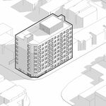
Here's my concept of what a Sunnyside mobility hub could look like:
I agree with this. This area could become a significant node of development with so much transit service (if it's built). Hell I wonder if you could convince VIA to return service to this area with an auxillary station here.
