


TwoWheelPoli
Active Member
CONSULTATION ALERT!!! 
The City of Toronto has released the dates for the Kingston Road Phase 2 public consultations! A virtual one will be held on Tuesday, October 21 at 7 PM while an in person one will be held on Monday, October 27 (6:00 - 8:30 PM) at R.H. King Academy (3800 St Clair Avenue East). The presentation materials are now up while you can submit your feedback until Monday, November 3.
 www.toronto.ca
The City of Toronto has released the dates for the Kingston Road Phase 2 public consultations! A virtual one will be held on Tuesday, October 21 at 7 PM while an in person one will be held on Monday, October 27 (6:00 - 8:30 PM) at R.H. King Academy (3800 St Clair Avenue East). The presentation materials are now up while you can submit your feedback until Monday, November 3.
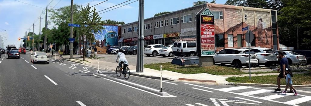
A Safer Kingston Road
Attend the public events on October 21 or 27 and complete the survey by November 3. View meeting materials in the Public Consultation tab below. The City of Toronto is proposing changes to approximately six kilometres of Kingston Road, from Cliffside Drive to Scarborough Golf Club Road. A...
www.toronto.ca
")