Burlington 1200 King Road | 174.4m | 53s | Alinea | Giannone Petricone

Branden Simon

Senior Member
Member Bio
Joined
Apr 30, 2018
Messages
1,969
Reaction score
6,599
Location
Hamilton
1200 King Rd - A Vision proposal of Mixed-Use development of Education Campus, Retail, Boutique Hotel, Sports facilities, Community Centre, Residential, Office and Public Space/Park and there is a MTO transitway on the site plan. The Developer is Alinea Properties in Burlington’s Aldershot neighbourhood.

The Concept Renderings
IMG_1722.jpeg
IMG_1723.jpeg
IMG_1724.jpeg


The Site plan
IMG_1725.jpeg


Links
King Rd Vision Presentation
https://mariannemeedward.ca/prelimi...es-space-for-housing-parks-recreation-campus/
https://investburlington.ca/king-road-development/
 

Arena, concert venue, college envisioned for ‘another downtown’ in Burlington


According to information contained in the report that will be presented at the meeting, discussions have been underway to bring a post-secondary institution to the site and also a hotel.

As for the arena, 5,000 fixed seats would be suitable for events such as hockey (large enough to accommodate an Ontario Hockey League team), monster truck rallies or wrestling. When converted into an event centre, the site could be filled with 7,000 patrons to attend a concert. A community centre, park and nature trails are also planned.
 
I kind of wonder why the employment, retail and residential isn't beside the Regional Rail station and national rail service and is instead on tiny King Rd.

Also what's this MTO Transit way?
Separation from the train station is because of forest/wetland preservation. The east portion of the site is disused farmland.

The transitway is a preliminary extension plan for the 407 transitway into Hamilton.
 
These condo towers will be walkable to almost nothing -- not even the Aldershot GO Station. But they are here so they can be up against Highway 403 and away from the expensive houses closer to the lake.

I really dislike how higher density new build developments in most of these suburbs are treated as noxious uses to be plopped along transportation and utility corridors.
 
I mean... Are these really not walking distance from the GO station? The furthest build is 2km away, with most being closer. That's a 25 minute walk at the furthest, likely 15 or so for the closest. 5 minute bicycle ride, and worst case Burlington could run a bus down the street every 30 minutes with a drop off time that aligns with the train. It's not too bad in my opinion, and if they build out the lifestyle components I don't think this is a bad spot for density. Better than many places in the GTA that have thrown up towers near exactly nothing. No different than the towers going up at Valhalla terrace and surrounding buildings.
 
It is funny how adding a simple protected bike lane at-grade with the sidewalk towards the GO station along "Street A" and perhaps "Street B" would resolve the distance to the GO station issue, but because this is the suburbs, that is sacrilege to suggest even in a brand new master-planned community that largely sits in isolation to the rest of the suburbia road network.
 
These condo towers will be walkable to almost nothing -- not even the Aldershot GO Station. But they are here so they can be up against Highway 403 and away from the expensive houses closer to the lake.

I really dislike how higher density new build developments in most of these suburbs are treated as noxious uses to be plopped along transportation and utility corridors.

If it could be done well, density next to a GO Station could make sense. Or along a major road.

But here, the contact with both (the GO Station and King Road) is minimal, at the fringes, meaning this makes far less sense, vs densifying right at the Station on its parking lots and having it relate to Waterdown Road instead.

This is just an overly dense configuration that is poorly situated within the nearby area, and will therefore get you a sub-optimal result, at best.
 
It is funny how adding a simple protected bike lane at-grade with the sidewalk towards the GO station along "Street A" and perhaps "Street B" would resolve the distance to the GO station issue, but because this is the suburbs, that is sacrilege to suggest even in a brand new master-planned community that largely sits in isolation to the rest of the suburbia road network.

There is a bi-directional Bike Lane along the length of both Street A and Street B as marked on the graphic above.

They are beside the sidewalks, rather than in the paved road area.


1774360313488.png


From the image of Street B above: (close-up and enlargement by me)

1774360380487.png


The cycle track is the green. There are sidewalks on both sides.

Here's the Transportation Plan:

1774360649016.png


***

I disagree with plunking the school in the middle of an existing forest. If you're going to do this, the school should be sited next to the development and the forest should be left in tact. Its a win-win environmental outcome that would also drastically increase 'walk to school'

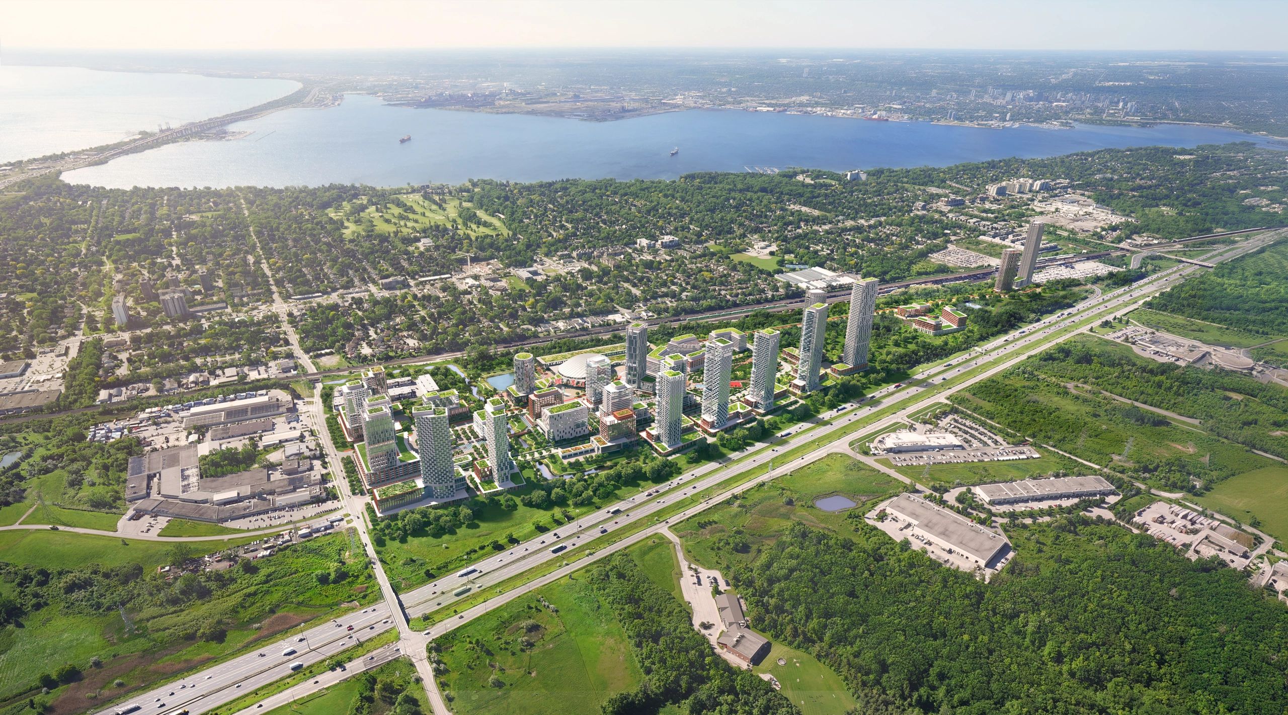
When you look at the organization of the site in terms of how density is laid out, its a bit dysfunctional:

1774360865559.png


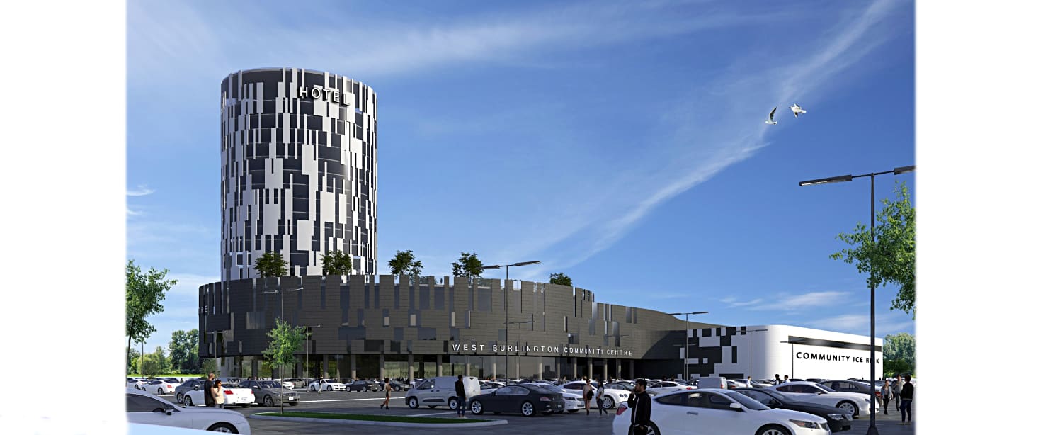
Street A, the main street, with the shuttle bus has low rise town homes along it at one point, while the highest density backs onto the freeway there, 2-3 blocks away, and that pocket of density is very far from King Road.

You want to pull the density on to street A, and have it lean towards King Rd. more.

I get what they're doing, other than trying to maximize their value first and foremost. They are using the high density as a highway shield (noise/pollution barrier), but they are also placing the density at the north end to mitigate shadow issues.

I have a different solution, build shorter. I don't mean low density, just don't have buildings casting giant shadows that literally can run a km from site..... particularly at the edge of urbanity. Its over-kill;.

If the highest density were lined up along King Rd, with some openings for western sun, you really don't have the same issue. Well done midrise, with a narrow;ish point tower here or there, or a N-S axis slab that tops out at 25s, anchored along Street A would be fine.

***

I also feel like the site is just too isolated. Connecting it across the 403 and the tracks is no mean feat, it would be pricey, but if you're doing to put density that far in, I think its worth considering.
 
Last edited:

Back
Top