As the Central Waterfront and East Bayfront see an influx of skyline-defining proposals, our gaze is continuously drawn skywards to the angles and curves of our future city. But at the same time, the more important and perhaps less sexier developments are happening down at ground level. The mention of 'infrastructure' typically doesn't inspire the same wonder as 'skyscraper', but a closer look at what's coming in the Port Lands may reverse that.
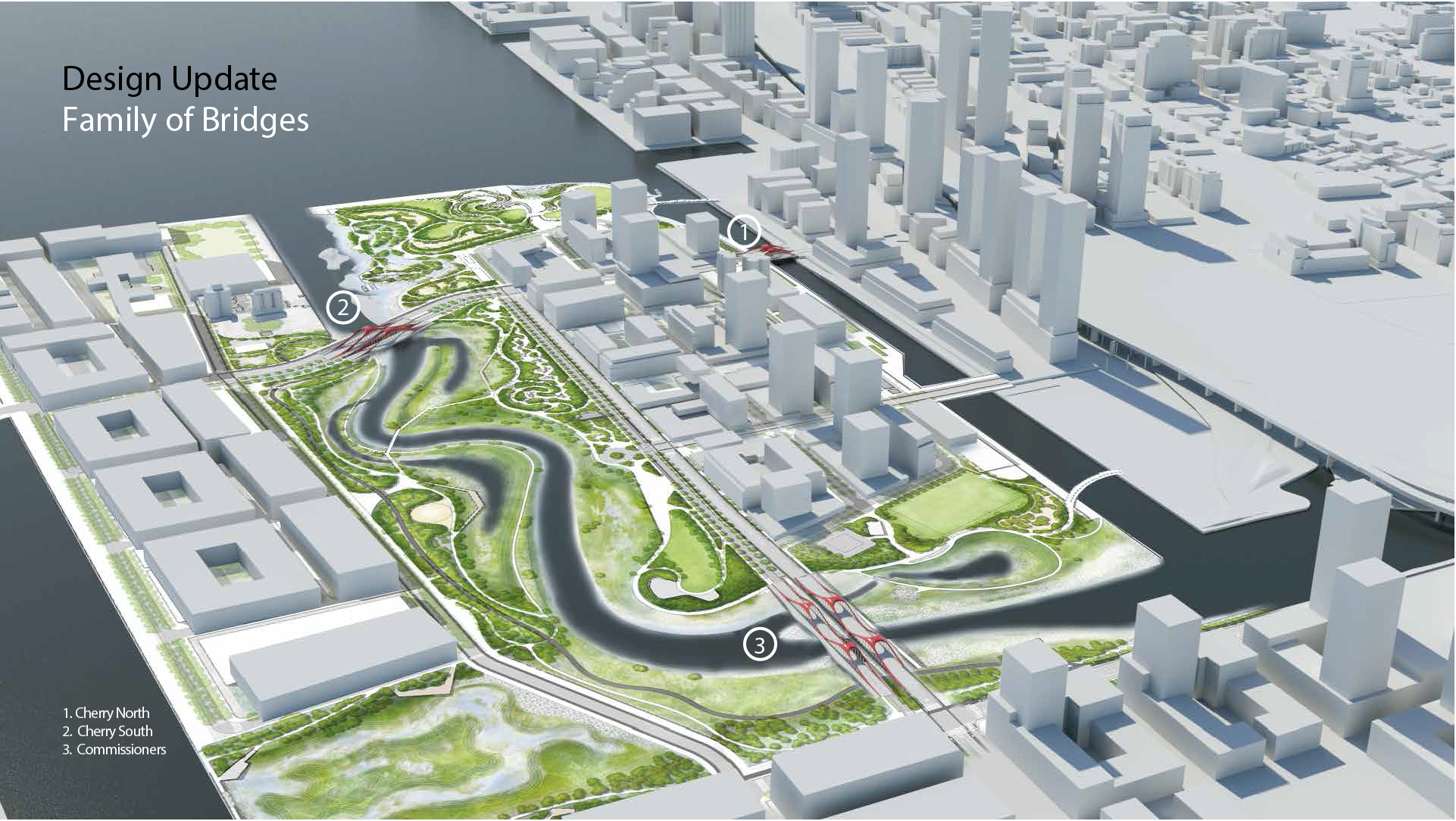 Aerial rendering of Villiers Island, showing the three bridges, draft image courtesy of Waterfront Toronto.
Waterfront Toronto has placed a heavy emphasis on the development of infrastructure over the past decade, and the results speak for themselves. The Queens Quay makeover, despite the occasional user confusion, has been a roaring success for the waterfront. The public-realm-first approach has also worked wonders for them: Corktown Common and the Front Street Promenade were installed prior to the full build-out of the Canary District, while Sherbourne Common and Sugar Beach have proven to be popular city-wide attractions, even before the new residents move in around them. A new park where the Gardiner offramp for Yonge-Bay-York Streets was, and the forthcoming makeover of Jack Layton Ferry Terminal are two further infrastructure investments that should have far-reaching impacts.
The City and Waterfront Toronto's plans for the Port Lands are no exception. The naturalization of the Don River, the Port Lands Planning Framework, and the public realm plan for Villiers Island have all previously been featured on UrbanToronto and each display a quality and attention to detail that has defined Waterfront Toronto's approach to infrastructure. Recently, another important piece of the Port Lands was presented to the Waterfront Toronto Design Review Panel, revealing eye-catching designs for a trio of bridges that will connect Villiers Island to the mainland.
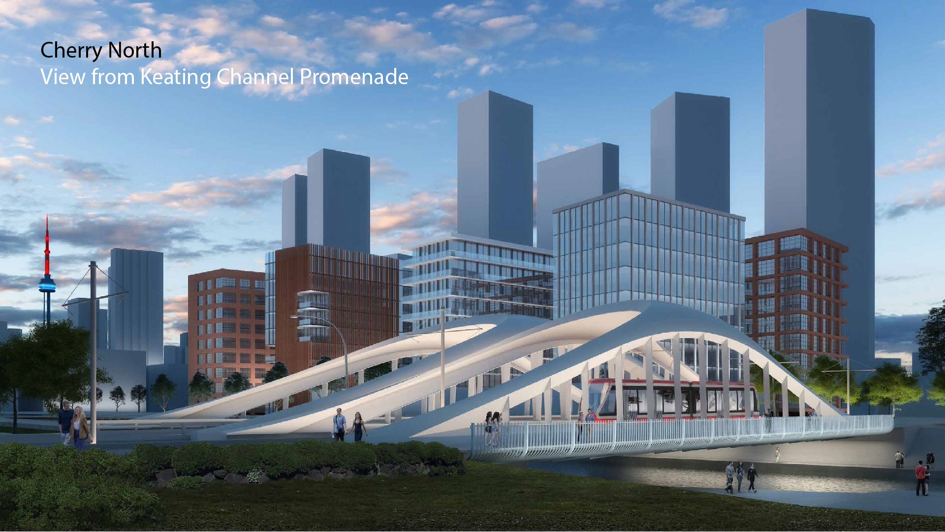 Rendering of the proposed Cherry Street North Bridge, draft image courtesy of Waterfront Toronto.
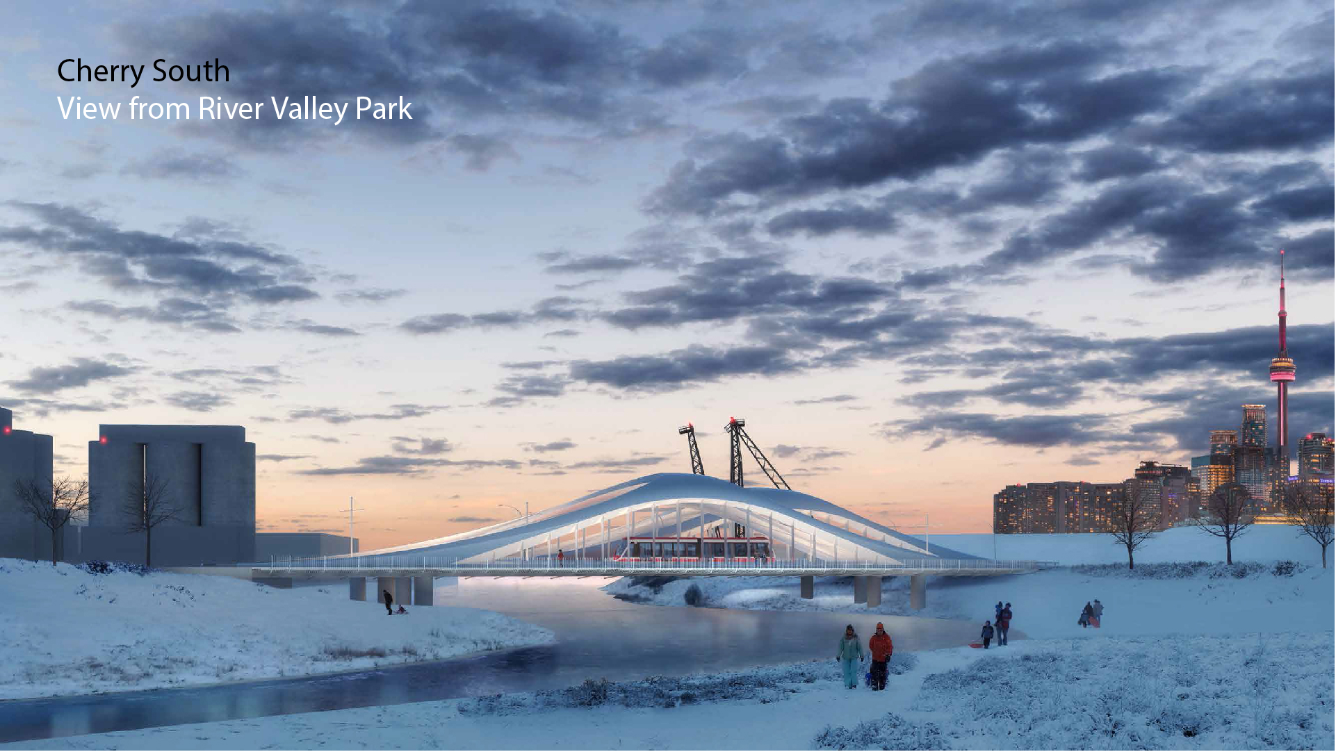 Rendering of the proposed Cherry Street South Bridge, draft image courtesy of Waterfront Toronto.
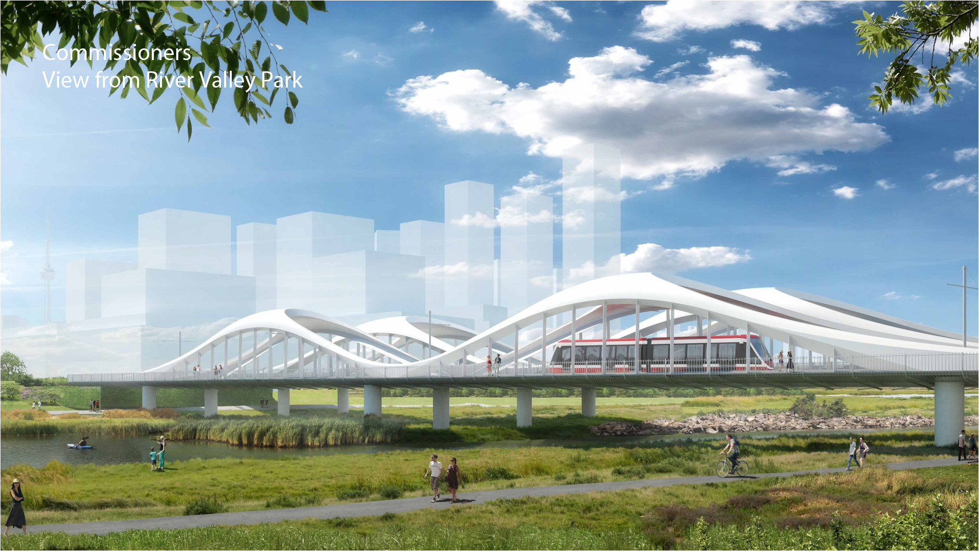 Rendering of the proposed Commissioners Street Bridge, draft image courtesy of Waterfront Toronto.
The three bridges in question are the Cherry Street North Bridge (connecting Lake Shore Boulevard to Villiers Island); the Cherry Street South Bridge (connecting Villiers Island to the southern Port Lands); and the Commissioners Street Bridge (connecting Villiers Island to the eastern Port Lands). All three bridges are being designed by Entuitive, along with London-based Grimshaw Architects and SBP.
All three bridges share a common aesthetic, intended to create a unique identity for Villiers Island and provide an iconic threshold into the future residential neighbourhood. The bridges will feature a pair of flat arches connected at their apex with a rounded, elastic form that gives them a more plastic, futuristic look. The gentle arches embrace the road surfaces that they support and create dynamic landmarks that are easily identifiable within the landscape. Proposed splashes of red colour add some vibrancy and playfulness to the structures.
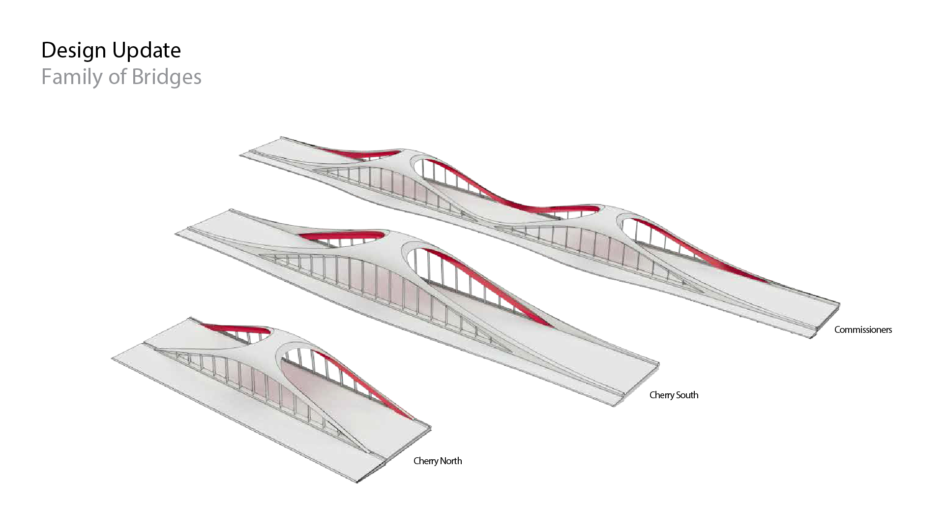 Schematic model of the three bridges, draft image courtesy of Waterfront Toronto.
Each bridge will be twinned, with one side carrying two-way vehicular traffic and the other carrying dedicated two-way lanes for future LRT lines. The Port Lands Planning Framework indicates an extension of the existing streetcar network south on Cherry Street into the Port Lands, which will terminate at a loop just north of Cherry Beach, while a streetcar line will branch off eastward through the Port Lands along Commissioners Street to Leslie Street. The Commissioners Street LRT will likely be a continuation of the future East Bayfront LRT along Queens Quay East.
The Cherry Street North Bridge will have both vehicular and LRT bridges constructed simultaneously, while the Cherry Street South and Commissioners Street Bridges have each marked the vehicular bridges as Phase One and the LRT bridges as Phase Two.
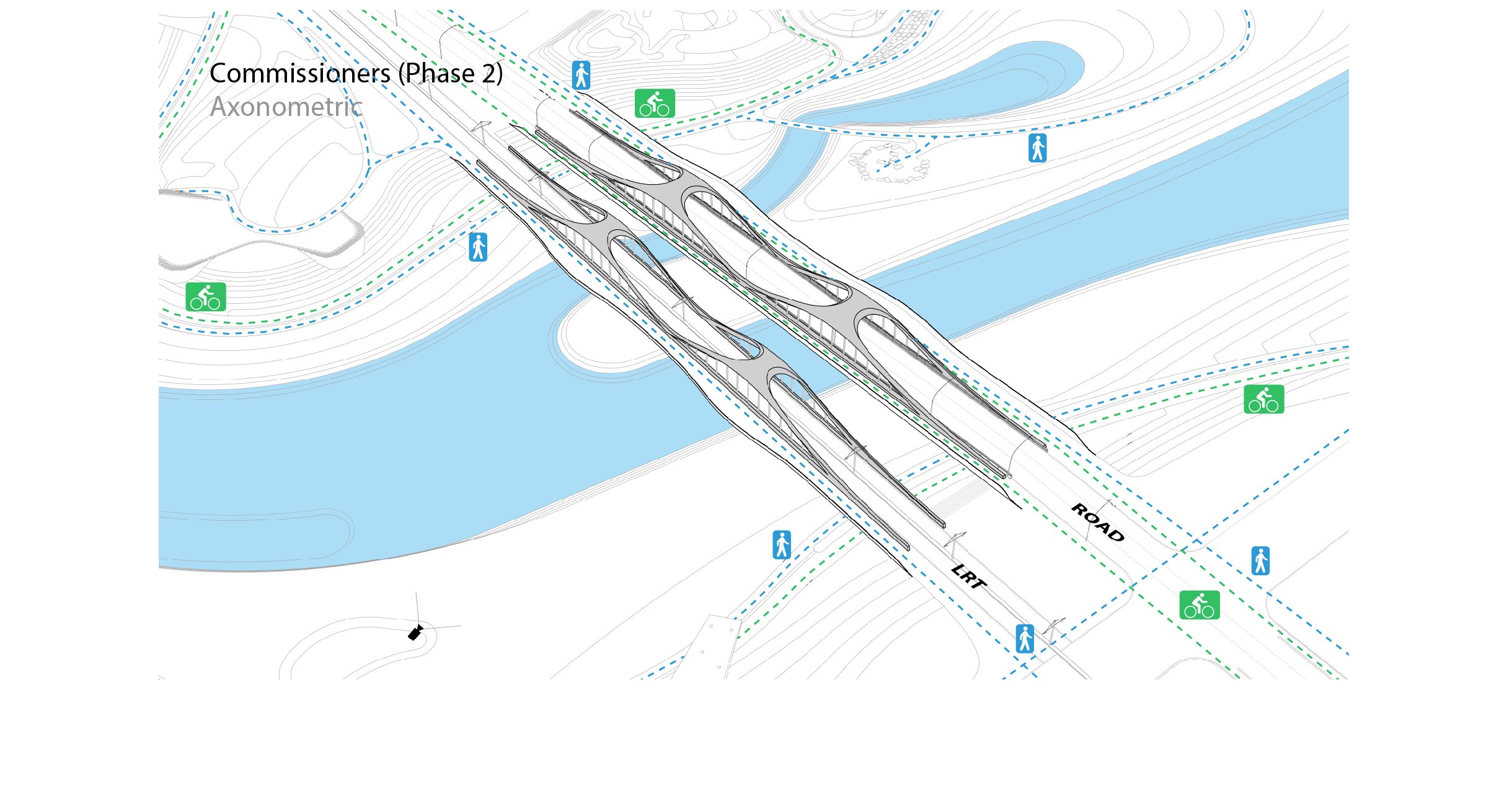 Axonometric of the Commissioners Street Bridge,draft image courtesy of Waterfront Toronto.
All bridges will also incorporate pedestrian and cycling lanes on one or both sides, depending on their configuration. Cycling and pedestrian infrastructure are included in Phase One of each bridge, while an additional pedestrian walkway will be incorporated on the Phase Two LRT bridges when they are constructed.
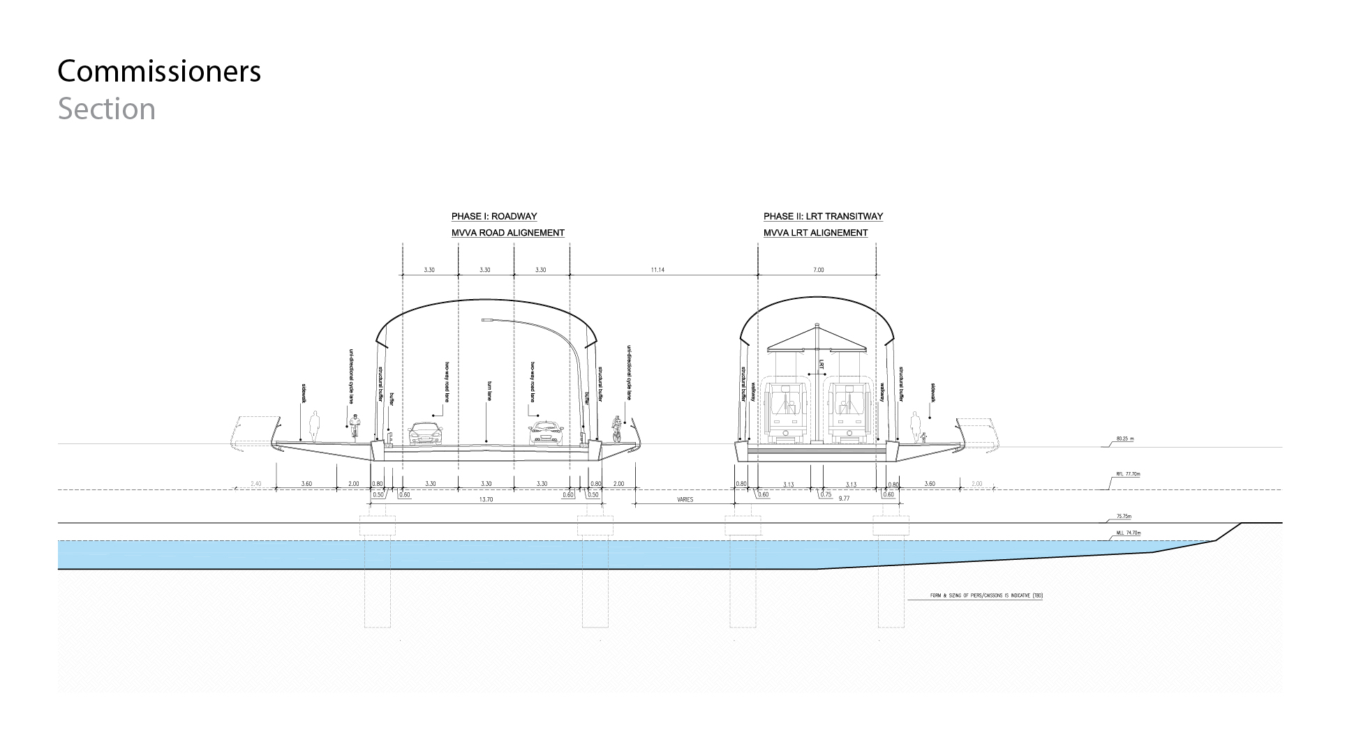 Cross section of the Commissioners Street Bridge, draft image courtesy of Waterfront Toronto.
The bridges are only in the schematic design phase and still far off from construction, so stay tuned for updates as their design continues to evolve. In the meantime, you can tell us what you think by checking out the associated Forum thread, or by leaving a comment in the space provided on this page.

 9.9K
9.9K 


