News   Apr 25, 2024
 354     0 
News   Apr 25, 2024
 1K     4 
News   Apr 25, 2024
 1K     0 

Waterfront: Lower Yonge Precinct Plan

Interesting....I wonder if WT is setting themselves in opposition to the 1 Yonge plan then.

It looks like it. Their density for the 1 Yonge plan appears much lower (less than half?) of what Pinnacle wants.

Of course, if 1 Yonge is approved then whomever has the LCBO site will also upscale significantly. It could cascade all the way across East Bayfront.
 
Waterfront Toronto

Apologies if there is already a thread like this, I did a forum search and didn't find any. I decided to make a catch-all thread for matters concerning Toronto's waterfront and Waterfront Toronto.

----

Recently got an email from Waterfront Toronto concerning a Town Hall Meeting on the next phase of waterfront revitalization.

The next phase of waterfront revitalization

In the first half of our mandate, Waterfront Toronto made significant strides to make our city’s waterfront dream a reality. Remarkable new places to live, work, learn and play are delivering lasting economic and social benefits for the people of Toronto, Ontario and Canada. And, there is still much more to do.

As we move forward on the next phase of revitalization, we want to hear from you. Please join us for a public town hall on Wednesday, April 1, 2015 at the Toronto Reference Library.

Waterfront Toronto’s President and CEO John Campbell will present a review of what has been achieved to date and provide an exciting look ahead to the future of our waterfront. Following the presentation, you will have the opportunity to ask questions and share your views with Mr. Campbell and members of the Waterfront Toronto senior management team.

When: Wednesday, April 1, 2015, 7 p.m. - 9 p.m.

Where: Bram and Bluma Appel Salon at the Toronto Reference Library [map], 789 Yonge Street

Closest major intersection: Yonge Street and Bloor Street. Located one block north of Bloor Street on the east side of Yonge Street.

Public Transit: TTC subway station Yonge-Bloor. Walk to library north on Yonge Street.

Parking: Paid parking lots on Cumberland Avenue, Asquith Ave and Church Street.

Accessibility: Wheelchair accessibility at the main entrance.
If you have specific accommodation requirements, please email info@waterfrontoronto.ca or call 416-214-1344 Extension 276.

Can’t join us in person?
Participate on the live webcast at: www.livemedia.biz/waterfronttorontotownhall.html
Any ideas on what this meeting could entail?
 
Should be WaterfronToronto 2.0, which is basically all the rest of proposed but unfunded projects
 
Lower Yonge Precinct Transportation Master Plan environmental assessment has returned.

It's recommendations are the following:

  • The extension of Harbour St. eastward from Yonge St. to Lower Jarvis St.
  • The conversion of Harbour St. from one-way eastbound to two-way operations from York St. to Yonge St.
  • The realignment of the Yonge St./Harbour St. intersection
  • The shortening of the Lower Jarvis St. off-ramp from the eastbound Gardiner Expressway to touch down at Yonge St.
  • The removal of the Bay St. on-ramp
  • The extension of Cooper St. north to connect with Church St and The Esplanade
  • The enhancement of the road network within the Lower Yonge Precinct area including the addition of New Street and various new intersection connections.

6Jm8M6n.png


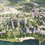
It is also proposing a Central Park in the Lower Yonge Precinct. Rendering Here.


edit: Thanks to the mod who moved the post, I couldn't find the appropriate thread.
 
Last edited:
Lower Yonge Precinct Transportation Master Plan environmental assessment has returned.

It's recommendations are the following:

  • The extension of Harbour St. eastward from Yonge St. to Lower Jarvis St.
  • The conversion of Harbour St. from one-way eastbound to two-way operations from York St. to Yonge St.
  • The realignment of the Yonge St./Harbour St. intersection
  • The shortening of the Lower Jarvis St. off-ramp from the eastbound Gardiner Expressway to touch down at Yonge St.
  • The removal of the Bay St. on-ramp
  • The extension of Cooper St. north to connect with Church St and The Esplanade
  • The enhancement of the road network within the Lower Yonge Precinct area including the addition of New Street and various new intersection connections.

6Jm8M6n.png


It is also proposing a Central Park in the Lower Yonge Precinct. Rendering Here.


edit: Thanks to the mod who moved the post, I couldn't find the appropriate thread.

This contemplates Loblaw's disappearing as well, correct? Is that currently in the plans?

I like the idea of the Central Park. Also, LOVE the fact that they left Captain John's in the render. Everything else changes, but the Cap'n is there forever in our hearts...
 
I really hope they don't keep the name "Central Park" for that relatively small chunk of greenspace.
 
Would be great to see all of these things happen, especially breaking up these megablocks into manageable street grid. What are the chances that Church St would be extended through the parking garage and under the rail corridor? Would that require eminent domain expropriation or something? Could we extend Harbour St further east past Jarvis too?
 
WT posted this short animated flythrough today of the East Bayfront and Portlands. I see quite a few highrise buildings in there, and also no Gardiner expressway.

[video=youtube;OZXLX6kUyC8]https://www.youtube.com/watch?v=OZXLX6kUyC8[/video]
 
Of interest to some UTers??

Request for Quotation
ecblank.gif
Call number: 9118-15-7297
Commodity:
Professional Services, Architectural Services
Description:
The non-exclusive provision of six (6) perspective renderings of the Lower Yonge Precinct Plan for the City of Toronto’s
QUOTATIONS ARE REQUESTED FOR: the non-exclusive provision of six (6) perspective renderings of the Lower Yonge Precinct Plan for the City of Toronto’s City Planning Division. The renderings shall comprise a minimum of one (1) elevated / bird's eye view, a minimum of one (1) skyline view, and a minimum of four (4) pedestrian level views. Base mapping of the street network and basic building modelling will be provided to the Vendor in digital format (.dwg, .dgn, or .skp). The Vendor shall be required to provide the renderings in both digital and print format.
Issue date: October 29, 2015
ecblank.gif
Closing date: November 16, 2015
at 12:00 Noon
Notes:
Viewing Copy
pdf.gif
9118-15-9297 Viewing Copy.pdf (1168 Kbytes) - Posted on 10/29/2015 12:37:34 PM
 

Good find, as always, AOD.

In looking it over, I'm pretty happy w/most of it.

I do, however, have some questions for WT/the City.

Church, south the Esplanade shows as having an ROW 5M larger than north of the Esplanade.

I'm assuming the difference is the room for the cycle tracks.

But does that mean the assumption is that cyclists will evaporate at the Esplanade?

Or that bike lanes will continue north?

They also show 4 'drive' lanes coming north, which nominally Church has north of the Esplanade, but in practice these are parking lanes.

Again, where does the excess traffic wander off to?

This is a precinct plan NOT a plan to actually build the tunnel under the rail corridor from Cooper to Church. The Plan "reserves' the space but this tunnel will only happen once the TPA redevelop the parking garage at the foot of Church and this is also dependent on the TCH folks redeveloping the TCH building above it. The Plan makes all this possible by ensuring that Cooper Street (south of the tracks) is wide enough bur I strongly doubt this tunnel will be built in next 15-20 years. Church south of The Esplanade will be kept / made wide enough to allow for all this when 75 The Esplanade (under discussion) is approved but Church north of The Esplanade is a well developed street where 'what you see is what you get'. I would not waste too much time worrying how the bike lane north of The esplanade will fit in.
 
Plan looks good but it will be a massive failure if the East Bayfront LRT is not built.
 

Back
Top