News   Apr 26, 2024
 1.6K     4 
News   Apr 26, 2024
 356     0 
News   Apr 26, 2024
 920     1 

Transit Fantasy Maps

Made another map, this one based around the Toronto Railway Company, Toronto Civic Railway, and Toronto Suburban Railways at their peaks after World War I before they became part of the TTC in 1921. This map is the same as last time with it using a New York style designation system. TRC routes are given letters, TCR routes use numbers, and routes that heavily interline share a colour. On the topic of interlining you'll notice the TRC didn't do this as much as its predecessor the TSR did as the network under the TRC was expanded further and so there was no longer a need to jam all the routes onto King Street. This map only shows the standard services, the various tripper services and exhibition runs are not included. EDIT* Updated map to include the missing BLOOR WEST line removed the PAPE line, and added the local Toronto Suburban Railway lines.

TRC-TCR.png
 
Last edited:
Another map, this one showing the streetcar network at its peak under the TTC in 1931. This map also shows the 3 lines that were owned by the Township of York Railway's but operated by the TTC under contract. Just like before this map uses a New York system with letters denoting TTC routes, numbers denoting TYR routes, and routes share a colour if they interline/share the same road. This map doesn't include the tripper services or exhibition services. The network would remain largely unchanged throughout the 1930's and 40's save for some minor route changes. It wouldn't be until after WWII that the network would begin to heavily contract into the one we have today.
TTC-TYR.png
 
Last edited:
Following the discussion of how best to connect Cambridge to Guelph, here's a concept for how the Waterloo Ion LRT system could be expanded into a more interurban network using abandoned or lightly-used branch railways. The longer-distance services to Elmira and Guelph would use higher-speed light rail vehicles capable of reaching at least 100 km/h. Due to the lower frequencies (probably not more than every 15 minutes) the outer branches could potentially include some single-track segments in constrained locations.
Capture4.PNG
 
Following the discussion of how best to connect Cambridge to Guelph, here's a concept for how the Waterloo Ion LRT system could be expanded into a more interurban network using abandoned or lightly-used branch railways. The longer-distance services to Elmira and Guelph would use higher-speed light rail vehicles capable of reaching at least 100 km/h. Due to the lower frequencies (probably not more than every 15 minutes) the outer branches could potentially include some single-track segments in constrained locations.
View attachment 543516
My three notes would be that:
a genuinely local line from Guelph to New Hamburg would very nicely finish the triangle and mostly piggyback on GO infrastructure;

Once I start including Guelph in Waterloo Region mapping I’m inclined to toss in an extension of the Milton train to Guelph via the GJR (on pure aesthetics at that point I’d rotate the Fergus line to be parallel to GO at Guelph with Milton in the 90 degree position, which would better reflect the actual station geometry); and

I’m really tenuous about terminating Elmira trains at Fairway. To me a minimal commuter service on still mostly single track really only needs to hit Central (my thought has generally been to either add a new chord to loop in DTK or a crossover to use Market station as a terminal). If it’s being upgraded to a level that it provides meaningful supplement to the overall service (and this is a tough sell to me; at least a minimalistic service is cheap and can be sold as an alternative to that Elmira bypass that the Region has in its transportation plan) not getting down to Pinebush for the link to the Guelph line seems like a lost opportunity.
 
Last edited:
View attachment 543594
I was thinking something like this with Sbahn service on the Guelph and Fergus sub supplemented by frequent buses(light blue) and the LRT (dark blue)
agree totally on the east/west s-bahn (maybe a couple more stations in Kitchener though) but a tram train down Hespeler Rd seems a better fit for the Fergus service.

I do like the concept of an Elmira train as an alternative to more highway expansion in the rural areas, though I grant it’s a very low priority.

I’d also do some significant tweaking to the buses, but the two that would really be noticeable at the level of this map would be extending that Breslau - airport bus south down Fountain, King and Coronation to Galt as a quasi BRT fully replacing the 206 (although if it were implemented before the Ion extension I’d be open to an interim configuration that runs to Fairway station via the “new”(ish) kossuth bridge and Fairway Rd) and add a Fairway - Airport - Kossuth Rd - Guelph route entering Guelph via a new (bus only?) bridge at Stone Rd and with the highest level of bus infrastructure on Stone Rd and Gordon that funds can be shaken loose for.
 

Interesting. Without knowledge of this plan I came up with a similar line for my grand GO Transit network plan. Except my plan used the Midtown Corridor rather than heading to Union, and had more stations than the above plan as my line was more of a RER line than a commuter line.

I had stations at: Summerhill, Bayview, Eglinton(Ontario Science Centre), Lawrence/Victoria Park, Ellesmere, Agincourt (transfer with Uxbridge line), Mccowan, Neilson(Malvern), Finch/Rouge Park (potential transfer station with proposed GO Northern Crosstown Line), Pickering West/Altona, Brock/Taunton, Ajax N(Taunton), Lake Ridge (412 Commuter Park and ride station), Whitby Central, and finally Stevenson GO in Oshawa
 
So I have made what I believe should be my final maps for the streetcar network unless I can think of something else. The first map is of the "Tripper" services from around the mid-1930's. Tripper's only operated in peak directions during rush-hour (inbound during the A.M. rush and outbound during the P.M. rush) and were meant to give riders a one-seat ride from the suburbs directly into downtown Toronto. Due to their high ridership they often operated as multiple-unit Peter Witt cars and eventually PCC's. These services ended with the opening of the subway as they were no longer needed; today the 508 LAKE SHORE is the only tripper service left. Following the trend of my recent maps I used the New York route designation system with Trippers getting a diamond bullet with the letter of there respective all-day local service from my previous map.

TTCTrippers.png


The second map is of the TTC's seasonal Exhibition services from 1923. The TTC used to operate special runs to the Exhibition when the CNE was happening with two types of services being offered. Some routes would operate all-day while others where "Late-Evening Return" services. These late-evening runs as their name implies only ran in the evening and when they reached there terminus the car would either go out of service and return to the carhouse or dead-head back to the Exhibition to pick up more passengers. These service would gradually disapear until there were only 2 left the 521 KING-EXHIBITION and 522 DUNDAS-EXHIBITION which themselves were ended in the 90's due to low ridership. The 511 BATHURST had also been running to the Exhibition all year since the 60's and the 509 HARBOURFRONT was going to make the 521 redundant. Just like before I use the New York System all though I coloured all of the lines pink like the TTC's seasonal routes. Routes also use the route letter from my previous map but with an additional "x" to denote it as an Exhibition service.

TTCEX.png
 
Carried over from the GO Transit Fleet Equipment and other thread:

I can certainly imagine St Catherines launchin a couple runs to Toronto every morning, but until someone solves the Seaway issue, I can't imagine NF originating more than a couple runs inbound.

Fantasy land, but given the better grade handling capabilities of a GO train versus freight, I often wonder if a small trenched and tunneled GO-only diversion to duck under Lock 5 would be possible? You'd have to slow a lot for the curves, but you'd never have to stop:

1710685140088.png


Going under Lock 4 would eliminate the curves, but the train would have to duck too deep to be practical. The bottom of Lock 5 is higher, and makes me wonder if this couldn't work? Of course that rail line running beside the lock is also a complication, but should be solvable with a bit of reconfiguration of the junction by Glendale Ave.
 
Last edited:
Carried over from the GO Transit Fleet Equipment and other thread:


Fantasy land, but given the better grade handling capabilities of a GO train versus freight, I often wonder if a small trenched and tunneled GO-only diversion to duck under Lock 5 would be possible? You'd have to slow a lot for the curves, but you'd never have to stop:

View attachment 548911

Going under Lock 4 would eliminate the curves, but the train would have to duck too deep to be practical. The bottom of Lock 5 is higher, and makes me wonder if this couldn't work? Of course that rail line running beside the lock is also a complication, but should be solvable with a bit of reconfiguration of the junction by Glendale Ave.
4% is the grade recommended for trains. How far back would the trench need to be?
 
4% is the grade recommended for trains. How far back would the trench need to be?

No idea, depends on all sorts of elevation and structural details of the locks that I don't have. But I do know that it has a better shot of getting under lock 5 than lock 4... :)
 
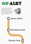
Focused on GO ALRT this past week, wanted to create the most comprehensive collection of maps describing each route proposed before it’s all lost to time:
You_Doodle+_2024-03-12T21_30_05Z.jpeg
You_Doodle+_2024-03-14T02_57_36Z.jpeg
You_Doodle+_2024-03-12T20_22_09Z.jpeg
You_Doodle+_2024-03-13T18_51_57Z.jpeg
You_Doodle+_2024-03-13T18_06_31Z.jpeg
You_Doodle+_2024-03-13T18_39_08Z.jpeg
You_Doodle+_2024-03-12T00_53_48Z.jpeg
You_Doodle+_2024-03-11T19_38_57Z.jpeg
You_Doodle+_2024-03-12T00_23_15Z.jpeg
You_Doodle+_2024-03-11T20_08_26Z.jpeg
You_Doodle+_2024-03-11T20_35_47Z.jpeg
You_Doodle+_2024-03-14T22_43_43Z.jpeg
You_Doodle+_2024-03-14T05_02_53Z.jpeg
You_Doodle+_2024-03-15T00_18_47Z.jpeg
 

Attachments

  • You_Doodle+_2024-03-13T18_51_57Z.jpeg
    You_Doodle+_2024-03-13T18_51_57Z.jpeg
    87.4 KB · Views: 4

Back
Top