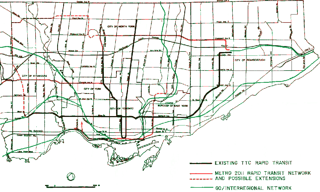
A few years ago I posted my
TTC2054 map to give an idea of what I thought the network could look like at its hundredth anniversary given the appropriate levels of capital funding. To my surprise it got published on places like BlogTO and got a boatload more attention than I expected. I decided to heavily revise my map to make it look more like a professional product you'd see in a bus shelter.
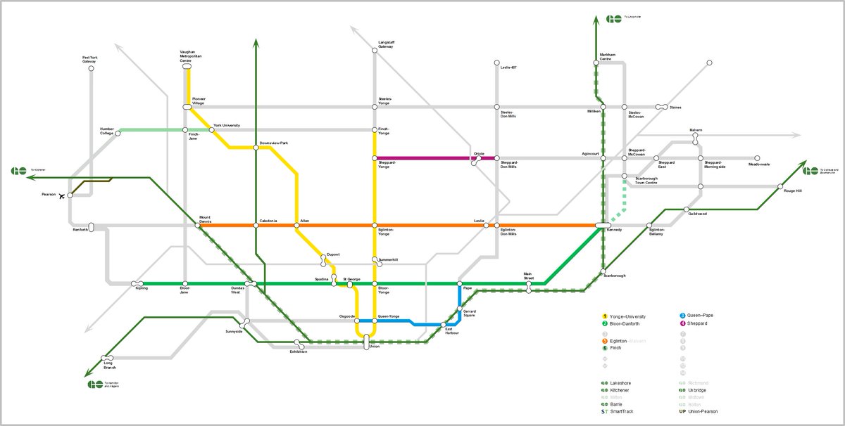
TTC2054 V3
This map contains:
- Full DRL
- GO RER
- Reactivated Midtown Line
- Expansion of existing streetcar lines (including in no particular order: Bremner, Harbourfront East, Dufferin, Kingston Road, Queensway, Lakeshore)
- On Line 1, TYSSE + YSE, plus logical extensions to Major Mackenzie in the later years as these corridors grow
- On Line 2, the 1994 Dixie Subway Extension + STC Subway Extension via SRT corridor
- On Line 4, the Network 2011 buildout
- MoveOntario 2020/Transit City LRT Lines
- Finch and Eglinton extended to Pearson
...among other minor enhancements.
The most controversial part of course, remains Scarborough. V1 followed the Murray (SRT) Subway Extension because it was the most likely looking plan at the time. In this version, I compromised by truncating it to STC and transforming it into a hub which would serve as the terminus for Sheppard and connections further into Scarborough and Malvern. Although the map doesn't need to be strictly geographically accurate (London's certainly isn't), I've drawn it to reflect an SRT corridor.
To avoid ambiguity between stations named after places and stations named after streets, I've tacked on the street title wherever possible. I've also avoided naming based on neighborhoods or landmarks since these can be respectively large (e.g. where might a station in Forest Hill be? Bathurst? Spadina? Allen?) or significantly far away from the station, instead naming them after streets wherever possible since that gives the rider the most precise resolution on their position.
Lastly, I think parks are Toronto's civic treasure, so I've added them onto the map. Ditto the lake, and other land forms, and regional context to help with wayfinding.