News   Apr 26, 2024
 1.6K     4 
News   Apr 26, 2024
 349     0 
News   Apr 26, 2024
 910     1 

Toronto Surface Transit Network Plan

Great info as always Dan.

Question; is there any real world analysis of whether the 'extra' capacity of the mixed floor height is actually taken up such that its a real gain over the 100% low-floor configuration?

To elaborate, it is my perception that between people who want to avoid stairs, have strollers/mobility devices, or simply can't see if there's any available seats up top, that one can have inordinate crowding in the low section of a mixed vehicle even while some space goes unused up top.

If that's sustained in detailed study, then perhaps that added capacity isn't 'real'? Just curious on your take on that.
I've tripped a whole bunch of different studies regarding vehicle capacities and loading problems/solutions and what-have-you, but I haven't had the opportunity yet to study them in depth. I don't know specifically if they look as deep as the actual mechanical configuration of the vehicle vis-a-vis the interior space restrictions, but it strikes me that it should be something on someone's radar somewhere.

But, to a degree, we can also look back and the TTC's own experiences to help extrapolate what we might find. The TTC found that going from a high floor vehicle to a low floor vehicle lost them about 10% of the capacity of the vehicle - primarily due to the front wheel wheels now intruding in the passenger cabin and preventing their use to carry passengers, but sped up loading/unloading times by a similar margin because there was now no longer a requirement for people to walk up and down the stairs before taking a seat/leaving the vehicle. (There are other factors to take into account that make these numbers not so cut-and-dried when it comes to the real world.)

Also, mixed level vehicles, I gather, preclude having the 3-door model, which I understand to be effective at reducing dwell times. I wonder how much capacity is eaten by longer dwells, due to fewer doors, due to mixed height?
This is my understanding, and my assumption as well. I'm hoping that once I start digging into those studies that there is some actual data to support that.

I hadn't realised that. Where in North America do they have them already?
Unlike buses, there is no regulatory need/requirement to build a streetcar to a "North American" standard.

So yeah, lots and lots and lots of them in places that aren't in North America.

Dan
 
The report on this passed Executive Ctte today, with amendments:

1706637754466.png
 
The Report has now passed Council, with a couple of additional amendments:

1707251203157.png


And

1707251291370.png


Plus:

1707251373648.png


And this:


1707251422400.png


Two dumb derail this motions from Holyday were nixed, and one dumb one from Perruzza. Moving on.
 

Chow:
“I think waiting for four, five years is long enough. There’s been a lot of consultations. It is not just painting the road. It is about right turn, left turn. So there are some things to work out with the neighbourhood, so I see that, I get that. It’s important my motions direct staff with the support,” said Chow prior to the meeting Tuesday. “Let’s get on with it.”

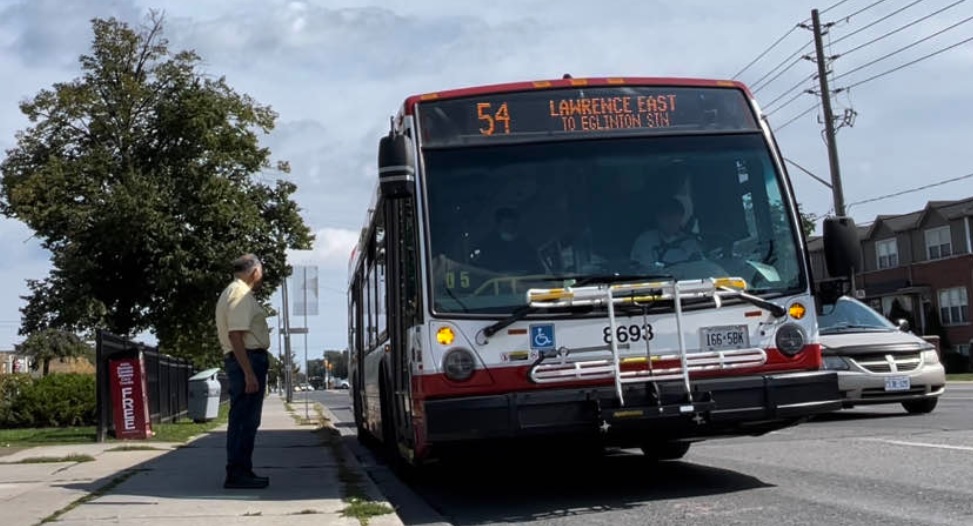
“We’re investing in a lot of increased services. Increasing more services means nothing if the bus is stuck in traffic … it doesn’t work,” said Chow.
 
What's the new wayfinding all about?

You mean the motion concerning Eglinton? I don't know, I'm assuming he's just asking that as RapidTO rolls out that any branding, distinct shelter designs or look to the bus-only/priority lanes be harmonious.

I expect, but don't know, that the feeling is Eglinton was done on the cheap, quickly, and that subsequent routes may get more 'design' elements and the Councillor didn't want his area left out.
 
I don't know, I'm assuming he's just asking that as RapidTO rolls out that any branding, distinct shelter designs or look to the bus-only/priority lanes be harmonious.
Ah - that make sense.

Though given how inconsistent TTC wayfinding is on other modes. There's still bus stops they haven't put the "new" signs on yet that they started using a decade ago. They are yet to synchronize the use of the TTC symbol at station entrances. And until a few weeks ago, there was still a 224 sign out there. The only consistency is inconsistency.
 
A report to next week's Executive Committee seeks to identify and prioritize corridors for higher order transit:


From the above:

1708613984012.png

1708614018088.png


***

A couple of interesting graphics:

1708614083050.png


1708614134035.png


This next one shows the prioritization of corridors based on preliminary assessment. I don't think those results would surprise anyone by and large............but there are some other interesting tidbits in there, in the form of Planning Assumptions
as to where Metro/Subway extensions might go in the future:

1708614286026.png


So........look up and there are some things of note..........

The City's most favoured subway extension after Sheppard and what's under way now, is the Ontario Line North......which, they envision going to Steeles.

Meanwhile, a western extension of Line 2 and the Western Waterfront LRT rank at the bottom.

So does the Jane LRT; taking the SSE north to Markham; and the Ontario Line West.

The latter of which is envisaged as being extended to Dundas West.
 
So, BRT on Kingston Rd East is high on the corridor evaluation. How would this interact with the complete street plans?
 
So, BRT on Kingston Rd East is high on the corridor evaluation. How would this interact with the complete street plans?

Don't know, is the short answer.

I expect on Kingston Road, the program would follow the LRT plans and extract space from the ROW (current median removed, 2 dedicated transit lanes, one per direction, 2 travel lanes per direction for cars, and cycle tracks.)

Danforth, from VP To Warden I can't imaging seeing dedicated lanes as there isn't the room. At least not if Cycle Tracks go in.
 

Good to see these expansions entering the discussion but I am worried that staff are projecting too little transit. I don’t think a single person at city hall or even queens park has fully processed that the GTA is projected to have more people than NYC does today by 2041.

I don’t think anyone in power has truly digested the fact that Toronto will have to build transit on China-level scales and speed in order to have enough capacity by 2041.

The above listed projects have about 5-10 years at the maximum to get shovels in the ground if we want to have a usable transit system in 20 years.
 
Good to see these expansions entering the discussion but I am worried that staff are projecting too little transit. I don’t think a single person at city hall or even queens park has fully processed that the GTA is projected to have more people than NYC does today by 2041.

What are we trying to compare here?

NYC: 778km2 - Population ~8,000,000

City of Toronto: 631km2 - Population ~3,000,000

****

NYC Metro Area ~ 21481km2 - Population: ~20,000,000

Greater Toronto Area - 7, 124km2 - Population - 6,800,000

Greater Golden Horseshoe - 31,500km2 - 10,000,000

*****

2041 projection has the GTA at 10,200,000

The GGH at 13,600,000

* Estimates from 2021

*******

Keep in mind, the City excluded all GO Transit projects, anything presumed to be in an existing rail corridor, along with Sheppard, as these are provincial projects. The provincial projects you see listed are only there to reference whether a City investment in corridor 'x' makes sense.
 
What are we trying to compare here?.

Perhaps LA county would be a more apt comparison which the GTA is also expected to exceed by 2041.

But my point was that if these projects are what city hall sees as long-term aspirations, rather than projects to be funded within the next 5-10 years, we are in for a very painful transit crunch.
 

Back
Top